Location | |
---|---|
Country | United States |
State | South Carolina |
Counties | Charleston, Colleton, Dorchester, Bamberg, Orangeburg |
Physical characteristics | |
Source | |
• coordinates | 33°15′46″N80°53′11″W / 33.262659°N 80.8864854°W |
Mouth | |
• location | Edisto Beach, Atlantic Ocean |
• coordinates | 32°39′16″N80°23′17″W / 32.65444°N 80.38806°W |
• elevation | 0 ft (0 m) |
Length | over 250 mi (400 km) |
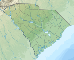
The Edisto River is one of the longest free-flowing blackwater rivers in North America, [1] flowing over 250 [1] meandering miles from its sources in Saluda and Edgefield counties, to its Atlantic Ocean mouth at Edisto Beach, South Carolina. It rises in two main tributaries (North Fork & South Fork) from springs under the Sandhills region of West Central South Carolina, just to the south of the Piedmont Fall Line. It is the longest and largest river system completely contained within the borders of South Carolina. Its name comes from the Edisto subtribe of the Cusabo Indians. [2]
Near the coast, part of the river was once known as the Ponpon River. The Dawhoo River (sometimes Dawho, or Dawhoe) connects the Edisto to the North Edisto River, also the confluence of the Wadmalaw and the Toogoodoo rivers, where they meet the Atlantic Ocean. Between the coast and the Dawhoo River, the river is known as the South Edisto River. [3]
The Edisto system flows through only one major town or city, Orangeburg, the location of Edisto Gardens (on the North Fork). The river system, being blackwater throughout its entire length, flows through highly intermittent bottom swampland. During an excessively rainy season, the river will leave its main channel, with its flow basin increasing to over a mile or more of total width. The lower Edisto basin forms a crucial part of the ACE Basin, an area that encompasses its bottomlands confluence with the Ashepoo and Combahee river basins. [4]
A major tributary is Four Holes Swamp, which is unique in that it has no single defined channel, but rather a network of braided channels.
Common fish by biomass in the freshwater portions of the Edisto include spotted sucker ( Minytrema melanops ), bowfin ( Amia calva ), flat bullhead ( Ameiurus platycephalus ), largemouth bass ( Micropterus salmoides ), common carp ( Cyprinus carpio ), longnose gar ( Lepisosteus osseus ), and American eel ( Anguilla rostrata ). [5] Redbreast sunfish ( Lepomis auritus ) is the species most prized by anglers. [5]
The Edisto Riverkeeper is a non-profit 501(c)(3) organization working to ensure equal access to drinkable, fishable, and swimmable water in the Edisto River basin and its surrounding aquifers and tributaries. As one of over 330 members of the Waterkeeper Alliance, Edisto Riverkeeper seeks to encourage balanced usage of the basin's water resources for residents, industry, and municipalities to utilize and enjoy through education, advocacy, and accountability. [6] [7]
Friends of the Edisto, Inc. FRED, a non-profit organization, was established in 1998 to facilitate conservation of natural resources and to encourage and support sustainable economic development within the Edisto River Basin in South Carolina [8] [9]
Edisto River Canoe and Kayak Trail "ERCK" is a group of volunteers committed to the preservation of the Edisto River, educating people on safe paddling, and emphasizing the enjoyment of paddling. All instructors are American Canoe Association certified. [10] [11]
In late August and early September 1718 pirate captains Charles Yeats and Charles Vane were anchored of Sullivan's Island, capturing ships as they left Charles Town harbor. After a number of disagreements Yeats fled from Vane, sailing up the Edisto River for shelter; Vane tried to pursue him but broke off. Yeats was ultimately pardoned:
The Yarra River or historically, the Yarra Yarra River, is a perennial river in south-central Victoria, Australia.
The Roanoke River runs 410 miles (660 km) long through southern Virginia and northeastern North Carolina in the United States. A major river of the southeastern United States, it drains a largely rural area of the coastal plain from the eastern edge of the Appalachian Mountains southeast across the Piedmont to Albemarle Sound. An important river throughout the history of the United States, it was the site of early settlement in the Virginia Colony and the Carolina Colony. An 81-mile (130 km) section of its lower course in Virginia between the Leesville Lake and Kerr Lake is known as the Staunton River, pronounced, as is the Shenandoah Valley city of that name. It is impounded along much of its middle course to form a chain of reservoirs.
The Shenandoah River is the principal tributary of the Potomac River, 55.6 miles (89.5 km) long with two forks approximately 100 miles (160 km) long each, in the U.S. states of Virginia and West Virginia. The river and its tributaries drain the central and lower Shenandoah Valley and the Page Valley in the Appalachians on the west side of the Blue Ridge Mountains, in northwestern Virginia and the Eastern Panhandle of West Virginia. There is a hydroelectric plant along the Shenandoah river constructed in 2014 by Dominion.
The St. Joseph River is a tributary of Lake Michigan with a length of 206 miles (332 km). The river flows in a generally westerly direction through southern Michigan and northern Indiana, United States, to its terminus on the southeast shore of the lake. It drains a primarily rural farming area in the watershed of Lake Michigan. It was enormously important to Native Americans and greatly aided in the colonial exploration, settlement and administration of New France and the nascent United States as a canoe route between Lake Michigan and the watershed of the Mississippi River.
The Watauga River is a large stream of western North Carolina and East Tennessee. It is 78.5 miles (126.3 km) long with its headwaters in Linville Gap to the South Fork Holston River at Boone Lake.
A blackwater river is a type of river with a slow-moving channel flowing through forested swamps or wetlands. Most major blackwater rivers are in the Amazon Basin and the Southern United States. The term is used in fluvial studies, geology, geography, ecology, and biology. Not all dark rivers are blackwater in that technical sense. Some rivers in temperate regions, which drain or flow through areas of dark black loam, are simply black due to the color of the soil; these rivers are black mud rivers. There are also black mud estuaries.
The Payette River is an 82.7-mile-long (133.1 km) river in southwestern Idaho and is a major tributary of the Snake River.
The Green River is a dam-release river that flows through the mountains of North Carolina, south of Asheville. The Green has numerous tributaries, but much of its water flows from a confluence with Big Hungry Creek. The Green River is itself a tributary of the Broad River. The river is dammed to form Lake Summit, in Tuxedo, North Carolina, and Lake Adger near Mill Spring, NC. The Green River is named for its deep green color but runs brown after heavy rains.
Chattahoochee Riverkeeper (CRK) -- formerly known as Upper Chattahoochee Riverkeeper (UCR) -- is an environmental advocacy organization with 10,000 members dedicated solely to protecting and restoring the Chattahoochee River Basin. CRK was modeled after New York’s Hudson Riverkeeper and was the 11th licensed program in the international Waterkeeper Alliance. In 2012, the organization officially changed its name to simply Chattahoochee Riverkeeper (CRK), dropping the "Upper" to better reflect its stewardship over the entire river basin.
The Blackwater River of southeastern Virginia flows from its source near the city of Petersburg, Virginia for about 105 miles (170 km) through the Inner Coastal Plain region of Virginia. The Blackwater joins the Nottoway River to form the Chowan River, which empties into Albemarle Sound. The Blackwater-Nottoway confluence forms the boundary between Virginia and North Carolina.
The Shiawassee River in the U.S. state of Michigan drains an area of 1,201 square miles (3,110 km2) within Oakland, Genesee, Livingston, Shiawassee, Midland and Saginaw counties. It flows in a generally northerly direction for approximately 110 miles (180 km) from its source to its confluence with the Tittabawassee River creating the Saginaw River, which drains into Saginaw Bay of Lake Huron.
The Beech Fork, or Beech Fork River, is a 112-mile-long (180 km) river in central Kentucky in the United States. It is a tributary of the Rolling Fork of the Salt River, with its waters flowing eventually to the Ohio River and ultimately the Mississippi River.
The Loxahatchee River is a 7.6 mile river near the southeast coast of Florida. It is a National Wild and Scenic River, one of only two in the state, and received its federal designation on May 17, 1985. The source of the Loxahatchee River is in Riverbend Park on the south side of Indiantown Road about 1.5 miles west of I-95 and Florida's Turnpike in Jupiter, Florida. The Loxahatchee River flows out of the Jupiter Inlet and into the Atlantic Ocean. This river was the inspiration for Florida film producer Elam Stoltzfus' 2005 project Our Signature: the Wild and Scenic Loxahatchee River, a film done in conjunction with the Loxahatchee River Preservation Initiative.
The Crooked River is a tributary, 125 miles (201 km) long, of the Deschutes River in the U.S. state of Oregon. The river begins at the confluence of the South Fork Crooked River and Beaver Creek. Of the two tributaries, the South Fork Crooked River is the larger and is sometimes considered part of the Crooked River proper. A variant name of the South Fork Crooked River is simply "Crooked River". The Deschutes River flows north into the Columbia River.
The Ashepoo Combahee Edisto Basin National Estuarine Research Reserve is a 140,000-acre (570 km2) reserve area located in the ACE Basin, one of the largest undeveloped estuaries on the Atlantic coast of the United States. It is named for the Ashepoo, Combahee and Edisto Rivers, which flow past cypress swamps, historic plantation houses, old rice fields and tidal marshes to meet at South Carolina's biologically rich St. Helena Sound.
The Ashepoo, Combahee and Edisto Basin is one of the largest undeveloped estuaries along the Atlantic Coast of the United States. Located primarily in Colleton, Charleston, and Beaufort counties in South Carolina, the Ashepoo, Combahee and South Edisto rivers combine into the larger St. Helena Sound and drain a significant portion of the Lowcountry region. The 350,000 acres (1,400 km2) area is known for its natural environment and the preservation of its marshes, wetlands, hardwood forests, and riverine systems and the fauna that occupy the area.
Potomac Riverkeeper Network is an environmental, registered non-profit organization based in Washington, D.C. that is dedicated to protecting the Potomac River and its tributaries. As a "riverkeeper" organization, it is a member of the umbrella organization Waterkeeper Alliance.
Willamette Riverkeeper is a non profit organization formed in 1996 in order to protect and restore the water quality and natural habitat of the Willamette River. WR was the 13th Riverkeeper organization formed after the original Hudson Riverkeeper. Today there are over 300 Riverkeeper, Baykeeper, and Coastkeeper organizations in the United States and internationally. Each organization is independent, but subscribes first and foremost to enforcing the Clean Water Act, or related international laws.
The H.F. Lee Energy Complex, formerly the Goldsboro Plant, is an electrical power generating complex operated by Duke Energy. The power complex was originally owned by the Carolina Power & Light Company, which inaugurated a coal-fired power plant in 1951. Two more coal plants were added in 1952 and 1962, and then oil-fueled turbines were added in 1967–71. In 2012 these units were shut down and replaced by four gas-fired units. The Quaker Neck Lake was built as a cooling pond for the coal-fired power stations, and is still used to supply cooling water. It was originally impounded by a low dam on the Neuse River, but in 1998 the dam was removed, while the lake remained contained in an earthen wall. This change allowed fish to migrate further upstream for spawning. Ash ponds near the lake hold toxic coal ash. There are plans to remove and recycle or bury the ash.