List of waterways forming and crossings of the Atlantic Intracoastal Waterway

Last updated

Atlantic Intracoastal Waterway [1]
BSicon uCONTg.svg
to Chesapeake Bay
BSicon uBHF.svg
Hampton Roads
W. Branch Elizabeth R.
BSicon uCONTgq.svg
BSicon uWABZgr.svg
BSicon CONTgq.svg
BSicon umKRZo.svg
BSicon CONTfq.svg
mile marker 0.0
BSicon uKMW.svg
BSicon RR+l.svg
BSicon uWABZgl.svg
BSicon uSKRZ-Ruq.svg
Eastern Branch Elizabeth River
BSicon RRq.svg
BSicon uSKRZ-Ro.svg
BSicon RRr.svg
BSicon uSKRZ-G1u.svg
Southern Branch Elizabeth River
BSicon CONTgq.svg
BSicon umKRZu.svg
BSicon CONTfq.svg
BSicon RRq.svg
BSicon uSKRZ-Ru.svg
BSicon RRq.svg
BSicon uKRW+l.svg
BSicon uABZlr.svg
BSicon uKRW+r.svg
BSicon uSTR.svg
BSicon STR+l.svg
BSicon umKRZu.svg
Dismal Swamp Canal
BSicon uSTR.svg
BSicon STR.svg
BSicon uSTR.svg
Albemarle and Chesapeake Canal
border of VA and NC
BSicon uSTR+GRZq.svg
BSicon STR+GRZq.svg
BSicon uKMW.svg
mile marker 34
BSicon umKRZu.svg
BSicon STRr.svg
BSicon uWASSER.svg
South Mills Lock
BSicon uSTOPLOCK.svg
BSicon uWASSER.svg
North Landing River
BSicon umKRZu.svg
BSicon STR+r.svg
BSicon uWASSER.svg
Pasquotank River
BSicon uWASSER.svg
BSicon STR.svg
BSicon uBHF.svg
Currituck Sound
BSicon uWASSER.svg
BSicon STRl.svg
BSicon umKRZu.svg
mile marker 68
BSicon uKMW.svg
BSicon uWASSER.svg
North River
BSicon uKRWl.svg
BSicon uABZ+lr.svg
BSicon uKRWr.svg
BSicon uBHF.svg
Albemarle Sound
BSicon uWASSER.svg
Alligator River
BSicon uSTR.svg
Alligator River-Pungo River Canal
BSicon uWASSER.svg
Pungo River
Pamlico River
BSicon uCONTgq.svg
BSicon uFKRZ.svg
BSicon uKBHFeq.svg
Pamlico Sound
BSicon uWASSER.svg
Goose Creek
BSicon uWASSER.svg
Neuse River
BSicon uSTR.svg
Adams Creek
BSicon uWASSER.svg
Harlowe Creek
BSicon uBHF.svg
Bogue Sound
New River
BSicon uCONTgq.svg
BSicon uFKRZ.svg
BSicon uKBHFeq.svg
Onslow Bay
BSicon CONTgq.svg
BSicon umKRZu.svg
BSicon ENDEeq.svg
Cape Fear River
BSicon uCONTgq.svg
BSicon uWABZg+r.svg
BSicon uWASSER.svg
Lockwood Folly River
BSicon uCONTgq.svg
BSicon uABZgr+r.svg
Shallotte River
BSicon uCONTgq.svg
BSicon uABZgr+r.svg
border of NC and SC
BSicon GRZq.svg
BSicon uSTR+GRZq.svg
BSicon GRZq.svg
BSicon CONTg+l.svg
BSicon umKRZu.svg
BSicon STR+r.svg
BSicon exCONTgq.svg
BSicon uemKRZu.svg
BSicon eABZgr+r.svg
Waccamaw River
BSicon uWASSER.svg
BSicon STR.svg
BSicon CONTf+l.svg
BSicon umKRZu.svg
BSicon STRr.svg
BSicon uBHF.svg
Winyah Bay
BSicon uSTR.svg
Estherville Minim Creek Canal
BSicon uWASSER.svg
Duck Creek
North Santee River
BSicon uCONTgq.svg
BSicon uFKRZ.svg
BSicon uCONTfq.svg
BSicon uSTR.svg
Fourmile Creek Canal
South Santee River
BSicon uCONTgq.svg
BSicon uFKRZ.svg
BSicon uCONTfq.svg
BSicon uWASSER.svg
Wando River
BSicon uCONTgq.svg
BSicon uDOCKSa.svg
BSicon uSTR.svg
Cooper River
BSicon uCONTgq.svg
BSicon uDOCKSm.svg
BSicon uSTR.svg
Charleston Harbor
Ashley River
BSicon uCONTgq.svg
BSicon uDOCKSe.svg
BSicon uSTR.svg
BSicon uWASSER.svg
Wappoo Creek
BSicon uSKRZ-G1u.svg
Wappoo Creek Bridge
BSicon uWASSER.svg
Stono River
BSicon uWASSER.svg
Wadmalaw River
BSicon uSTR.svg
Watts Cut
BSicon uWASSER.svg
South Edisto River
BSicon uWASSER.svg
Ashepoo River
BSicon uWASSER.svg
ACE Basin Research Reserve
BSicon CONTgq.svg
BSicon umKRZu.svg
BSicon CONTfq.svg
BSicon uWASSER.svg
Beaufort River
BSicon uBHF.svg
Port Royal Sound
BSicon CONTgq.svg
BSicon umKRZu.svg
BSicon WSLeq.svg
BSicon uWASSER.svg
Cooper River
BSicon uWASSER.svg
Ramshorn Creek
BSicon uSTR.svg
Walls Cut
BSicon uSTR.svg
Fields Cut
Savannah River
BSicon GRZq.svg
BSicon uCONTgq.svg
BSicon GRZq.svg
BSicon uABZgr+r.svg
BSicon GRZq.svg
border of SC and GA
BSicon CONTgq.svg
BSicon umKRZu.svg
BSicon ENDEeq.svg
Wilmington River
BSicon uCONTgq.svg
BSicon uFKRZ.svg
BSicon uKBHFeq.svg
Wassaw Sound
BSicon uWASSER.svg
Skidaway River
BSicon uWASSER.svg
Moon River
BSicon uWASSER.svg
Vernon River
Green Island Sound
BSicon uKBHFaq.svg
BSicon uSTR.svg
BSicon uKBHFeq.svg
Ossabaw Sound
BSicon uWASSER.svg
Ogeechee River
BSicon uWASSER.svg
Florida Passage
Medway River
BSicon uCONTgq.svg
BSicon uFKRZ.svg
BSicon uKBHFeq.svg
St. Catherines Sound
BSicon uWASSER.svg
Johnson Creek
BSicon uWASSER.svg
South Newport River
BSicon uBHF.svg
Sapelo Sound
BSicon uWASSER.svg
Creighton Narrows
BSicon uWASSER.svg
Crescent River
BSicon uWASSER.svg
Old Teakettle Creek
BSicon uBHF.svg
Doboy Sound
North River
BSicon uCONTgq.svg
BSicon uFKRZ.svg
BSicon uCONTfq.svg
Back River
Rockdedundy River
BSicon uCONTgq.svg
BSicon uFKRZ.svg
BSicon uCONTfq.svg
South River
BSicon uWASSER.svg
Little Mud River
BSicon uBHF.svg
Altamaha Sound
BSicon uWASSER.svg
Altamaha River
BSicon uBHF.svg
Buttermilk Sound
BSicon uWASSER.svg
Mackay River
BSicon uBHF.svg
Manhead Sound
BSicon uBHF.svg
Saint Simons Sound
BSicon uWASSER.svg
Brunswick River
BSicon uWASSER.svg
Jekyll Creek
BSicon uBHF.svg
Jekyll Sound
BSicon uBHF.svg
The Hole
BSicon uBHF.svg
Saint Andrew Sound
BSicon uWASSER.svg
Cumberland River
BSicon uBHF.svg
Cumberland Sound
St. Mary's River
BSicon GRZq.svg
BSicon uCONTgq.svg
BSicon GRZq.svg
BSicon uABZgr+r.svg
BSicon GRZq.svg
border of GA and FL
BSicon uWASSER.svg
Ameila River
BSicon uWASSER.svg
South Ameila River
Back River
BSicon uCONTgq.svg
BSicon uFKRZ.svg
BSicon uKBHFeq.svg
Nassau Sound
BSicon uWASSER.svg
Sawpit Creek
BSicon uWASSER.svg
Gunnison Cut
BSicon uWASSER.svg
Sisters Creek
BSicon uWASSER.svg
Clapboard Creek
BSicon uCONTgq.svg
BSicon uFKRZ.svg
BSicon uCONTfq.svg
St. Johns River
BSicon uWASSER.svg
Pablo Creek
BSicon CONTgq.svg
BSicon umKRZu.svg
BSicon ENDEeq.svg
BSicon uWASSER.svg
Pablo Creek
BSicon uWASSER.svg
Tolomato River
BSicon uWASSER.svg
Matanzas River
BSicon uWASSER.svg
Halifax River
Broadway Bridge
BSicon CONTgq.svg
BSicon umKRZu.svg
BSicon ENDEeq.svg
BSicon uWASSER.svg
Indian River North
BSicon uWASSER.svg
Indian River
Melbourne Causeway
BSicon CONTgq.svg
BSicon umKRZu.svg
BSicon ENDEeq.svg
BSicon uWASSERlf.svg
BSicon uWASSERlg.svg
BSicon CONTg@G.svg
BSicon uWASSER.svg
Indian River
St. Lucie River
BSicon uKRW+l.svg
BSicon hKRZuWae.svg
BSicon uWABZg+r.svg
Roosevelt Bridge
BSicon uvxWFALL+LOCKg.svg
BSicon STR.svg
BSicon uWASSER.svg
Great Pocket
Lake Okeechobee
BSicon uDOCKS.svg
BSicon uSTR.svg
BSicon STR.svg
BSicon uBHF.svg
Peck Lake
Okeechobee Waterway
BSicon uSTR.svg
BSicon STR.svg
BSicon uWASSER.svg
Loxahatchee River
BSicon uveWLOCK+FALLf.svg
BSicon STRl.svg
BSicon umvSHI1+l-STR+ro.svg
BSicon umKRZu.svg
BSicon umvSTR.svg
Lake Worth Creek
Caloosahatchee Canal
BSicon uSTR.svg
BSicon STR+l.svg
BSicon umvSHI1l-STRro.svg
Parker Bridge
Caloosahatchee River
BSicon uWASSER.svg
BSicon CONTf.svg
BSicon uBHF.svg
Lake Worth Lagoon
Franklin Lock and Dam
BSicon uvxWFALL+LOCKf.svg
BSicon uBHF.svg
Lake Rogers
BSicon uSKRZ-Ru.svg
BSicon uBHF.svg
Lake Wyman
Edison Bridge
BSicon umKRZu.svg
BSicon uBHF.svg
Lake Boca Raton
Caloosahatchee Bridge
BSicon umKRZu.svg
BSicon uWASSER.svg
Hillsboro River
BSicon uCONTr+g.svg
BSicon uBHF.svg
New River Sound
BSicon uWASSERrg.svg
BSicon uWASSERrf.svg
Stranahan River
BSicon uBHF.svg
Lake Mabel
BSicon uBHF.svg
Dumfounding Bay
BSicon uDOCKS.svg
Biscayne Bay
BSicon uBHF.svg
Card Sound
BSicon uBHF.svg
Barnes Sound
Jewfish Creek Bridge
BSicon CONTg+l.svg
BSicon umKRZu.svg
BSicon CONTf+r.svg
US 1.svg US 1 to Key West
BSicon uBHF.svg
Blackwater Sound
BSicon uWASSER.svg
Dusenbury Creek
BSicon uBHF.svg
Tarpon Basin
BSicon uBHF.svg
Buttonwood Sound
BSicon uWASSER.svg
Ramshorn Cut
BSicon uWASSER.svg
Cowpens Cut
BSicon uBHF.svg
Cotton Key Basin
BSicon uBHF.svg
Barley Basin
Frequent access points to the Atlantic Ocean are not shown. See also:
List of waterways and crossings of the Atlantic Intracoastal Waterway

This is a list of waterways that form the Atlantic Intracoastal Waterway, sometimes called the Intracoastal Canal, and crossings (bridges, tunnels and ferries) of it.

Contents

Florida

Sunset from the Intracoastal Waterway in Hobe Sound HobeSoundFlorida-sunset.jpg
Sunset from the Intracoastal Waterway in Hobe Sound

Georgia

South Carolina

In South Carolina, the waterway is made of numerous natural and manmade waterways that wind among the sea islands. [2] [3] [4] The Pine Island cut is the longest manmade section of the entire waterway. It was the last section of the waterway to be completed and was dedicated on April 11, 1936. [5]

North Carolina

Virginia

Maryland

Delaware

New Jersey

New York

Connecticut

Rhode Island

Massachusetts

New Hampshire

Maine

Related Research Articles

<span class="mw-page-title-main">Intracoastal Waterway</span> Inland waterway along the Atlantic and Gulf coasts of the United States

The Intracoastal Waterway (ICW) is a 3,000-mile (4,800 km) inland waterway along the Atlantic and Gulf of Mexico coasts of the United States, running from Massachusetts southward along the Atlantic Seaboard and around the southern tip of Florida, then following the Gulf Coast to Brownsville, Texas. Some sections of the waterway consist of natural inlets, saltwater rivers, bays, and sounds, while others are artificial canals. It provides a navigable route along its length without many of the hazards of travel on the open sea.

<span class="mw-page-title-main">Gulf Intracoastal Waterway</span> Portion of the Intracoastal Waterway located along the Gulf Coast of the United States

The Gulf Intracoastal Waterway (GIWW) is the portion of the Intracoastal Waterway located along the Gulf Coast of the United States. It is a navigable inland waterway running approximately 1,300 mi (2,100 km) from Saint Marks, Florida, to Brownsville, Texas.

<span class="mw-page-title-main">Biscayne Bay</span> Florida lagoon

Biscayne Bay is a lagoon with characteristics of an estuary located on the Atlantic coast of South Florida. The northern end of the lagoon is surrounded by the densely developed heart of the Miami metropolitan area while the southern end is largely undeveloped with a large portion of the lagoon included in Biscayne National Park.

<span class="mw-page-title-main">Florida State Road A1A</span> State highway in Florida, United States

State Road A1A (SR A1A) is a major north–south Florida State Road consisting of seven separate sections running a total of 338.752 miles (545.168 km) along the Atlantic Ocean, from Key West at the southern tip of Florida, to Fernandina Beach, just south of Georgia on Amelia Island. It is the main road through most oceanfront towns. Part of SR A1A is designated the A1A Scenic and Historic Coastal Byway, a National Scenic Byway. A portion of SR A1A that passes through Volusia County is designated the Ormond Scenic Loop and Trail, a Florida Scenic Highway. It is also called the Indian River Lagoon Scenic Highway from State Road 510 at Wabasso Beach to U.S. Route 1 in Cocoa. SR A1A is famous worldwide as a center of beach culture in the United States, a scenic coastal route through most Atlantic coastal cities and beach towns, including the unique tropical coral islands of the Florida Keys. SR A1A also serves as a major thoroughfare through Miami Beach and other south Florida coastal cities.

<span class="mw-page-title-main">Florida State Road 60</span> Highway in Florida

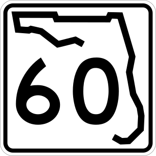
State Road 60 is an east–west route transversing Florida from the Gulf of Mexico to the Atlantic Ocean. The western terminus of SR 60 is at the Sunsets at Pier 60 site in Clearwater Beach. The eastern terminus is in Vero Beach near the Atlantic Coast just past State Road A1A.

<span class="mw-page-title-main">Eau Gallie Causeway</span> Bridge in Florida, United States of America

The Eau Gallie Causeway connects Eau Gallie, Florida, with SR A1A near Indian Harbour Beach, across the Indian River Lagoon. Located entirely within the Melbourne city limits, the causeway consists of a main bridge crossing over the Intracoastal Waterway and a relief bridge. The bridge is a key link in SR 518, Eau Gallie Boulevard, of which the causeway is a part.

<span class="mw-page-title-main">Florida State Road 856</span> Highway in Florida

State Road 856 (SR 856), also known as the William Lehman Causeway, is a 1.704-mile-long (2.742 km) causeway connecting Biscayne Boulevard in Aventura and Collins Avenue (SR A1A) in Sunny Isles Beach, Florida.

<span class="mw-page-title-main">Florida State Road 441</span> State highway in Florida, United States

State Road 441 is a 5.4-mile-long (8.7 km) street in Port Orange, Daytona Beach Shores, and Daytona Beach. It is locally known as Peninsula Drive, and signed as a north–south road.

<span class="mw-page-title-main">Halifax River</span> River in Florida, United States

The Halifax River is part of the Atlantic Intracoastal Waterway, located in northeast Volusia County, Florida. The waterway was originally known as the North Mosquito River, but was renamed after George Montagu-Dunk, 2nd Earl of Halifax, during the British occupation of Florida (1763–1784).

<span class="mw-page-title-main">Florida State Road 732</span> State highway in Florida, United States

State Road 732 (SR 732) comprises two segments of a state highway in the Jensen Beach, Florida vicinity. The western 2.2-mile-long (3.5 km) segment is a part of Jensen Beach Boulevard between U.S. Route 1 (US 1) and County Road 723 (CR 723) and CR 707A. The eastern 1.9-mile-long (3.1 km) segment consists of Causeway Boulevard and the Jensen Beach Causeway over the Indian River Lagoon and runs between CR 707 and SR A1A.

<span class="mw-page-title-main">U.S. Route 1 in Florida</span> Highway in Florida

U.S. Highway 1 (US 1) in Florida runs 545 miles (877 km) along the state's east coast from Key West to its crossing of the St. Marys River into Georgia north of Boulogne and south of Folkston. US 1 was designated through Florida when the U.S. Numbered Highway System was established in 1926. With the exception of Monroe County, the highway runs through the easternmost tier of counties in the state, connecting numerous towns and cities along its route, including nine county seats. The road is maintained by the Florida Department of Transportation (FDOT).

<span class="mw-page-title-main">Beach Boulevard (Jacksonville)</span>

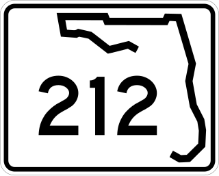
Beach Boulevard is an east–west road running from Jacksonville, Florida, United States east to Jacksonville Beach. Most of the road is part of U.S. Route 90 and unsigned as State Road 212, and a small portion at the eastern end is unsigned as County Road 212.

<span class="mw-page-title-main">Florida State Road 510</span> State highway in Florida, United States

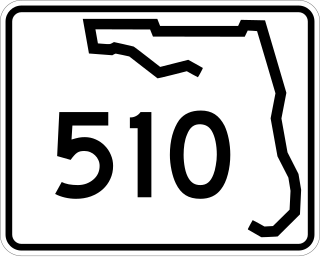
State Road 510 is a 2.606-mile-long (4.194 km) state highway in northern Indian River County, extending from U.S. Route 1 in Wabasso to SR A1A in Orchid. The route acts primarily as a bridge across the Indian River, known as the Wabasso Causeway, the northernmost crossing of the Intracoastal Waterway in Indian River County. The entire highway is on the Indian River Lagoon Scenic Highway.

<span class="mw-page-title-main">Florida State Road 64</span> State highway in Florida, United States

State Road 64 extends from City Road 789 near the Gulf of Mexico in Holmes Beach on Anna Maria Island in Manatee County to US 27/US 98 in Avon Park in Highlands County. State Road 64 travels from west to east through the counties of Manatee, Hardee and Highlands. It is a mostly rural two-lane highway going through only two cities, Bradenton and Zolfo Springs. It crosses the Gulf Intracoastal Waterway as well as the Braden River, Lake Manatee, and the Myakka River. East of Avon Park, a bi-county extension runs northeast into Polk County which runs through Lake Wales Ridge State Forest and terminates at the Avon Park US Air Force Base. It is designated as the Florida Cracker Trail from Bradenton to the Hardee County Line.

Brevard County, Florida has transportation available in the usual modes for a coastal county - highways, shipping, and airlines.

<span class="mw-page-title-main">Ormond Scenic Loop and Trail</span>

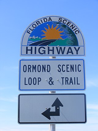
The Ormond Scenic Loop and Trail is a series of scenic state and county highways in Volusia County, Florida. CR 2002 is the northern leg of the trail. CR 4011(Old Dixie Highway and North Beach Street) is the western leg, with a spur onto Pine Tree Drive. SR 40(East Granada Boulevard) is the southern leg of the trail. CR 2803(John Anderson Drive) is the central leg of the trail, and SR A1A is the eastern leg of the trail. Florida Scenic Highway, designated this route on July 9, 2007.

<span class="mw-page-title-main">Corey Causeway</span> Bridge in Florida, United States of America

The Corey Causeway is a series of three twin-span bridges that cross the Boca Ciega Bay, part of the Gulf Intracoastal Waterway. The causeway carries SR 693. The two east bridges are fixed bridges, and the west bridge is a double-leaf bascule bridge. It connects the barrier islands of St. Pete Beach and the mainland of South Pasadena, Florida. The westbound span of the Corey Causeway was built in 1966, and the eastbound span was built in 1975, which replaced the original causeway built in the 1930s.

<span class="mw-page-title-main">Dunedin Causeway</span> Bridge in Florida, United States of America

The Dunedin Causeway is a series of three bridges that cross the St. Joseph Sound, part of the Gulf Intracoastal Waterway, connecting the barrier islands of Honeymoon Island State Park and the mainland of Dunedin, Florida. The causeway carries CR 586 and it was built in 1963.

References

  1. Compiled from NOAA-published charts directly and via "Aquamap". Atlantic Intracoastal Waterway Association.
  2. Intracoastal Waterway: Beaufort River to St. Simons Sound (Map). 1 : 40,000. Nautical Charts. National Oceanic and Atmospheric Administration, Office of Coast Survey. 2009. 11507. Retrieved 2009-02-08.
  3. Intracoastal Waterway: Casino Creek to Beaufort River (Map). 1 : 40,000. Nautical Charts. National Oceanic and Atmospheric Administration, Office of Coast Survey. 2009. 11518. Retrieved 2009-02-08.
  4. Intracoastal Waterway: Myrtle Grove Sound and Cape Fear River to Casino Creek (Map). 1 : 40,000. Nautical Charts. National Oceanic and Atmospheric Administration, Office of Coast Survey. 2009. 11534. Retrieved 2009-02-08.
  5. Lewis, Catherine Heniford (1998). Horry County, South Carolina, 1730–1993 (Google books). Columbia, South Carolina: University of South Carolina Press. pp. xxiii, 192. ISBN   978-1-57003-207-3 . Retrieved 2009-02-08.
  6. Socastee Swing Bridge Archived 2009-06-16 at the Wayback Machine on HorryCounty.org
  7. Intracoastal Waterway Archived 2009-06-16 at the Wayback Machine on HorryCounty.org
  8. House Bill 4430 of the 110th session of the South Carolina General Assembly
  9. Little River Bridge Archived 2008-10-11 at the Wayback Machine on HorryCounty.org
  10. http://www.nyscanals.gov/exvac/landwater/index.html Archived 2007-10-25 at the Wayback Machine , 4th paragraph, as of 8-NOV-2007

2. Cruiser Net – http://www.cruisersnet.net/index.php?categoryid=65

See also