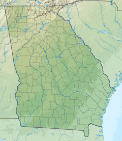
Chatham County is located in the U.S. state of Georgia, on the state's Atlantic coast. The county seat and largest city is Savannah. One of the original counties of Georgia, Chatham County was created February 5, 1777, and is named after William Pitt, 1st Earl of Chatham.

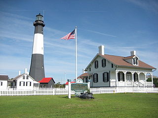
Tybee Island is a city and a barrier island located in Chatham County, Georgia, 18 miles (29 km) east of Savannah, United States. Though the name "Tybee Island" is used for both the island and the city, geographically they are not identical: only part of the island's territory lies within the city.

The Suwannee River is a river that runs through south Georgia southward into Florida in the southern United States. It is a wild blackwater river, about 246 miles (396 km) long. The Suwannee River is the site of the prehistoric Suwanee Straits which separated peninsular Florida from the panhandle.

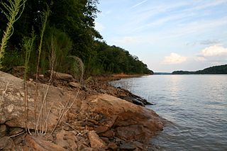
The Tugaloo River is a 45.9-mile-long (73.9 km) river that forms the border between the U.S. states of Georgia and South Carolina. It was named for the historic Cherokee town of Tugaloo at the mouth of Toccoa Creek, south of present-day Toccoa, Georgia and Travelers Rest State Historic Site in Stephens County, Georgia.
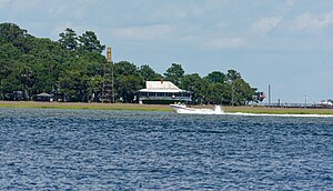
Wassaw Sound is a bay of the Atlantic Ocean on the coast of Georgia, United States near Savannah at the mouth of the Wilmington River.
The 1940 South Carolina hurricane was a Category 2 hurricane that struck the Georgia and South Carolina coast between August 11 and 12, 1940. After forming north of the Leeward Islands, the storm moved west-northwest, moving east of the Bahamas before resuming a west-northwest track towards the Southeastern United States. Hurricane warnings were in effect for the United States coastline near and north of where the center made landfall. A 13-foot storm tide was measured along the South Carolina coast, while over 15 inches (380 mm) of rain fell across northern North Carolina. Significant flooding and landslides struck Georgia, North Carolina, Tennessee, and Virginia during the system's slow trek as a weakening tropical storm, and then as an extratropical cyclone, through the Southeast. The landslides which struck North Carolina were considered a once in a century event. Damages relating to the storm totaled $13 million and 50 people perished.
U.S. Route 17 (US 17) is a 124.20-mile-long (199.88 km) U.S. Highway in the U.S. state of Georgia. It travels south-to-north near the Atlantic Ocean, serving the Brunswick and Savannah metropolitan areas on its path from Florida at the St. Marys River to South Carolina at the Savannah River. Except for part of the highway in Savannah, which is concurrent with Interstate 16 and SR 404 Spur to the Talmadge Memorial Bridge to Hutchinson Island, US 17 is concurrent with State Route 25. SR 25 uses an older western alignment of US 17 into South Carolina.

State Route 25 (SR 25) is a state highway in the eastern part of the U.S. state of Georgia. It travels south-to-north near the Atlantic Ocean, serving the Brunswick and Savannah metropolitan areas on its path from the Florida state line at the St. Marys River to the South Carolina state line at the Little Back River, a channel of the Savannah River. Except for the northern part of the highway, from Savannah to Port Wentworth, it is concurrent with U.S. Route 17 (US 17) for its entire length.

Wassaw Island is one of the Sea Islands. It is located on the Atlantic Ocean off the coast of the U.S. state of Georgia and is within the borders of Chatham County of that state. The island and its surrounding marshlands are part of the Wassaw National Wildlife Refuge, which has a total area of 10,053 acres (40.68 km2) of marsh, mudflats, and tidal creeks, including approximately 7 miles (11 km) of undeveloped beaches. The land mass is 76 percent salt marshes and 24 percent beaches, dunes, and maritime forest. The refuge is a part of the Savannah Coastal Refuges Complex.
U.S. Route 80 (US 80) is a 296-mile-long (476 km) U.S. Highway in the U.S. state of Georgia. It travels west-to-east from the Alabama state line in Columbus across the central portion of the state through cities such as Macon, Dublin, Statesboro, and Savannah to connect to its eastern terminus at an intersection with Tybrisa Street and Inlet Avenue in Tybee Island, near the Atlantic Ocean. Here, the roadway continues as Butler Avenue.

Brier Creek is a 123-mile-long (198 km) tributary of the Savannah River in the U.S. state of Georgia. It rises in Warren County east of Camak and flows southeast to the Savannah River in Screven County, 12 miles (19 km) east of Sylvania.
The Bull River is an 8.1-mile-long (13.0 km) tidal river in the U.S. state of Georgia, running through Chatham County east of Savannah. At its north end it connects via St. Augustine Creek and the Wilmington River with the Savannah River. Its south end is at Wassaw Sound, leading to the Atlantic Ocean. The Bull River flows between Wilmington Island to the west and McQueens Island and Little Tybee Island to the east. The river is crossed by one bridge, carrying U.S. Route 80 between the communities of Wilmington Island and Tybee Island.

The Halfmoon River is a 4.6-mile-long (7.4 km) tidal river in the U.S. state of Georgia. It flows through saltmarshes connected to Wilmington Island in Chatham County, ending at Wassaw Sound, an arm of the Atlantic Ocean.

The Herb River is an 8.0-mile-long (12.9 km) tidal river in the U.S. state of Georgia. It is located in Chatham County, near the southeastern edge of Savannah. It connects with the Wilmington River to the north and the Moon River to the south, and it separates the mainland on the west from Isle of Hope and Dutch Island to the east.
The Hudson River is a 49.5-mile-long (79.7 km) tributary of the Broad River in the U.S. state of Georgia. Via the Broad River, it is part of the Savannah River watershed.
The Little River is a 72-mile-long (116 km) tributary of the Savannah River in the U.S. state of Georgia. It is formed by the juncture of its North and South forks 5 miles (8 km) north of Crawfordville, and it flows generally east to Clark Hill Lake, where it joins the Savannah River 2 miles (3 km) north of the dam.

The Odingsell River is a 5.7-mile-long (9.2 km) tidal river in the U.S. state of Georgia. It flows into Ossabaw Sound just north of the mouth of the Ogeechee River. It passes through salt marshes lying between Skidaway Island to the west, Wassaw Island to the north and east, and Little Wassaw Island to the south.

The Skidaway River is an 8.4-mile-long (13.5 km) tidal river in the U.S. state of Georgia. It is located in Chatham County southeast of Savannah. Its north end is at the Wilmington River, and it flows southwest from there through Skidaway Narrows to end at the Burnside River, which connects via the Vernon and Little Ogeechee rivers with Ossabaw Sound, an arm of the Atlantic Ocean. The Skidaway River flows between Skidaway Island to the east and Dutch Island and Isle of Hope to the west. It is part of the Atlantic Intracoastal Waterway.
The Vernon River is a 12.4-mile-long (20.0 km) primarily tidal river in the U.S. state of Georgia. Located in Chatham County, it rises south of Hunter Army Airfield in Savannah and flows south into tidal marshes, where it joins the Little Ogeechee River southwest of Skidaway Island.

Talahi Island is a census-designated place (CDP) in Chatham County, Georgia, United States. The population was 1,248 at the 2010 census. It is part of the Savannah Metropolitan Statistical Area.


