
Gilmer County is a county in the Northwest region of the U.S. state of Georgia. As of the 2020 census, the population was 31,353. The county seat is Ellijay. named for a historic Cherokee town also spelled as Elejoy in the eighteenth century. The county was created on December 3, 1832, and was named for George Rockingham Gilmer, a politician who served two non-consecutive terms as governor of the state. Gilmer County is home of the annual Apple Festival, which is held in mid-October. Ninety percent of the land is in cropland and forest. Poultry raising and processing makes up the largest portion of the agricultural economy, which generates 33.2% of the total revenues. Manufacturing is about 20%.
East Ellijay is a city in Gilmer County, Georgia, United States. The population was 546 at the 2010 census, down from 707 in 2000.

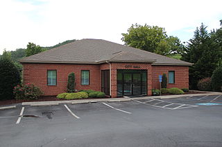
Ellijay, occasionally spelled Elijay, is a city in Gilmer County, Georgia, United States. The population was 1,862 at the 2020 census. The city is the county seat of Gilmer County.

The Cullasaja River is a short river located entirely in Macon County, North Carolina. It is a tributary of the Little Tennessee River into which it flows near the county seat of Franklin.

The Coosa River is a tributary of the Alabama River in the U.S. states of Alabama and Georgia. The river is about 280 miles (450 km) long.
The Nottely River is a river in the United States. The river originates in the Blue Ridge Mountains in northern Georgia. The river flows for 51.1 miles (82.2 km) into the artificial Hiwassee Reservoir in North Carolina. The Nottely River is dammed in Georgia, creating Lake Nottely. Arkaqua Creek is a tributary.
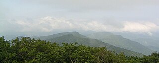
North Georgia is the northern hilly/mountainous region in the U.S. state of Georgia. At the time of the arrival of settlers from Europe, it was inhabited largely by the Cherokee. The counties of north Georgia were often scenes of important events in the history of Georgia. It was the site of many American Civil War battles, including the Battle of Lookout Mountain and the Battle of Chickamauga, leading up to the Atlanta Campaign. Today, particularly in the northeast portion of the region, tourism sustains the local economy.

The Oostanaula River is a principal tributary of the Coosa River, about 49 miles (79 km) long, formed by the confluence of the Conasauga and Coosawattee in northwestern Georgia in the United States. Via the Coosa and Alabama rivers, it is part of the watershed of the Mobile River, which flows to the Gulf of Mexico.

Black Mountain is located in Georgia USA on the boundary between Dawson and Gilmer counties. The summit is the highest point in Dawson County. It is in the Chattahoochee National Forest and is part of the Blue Ridge Wildlife Management Area.

The Coosawattee River is a 49.3-mile-long (79.3 km) river located in northwestern Georgia, United States.

State Route 52 (SR 52) is a 124.697-mile-long (200.680 km) state highway that travels west to east through portions of Whitfield, Murray, Gilmer, Dawson, Lumpkin, Hall, Banks, and Jackson counties in the northern part of the U.S. state of Georgia. The highway extends from its western terminus at Interstate 75 (I-75) in Dalton to its eastern terminus at SR 98 in Maysville.

The Cartecay River is a 19.1-mile-long (30.7 km) river that runs into Ellijay, Georgia, in Gilmer County. It is the site of a class II whitewater run.
Salacoa Creek is a stream in Bartow County, in northwestern Georgia, United States, that is a tributary of the Coosawattee River. Its own tributaries include the Pine Log Creek.

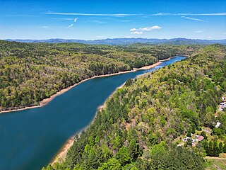
Carters Lake is a man-made reservoir located on the Coosawattee River in the Blue Ridge Mountains in Gilmer and Murray counties in the U.S. state of Georgia. It is the state's deepest lake.
There are two streams named the Little Ochlockonee River in southern Georgia in the United States. Both are tributaries of the Ochlockonee River.
Talking Rock Creek is a stream in the northwestern Georgia, United States, that is a tributary of the Coosawattee River.
Crane Eater Creek is a stream in Gordon County, Georgia, United States, that is a tributary of the Coosawattee River.
Mountaintown Creek is a stream in Gilmer County, Georgia, United States, that is a tributary of the Coosawattee River.
