Related Research Articles

Screven County is a county located in the southeastern part of the U.S. state of Georgia. As of the 2020 census, the population was 14,067. The county seat is Sylvania.

Bulloch County is a county located in the southeastern part of the U.S. state of Georgia. As of the 2020 census, the population was 81,099, up from 70,217 in 2010. The county seat is Statesboro. With Evans County, Bulloch forms part of the Statesboro micropolitan statistical area, a component of the Savannah–Hinesville–Statesboro combined statistical area.

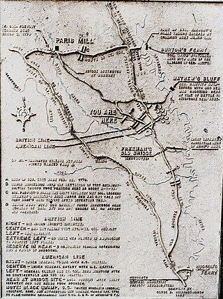
The Battle of Brier Creek was an American Revolutionary War battle fought on March 3, 1779, near the confluence of Brier Creek with the Savannah River in eastern Georgia. An American Patriot force consisting principally of militia from North Carolina and Georgia along with some Continental Army troops were defeated by British forces, suffering significant casualties. The rout damaged Patriot morale.

Millerstown is an unincorporated community in eastern Johnson Township, Champaign County, Ohio, United States. It lies at the intersection of Heck Hill, Ward, and Zimmerman Roads, 2+1⁄2 miles (4.0 km) north of U.S. Route 36. Nettle Creek, a tributary of the Mad River, flows past Millerstown. It is located approximately 4 miles northeast of the city of St. Paris and 10 miles (16 km) west-northwest of the city of Urbana, the county seat of Champaign County.

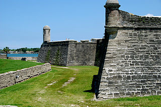
The siege of St. Augustine was a military engagement that took place during June–July 1740. It involved a British attack on the city of St. Augustine in Spanish Florida and was a part of the much larger conflict known as the War of Jenkins' Ear.

Brier Creek or Briar Creek is a 123-mile-long (198 km) tributary of the Savannah River in the U.S. state of Georgia. It rises in Warren County east of Camak and flows southeast to the Savannah River in Screven County, 12 miles (19 km) east of Sylvania.
The Buffalo River is a 4.5-mile-long (7.2 km) tidal river northwest of Brunswick, Georgia. It is part of the Brunswick River network of tidal channels along the Atlantic coast of the U.S. state of Georgia.
The Bull River is an 8.1-mile-long (13.0 km) tidal river in the U.S. state of Georgia, running through Chatham County east of Savannah. At its north end it connects via St. Augustine Creek and the Wilmington River with the Savannah River. Its south end is at Wassaw Sound, leading to the Atlantic Ocean. The Bull River flows between Wilmington Island to the west and McQueens Island and Little Tybee Island to the east. The river is crossed by one bridge, carrying U.S. Route 80 between the communities of Wilmington Island and Tybee Island.
The Crescent River is a 5.4-mile-long (8.7 km) tidal river in McIntosh County, Georgia, in the United States. It forms in salt marshes east of the community of Bellville Point and flows southeast, ending at a river junction where the Mud River flows northeast into Sapelo Sound and Old Teakettle Creek flows south to Doboy Sound.

The Herb River is an 8.0-mile-long (12.9 km) tidal river in the U.S. state of Georgia. It is located in Chatham County, near the southeastern edge of Savannah. It connects with the Wilmington River to the north and the Moon River to the south, and it separates the mainland on the west from Isle of Hope and Dutch Island to the east.
The Jerico River is a 12.8-mile-long (20.6 km) river on the Atlantic coastal plain in the U.S. state of Georgia. It serves as the boundary between Bryan and Liberty counties for its entire length.

The Little Satilla River is a 28.4-mile-long (45.7 km) freshwater tributary of the Satilla River in the U.S. state of Georgia. It should not be confused with the tidal Little Satilla River that is 20 miles (32 km) to the southeast and is an inlet of the Atlantic Ocean.
Rocky Comfort Creek is a 62.4-mile-long (100.4 km) tributary of the Ogeechee River in the U.S. state of Georgia. Rising in Warren County 9 miles (14 km) northwest of Warrenton, it flows southeast, entering Glascock County and passing the town of Gibson, then continuing south into Jefferson County, where it reaches the Ogeechee River at Louisville.
Deep Creek State Forest (DCSF) is a 380-acre state forest 11 miles north of St. Augustine, Florida in St. Johns County, Florida. Deep Creek State Forest is located on both sides of Deep Creek, for which it is named. The state forest is west of the Guana River Wildlife Management Area across the Intracoastal Waterway.
Winans Creek is a stream in Bandera County, Texas, in the United States.
Mahoney Creek is a stream in the U.S. state of South Dakota.
Hickory Creek is an extinct town in southeast Audrain County, in the U.S. state of Missouri. The community was on the north floodplain of the West Fork Cuivre River at the confluence of Hickory Creek along Missouri Route W. Middletown is five miles to the southeast in adjacent Montgomery County.
Abercorn Creek is a stream in the U.S. state of Georgia. It is a tributary to the Savannah River.
Black Creek is a stream in the U.S. state of Georgia. It is a tributary to the Ogeechee River.

Tocoi is a former settlement along the St. Johns River in St. Johns County, Florida.
References
- 1 2 U.S. Geological Survey Geographic Names Information System: Saint Augustine Creek
- 1 2 Krakow, Kenneth K. (1975). Georgia Place-Names: Their History and Origins (PDF). Macon, GA: Winship Press. p. 10. ISBN 0-915430-00-2.
- ↑ "BONAVENTURE: A HISTORICAL SKETCH" - Telfair.org, July 27, 2018
32°10′08″N81°09′25″W / 32.16889°N 81.15694°W