Wassaw Island

Last updated
Wassaw National Wildlife Refuge
IUCN category IV (habitat/species management area)
DSC 9425 (8091112286).jpg
USA Georgia relief location map.svg
Red pog.svg
Map of the United States
Usa edcp relief location map.png
Red pog.svg
Wassaw Island (the United States)
Location Chatham County, Georgia, United States
Nearest city Montgomery, Georgia
Coordinates 31°54′01″N80°58′56″W / 31.9003°N 80.9822°W / 31.9003; -80.9822 Coordinates: 31°54′01″N80°58′56″W / 31.9003°N 80.9822°W / 31.9003; -80.9822
Area10,053 acres (40.68 km2)
Established1969
Governing body U.S. Fish and Wildlife Service
Website Wassaw National Wildlife Refuge
Designated1967
Wassaw Island

Wassaw Island is one of the Sea Islands. It is located on the Atlantic Ocean off the coast of the U.S. state of Georgia and is within the borders of Chatham County. The island and its surrounding marshlands are part of the Wassaw National Wildlife Refuge, which has a total area of 10,053 acres (40.68 km2) of marsh, mudflats, and tidal creeks, including approximately 7 miles (11 km) of undeveloped beaches. The land mass is 76 percent salt marshes and 24 percent beaches, dunes, and maritime forest. The refuge is a part of the Savannah Coastal Refuges Complex. [1]

Contents

The United States government owns most of the island. Loggerhead sea turtles nest on the beaches in late spring and early summer, and turtlers can camp at the turtlers' cabin at the Federal Dock (refuge headquarters office), and then go to the beach at night to observe the turtles. Aside from this, the Federal Dock is usually only used when natural disasters occur on the island and assistance is necessary.

The island is accessible only by chartered or private boat. Most visitors arriving by private boat anchor their boats to the north or south beaches or in Wassaw Creek, near the boat dock for the refuge headquarters office. The public is encouraged to use twenty miles (32 km) of dirt trails for hiking or bicycling.

History

Human activity and impact on Wassaw has been minimal. Native Americans apparently used the island for hunting fish, fowl, reptiles, and shellfish. Indian artifacts dating to A.D. 500-600 have been found on the island.

For most of the 19th century the island was occupied by Anthony Odingsell, an African American planter, who inherited Little Wassaw Island from his former master and probable father, Charles Odingsell. Anthony Odingsell was the wealthiest free person of color in Georgia for many years.

During the Civil War the island was occupied first by Confederate troops and then Union troops. Then in 1866, George Parsons, a wealthy businessman, purchased the island with the intent of making it a holiday retreat for family and friends. Although his attempts to populate the island with hogs, pheasants, turkey and quail failed, he did end up building a home in the center of the island along with approximately 20 miles (32 km) of interior roads.

In 1898, during the Spanish–American War, a fort was built into the dunes on the north end of the island as part of the Endicott system of coastal forts. Over time, high tides, wind, and rain have eroded away the dunes, and the fort made of oyster tabby, poured concrete, and North Georgia granite continues to deteriorate from its already dilapidated condition.

In 1969, the Parsons family, in an effort to keep the island from being developed, conveyed the island to the Nature Conservancy of Georgia. Today, the island is a national wildlife refuge managed by the U.S. Fish and Wildlife Service. The Caretta Research Project, which focuses on learning more about the endangered loggerhead sea turtles, is conducted on the island by volunteers.

Wassaw National Wildlife Refuge

Designated a Natural Landmark in 1975 Wassaw Island Natural Landmark 1975.JPG
Designated a Natural Landmark in 1975

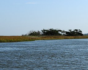
The wildlife refuge, established in 1969, is located at 31°52′46″N81°01′29″W / 31.87944°N 81.02472°W / 31.87944; -81.02472 , approximately 14 miles (23 km) southeast of Savannah and at its closest point is 3.25 miles (5.23 km) southeast of popular Skidaway Island separated by marsh and tidal creeks. The refuge is bordered by the Wilmington River and Wassaw Sound to the north and the Vernon River and Ossabaw Sound to the south and encompasses the barrier island, two smaller islands known collectively as Little Wassaw Island, and a few hammocks.

Fishing, collecting shells and wildlife, biking, and camping are illegal on the beach of the island.

Fort Morgan

At the northern end of the Wassaw Beach, facing the ocean, are the ruins of Fort Morgan from the Spanish–American War, built in 1898 by Second Lieutenant Henry Sims Morgan of the U.S. Army Corps of Engineers. The fort is made from cement and granite gravel, with small clam shells embedded in the walls. The ruins are slowly deteriorating as tidal forces and shifting sands have caused sections to crumble under their own weight. The tidal action of the beach leaves much of the ruins exposed some years and other years much of it appears to have been buried under several feet of sand.

Sometimes the corroded remains of the bolts which held the two 4.7-inch rapid fire cannon mounts are clearly visible in their circular pattern located on either side of the main bunker. These two cannons were intended to defend Savannah against a possible approach by the Spanish via the Wilmington River. The fort was the largest single fortification built specifically for the Spanish–American War and was constructed by civilians under the guidance of the US Army Corps of Engineers.

As the ruins are a prominent feature easily visible from other coastal islands to the north, the top of the bunker has an official USGS Survey marker embedded in the concrete roof.

Since Hurricane Irma in 2017 the surrounding beach has eroded, leaving the structure approximately 40 yards off of the beach at low tide.

Airplane crash

According to the NTSB report, At 9:30 on July 4, 1980 a mosquito control Beach C18S tail number N35MS twin-engine airplane on a flight from Johns Island, South Carolina with a destination of Kings Bay, Georgia, crashed on the south end of the island killing both pilot and copilot. The pilot was 50 years old and had over 8,000 hours flight time. Both pilots were incapacitated at the time of the uncontrolled descent.

NTSB remarks: Aircraft observed in shallow descent til impact. DIBROM 14 on board that when atomized produces blinding fumes. [2]

Wildlife

Mammals and reptiles

Birds

Related Research Articles

Tybee Island, Georgia City and barrier island in Georgia, United States

Tybee Island is a city and a barrier island located in Chatham County, Georgia, 18 miles (29 km) east of Savannah, United States. Though the name "Tybee Island" is used for both the island and the city, geographically they are not identical: only part of the island's territory lies within the city.

Merritt Island National Wildlife Refuge United States National Wildlife Refuge in Florida

Merritt Island National Wildlife Refuge is a 140,000 acres (57,000 ha) U.S. National Wildlife Refuge (NWR) on the Atlantic coast of Florida's largest barrier island. NASA's Kennedy Space Center and visitor complex are also situated on the island and NASA can restrict access to the refuge based on its operational needs.

Plum Island (Massachusetts) Human settlement in Massachusetts, U.S.

Plum Island is a barrier island located off the northeast coast of Massachusetts, north of Cape Ann, in the United States. It is approximately 11 miles (18 km) in length. The island is named for the wild beach plum shrubs that grow on its dunes, but is also famous for the purple sands at high tide, which get their color from tiny crystals of pink pyrope garnet. It is located in parts of four municipalities in Essex County. From north to south they are the city of Newburyport, and the towns of Newbury, Rowley, and Ipswich.

Golden Isles of Georgia Place in Georgia, United States

The Golden Isles of Georgia are a group of four barrier islands and the mainland port city of Brunswick on the 100-mile-long coast of the U.S. state of Georgia on the Atlantic Ocean. They include St. Simons Island, Sea Island, Jekyll Island, Little St. Simons Island, and Historic Brunswick.

Lower Suwannee National Wildlife Refuge Refuge on the western coast of Florida, U.S.

The Lower Suwannee National Wildlife Refuge (LSNWR) is part of the United States National Wildlife Refuge System. It is located in southeastern Dixie and northwestern Levy counties on the western coast of Florida, approximately fifty miles southwest of the city of Gainesville.

Pea Island National Wildlife Refuge National Wildlife Refuge in North Carolina, United States

Pea Island National Wildlife Refuge is a national wildlife refuge located on North Carolina's Pea Island, a coastal barrier island and part of a chain of islands known as the Outer Banks, adjacent to Cape Hatteras National Seashore. The sanctuary is located 10 miles (16 km) south of Nags Head, North Carolina on NC 12.

Cape St. George Island Barrier island in Florida panhandle

Cape St. George Island is an uninhabited barrier island situated on Florida's North Gulf Coast, south-southeast of St. Vincent Island, west of St. George Island and 8–10 miles south-southwest of the town of Apalachicola in Franklin County, Florida. It was formerly part of St. George Island, but was separated from the main island in 1954, when the U.S. Army Corps of Engineers constructed the ship channel known as Bob Sikes Cut.

Bon Secour National Wildlife Refuge is a 7,157-acre (29 km2) National Wildlife Refuge located in five separate units in Baldwin and Mobile Counties, United States, directly west of Gulf Shores, Alabama on the Fort Morgan Peninsula. The refuge serves as a resting and feeding area for migratory birds and as a sanctuary for native flora and fauna. The refuge is one of the largest undeveloped parcels of land on the Alabama coast.

The Savannah National Wildlife Refuge is a 31,551-acre (12,768 ha) National Wildlife Refuge located in Chatham and Effingham counties in Georgia and Jasper County in South Carolina. Of the total area, 15,395 acres (6,230 ha) is in Georgia and 15,263 acres (6,177 ha) is in South Carolina. The refuge was established to provide sanctuary for migratory waterfowl and other birds and as a nature and forest preserve for aesthetic and conservation purposes.

The Savannah Coastal Refuges Complex administers seven wildlife refuges between Georgia and South Carolina. Over 56,000 acres (230 km2) of refuge land along a 100-mile coast line are administered by the complex.

The Key West National Wildlife Refuge is a 189,497 acre (766.867 km2) National Wildlife Refuge located in Monroe County, Florida, between Key West, Florida and the Dry Tortugas. Only 2,019 acres (8.171 km2) of land are above sea level, on several keys within the refuge. These keys are unpopulated and are also designated as Wilderness within the Florida Keys Wilderness. The refuge was established to provide a preserve and breeding ground for native birds and other wildlife as well as to provide habitat and protection for endangered and threatened fish, wildlife, plants and migratory birds.

Ossabaw Island is one of the Sea Islands located on the Atlantic Ocean off the coast of the U.S. state of Georgia approximately twenty miles by water south from the historic downtown of the city of Savannah. One of the largest of Georgia's barrier islands, Ossabaw contains 9,000 acres (3,600 ha) of wooded uplands with freshwater ponds and 16,000 acres (6,500 ha) of marshlands interlaced with tidal creeks. Located between Wassaw Island and the Ogeechee River on the north and St. Catherines Island on the south, the island is not linked to the mainland by bridge or causeway. At 26,000 acres (11,000 ha), it is the third-largest barrier island off the coast of Georgia.

Rachel Carson National Wildlife Refuge

The Rachel Carson National Wildlife Refuge is a 9,125-acre (37 km2) National Wildlife Refuge made up of several parcels of land along 50 miles (80 km) of Maine's southern coast. Created in 1966, it is named for environmentalist and author Rachel Carson, whose book Silent Spring raised public awareness of the effects of DDT on migratory songbirds, and of other environmental issues.

The Blackbeard Island National Wildlife Refuge is a 5,618 acres (2,274 ha) National Wildlife Refuge located in McIntosh county in Georgia. The refuge was established to provide a nature and forest preserve for aesthetic and conservation purposes.

Cape Romain National Wildlife Refuge Wildlife refuge located in South Carolina, United States

The Cape Romain National Wildlife Refuge is a 66,287 acre (267 km²) National Wildlife Refuge in southeastern South Carolina near Awendaw, South Carolina. The refuge lands and waters encompass water impoundments, creeks and bays, emergent salt marsh and barrier islands. 29,000 acres (120 km2) are designated as Class I Wilderness. Most of the refuge is only accessible by boat. Mainland facilities include the refuge's headquarters and visitor center which are located on U.S. Highway 17 about 30 minutes by car from Charleston, South Carolina.

The Odingsell River is a 5.7-mile-long (9.2 km) tidal river in the U.S. state of Georgia. It flows into Ossabaw Sound just north of the mouth of the Ogeechee River. It passes through salt marshes lying between Skidaway Island to the west, Wassaw Island to the north and east, and Little Wassaw Island to the south.

Wolf Island National Wildlife Refuge

Wolf Island National Wildlife Refuge, located approximately 12 miles (19 km) off the coast of Darien, Georgia, in McIntosh County, was established on April 3, 1930 to provide protection and habitat for migratory birds. The barrier island refuge consists of Wolf Island and two smaller islands, Egg and Little Egg. Over 75% of the refuge's 5,126 acres (20.74 km2) are composed of saltwater marsh.

Elizabeth A. Morton National Wildlife Refuge

The Elizabeth A. Morton National Wildlife Refuge is a 187-acre (76 ha) National Wildlife Refuge in Noyack, New York. Much of the refuge is situated on a peninsula surrounded by Noyack and Little Peconic bays. The refuge is managed by the United States Fish and Wildlife Service as part of the Long Island National Wildlife Refuge Complex.

Currituck National Wildlife Refuge National Wildlife Refuge in North Carolina, United States

Currituck National Wildlife Refuge, located on the northern end of North Carolina's Outer Banks, was established in 1984 to preserve and protect the coastal barrier island ecosystem. Refuge lands are managed to provide wintering habitat for waterfowl and to protect endangered species such as piping plover, sea turtles, and seabeach amaranth.

The Amazon Venture oil spill occurred at the port of Savannah on the Savannah River in the U.S. state of Georgia. The spill, which occurred from December 4 to 6, 1986, was caused by three defective valves in the piping system of the oil tanker MV Amazon Venture, which leaked approximately 500,000 US gallons of fuel oil into the river.

References

PD-icon.svg This article incorporates  public domain material from websites or documents ofthe United States Fish and Wildlife Service .