It is uncertain why the name "Skidaway" was applied to this island. The name may relate to one in Yamacraw or another Native American Creek language. In his 1967 publication How Georgia Got Her Names, Hal E. Brinkley speculated it might be an Anglicized form of Scenawki, wife of the local Yamacraw chief Tomochichi and for whom Georgia's founder James Oglethorpe named the island.[4]
Before the American Civil War, planters farmed on the island using enslaved labor. On January 15, 1965, during the final year of the conflict, U.S. General William T. Sherman issued Special Field Order, No. 15 (series 1865). The order reallocated plantation lands on "Skidmore Island" to some formerly enslaved people whom Sherman had freed pursuant to the Emancipation Proclamation. The former slaves received plots of land no larger than 40 acres (16ha).[5] Land records show that many such plots were issued on the island beginning on April 11, 1865, two days after C.S.A. General Robert E. Lee surrendered his Army of Northern Virginia at Appomattox Court House; plots were issued though that summer and early fall, despite the death of President Abraham Lincoln, and before Georgia's readmission to the Union and the resumption of civil authority there.[6][7] Lincoln's successor, President Andrew Johnson, opposed such land transfers, as would various courts, especially since no legislation supported it. During the Reconstruction era, federal and state policy emphasized wage labor, not land ownership, for black people. Almost all land allocated to blacks in 1865 was ultimately restored to its original white owners.[8]
In a March 2019 referendum, Skidaway Island voters overwhelmingly rejected a bill that would have incorporated their community as the City of Skidaway Island. The island remains unincorporated.[9]
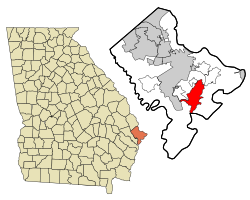
According to the United States Census Bureau, the CDP has a total area of 17.9 square miles (46km2), of which 16.4 square miles (42km2) is land and 1.5 square miles (3.9km2) (8.45%) is water.
Skidaway Island, Georgia – Racial and ethnic composition Note: the US Census treats Hispanic/Latino as an ethnic category. This table excludes Latinos from the racial categories and assigns them to a separate category. Hispanics/Latinos may be of any race.
This page is based on this Wikipedia article Text is available under the CC BY-SA 4.0 license; additional terms may apply. Images, videos and audio are available under their respective licenses.