
Elijah Clark State Park is a 447-acre (1.81 km2) Georgia state park located in Lincolnton, on the western shore of Lake Strom Thurmond. The park is named for Elijah Clarke, a frontiersman and war hero who led a force of pioneers in Georgia during the American Revolution. A reconstructed log cabin displays colonial life with furniture and tools dating back to 1780. The park is also the site of the graves of Clark and his wife, Hannah. The park's location on the lake makes it popular with fishermen.

Fort Yargo State Park is a 1,816-acre (7.35 km2) Georgia state park located in Winder, situated between Athens and Atlanta. The park is located 1 mile south of Winder and is accessible by Georgia State Route 81. There is a 260-acre (1.1 km2) lake with a public beach. Available activities at Fort Yargo include GeoCaching, hiking, mountain biking, disc golf, boating, lake swimming, fishing, picnicking, miniature golf, tennis, and basketball. The park also features a log fort built in 1792 by settlers, for protection against the Creek and Cherokee.

George L. Smith State Park is a 1,634-acre (6.61 km2) Georgia state park located in Emanuel County. The park is named after George L. Smith, a former speaker of the Georgia House of Representatives and Emanuel County native. Attractions include a grist mill, covered bridge, and the dam of the Watson Mill. The park's location on a 412-acre (1.67 km2) mill pond dotted with many cypress trees makes it a destination for anglers and canoeists. The moderately-sized state park is in a remote location, making it an attraction for bird watchers and naturalists. Rare birds in residence include the great blue heron and the white ibis.
Hamburg State Park is a 741 acre (3.00 km²) state park located near Jewell and Warthen in the U.S. state of Georgia. It is home to a 1921 water-powered grist mill still operating today, and a museum with antique agricultural tools and appliances used in rural Georgia. The park's location on the 225 acre (0.91 km²) Hamburg Lake makes it a great place for fishing.
Hard Labor Creek State Park is a 5,804 acre (23.49 km²) Georgia state park located between Fairplay and Rutledge. The park is named after Hard Labor Creek, a small stream that cuts through the park. The creek's name comes either from slaves who once tilled the summer fields, or from Native Americans who found the area around the stream difficult to ford. The park plays host to an 18-hole public golf course, which offers a pro shop, driving range, rental cars, and senior citizen discounts. Rocky Creek provides many of the water hazards on the course including the 14th hole with its signature water wheel.
High Falls State Park is a 1,050-acre (4.2 km2) Georgia state park located near the city of Jackson in Monroe County, part of the Macon metropolitan area. It is the site of a prosperous 19th-century industrial center, which became a ghost town when it was bypassed by the railroad. The park contains the largest waterfall in middle Georgia and a 650-acre (2.6 km2) lake.

Indian Springs State Park is a 528-acre (2.14 km²) Georgia state park located near Jackson and Flovilla. The park is named for its several springs, which the Creek Indians used for centuries to heal the sick. The water from these springs is said to have a sulfur smell and taste. Indian Springs is thought to be the oldest state park in the nation. It was acquired from the Creek Indians by the state through the Treaty of Indian Springs (1825) and the Treaty of Washington (1826). Thereafter, Indian Springs has been operated continuously by the state as a public park, although it did not gain the title "State Park" until 1931. The area became a resort town in the 19th century. It became an official "State Forest Park" in 1927. In 1931, along with Vogel State Park, it became a founding unit of Georgia's state park system.

James H. Floyd State Park is a 561-acre (2.27 km²) Georgia State Park located near Summerville at the base of Taylor Ridge (Georgia). The park is named after Democrat James H. "Sloppy" Floyd who served in the Georgia House of Representatives from 1953 until 1974 and was from the area. Surrounded by rural countryside and the Chattahoochee National Forest, the park offers many activities, including camping, hiking and fishing. In addition, the park contains two lakes that total 51 acres (0.21 km²) and a children’s playground. The Pinhoti Trail is accessible through the park.

Laura S. Walker State Park is a 626-acre (2.53 km²) Georgia state park located near Hoboken and the Okefenokee Swamp. The park is named after Laura S. Walker, a Georgia writer, teacher, civic leader, and naturalist. The park's location near the Okefenokee makes it home to many exotic plant and animal species, including alligators, great blue herons, and pitcher plants. The park includes a 120-acre (0.49 km²) lake and a championship 18-hole golf course plus pro shop.

Cooper Lake State Park is a Texas State Park about three miles (5 km) south of Cooper, Texas. The park is situated on Jim Chapman Lake, formerly known as Cooper Lake. There are actually two geographically separate units; the Doctors Creek unit 33°20′54″N95°40′08″W is located on the north side of the lake, in Delta County, while the South Sulphur unit 33°17′49″N95°39′35″W is located on the south side of the lake, in Hopkins County.

Little Ocmulgee State Park & Lodge is a 1,360-acre (550 ha) Georgia state park located 2 miles (3.2 km) north of McRae on the Little Ocmulgee River. Part of the park was initially built by the Civilian Conservation Corps during the Great Depression, around the natural diversion of the Little Ocmulgee into a lake. This is a 256-acre (104 ha) lake with beach, and the park includes a 60 room lodge and a championship 18-hole golf course with pro shop, known as the Wallace Adams Memorial Golf Course. The soil around the Ocmulgee River and the Little Ocmulgee is a fine white sand, and therefore the lake has its own "beach sand". Also within the park is the 2.6-mile (4.2 km) long Oak Ridge Trail, allowing visitors to see native wildlife and plants.
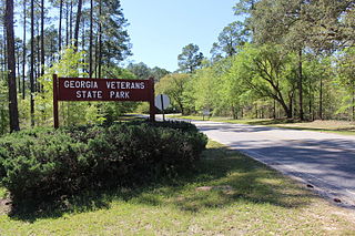
Georgia Veterans State Park is a state park located on Lake Blackshear in Crisp County, west of Cordele, Georgia. It was established in December 4, 1946 as a memorial to U.S. Veterans. The 1,308-acre (5 km2) park features a museum with aircraft, vehicles, weapons, uniforms and other memorabilia dating from the Revolutionary War to the present.
The Hart State Outdoor Recreation Area, also known as Hart State Park and Hart Park, is a community 147 acres (59 ha) natural park located at 330 of Hart Park Road, in Hartwell, Georgia, in northeast Georgia. The park is named after the American Revolutionary War heroine Nancy Hart, who lived in the Georgia frontier, and it was her devotion to freedom that has helped make her name commonplace in the Georgia upcountry today.

Moccasin Creek State Park is a 32-acre (13 ha) state park located on the western shore of Lake Burton in Rabun County in the northeast corner of Georgia. The park features campgrounds; a fishing pier for the physically disabled, the elderly, and children; and walking trails. Even though the surrounding area is mountainous, the camping area is relatively flat.

Unicoi State Park & Lodge is a 1,050-acre state park located immediately north-northeast of Helen, Georgia in the northeastern portion of the state. The centerpiece of the park is 53-acre (21 ha) Unicoi Lake on Smith Creek. The park is especially popular in October, when the autumn leaves in the forest change colors.
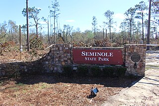
Seminole State Park is a 604 acre state park located on the shores of Lake Seminole in the extreme southwest corner of Georgia. The park offers excellent fishing opportunities on the lake, as well as a tranquil getaway in one of the park's cottages or campsites. The park also offers a scenic nature trail to experience the forest in the park. The park also offers treehouse camping that sleeps up to fifteen people. The park recently opened a new group shelter that seats up to two hundred people. The park has a new Facebook page where people can go and see what events or specials are going on at the park.
Richard B. Russell State Park is a 2,508 acre state park located on the shore of Russell Lake in Elbert County, Georgia. The park features the 18-hole Arrowhead Golf Course, as well as picnic shelters and a swimming beach.

Stephen C. Foster State Park is an 80-acre (32 ha) state park located in the Okefenokee Swamp in Charlton County, Georgia. the park offers visitors several ways to explore the swamp's unique ecosystem.
Tugaloo State Park is a 393 acre state park located on the shore of Lake Hartwell in Franklin County, Georgia. The park features a swimming beach, boat ramps, and ample fishing opportunities, and is located near S.R. 328 north of Lavonia.

Greenleaf State Park is located near Braggs, Oklahoma, and is situated around the 930-acre (3.8 km2) Greenleaf Lake. Greenleaf Lake was built in the late 1930s. There is an 18-mile (29 km) hiking trail that begins inside the park and weaves its way around Greenleaf lake and into the adjacent government land of Camp Gruber.


