
Melbourne is a city in Brevard County, Florida, United States. It is located 72 miles (116 km) southeast of Orlando and 175 miles (282 km) northwest of Miami. It had population of 84,678 at the 2020 United States Decennial Census, up from 76,068 at the 2010 census. The municipality is the second-largest in the county by both size and population. Melbourne is a principal city of the Palm Bay–Melbourne–Titusville, Florida Metropolitan Statistical Area. In 1969, the city was expanded by merging with nearby Eau Gallie. The city is also home to the National Weather Service office that serves East Central Florida including the cities of Orlando, Kissimmee, Sanford, Deltona, Daytona Beach, Cape Canaveral, Port St. Lucie and Stuart.

Merritt Island is a peninsula, commonly referred to as an island, in Brevard County, Florida, United States, located on the eastern Florida coast, along the Atlantic Ocean. It is also the name of an unincorporated town in the central and southern parts of the island and a census-designated place (CDP).

The Indian River is a 121-mile (195 km) long brackish-water lagoon on Florida's eastern Atlantic coast. It is part of the Indian River Lagoon system, which in turn forms part of the Atlantic Intracoastal Waterway. It was originally called Río de Ais by the Spanish, after the Ais tribe who lived along the east coast of what is now Florida.
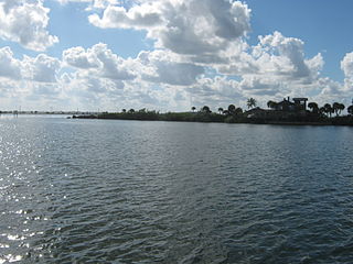
The Banana River is a 31-mile-long (50 km) lagoon that lies between Cape Canaveral and Merritt Island in Brevard County, Florida in the United States. It is part of the Indian River Lagoon system, and connects at its south end to the Indian River; it is the only part of the lagoon system not in the Intracoastal Waterway. It also has an outlet to the Atlantic Ocean via a lock into Port Canaveral. The lagoon includes salt marshes, mangrove swamps, seagrass beds, drift algae, oyster bars, tidal flats, and spoil islands, providing habitats for many marine species. These are brackish waters mixed of salt and fresh water; waist deep with a soft bottom sand/grass. Commercial and recreational activities in the lagoon generate more than US$ 800 million annually for the local economy.

Eau Gallie is a neighborhood in the city of Melbourne, Florida, located on the city's northern side. It was an independent city in Brevard County from 1860 until 1969.
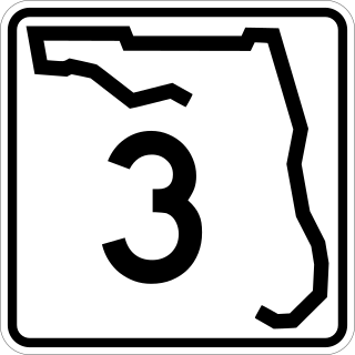
State Road 3, known locally as both North Courtenay Parkway and North Kennedy Parkway is a north–south road located entirely on Merritt Island, serving as the southern access for the Kennedy Space Center near Cape Canaveral, Florida. The shortest of the one-digit Florida State Roads, its southern terminus is an intersection with SR 520 on Merritt Island, east of Cocoa.
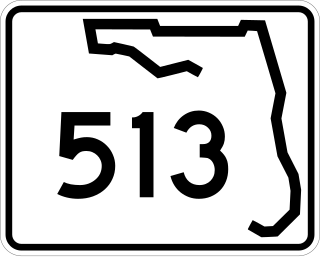
State Road 513, also known as South Patrick Drive, is a short north–south road located along the western side of the barrier island towns of Indian Harbour Beach, Satellite Beach and South Patrick Shores in Brevard County. The southern terminus is at an intersection with SR 518 near the eastern end of the Eau Gallie Causeway in Indian Harbour Beach. The northern terminus is at a partial interchange with the Pineda Causeway, just south of the southern entrance of Patrick Space Force Base.

State Road 518, also called Eau Gallie Boulevard, is a short but major east–west highway with a western terminus at Interstate 95 on the Florida mainland, crossing the Indian River via the Eau Gallie Causeway, and having its eastern terminus at SR A1A. Most of SR 518 is located within the city of Melbourne.

The Melbourne Causeway is located entirely within Brevard County, Florida in the United States. It is composed of three bridges and connects the municipalities of Melbourne and Indialantic across the Indian River Lagoon in Brevard County. The causeway is part of U.S. 192, whose eastern terminus is located approximately 2 miles (3.2 km) east of the bridge, at SR A1A. East of the bridge, the road is known locally as Fifth Avenue. On the western side, the road continues through downtown Melbourne as Strawbridge Avenue. Each July 4, the bridge is closed for a fireworks show.

State Road 404 (SR 404), the Pineda Causeway, is an east–west divided highway currently running from Interstate 95 (I-95) to SR A1A at Patrick Space Force Base, Florida, US. It was opened as a toll road in 1971 and classified as a state road two years later. The tolls were removed in 1990. It was named after Pineda, a former village east of Suntree on U.S. Route 1 (US 1). With interchanges at US 1 (SR 5), South Tropical Trail, and South Patrick Drive (SR 513), the Pineda Causeway is the primary access for Patrick Space Force Base and the southern end of Merritt Island. From US 1 to the eastern terminus, it is part of the Indian River Lagoon Scenic Highway system.

State Road 856 (SR 856), also known as the William Lehman Causeway, is a 1.704-mile-long (2.742 km) causeway connecting Biscayne Boulevard in Aventura and Collins Avenue (SR A1A) in Sunny Isles Beach, Florida.

State Road 732 (SR 732) comprises two segments of a state highway in the Jensen Beach, Florida vicinity. The western 2.2-mile-long (3.5 km) segment is a part of Jensen Beach Boulevard between U.S. Route 1 (US 1) and County Road 723 (CR 723) and CR 707A. The eastern 1.9-mile-long (3.1 km) segment consists of Causeway Boulevard and the Jensen Beach Causeway over the Indian River Lagoon and runs between CR 707 and SR A1A.

The NASA Causeway, is an east–west expressway in Brevard County, Florida, containing two causeways. The first causeway connects the Florida mainland to Merritt Island and later, over the private second causeway, connects Merritt Island to Cape Canaveral. As such, the NASA Causeway is the main route connecting points of interest in Titusville, Florida to the Kennedy Space Center on Merritt Island.

U.S. Highway 1 (US 1) in Florida runs 545 miles (877 km) along the state's east coast from Key West to its crossing of the St. Marys River into Georgia north of Boulogne and south of Folkston. US 1 was designated through Florida when the U.S. Numbered Highway System was established in 1926. With the exception of Monroe County, the highway runs through the easternmost tier of counties in the state, connecting numerous towns and cities along its route, including nine county seats. The road is maintained by the Florida Department of Transportation (FDOT).

The Merritt Island Dragon or Merrit Island River Dragon was a dragon-shaped green concrete structure that stood at the southern tip of Merritt Island, Florida, known as Dragon Point, where the Indian River Lagoon splits to form the Banana River Lagoon. The dragon was built in 1971 by Florida artist Lewis VanDercar and property owner Aynn Christal. In 1981, the statue was expanded for new property owner Warren McFadden, with the addition of a tail, an extended neck, two cavepeople a caveman named Fred and a cavewoman named Wilma and four hatchling dragons named Joy, Sunshine, Charity, and Freedom. The statues were located between the cities of Melbourne and Indian Harbour Beach, Florida, north of the Eau Gallie Causeway.
The Indian River Lagoon Scenic Highway is a 130-mile-long (210 km) scenic byway located in Florida. The highway is a collection of several roads, running north and south along either side of the Indian River Lagoon, connected by other roads running over the Lagoon.
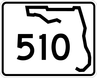
State Road 510 is a 2.606-mile-long (4.194 km) state highway in northern Indian River County, extending from U.S. Route 1 in Wabasso to SR A1A in Wabasso Beach. The route acts primarily as a bridge across the Indian River, known as the Wabasso Causeway, the northernmost crossing of the Intracoastal Waterway in Indian River County. The entire highway is on the Indian River Lagoon Scenic Highway.
Brevard County, Florida has transportation available in the usual modes for a coastal county - highways, shipping, and airlines.

