Lee County is located in southwestern Florida, United States, on the Gulf Coast. As of the 2020 census, its population was 760,822. In 2022, the population was 822,453, making it the eighth-most populous county in the state. The county seat is Fort Myers, with a population of 86,395 as of the 2020 census, and the largest city is Cape Coral, with an estimated 2020 population of 194,016.

Marco Island is a city and barrier island in Collier County, Florida, 20 miles (32 km) south of Naples on the Gulf Coast of the United States. It is the largest barrier island in Southwest Florida's Ten Thousand Islands area, which extends southerly to Cape Sable. Marco Island is home to an affluent beach community with resort amenities.

The Florida Keys are a coral cay archipelago off the southern coast of Florida, forming the southernmost part of the continental United States. They begin at the southeastern coast of the Florida peninsula, about 15 miles (24 km) south of Miami and extend in a gentle arc south-southwest and then westward to Key West, the westernmost of the inhabited islands, and on to the uninhabited Dry Tortugas. The islands lie along the Florida Straits, dividing the Atlantic Ocean to the east from the Gulf of Mexico to the northwest, and defining one edge of Florida Bay. The southern part of Key West is 93 miles (150 km) from Cuba. The Keys are located between about 24.3 and 25.5 degrees North latitude.

A swing bridge is a movable bridge that can be rotated horizontally around a vertical axis. It has as its primary structural support a vertical locating pin and support ring, usually at or near to its center of gravity, about which the swing span can then pivot horizontally as shown in the animated illustration to the right.

The Seven Mile Bridge is a bridge in the Florida Keys, in Monroe County, Florida, United States. It connects Knight's Key in the Middle Keys to Little Duck Key in the Lower Keys. Among the longest bridges in existence when it was built, it is part of the Overseas Highway in the Keys, which is part of the 2,369-mile (3,813 km) U.S. Route 1.

The Seminole Gulf Railway is a short line freight and passenger excursion railroad headquartered in Fort Myers, Florida, that operates two former CSX Transportation railroad lines in Southwest Florida. The company's Fort Myers Division, which was previously the southernmost segment of CSX's Fort Myers Subdivision, runs from Arcadia south to North Naples via Punta Gorda, Fort Myers, Estero, and Bonita Springs. The company's other line, the Sarasota Division, runs from Oneco south through Sarasota. Seminole Gulf acquired the lines in November 1987 and operates its own equipment. The company's first train departed Fort Myers on November 14, 1987.
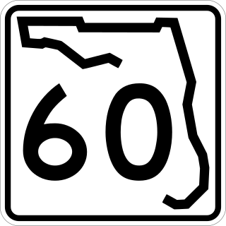
State Road 60, or Route 60 is an east–west route transversing Florida from the Gulf of Mexico to the Atlantic Ocean. The western terminus of SR 60 is at the Sunsets at Pier 60 site in Clearwater Beach. The eastern terminus is in Vero Beach near the Atlantic Coast just past State Road A1A.

State Road 29 is a state highway that runs north–south through Southwest Florida. It begins in Carnstown and runs north to a point just south of Palmdale. A rural road, it runs mostly through uninhabited farmland in its northern half, and along wetlands in its southern half. The route previously continued south of Carnestown to Everglades City and Chokoloskee, which has since become County Road 29.

State Road 78 is the Florida Department of Transportation designation of the highway that historically extended from Pine Island Center on the Gulf Coast of Florida to the northern tip of Lake Okeechobee. In the 1980s, two segments of the route were removed from state maintenance to county maintenance and both were redesignated County Road 78. All three sections of SR 78 are signed east–west, even though the easternmost section is actually a north–south route.

The Venetian Islands are a chain of artificial islands in Biscayne Bay in the cities of Miami and Miami Beach, Florida. The islands are, from west to east: Biscayne Island (Miami), San Marco Island (Miami), San Marino Island, Di Lido Island, Rivo Alto Island, and Belle Isle. Flagler Monument Island remains an uninhabited picnic island, originally built in 1920 as a memorial to railroad pioneer Henry Flagler. The islands are connected by bridges from the Miami mainland to Miami Beach.

The Schuylkill River Trail is a multi-use trail along the banks of the Schuylkill River in southeastern Pennsylvania. Partially complete as of 2018, the trail is ultimately planned to run about 140 miles (230 km) from the river's headwaters in Schuylkill County to Fort Mifflin in Philadelphia.

State Route 175 (SR 175) is a primary state highway in the U.S. state of Virginia. Known as Chincoteague Road, the state highway runs 10.49 miles (16.88 km) from U.S. Route 13 (US 13) at Nash Corner east to Main Street in Chincoteague. SR 175 passes through the northeastern corner of Accomack County, providing the primary access to NASA's Wallops Flight Facility and both Chincoteague Island and the Virginia portion of Assateague Island. The route travels between the mainland and Chincoteague Island along the John B. Whealton Memorial Causeway.

The Matanzas Pass Bridge is a bridge located in Fort Myers Beach, Florida. It carries State Road 865 between the Florida mainland and Estero Island, which is a major tourist destination. The bridge is one of the island's two connections to the mainland. The other is the Bonita Beach Causeway on the south end of the island.
The Edison Bridge is a set of two one-way bridges located in Fort Myers, Florida. Named after inventor Thomas Alva Edison, the two bridges carry each direction of U.S. Highway 41 Business over the Caloosahatchee River, connecting downtown Fort Myers with North Fort Myers.

The Pine Island Causeway is a roadway in Southwest Florida spanning Matlacha Pass connecting Pine Island, the largest island in Florida, to the main land in Cape Coral. The causeway carries Pine Island Road and consists of three bridges with dredged land sections in between them. The islands connected to the middle of the causeway are also home to the community of Matlacha. It provides the only vehicular access to both Matlacha and Pine Island.

The New River is a tidal estuary in South Florida, United States. Despite its name, it is not a true natural river, but a channel composed of many tributary canals. The channel is connected to the Everglades through a series of man-made canals. After passing through Fort Lauderdale, the channel connects to the Intracoastal Waterway and Atlantic Ocean at Port Everglades cut. The channel is entirely within Broward County and is composed from the junction of three main canals which originate in the Everglades, splitting off from the Miami Canal. They are the North New River Canal, which flows south from Lake Okeechobee along the east side of U.S. 27 and then east along the north side of State Road 84 / Interstate 595; the South New River Canal, which flows east from the Miami Canal along the north side of Griffin Road and the south side of Orange Drive; and a canal which flows east along the south side of Sunrise Boulevard. The Henry E. Kinney Tunnel in downtown Fort Lauderdale travels underneath the New River.

The Boca Grande Causeway is a causeway located in Charlotte County, Florida, connecting the community of Boca Grande on Gasparilla Island with the mainland near Placida. The 2.5-mile (4.0 km) causeway crosses Gasparilla Sound and consists of three bridges, and is the only vehicular access to the island.
S.S. Jolley Bridge is a bridge located in Collier County, Florida connecting Marco Island with the mainland in Naples. The bridge is a good location for fishing.
The Atlantic Coast Line Railroad's Lakeland—Fort Myers Line was one of the railroad company's secondary main lines in Central and Southwest Florida. It was built incrementally in the late 1800s and early 1900s. Parts of the line are still active today.
