Florida State Road 913

Last updated
See also Rickenbacker Causeway, a causeway that forms part of the current alignment of SR 913

Florida 913.svg

State Road 913

26th Road
Rickenbacker Causeway
Crandon Boulevard
Florida State Road 913
SR 913 highlighted in red
Route information
Maintained by FDOT
Length7.486 mi [1] [2]  (12.048 km)
0.373 miles (0.600 km) of state-maintained SR 913
Major junctions
South end Cape Florida State Park in Key Biscayne
North endI-95.svgUS 1.svg I-95  / US 1 in Miami
Location
Country United States
State Florida
Counties Miami-Dade
Highway system
Florida 909.svg SR 909 Florida 915.svg SR 915

State Road 913 is an access road between the village of Key Biscayne on the island of Key Biscayne and I-95 in Miami on the western end of Biscayne Bay.

Contents

The only part of the road that is state maintained is South 26th Road; Miami-Dade County maintains the Rickenbacker Causeway across the Biscayne Bay and Virginia Key to Key Biscayne. [3] Inside the village of Key Biscayne, the roadway is known as Crandon Boulevard after it crosses Bear Cut. [4] Mile markers are posted along the entire route, with zero at the entrance to Bill Baggs Cape Florida State Park at the south end of Crandon Boulevard.

Route description

Crandon Boulevard starts at the entrance to Bill Baggs Cape Florida State Park, and serves as a main artery for the village of Key Biscayne. North of the village, the road cuts through Crandon Park, passing by Crandon Beach and the Tennis Center at Crandon Park before it crosses Bear Cut onto Virginia Key, where the road becomes three lanes wide. Bear Cut also marks the southern terminus of the Rickenbacker Causeway and northern terminus of Crandon Boulevard.

After arriving on Virginia Key, the road passes by the University of Miami's Rosenstiel School of Marine, Atmospheric, and Earth Science, NOAA's Atlantic Oceanographic and Meteorological Laboratory (AOML), the Miami Seaquarium, MAST Academy, and Miami Marine Stadium. The William M. Powell Bridge [5] carries traffic over Biscayne Bay. The road passes by more beaches on a short and thin barrier island before it reaches the toll plaza for the southbound Rickenbacker Causeway on the mainland, where state maintenance begins. The road's state road designation ends at I-95, but the road itself continues into Miami's The Roads neighborhood as Southwest 26th Road.

Toll on the Rickenbacker Causeway for southbound automobiles is $3.00 for drivers without a Sunpass and $2.25 for drivers with a Sunpass; northbound vehicles do not stop to pay toll.

History

Originally, there was no State Road connection between I-95 and Key Biscayne when the Interstate highway was opened in 1967. The southernmost exit of the expressway was a short "trunk ramp" forming the southwestern end of Southwest 23rd Road at Southwest First Avenue (with the ramps having an at-grade crossing with Florida East Coast Railroad tracks before reaching First Avenue). Southbound traffic for the Miami Seaquarium, beaches, and other tourist attractions along the Rickenbacker Causeway would exit at Southwest 23rd Road, then take Southwest First Avenue to Southwest 25th Road, which would lead (via Brickell Avenue) to the toll booths on the entrance of the Causeway.

In the late 1970s and early 1980s, the railroad tracks were removed and houses along Southwest First Avenue between Southwest 15th Road and Southwest 12th Avenue were demolished to make room for Metrorail. The removal of this section of Southwest First Avenue resulted in a temporary lack of access of the Rickenbacker Causeway to southbound I-95 motorists (briefly, they were guided to it by way of Southwest Eighth Street (US 41-SR 90) and Brickell Avenue (US 1-SR 5). Ultimately (in the early 1980s), a new partial interchange was built for southbound I-95, this time at Southwest 25th and 26th Roads. This became the primary mode of access to Key Biscayne from the expressway.

On the other hand, motorists leaving the Rickenbacker Causeway has had direct access with northbound I-95 and southbound US 1 (Brickell Avenue) with flyover ramps since 1967.

In the mid-1980s, newly built sections Southwest and Southeast 26th Road, plus the two flyover ramps, were designated an unsigned State Road 913 and maintained by the Florida Department of Transportation as a state highway. [6] [7] [8] [9] FDOT now inventories the causeway and Crandon Boulevard as County Road 913. [2]

Major intersections

The entire route is in Miami-Dade County.

Locationmi [1] [2] kmDestinationsNotes
Key Biscayne 0.0000.000 Bill Baggs Cape Florida State Park
0.4 [10] 0.64West Mashta Drive
1.3 [10] 2.1Harbor Drive
Crandon Park
Virginia Key
3.6 [10]
4.1
5.8–
6.6
Bear Cut Bridge over Bear Cut
Virginia Key 4.3 [10] 6.9 Virginia Key Beach Park, MAST Academy, Miami Marine Stadium & Miami Seaquarium
Miami 5.6 [10]
6.2
9.0–
10.0
William M. Powell Bridge over Biscayne Bay (Atlantic Intracoastal Waterway)
6.9 [10]
7.0
11.1–
11.3
West Bridge over Biscayne Bay
7.11311.447 Rickenbacker Causeway Toll Plaza ($1.75 toll southbound)
south end of state maintenance
7.14511.499North plate blue.svg
I-95.svg
US 1.svgAirport Sign.svg I-95 north (SR 9A) / US 1 (SR 5) Downtown Miami, Airport, Coral Gables
northbound exit; flyover
7.26411.690 Brickell Avenue, South Dixie Highway former US 1/SR 5, no left turn northbound onto South Dixie Highway
7.34111.814South Miami Avenue - Museum of Science, Vizcaya Museum & Gardens
7.4411.97North plate blue.svg
I-95.svg
North plate.svg
US 1.svg
Airport Sign.svg I-95 north (SR 9A) / US 1 north (SR 5) / Southwest 25th Road Downtown Miami, Airport, Coral Gables
I-95 exit 1A; SR 913 is one-way southbound through the I-95 interchange
7.48612.048Southwest 1st Avenuenorth end of state maintenance
1.000 mi = 1.609 km; 1.000 km = 0.621 mi

Related Research Articles

<span class="mw-page-title-main">Virginia Key</span> Neighborhood of Miami in Miami-Dade County, Florida, United States

Virginia Key is an 863-acre (3.49 km2) barrier island in Miami, Florida. It is located in Biscayne Bay south of Brickell and north of Key Biscayne and is accessible from the mainland via the Rickenbacker Causeway.

<span class="mw-page-title-main">Florida State Road 970</span> Highway in Florida

State Road 970, also known as the Downtown Distributor, is a short 0.563-mile (0.906 km) elevated freeway connecting Interstate 95 and Biscayne Boulevard in Downtown Miami. As of June 20, 2014, the entirety of the road cosigns with US 1/SR 5.

<span class="mw-page-title-main">Florida State Road 826</span> Highway in Florida

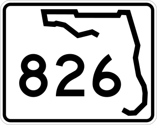
State Road 826 is a bypass route around the greater Miami area, traveling approximately 30 miles (48 km) in a northeasterly arc from U.S. Route 1 in Pinecrest to its terminus at State Road A1A in Sunny Isles Beach. Between its southern terminus and the Golden Glades Interchange, State Road 826 is known as the Palmetto Expressway, a heavily traveled freeway with portions of the road carrying in excess of 250,000 vehicles a day. Unlike many of the other non-interstate freeways in Miami-Dade County, the Palmetto Expressway is untolled. East of the interchange, State Road 826 is a surface road connecting North Miami and North Miami Beach to Sunny Isles Beach over the Intracoastal Waterway.

<span class="mw-page-title-main">Florida State Road 112</span> Highway in Florida

State Road 112 (SR 112) is a 9.9-mile-long (15.9 km) east–west state highway connecting Miami International Airport in Miami to Miami Beach in the U.S. state of Florida. Between the airport and Interstate 95, it is locally known as the Airport Expressway, and is a controlled-access toll road between SR 9 and I-95. Between I-95 and Alton Road (SR 907A) in Miami Beach, SR 112 is signed only as Interstate 195 as it crosses Biscayne Bay by way of the Julia Tuttle Causeway. Between I-195 and its eastern terminus at Collins Avenue (SR A1A), the SR 112 signs are present but infrequent, and the road is locally maintained as Arthur Godfrey Road.

<span class="mw-page-title-main">Florida State Road 886</span> Highway in Florida

State Road 886, also known as Port Boulevard, is a causeway connecting the Port of Miami with downtown Miami, Florida. Its western terminus is an intersection with U.S. Route 1 just north of Bayside Marketplace, and its eastern terminus is at the Port of Miami entrance. It received its FDOT designation in 1980.

<span class="mw-page-title-main">Florida State Road 909</span> Highway in Miami-Dade County, Florida, United States

State Road 909 is a 3.77-mile (6.07 km) state highway in northern Miami-Dade County, Florida, United States, that runs along West Dixie Highway, the original alignment of the Dixie Highway, from the east end of Gratigny Drive in North Miami northeast to North Miami Beach Boulevard in North Miami Beach, just across the Florida East Coast Railway from Biscayne Boulevard (U.S. Route 1 and Florida State Road 5. SR 909 is actually in two pieces as motorists traveling the route in North Miami encounter signs on North Miami Boulevard saying "TO 909" and "To W Dixie Hwy" and guiding them along a two-block "detour" to the other section.

<span class="mw-page-title-main">Dolphin East–West Expressway</span> Highway in Florida

The Dolphin East–West Expressway is a 15.4-mile (24.8 km) freeway, with the westernmost 14 miles (23 km) as an all-electronic tollway signed as State Road 836, and the easternmost 1.292 miles (2.079 km) between Interstate 95 (I-95) and SR A1A cosigned as Interstate 395 (I-395).

<span class="mw-page-title-main">Florida State Road 915</span> Highway in Miami-Dade County, Florida, United States

State Road 915 (SR 915), locally known as Northeast Sixth Avenue, is a 5.86-mile-long (9.43 km) north–south street through the residential and business areas of the northern Miami-Dade County municipalities of Miami Shores, Biscayne Park, North Miami, and North Miami Beach. It extends from an intersection with Biscayne Boulevard near Northeast 88th Terrace north to an interchange of Interstate 95 (I-95) and Miami Gardens Drive. It is often used by commuters as an alternative to the oft-congested Interstate and U.S. Highway between Miami and Hollywood.

<span class="mw-page-title-main">Florida State Road 922</span> Highway in Florida, US

State Road 922 is a 5.548 miles (8.929 km) east–west road built in 1951, passing through the cities of North Miami, Bay Harbor Islands, and Bal Harbour, Florida. Locally, the street is also known as North 125th Street, North Miami Boulevard, Northeast 123rd Street, Broad Causeway, 96th Street, and Kane Concourse. Its western terminus is an intersection with Northwest Seventh Avenue, one block west of Interstate 95, its eastern terminus is an intersection with SR A1A. The street is an important commercial artery in northeastern Miami-Dade County, with stores lining much of the route, including the Bal Harbour Shops mall near its eastern terminus.

<span class="mw-page-title-main">Florida State Road 916</span> State highway in Florida, United States

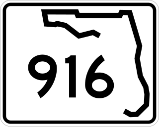
State Road 916, locally known as Northwest 138th Street, West 84th Street, North 135th Street, Opa-locka Boulevard, and Natural Bridge Road is a 10.253 miles (16.501 km) long east–west highway crossing northern Miami-Dade County, Florida. Its western terminus is at an interchange with Interstate 75 (I-75), the Palmetto Expressway, and the Gratigny Parkway on the boundary between Hialeah and Miami Lakes, traveling east to Biscayne Boulevard.

<span class="mw-page-title-main">Florida State Road 934</span> Highway in Florida

State Road 934 runs for 13.1 miles (21.1 km) from State Road 826 in Medley to SR A1A in Miami Beach. It is a major east–west highway in the Miami metropolitan area.

<span class="mw-page-title-main">Florida State Road 856</span> Highway in Florida

State Road 856 (SR 856), also known as the William Lehman Causeway, is a 1.704-mile-long (2.742 km) causeway connecting Biscayne Boulevard in Aventura and Collins Avenue (SR A1A) in Sunny Isles Beach, Florida.

<span class="mw-page-title-main">Flagler Street</span> Main east-west road in Miami, Florida, United States

Flagler Street is a 12.4-mile (20.0 km) main east–west road in Miami. Flagler Street is the latitudinal baseline that divides all the streets on the Miami-Dade County grid plan as north or south streets. Flagler Street is named after industrialist Henry Flagler and serves as a major commercial east–west highway through central Miami-Dade County, with a mixture of residential neighborhoods and strip malls, the commercial presence increasing as SR 968 approaches downtown Miami.

<span class="mw-page-title-main">Interstate 95 in Florida</span> Highway in Florida

Interstate 95 (I-95) is the main Interstate Highway of Florida's Atlantic Coast. It begins at a partial interchange with US Highway 1 (US 1) just south of downtown Miami and heads north through Jacksonville, and to the Georgia state line at the St. Marys River near Becker. The route also passes through the cities of Fort Lauderdale, West Palm Beach, Port St. Lucie, Titusville, and Daytona Beach.

<span class="mw-page-title-main">Rickenbacker Causeway</span> Bridge in Florida, United States of America

The Rickenbacker Causeway is a causeway that connects Miami, Florida to the barrier islands of Virginia Key and Key Biscayne across Biscayne Bay.

<span class="mw-page-title-main">Brickell</span> Neighborhood of Miami in Miami-Dade County, Florida, United States

Brickell is a neighborhood in Miami, Florida, historically referenced at times as "Southside", located directly east of Interstate 95, south of the Miami River, and north of Coconut Grove. Brickell is known as the financial district of Miami, as well as South Florida.

<span class="mw-page-title-main">Crandon Park</span> Public park in Florida, US

Crandon Park is an 808-acre (3.27 km2) urban park in metropolitan Miami, occupying the northern part of Key Biscayne. It is connected to mainland Miami via the Rickenbacker Causeway.

<span class="mw-page-title-main">Brickell Avenue</span> Major street in Miami

Brickell Avenue is a north–south road that is part of U.S. Route 1, in Miami, Florida, just south of the Miami River. North of the Brickell Avenue Bridge, U.S. Route 1 is known as Biscayne Boulevard. Brickell Avenue is the main road through the Brickell financial district of Downtown Miami and is considered the Park Avenue of Florida. Brickell Avenue is lined with high-rise office buildings and residential condominiums, as well as many banks and restaurants. It is also famed for "Millionaire Row's" home to a cluster of Miami's most expensive residences.

<span class="mw-page-title-main">Central Business District (Miami)</span> Central business district in the United States

The Central Business District (CBD) of Miami is the historic central business district and city center of what has become Greater Downtown Miami in Miami, Florida. Over 92,000 people work in Miami's Central Business District.

<span class="mw-page-title-main">Florida State Road 925</span> Highway in Florida

State Road 925 is a pair of north-south roads in Miami, Florida connecting westbound SR 968 with the Interstate 95 (I-95) exits on Northwest 8th Street. The northbound road is known locally as Northwest 3rd Avenue and runs 0.565 miles (0.909 km). The southbound road is known as Northwest 3rd Court and runs 0.506 miles (0.814 km). The roads run parallel Interstate 95 on opposite sides and serve as frontage roads for exits 2B and 3B off of the highway. The SR 925 designation was created in 2014 as part of a jurisdictional swap over various roadways between the Florida Department of Transportation (FDOT) and the City of Miami.

References

  1. 1 2 FDOT straight line diagrams Archived March 6, 2014, at the Wayback Machine , accessed March 2014
  2. 1 2 3 FDOT GIS data Archived 2008-12-11 at the Wayback Machine , accessed January 2014
  3. U.S. Census Bureau. "2009 Boundary and Annexation Survey Maps" . Retrieved June 4, 2009.[ permanent dead link ]
  4. Google (11 January 2013). "Bear Cut" (Map). Google Maps . Google. Retrieved 11 January 2013.
  5. "William M. Powell Bridge". Emporis. Archived from the original on February 3, 2014. Retrieved 11 February 2013.{{cite web}}: CS1 maint: unfit URL (link)
  6. FDOT GIS data Archived June 23, 2007, at the Wayback Machine
  7. Florida Department of Transportation, Official Florida Transportation Map (1989)
  8. Rand McNally, Miami Metro map (1995) ISBN   0-525-98289-2
  9. Dolph Map Company, Map of Metropolitan Miami, Dade County, Florida (1996) ISBN   1-57396-072-1
  10. 1 2 3 4 5 6 Google Maps distance
Template:Attached KML/Florida State Road 913
KML is not from Wikidata