SR 337 begins at U.S. Route 58 Business west of downtown Suffolk and ends at the north end of Interstate 564 at Naval Station Norfolk.[5] It uses a number of different streets to get there. Through downtown Suffolk, SR 337 is Washington Street. This becomes Nansemond Parkway after crossing US 58 Bus. at Magnolia,[1] and becomes Portsmouth Boulevard as it enters Chesapeake.[2] The name remains after it enters Portsmouth via the Hodges Ferry Bridge, including a short concurrency with US 460 Alt. between US 58 and I-264, until the Elm Avenue intersection. There SR 337 turns south on Elm Avenue, which turns east to reach the Jordan Bridge.[3] At the Jordan Bridge, SR 337 again enters Chesapeake, heading east on Poindexter Street across I-464 and north on Bainbridge Boulevard. (US 460 and SR 166 use the other two legs of the Poindexter-Bainbridge intersection.)[2]
Bainbridge Boulevard takes SR 337 into Norfolk, where it makes several turns onto Main Street, Liberty Street, State Street, and Berkeley Avenue to join I-464, quickly merging into I-464 (and US 460 Alt.) over the Berkley Bridge. SR 337 leaves I-264 in downtown Norfolk to head north on Tidewater Drive. (US 460 Alt. also leaves there, but onto St. Pauls Boulevard.) SR 337 turns west at Brambleton Avenue, joining US 460 for a short while before it turns onto St. Pauls Boulevard. Between Boush Street and the Midtown Tunnelinterchange, SR 337 is concurrent with US 58; US 58 runs into the tunnel while SR 337 turns north there onto Hampton Boulevard. Inside the Naval Station Norfolk, SR 337 turns east on Admiral Taussig Boulevard to end at the beginning of I-564, where Taussig Boulevard becomes a freeway.[4]
SR 337 Alt. concurrent with US 460 and SR 166 in South Norfolk
There are three routes known as State Route 337 Alternate, one in Portsmouth, one in downtown Norfolk, and one along US 460 in South Norfolk and Norfolk. The Portsmouth route does not return to SR 337 at its east end.
View south along SR 337 Alt. in downtown Norfolk
The 1.09 miles (1.75km) downtown Norfolk route uses Waterside Drive and Boush Street between the Berkley Bridge (SR 337/I-264/US 460 Alt.) and Brambleton Avenue (SR 337/US 58). The route runs by major attractions such as Waterside Marketplace, Town Point Park, and Nauticus. Waterside Drive was built in order to revive the Downtown area. According to the traffic counts, southbound traffic uses Duke Street from Brambleton Avenue south to Tazewell Street, but the one-way pair no longer exists, as Norfolk has made Boush Street two-way.[4][5]
History
By 1939,[6] SR 337 existed along 21st Street and Hampton Boulevard from Granby Street (part of State Route 27, State Route 170 after 1940[7]) near downtown Norfolk north to the Newport News Ferry at Sewell's Point. This route and its extension to downtown, using Hampton Boulevard, 21st Street, Granby Street, Princess Anne Road, Bank Street, Main Street, and Commercial Place to the Portsmouth Ferry in downtown Norfolk, had been designated as a state highway in 1932, to be maintained by Norfolk with aid from Virginia under Chapter 415, Acts of 1932.[8][9] It was initially part of US 17, but in the early 1930s US 17 was rerouted west of Norfolk via the James River Bridge, bypassing both ferries.[10] The part south of 21st Street and Granby Street was still SR 27, but the rest became SR 337 (or was unnumbered for several years).
In 1942 or 1943,[11][12] US 460 was moved onto its current alignment between downtown Suffolk and South Norfolk, using US 58, the Norfolk Bypass (State Route 13, now US 13), and former SR 170 (moved then to a more easterly alignment between Great Bridge and downtown Norfolk). The part of former US 460 from Main Street and Washington Street in downtown Suffolk to Park Avenue and Bainbridge Boulevard in South Norfolk became an extension of SR 337 (this was State Route 287 from July 1933 to 1934).[13] In South Norfolk, SR 337 then followed US 460 and former SR 170 north on Bainbridge Boulevard and northeast on Poindexter Street. US 460 continued northeast on Wilson Road, but SR 337 replaced SR 170 northwest on Liberty Street into Norfolk and north on Main Street over the old Berkley Bridge. In downtown Norfolk, it continued along former SR 170 on Main Street and Bank Street, merging with SR 170 at Brambleton Avenue. The routes continued together along Bank Street, Princess Anne Road, and Granby Street to the former south end of SR 337 (21st Street).
An alternate route was formed in 1947 in South Norfolk and Norfolk by request of those two cities. The route was completely locally maintained, receiving none of the state funds that were typically assigned to numbered routes in cities. It began at the intersection of Bainbridge Boulevard and Poindexter Street, and traveled north on Bainbridge Boulevard and northeast on Main Street to end at Liberty Street.[14] This alternate became the main route in 1953, with a corresponding transfer in state funding. The portion of Liberty Street between Poindexter Street and Main Street thus became unnumbered, while the piece of Poindexter Street that had carried SR 337 continued to carry US 460. However, at the same time, a new alternate route was created, entirely concurrent with US 460 (Poindexter Street, Wilson Road, Campostella Road, and Brambleton Avenue) between Bainbridge Boulevard in South Norfolk and Bank Street in downtown Norfolk.[15] It was eliminated by 1957.[16]
When the Berkley Bridge replacement was being planned, it was temporarily assigned the State Route 337 Alternate designation in 1951, pending the completion of the "Norfolk Traffic Study".[17] The bridge opened in 1952, and in 1953 SR 337 was rerouted to use it. The new alignment began at the intersection of Main and Liberty Streets and used Liberty and State Streets to reach the bridge. On the downtown side it exited onto City Hall Avenue, rejoining the former SR 337 at Bank Street. Part of the former SR 337 was deleted, but US 58 continued to use Main Street between Commercial Place (the Portsmouth Ferry approach) and the north end of the old Berkley Bridge[18] until the Downtown Tunnel opened. Southbound traffic, at least after the tunnel opened, used Liberty Street from the south end of the bridge to State Street.
Also in 1953, the new US 58 bypass of downtown Suffolk (now US 58 Bus.) was completed. US 58 was rerouted onto the bypass, and SR 337 was extended west from Main Street in downtown Suffolk (where US 58 had previously turned) along Washington Street to the west end of the bypass, where it continues to end today.[18]
In 1957, once the relocation of Bank Street (now St. Pauls Boulevard) and reconstruction of Monticello Avenue north of Brambleton Avenue was completed, the numbered routes in Norfolk were modified. Coming off the bridge into downtown Norfolk, SR 337 instead turned east at City Hall Avenue, running onto Tidewater Drive along with US 58. At Virginia Beach Boulevard, where US 58 turned east, SR 337 turned west, turning north on Monticello Avenue (US 460) and west on 21st Street to rejoin its former route.[16]
In 1962, SR 337 was rerouted off 21st Street to use the rebuilt Brambleton Avenue. It turned off Tidewater Drive at Brambleton (there US 460), running west and northwest to the new Midtown Tunnel interchange. It turned north there onto Hampton Boulevard, rejoining the old route at 21st Street. 21st Street was dropped from the state highway system; the piece of Virginia Beach Boulevard that had been used by SR 337 was reassigned to US 58, which ran concurrently with the new SR 337 between Bank Street (St. Pauls Boulevard) and the Midtown Tunnel.[19]
The final changes in the alignment of SR 337 were caused by Interstate Highways. I-564 replaced part of SR 170, which had shared a terminus with SR 337 at the Naval Air Station Norfolk, in 1979. The northern section, from the end of I-564 along Admiral Taussig Boulevard to SR 337, became an extension of SR 337.[20] In the late 1980s,[21] I-464 was completed to I-264 between the Downtown Tunnel and Berkley Bridge, resulting in a reconfiguration of the interchange where SR 337 had joined I-264 to cross the bridge. Both bridge ramps now serve Berkley Avenue, which SR 337 now uses to get between the bridge and State Street. A direct connection was also built at that time from the Jordan Bridge to the intersection of Bainbridge Boulevard and Poindexter Street, in conjunction with a full interchange at I-464. The section on Park Avenue was removed, along with the concurrency with US 460 and SR 166, in favor of the direct connection.
The original Jordan Bridge closed on November 8, 2008, and was reopened as the South Norfolk Jordan Bridge in October 2012.[22]
Interstate 664 (I-664) is an auxiliary Interstate Highway in the US state of Virginia. The Interstate runs 20.79 miles (33.46 km) from I-64 and I-264 in Chesapeake north to I-64 in Hampton. I-664 forms the west side of the Hampton Roads Beltway, a circumferential highway serving the Hampton Roads metropolitan area. The Interstate crosses Hampton Roads via the Monitor–Merrimac Memorial Bridge–Tunnel (MMMBT) between Suffolk and Newport News. I-664 is connected to the other major cities of the metropolitan area—Portsmouth, Norfolk, and Virginia Beach—by I-264. The Interstate also has a connection to Portsmouth through State Route 164 (SR 164) and to Suffolk via U.S. Route 13 (US 13), US 58, and US 460.
Interstate 264 (I-264) is an Interstate Highway in the US state of Virginia. It serves as the primary east–west highway through the South Hampton Roads region in southeastern Virginia. The route connects the central business districts of Chesapeake, Portsmouth, Norfolk, and Virginia Beach and serves as the most direct link between those cities and the resort beaches along Virginia's Atlantic coast.
State Route 10 is a primary state highway in the U.S. state of Virginia. The state highway runs 93.58 miles (150.60 km) from U.S. Route 360 in Richmond east to SR 337 in Suffolk. SR 10 is a major suburban highway through Chesterfield County between the Southside of Richmond and Hopewell. Between Hopewell and Smithfield, which is served by SR 10 Business, the state highway passes through rural Prince George, Surry, and Isle of Wight counties, following the route of an old stagecoach road through an area that features many of the preserved James River plantations. SR 10 runs concurrently with US 258 and SR 32 between Smithfield and Suffolk.
State Route 32 is a primary state highway in the U.S. state of Virginia. The state highway runs 38.89 miles (62.59 km) from the North Carolina state line in Suffolk north to U.S. Route 17, US 258, and SR 143 in Newport News. The southernmost part of SR 32 connects Suffolk with the Albemarle Region of North Carolina via North Carolina Highway 32. The remainder of SR 32 runs concurrently with at least one other state or U.S. Highway between Suffolk and Newport News, including US 13, SR 10, US 258, and US 17. The last two highways run together with SR 32 on the James River Bridge.
The Interstate 264 Berkley Bridge is a double-leaf bascule bridge that crosses the Eastern Branch of the Elizabeth River in Norfolk, Virginia, United States. It carries Interstate 264 (I-264), U.S. Route 460 Alternate, and State Route 337 (SR 337) across the river, connecting the Berkley neighborhood south of the river with downtown Norfolk to the north. The toll-free facility is one of only a small number of movable bridges on the Interstate Highway System, and is the first of two in the Hampton Roads region, predating the High Rise Bridge. It is named for the former Town of Berkley that is now a part of the City of Norfolk.
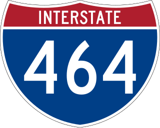
Interstate 464 (I-464) is an Interstate Highway in the US state of Virginia. The highway runs 5.67 miles (9.12 km) from U.S. Route 17 (US 17) and State Route 168 (SR 168) in Chesapeake north to I-264 in Norfolk. I-464 connects two major highway junctions in the South Hampton Roads region. At its southern end, the Interstate meets two major highways that head toward North Carolina, US 17 and SR 168, and I-64, which follows the southern side of the Hampton Roads Beltway. At its northern terminus, I-464 has connections with Downtown Norfolk and Portsmouth via I-264.
Interstate 564 (I-564) is an Interstate Highway in the US state of Virginia. Known as Admiral Taussig Boulevard, after US Navy Rear Admiral Edward D. Taussig, the Interstate runs 3.03 miles (4.88 km) from State Route 337 (SR 337) east to I-64 within the city of Norfolk. I-564 is the primary access highway to Naval Station Norfolk, the world's largest naval base. The Interstate also links I-64 with Norfolk International Terminals via SR 406 and the Wards Corner area of Norfolk through connections with U.S. Route 460 (US 460) and SR 165.
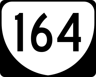
State Route 164 is a 7.27-mile-long (11.70 km) primary state highway in the U.S. state of Virginia that connects the northern parts of Suffolk and Portsmouth with Newport News and Hampton via Interstate 664 (I-664) with Downtown Portsmouth and Norfolk through either the Downtown or Midtown Tunnels.
U.S. Route 301 is a part of the U.S. Highway System that runs from Sarasota, Florida, to Biddles Corner, Delaware. In Virginia, the U.S. Highway runs 142.70 miles (229.65 km) from the North Carolina state line near Skippers north to the Maryland state line at the Potomac River near Dahlgren. US 301 forms the local complement to Interstate 95 (I-95) from Emporia to Petersburg. The U.S. Highway runs concurrently with US 1 between Petersburg and the state capital of Richmond, where the highways form one of the main north–south avenues. US 301 continues north concurrent with Virginia State Route 2 to Bowling Green, forming an eastern alternative to I-95 and US 1 north of Richmond. At Bowling Green, which is connected to I-95 by SR 207, US 301 becomes the primary highway connecting Richmond and the Northern Neck with Southern Maryland. US 301 was constructed in four main segments: as the original SR 24 and then US 17-1 south of Petersburg, as US 1 from Petersburg to Richmond, as SR 2 from Richmond to Bowling Green, and as part of SR 207 toward Dahlgren. US 301 replaced US 17–1 in the early 1930s and was extended from Petersburg north along its current course into Maryland when the Potomac River Bridge was completed in 1940.
State Route 337 Alternate is a primary state highway in the U.S. state of Virginia, lying entirely within the city of Portsmouth. It is an alternate route of SR 337, but only intersects SR 337 at its west end.
U.S. Route 460 (US 460) in Virginia runs west-east through the southern part of the Commonwealth. The road has two separate pieces in Virginia, joined by a relatively short section in West Virginia. Most of US 460 is a four-lane divided highway and is a major artery in the southern third of the state. From Petersburg to Suffolk, US 460 is a four-lane non-divided highway. It is a popular alternative to Interstate 64 (I-64) when going from Richmond and other points in central Virginia to the Currituck Sound and Outer Banks of North Carolina, avoiding the congestion and tunnels of the more northerly I-64 corridor. The road passes through several small towns that built up at stops along the railroad line.
U.S. Route 17 (US 17) is a part of the United States Numbered Highway System that runs from Punta Gorda, Florida, to Winchester, Virginia. In Virginia, the U.S. Highway runs 255.83 miles (411.72 km) from the North Carolina state line in Chesapeake north to its northern terminus at US 11, US 50, and US 522 in Winchester. US 17 is a major highway in the eastern half of Virginia. The U.S. Highway connects the Albemarle Region of North Carolina with the Hampton Roads metropolitan area. Within the urban area, US 17 passes through the South Hampton Roads cities of Chesapeake, Portsmouth, and Suffolk and the Virginia Peninsula city of Newport News. Between Yorktown and Fredericksburg, the U.S. Highway serves as the primary highway of the Middle Peninsula. At Fredericksburg, US 17 leaves the Atlantic Plain; the highway passes through the Piedmont town of Warrenton and crosses the Blue Ridge Mountains on its way to Winchester in the Shenandoah Valley. The route from Tappahannock to Winchester roughly follows the Confederate march during the Civil War to Gettysburg.
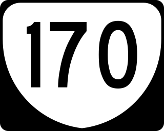
State Route 170 is a primary state highway in the U.S. state of Virginia. Known as Little Creek Road, the state highway runs 2.65 miles (4.26 km) from SR 165 east to U.S. Route 60 within the independent city of Norfolk. SR 170 is the eastern part of the connection between Naval Station Norfolk and Naval Amphibious Base Little Creek.
U.S. Route 221 (US 221) is a part of the U.S. Highway System that runs from Perry, Florida to Lynchburg, Virginia. In Virginia, the U.S. Highway runs 149.61 miles (240.77 km) from the North Carolina state line near Independence north to its northern terminus at US 29 Business, US 460 Business, and US 501 Business in Lynchburg. US 221 connects Independence, Galax, and Hillsville in Southwest Virginia while running concurrently with US 58. The U.S. Highway connects those communities with Roanoke via Floyd County, within which US 221 is the main east–west highway. Entering Bedford County, US 221 exits the Blue Ridge Mountains; it then passes through the Piedmont town of Bedford on its way to Lynchburg and shares a brief overlap with US 460 Business through the town. The U.S. Highway also runs concurrently with US 460 from Roanoke to Bedford and parallels that U.S. Highway from Bedford to Lynchburg.
State Route 141 is a primary state highway in the U.S. state of Virginia. The state highway runs 3.25 miles (5.23 km) from U.S. Route 17 north to US 58 within the independent city of Portsmouth. SR 141 connects the aforementioned U.S. Highways and Interstate 264 (I-264) with Downtown Portsmouth and the Norfolk Naval Shipyard.
State Route 166 is a primary state highway in the U.S. state of Virginia. The state highway runs 15.47 miles (24.90 km) from U.S. Route 17 in Chesapeake north to US 60 in Virginia Beach.
State Route 191 is a primary state highway in the U.S. state of Virginia. Known as Jolliff Road, the state highway runs 3.13 miles (5.04 km) from U.S. Route 13, US 58, US 460, and US 460 Alternate north to SR 337 within the independent city of Chesapeake.
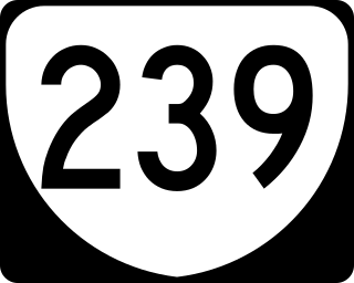
State Route 239 is a primary state highway in the U.S. state of Virginia. Known as Victory Boulevard, the state highway runs 4.46 miles (7.18 km) between intersections with SR 337 in the independent city of Portsmouth. SR 239 connects U.S. Route 58 and Interstate 264 (I-264) in the western part of Portsmouth with US 17 in the southern part of the city.
State Route 247 is a primary state highway in the U.S. state of Virginia. The state highway runs 5.31 miles (8.55 km) from SR 337 east to SR 165 within the independent city of Norfolk. SR 247 is a major east–west thoroughfare that connects U.S. Route 460 and Interstate 64 (I-64) with Norfolk International Airport.
Located in the southeastern corner of the state, Norfolk is economically and culturally important to Virginia. A variety of transportation modes have developed around the city's importance and somewhat unusual geography.
This page is based on this Wikipedia article Text is available under the CC BY-SA 4.0 license; additional terms may apply. Images, videos and audio are available under their respective licenses.