List of U.S. Highways in Virginia

Last updated

United States Numbered Highway System

US 1.svg

US 58.svg

US 460.svg

US Route markers
List of U.S. Highways in Virginia
U.S. Highways in Virginia highlighted in red
System information
NotesOutside cities, some towns, and two counties, every road is state-maintained. These roads are split into Primary and Secondary State Routes, and receive different levels of funding. Inside cities, most Primary State Routes are locally maintained.
Highway names
Interstates Interstate X (I-X)
US Highways U.S. Route X (US X)
State State Route X (SR X) or Virginia Route X (VA X)
System links

United States Numbered Highways in the state of Virginia are numbered by the American Association of State Highway and Transportation Officials (AASHTO) and maintained by the Virginia Department of Transportation as part of the system of state highways. In Virginia, U.S. Highways are treated, for funding purposes, as identical to primary state highways and receive more funding than secondary state routes.

Contents

Mainline highways

NumberLength (mi)Length (km)Southern or western terminusNorthern or eastern terminusFormedRemovedNotes
US 1.svg US 1 196.55316.32 US 1 at the North Carolina state line US 1 at the District of Columbia line01926-01-011926current
US 11.svg US 11 339.41546.23 US 11E & US 11W in Bristol US 11 at the West Virginia state line01926-01-011926currentUS 11 is split into US 11E and US 11W from the Tennessee state line to Bristol
US 11E.svg US 11E 0.580.93 US 11E at the Tennessee state line US 11 in Bristol 01929-01-011929current
US 11W.svg US 11W 1.121.80 US 11W at the Tennessee state line US 11 in Bristol 01929-01-011929current
US 13.svg US 13 129.06207.70 US 13 at the North Carolina state line US 13 at the Maryland state line01926-01-011926current
US 15.svg US 15 230.37370.74 US 15 at the North Carolina state line US 15 at the Maryland state line01926-01-011926current
US 17.svg US 17 255.83411.72 US 17 at the North Carolina state line US 11/US 50/US 522 in Winchester 01926-01-011926currentPreviously had a spur route: US 17-1 (1926–early 1930s)
US 19.svg US 19 88.89143.05 US 19 at the Tennessee state line US 19 at the West Virginia state line01933-01-011933current
US 21.svg US 21 34.9956.31 US 21 at the North Carolina state line I-81/US 52 in Wytheville 01926-01-011926current
US 23.svg US 23 60.8097.85 US 23 at the Tennessee state line US 23 at the Kentucky state line01931-01-011931current
US 25E.svg US 25E 0.81.301926-01-01192601996-01-011996Replaced by US 58
US 29.svg US 29 248.00399.12 US 29 at the North Carolina state line US 29 at the District of Columbia line01931-01-011931current
US 33.svg US 33 135.60218.23 US 33 at the West Virginia state line SR 33 in Richmond 01938-01-011938current
US 48.svg US 48 14.2622.95 US 48 at the West Virginia state line I-81 & SR 55 in Strasburg 02002-01-012002currentSignage not Posted until 2017
US 50.svg US 50 86.00138.40 US 50 at the West Virginia state line US 50 at the District of Columbia line01926-01-011926current
US 52.svg US 52 85.00136.79 US 52 at the North Carolina state line US 52 at the West Virginia state line01935-01-011935current
US 58.svg US 58 507.40816.58 US 58 at the Tennessee state line US 60 in Virginia Beach 01932-01-011932current
US 60.svg US 60 302.69487.13 US 60 at the West Virginia state line5th Street in Virginia Beach 01926-01-011926current
US 117 (1926).svg US 117 01926-01-01192601933-01-011933Replaced by US 158
US 121 (1926).svg US 121 01926-01-01192601935-01-011935Replaced by US 52
US 121.svg US 121 61.7199.31 US 23 in Pound US 121 at the West Virginia state lineproposedUnder construction
US 158 (1926).svg US 158 01932-01-01193201940-01-011940Re Routed into North Carolina
US 170 (1926).svg US 170 01926-01-01192601931-01-011931Replaced by US 29
US 211.svg US 211 59.0995.10 I‑81/SR 211 in New Market US 15 Bus./US 29 Bus./US 211 Bus. in Warrenton 01926-01-011926current
US 219.svg US 219 1.302.09 US 460 in Rich Creek US 219 at the West Virginia state line01934-01-011934current
US 220.svg US 220 185.96299.27 US 220 at the North Carolina state line US 220 at the West Virginia state line01934-01-011934current
US 221.svg US 221 149.61240.77 US 221 at the North Carolina state line US 29 Bus./US 460 Bus./US 501 Bus. in Lynchburg 01932-01-011932current
US 250.svg US 250 166.74268.34 US 250 at the West Virginia state line US 360 in Richmond 01935-01-011935current
US 258.svg US 258 68.17109.71 US 258 at the North Carolina state line SR 143 at Fort Monroe in Hampton 01940-01-011940current
US 301.svg US 301 142.70229.65 US 301 at the North Carolina state line US 301 at the Maryland state line01932-01-011932current
US 311 (1926).svg US 311 01926-01-01192601934-01-011934Truncated into North Carolina
US 311.svg US 311 7.5012.07 US 311 at the North Carolina state line US 58 Bus. in Bachelors Hall 02012-01-012012 [1] current
US 321 (1926).svg US 321 01930-01-01193001933-01-011933Replaced by US 421
US 340.svg US 340 122.03196.39 US 11 north of Greenville US 340 at the West Virginia state line01926-01-011926currentSouthern segment
US 340.svg US 340 0.570.92 US 340 at the West Virginia state line US 340 at the Maryland state line01926-01-011926currentNorthern segment
US 360.svg US 360 225.31362.60 US 58 Bus./SR 293/SR 360 in Danville SR 644 in Reedville 01933-01-011933current
US 401 (1926).svg US 401 01927-01-01192701931-01-011931Replaced by US 58
US 411 (1926).svg US 411 U.S. Route 25E in Cumberland Gap 01926-01-01192601932-01-011932Replaced by US 58
US 421 (1926).svg US 421 01932-01-01193201933-01-011933Truncated into Tennessee
US 421.svg US 421 69.23111.41 US 421 at the Tennessee state line US 421 at the Kentucky state line01950-01-011950current
US 460.svg US 460 79.59128.09 US 460 at the Kentucky state line US 460 at the West Virginia state line01947-01-011947currentWestern segment
US 460.svg US 460 326.84526.00 US 460 at the West Virginia state line US 60 in Norfolk 01933-01-011933currentEastern segment
US 501.svg US 501 111.42179.31 US 501 at the North Carolina state line US 60 in Buena Vista 01926-01-011926current
US 511 (1926).svg US 511 01926-01-01192601929-01-011929Replaced by US 11E
US 522.svg US 522 159.65256.93 US 60/SR 1002 west of Powhatan US 522 at the West Virginia state line01944-01-011944current
  •       Former

Special routes

NumberLength (mi)Length (km)Southern or western terminusNorthern or eastern terminusFormedRemovedNotes
Business plate.svg
US 1.svg US 1 Bus.
Business plate.svg
US 11.svg US 11 Bus.
Business plate.svg
US 11.svg US 11 Bus.
Alternate plate.svg
US 11.svg US 11 Alt.
Salem Roanoke
Business plate.svg
US 13.svg US 13 Bus.
Business plate.svg
US 13.svg US 13 Bus.
Business plate.svg
US 13.svg US 13 Bus.
Business plate.svg
US 15.svg US 15 Bus.
Business plate.svg
US 15.svg US 15 Bus.
Business plate.svg
US 15.svg US 15 Bus.
Business plate.svg
US 15.svg US 15 Bus.
Business plate.svg
US 15.svg US 15 Bus.
Business plate.svg
US 15.svg US 15 Bus.
Business plate.svg
US 17.svg US 17 Bus.
Business plate.svg
US 17.svg US 17 Bus.
Business plate.svg
US 17.svg US 17 Bus.
Business plate.svg
US 17.svg US 17 Bus.
Business plate.svg
US 17.svg US 17 Bus.
Business plate.svg
US 17.svg US 17 Bus.
Business plate.svg
US 19.svg US 19 Bus.
Business plate.svg
US 19.svg US 19 Bus.
Business plate.svg
US 23.svg US 23 Bus.
Business plate.svg
US 23.svg US 23 Bus.
Business plate.svg
US 23.svg US 23 Bus.
Business plate.svg
US 23.svg US 23 Bus.
Business plate.svg
US 29.svg US 29 Bus.
Business plate.svg
US 29.svg US 29 Bus.
Business plate.svg
US 29.svg US 29 Bus.
Business plate.svg
US 29.svg US 29 Bus.
Business plate.svg
US 29.svg US 29 Bus.
Business plate.svg
US 29.svg US 29 Bus.
Business plate.svg
US 29.svg US 29 Bus.
CharlottesvilleCharlottesville
Business plate.svg
US 29.svg US 29 Bus.
Business plate.svg
US 29.svg US 29 Bus.
Business plate.svg
US 29.svg US 29 Bus.
Business plate.svg
US 29.svg US 29 Bus.
Business plate.svg
US 33.svg US 33 Bus.
Business plate.svg
US 58.svg US 58 Bus.
Business plate.svg
US 58.svg US 58 Bus.
Business plate.svg
US 58.svg US 58 Bus.
Business plate.svg
US 58.svg US 58 Bus.
Business plate.svg
US 58.svg US 58 Bus.
Business plate.svg
US 58.svg US 58 Bus.
Business plate.svg
US 58.svg US 58 Bus.
Business plate.svg
US 58.svg US 58 Bus.
Business plate.svg
US 58.svg US 58 Bus.
Business plate.svg
US 58.svg US 58 Bus.
Business plate.svg
US 58.svg US 58 Bus.
Business plate.svg
US 58.svg US 58 Bus.
Business plate.svg
US 58.svg US 58 Bus.
Business plate.svg
US 58.svg US 58 Bus.
Business plate.svg
US 58.svg US 58 Bus.
NorfolkUS 60 in Virginia Beach
Alternate plate.svg
US 58.svg US 58 Alt.
Jonesville Abingdon
Business alternate plate.svg
US 58.svg US 58 Alt. Bus.
Business plate.svg
US 60.svg US 60 Bus.
No image.svgBusiness plate.svgNo image.svg
US 211.svg US 211 Bus.
No image.svgBusiness plate.svgNo image.svg
US 211.svg US 211 Bus.
No image.svgBusiness plate.svgNo image.svg
US 211.svg US 211 Bus.
No image.svgBusiness plate.svgNo image.svg
US 220.svg US 220 Bus.
No image.svgBusiness plate.svgNo image.svg
US 220.svg US 220 Bus.
No image.svgBusiness plate.svgNo image.svg
US 220.svg US 220 Bus.
No image.svgBusiness plate.svgNo image.svg
US 220.svg US 220 Bus.
No image.svgBusiness plate.svgNo image.svg
US 220.svg US 220 Bus.
No image.svgBusiness plate.svgNo image.svg
US 250.svg US 250 Bus.
No image.svgBusiness plate.svgNo image.svg
US 258.svg US 258 Bus.
No image.svgBusiness plate.svgNo image.svg
US 258.svg US 258 Bus.
No image.svgBusiness plate.svgNo image.svg
US 301.svg US 301 Bus.
No image.svgAlternate plate.svgNo image.svg
US 301.svg US 301 Alt.
Petersburg Petersburg
No image.svgBusiness plate.svgNo image.svg
US 340.svg US 340 Bus.
No image.svgBusiness plate.svgNo image.svg
US 360.svg US 360 Bus.
No image.svgBusiness plate.svgNo image.svg
US 360.svg US 360 Bus.
No image.svgBusiness plate.svgNo image.svg
US 360.svg US 360 Bus.
No image.svgBusiness plate.svgNo image.svg
US 360.svg US 360 Bus.
No image.svgBusiness plate.svgNo image.svg
US 421.svg US 421 Bus.
No image.svgBusiness plate.svgNo image.svg
US 460.svg US 460 Bus.
No image.svgBusiness plate.svgNo image.svg
US 460.svg US 460 Bus.
No image.svgBusiness plate.svgNo image.svg
US 460.svg US 460 Bus.
No image.svgBusiness plate.svgNo image.svg
US 460.svg US 460 Bus.
No image.svgBusiness plate.svgNo image.svg
US 460.svg US 460 Bus.
No image.svgBusiness plate.svgNo image.svg
US 460.svg US 460 Bus.
No image.svgBusiness plate.svgNo image.svg
US 460.svg US 460 Bus.
No image.svgBusiness plate.svgNo image.svg
US 460.svg US 460 Bus.
No image.svgBusiness plate.svgNo image.svg
US 460.svg US 460 Bus.
No image.svgBusiness plate.svgNo image.svg
US 460.svg US 460 Bus.
No image.svgBusiness plate.svgNo image.svg
US 460.svg US 460 Bus.
No image.svgBusiness plate.svgNo image.svg
US 460.svg US 460 Bus.
No image.svgBusiness plate.svgNo image.svg
US 460.svg US 460 Bus.
No image.svgBusiness plate.svgNo image.svg
US 460.svg US 460 Bus.
No image.svgAlternate plate.svgNo image.svg
US 460.svg US 460 Alt.
Salem Salen
No image.svgAlternate plate.svgNo image.svg
US 460.svg US 460 Alt.
Chesapeake Norfolk 01952-01-011952current
No image.svgBusiness plate.svgNo image.svg
US 501.svg US 501 Bus.
No image.svgBusiness plate.svgNo image.svg
US 522.svg US 522 Bus.
  •       Former

See also

Related Research Articles

<span class="mw-page-title-main">Interstate Highway System</span> Network of freeways in the United States

The Dwight D. Eisenhower National System of Interstate and Defense Highways, commonly known as the Interstate Highway System, or the Eisenhower Interstate System, is a network of controlled-access highways that forms part of the National Highway System in the United States. The system extends throughout the contiguous United States and has routes in Hawaii, Alaska, and Puerto Rico.

<span class="mw-page-title-main">Interstate 68</span> Interstate in West Virginia and Maryland

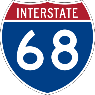
Interstate 68 (I-68) is a 113.15-mile (182.10 km) Interstate Highway in the U.S. states of West Virginia and Maryland, connecting I-79 in Morgantown, West Virginia, east to I-70 in Hancock, Maryland. I-68 is also Corridor E of the Appalachian Development Highway System (ADHS). From 1965 until the freeway's construction was completed in 1991, it was designated as U.S. Route 48 (US 48). In Maryland, the highway is known as the National Freeway, an homage to the historic National Road, which I-68 parallels between Keysers Ridge and Hancock. The freeway mainly spans rural areas and crosses numerous mountain ridges along its route. A road cut at Sideling Hill exposed geological features of the mountain and has become a tourist attraction.

<span class="mw-page-title-main">Interstate 73</span> Interstate in North Carolina

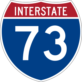
Interstate 73 (I-73) is a north–south Interstate Highway, currently located entirely within the US state of North Carolina. It travels 93.5 miles (150.5 km), from south of Ellerbe, North Carolina to northeast of Stokesdale, providing a freeway connection to Greensboro and Asheboro. Other than a short 9.5 mi (15.3 km) segment near the Piedmont Triad International Airport west of Greensboro, the interstate runs concurrently with at least one other route.

<span class="mw-page-title-main">U.S. Route 35</span> Highway in the United States

U.S. Route 35 (US 35) is a United States Highway that runs southeast-northwest for approximately 412 miles (663 km) from the western suburbs of Charleston, West Virginia to northern Indiana. Although the highway is physically southeast-northwest, it is nominally north–south. The highway's southern terminus is in Teays Valley, West Virginia, near Scott Depot, at Interstate 64 (I-64). Its northern terminus is near Michigan City, Indiana, at US 20. The West Virginia portion of the highway is mostly expressway, becoming a freeway shortly before it crosses the Ohio River into Ohio. The Ohio portion has been upgraded to a four-lane highway/freeway between the West Virginia state line and Trotwood, west of Dayton.

<span class="mw-page-title-main">Concurrency (road)</span> Road bearing more than one route number

A concurrency in a road network is an instance of one physical roadway bearing two or more different route numbers. When two roadways share the same right-of-way, it is sometimes called a common section or commons. Other terminology for a concurrency includes overlap, coincidence, duplex, triplex, multiplex, dual routing or triple routing.

<span class="mw-page-title-main">U.S. Route 48</span> Highway in the United States

U.S. Route 48 (US 48), also known as the incomplete Corridor H of the Appalachian Development Highway System, extends from Interstate 79 (I-79) in Weston, West Virginia, eastward across the crest of the Allegheny Mountains to I-81 in Strasburg, Virginia. It is planned to extend 157 miles (253 km) from northwestern Virginia to central West Virginia.

<span class="mw-page-title-main">U.S. Route 730</span> Highway in Oregon and Washington

U.S. Route 730 (US 730) is an east–west United States Numbered Highway, of which all but 6.08 miles of its 41.78 miles are within the state of Oregon. The highway starts in rural Morrow County in Eastern Oregon at an interchange with Interstate 84 (I-84) and US 30, located east of the city of Boardman. US 730 travels east along the Columbia River as a continuation of Columbia River Highway No. 2 into Umatilla County, intersecting I-82 and US 395 in the city of Umatilla. US 730 and US 395 form a short concurrency within the city before the highways part, and US 730 continues northeast into Washington. The highway travels through rural Walla Walla County and ends at an intersection with US 12 south of Wallula.

<span class="mw-page-title-main">Ohio State Route 7</span> State highway in Ohio, US

State Route 7 (SR 7), formerly known as Inter-county Highway 7 until 1921 and State Highway 7 in 1922, is a north–south state highway in the southern and eastern portions of the U.S. state of Ohio. At about 336 miles (541 km) in length, it is the longest state route in Ohio. Its southern terminus is an interchange with U.S. Route 52 (US 52) just west of Chesapeake. Its northern terminus also serves as the eastern terminus of SR 531 in Conneaut. The path of SR 7 stays within five miles (8.0 km) of the Ohio River for the southern portion, with the river being visible from much of the route. The road also remains within 10 miles (16 km) of the Pennsylvania state line for the northern portion.

The West Virginia State Highway System is an integrated system of numbered roads in the U.S. state of West Virginia. These highways were coordinated by the West Virginia Department of Transportation, Division of Highways.

<span class="mw-page-title-main">State highways in Virginia</span> Highway system in Virginia, United States

The state highway system of the U.S. state of Virginia is a network of roads maintained by the Virginia Department of Transportation (VDOT). As of 2006, the VDOT maintains 57,867 miles (93,128 km) of state highways, making it the third-largest system in the United States.

<span class="mw-page-title-main">Interstate 470 (Ohio–West Virginia)</span> Highway in Ohio and West Virginia

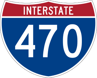
Interstate 470 (I-470) is a 10.63-mile-long (17.11 km) auxiliary Interstate Highway of I-70 that bypasses the city of Wheeling, West Virginia, United States. I-470 is one of 13 auxiliary Interstate Highways in Ohio and the only auxiliary Interstate Highway in West Virginia. The western terminus of I-470 is an interchange with I-70 in Richland Township, Ohio. Traveling southeast through rural Belmont County, I-470 approaches the Vietnam Veterans Memorial Bridge, which spans the Ohio River. After crossing the river into Ohio County, West Virginia, the highway continues east toward the Wheeling communities of Bethlehem and Elm Grove and its eastern terminus at I-70 near Elm Grove. The portion of the highway in West Virginia is named the USS West Virginia Memorial Highway by proclamation of then-Governor Cecil H. Underwood on the 59th anniversary of the attack on Pearl Harbor.

The Mon–Fayette Expressway is a partially-completed controlled-access toll road that is planned to eventually link Interstate 68 near Morgantown, West Virginia with Interstate 376 near Monroeville, Pennsylvania. The ultimate goal of the highway is to provide a high speed north–south connection between Morgantown and the eastern side of Pittsburgh while revitalizing economically distressed Monongahela River Valley towns in Fayette and Washington counties, serving as an alternative to Interstate 79 to the west, as well as relieving the PA 51 alignment from Pittsburgh to Uniontown.

<span class="mw-page-title-main">Special routes of U.S. Route 17</span> United States Numbered Highway System

A total of at least 31 special routes of U.S. Route 17 (US 17) exist: 3 in Florida, 5 in South Carolina, 17 in North Carolina, and 6 in Virginia.

<span class="mw-page-title-main">U.S. Route 25 in South Carolina</span> Section of U.S. highway in South Carolina

U.S. Route 25 (US 25) is a 140.600-mile (226.274 km) United States Numbered Highway that travels from Brunswick, Georgia, to the Kentucky–Ohio state line, where Covington, Kentucky, meets Cincinnati, Ohio, at the Ohio River. In the U.S. state of South Carolina, it travels south to north in the western part of the state, serving the northern part of the Augusta metropolitan area, Greenwood, and Upstate South Carolina on its path from North Augusta to North Carolina in the Saluda Mountains, near Travelers Rest.

<span class="mw-page-title-main">Iowa Primary Highway System</span>

The primary highway system makes up over 9,000 miles (14,000 km), approximately 8 percent of the U.S. state of Iowa's public road system. The Iowa Department of Transportation is responsible for the day-to-day maintenance of the primary highway system, which consists of Interstate Highways, United States Highways, and Iowa state highways. Currently, the longest primary highway is U.S. Highway 30 at 332 miles (534 km). The shortest highway is Interstate 129 at 0.27 miles (430 m).

<span class="mw-page-title-main">Special routes of U.S. Route 19</span>

Several special routes of U.S. Route 19 (US 19) exist. In order from south to north, they are as follows.

<span class="mw-page-title-main">Interstate 87 (North Carolina)</span> Interstate Highway in Wake County, North Carolina, United States

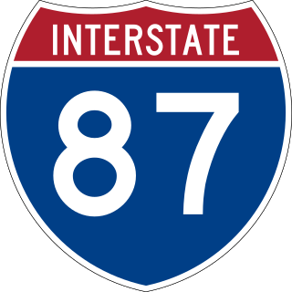
Interstate 87 (I-87) is a partially completed Interstate Highway in the US state of North Carolina, the shortest designated primary Interstate Highway at 12.90 miles (20.76 km). The completed portion is in eastern Wake County, between Raleigh and Wendell; the majority of the completed route is known as the Knightdale Bypass, while the remaining three miles (4.8 km) follows the Raleigh Beltline (I-440). It is planned to continue northeast through Rocky Mount, Williamston, and Elizabeth City, ending in Norfolk, Virginia. It is signed as north–south, in keeping with the sign convention for most odd-numbered interstates, but the route goes primarily east–west, with the eastern direction aligning to the north designation. The entire route is concurrent with US Highway 64 (US 64), with portions also concurrent with I-440 and US 264.

<span class="mw-page-title-main">Delaware State Route System</span> Overview of the State Route System of Delaware

The Delaware State Route System consists of roads in the U.S. state of Delaware that are maintained by the Delaware Department of Transportation (DelDOT). The system includes the portions of the Interstate Highway System and United States Numbered Highways system located in the state along with state routes and other roads maintained by DelDOT. All roads maintained by the state are assigned a maintenance road number that is only marked on little white markers at intersections and on auxiliary plates below warning signs approaching intersections. These numbers are only unique in a specific county; some roads can be designated with multiple road numbers, and numbers do not necessarily correspond to the signed Interstate, U.S., or state route numbers. DelDOT maintains a total of 5,386.14 miles (8,668.15 km) of roads, comprising 89 percent of the roads within the state. Some large bridges in the state are maintained by other agencies including the U.S. Army Corps of Engineers and the Delaware River and Bay Authority. Roads in the system include multilane freeways, multilane surface divided highways, and two-lane undivided roads serving urban, suburban, and rural areas. Some of the roads maintained by DelDOT are toll roads, in which motorists must pay to use.

References

  1. "US 311 Route Change (2013-01-22)" (PDF). North Carolina Department of Transportation. January 22, 2013. Retrieved February 14, 2013.