
Hampton Roads is the name of a body of water in the United States that serves as a wide channel for the James, Nansemond, and Elizabeth rivers between Old Point Comfort and Sewell's Point near where the Chesapeake Bay flows into the Atlantic Ocean. It also gave its name to the surrounding metropolitan region located in the southeastern Virginia and northeastern North Carolina portions of the Tidewater Region.

The Chesapeake Bay Bridge–Tunnel is a 17.6-mile (28.3 km) bridge–tunnel that crosses the mouth of the Chesapeake Bay between Delmarva and Hampton Roads in the U.S. state of Virginia. It opened in 1964, replacing ferries that had operated since the 1930s. A major project to dualize its bridges was completed in 1999, and in 2017 a similar project was started to dualize one of its tunnels.

Joint Expeditionary Base–Little Creek (JEB–LC), formerly known as Naval Amphibious Base Little Creek and commonly called simply Little Creek, is the major operating base for the Amphibious Forces in the United States Navy's Atlantic Fleet. The mission of the Naval Amphibious Base is to provide required support services to over 15,000 personnel of the 27 homeported ships and 78 resident and/or supported activities. The base's combination of operational, support, and training facilities are geared predominantly to amphibious operations, making the base unique among bases of the United States and Allied Navies.

The Hampton Roads Bridge–Tunnel (HRBT) is a 3.5-mile-long (5.6 km) Hampton Roads crossing for Interstate 64 (I-64) and US Route 60 (US 60). It is a four-lane facility comprising bridges, trestles, artificial islands, and tunnels under the main shipping channels for Hampton Roads harbor in the southeastern portion of Virginia in the United States.
The Hampton Roads Beltway is a loop of Interstate 64 and Interstate 664, which links the communities of the Virginia Peninsula and South Hampton Roads which surround the body of water known as Hampton Roads and comprise much of the region of the same name in the southeastern portion of Virginia in the United States. It crosses the harbor of Hampton Roads at two locations on large four-laned bridge-tunnel facilities: the eastern half carries Interstate 64 and uses the Hampton Roads Bridge-Tunnel and the western half carries Interstate 664 and uses the Monitor-Merrimac Memorial Bridge-Tunnel. The beltway has the clockwise direction signed as the Inner Loop, and the counter-clockwise direction signed as the Outer Loop. The entire beltway, including the bridge-tunnels, is owned and operated by the Virginia Department of Transportation.

The James River Bridge (JRB) is a four-lane divided highway lift bridge across the James River in the Commonwealth of Virginia. Owned and operated by the Virginia Department of Transportation, it carries U.S. Route 17 (US 17), US 258, and State Route 32 across the river near its mouth at Hampton Roads. The bridge connects Newport News on the Virginia Peninsula with Isle of Wight County in the South Hampton Roads region, and is the easternmost such crossing without a tunnel component.
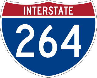
Interstate 264 (I-264) is an Interstate Highway in the US state of Virginia. It serves as the primary east–west highway through the South Hampton Roads region in southeastern Virginia. The route connects the central business districts of Chesapeake, Portsmouth, Norfolk, and Virginia Beach and serves as the most direct link between those cities and the resort beaches along Virginia's Atlantic coast.
Old Point Comfort is a point of land located in the independent city of Hampton, Virginia. Previously known as Point Comfort, it lies at the extreme tip of the Virginia Peninsula at the mouth of Hampton Roads in the United States. It was renamed Old Point Comfort to differentiate it from New Point Comfort 21 miles (34 km) up the Chesapeake Bay. A group of enslaved Africans was brought to colonial Virginia at this point in 1619. Today the location is home to Continental Park and Fort Monroe National Monument.

The Downtown Tunnel on Interstate 264 (I-264) and U.S. Route 460 Alternate crosses the Southern Branch of the Elizabeth River in the South Hampton Roads area of Virginia, US. It links the independent City of Portsmouth with the independent City of Norfolk. In conjunction with the Berkley Bridge, the Downtown Tunnel connects to Interstate 464 to the City of Chesapeake and a continuation I-264 to the downtown and Waterside areas of Norfolk, and on to Virginia Beach. Owned by the Virginia Department of Transportation (VDOT), it is operated and maintained by Elizabeth River Crossings under a 58-year public–private partnership concession agreement. Formerly a toll-free facility, open road tolling was implemented on February 1, 2014 by VDOT to help finance repairs and expansion to the tunnel.

Hampton Roads Transit (HRT), incorporated on October 1, 1999, began through the voluntary merger of PENTRAN on the Virginia Peninsula and TRT in South Hampton Roads and currently serves over 22 million annual passengers within its 369-square-mile (960 km2) service area around Hampton Roads. The purpose of the HRT is to provide reliable and efficient transportation service and facilities to the Hampton Roads community. In 2023, the system had a ridership of 7,263,900, or about 32,100 per weekday as of the third quarter of 2024.

Transportation in the Commonwealth of Virginia is by land, sea and air. Virginia's extensive network of highways and railroads were developed and built over a period almost 400 years, beginning almost immediately after the founding of Jamestown in 1607, and often incorporating old established trails of the Native Americans.

State Route 168 is a primary state highway in the South Hampton Roads region of the U.S. state of Virginia. It runs from the border with North Carolina through the independent cities of Chesapeake and Norfolk where it ends in the Ocean View area near the Hampton Roads Bridge-Tunnel.

The Little Creek-Cape Charles Ferry was a passenger ferry service operating across the mouth of the Chesapeake Bay from the 1930s until 1964. Known also as the Princess Anne-Kiptopeke Beach Ferry or Little Creek-Kiptopeke Beach Ferry, the service connected Virginia Beach, Virginia with Cape Charles on the Eastern Shore of Virginia. Departures from and arrivals to Cape Charles were matched with times of Pennsylvania Railroad passenger trains such as the Del-Mar-Va Express and the Cavalier that operated the length of the Delmarva Peninsula.

U.S. Route 13 (US 13) is a north–south United States Numbered Highway established in 1926 that runs for 518 miles (834 km) from Interstate 95 (I-95) just north of Fayetteville, North Carolina, north to US 1 in Morrisville, Pennsylvania, a northeastern suburb of Philadelphia. In the U.S. state of Virginia, US 13 runs north–south through the Hampton Roads and Eastern Shore regions of the state, using the Chesapeake Bay Bridge–Tunnel to get between the two. In the Hampton Roads area, it uses Military Highway to bypass the city centers. It is most usually a four-lane highway, sometimes up to freeway or expressway standards with controlled access.

U.S. Route 60 (US 60) in the Commonwealth of Virginia runs 303 miles (488 km) west to east through the central part of the state, generally close to and paralleling the Interstate 64 corridor, except for the crossing of the Blue Ridge Mountains, and in the South Hampton Roads area.

Interstate 64 (I-64) in the US state of Virginia runs east–west through the middle of the state from West Virginia to the Hampton Roads region, for a total of 299 miles (481 km). From the West Virginia state line to Chesapeake, it passes through the major cities of Lexington, Staunton, Charlottesville, the state capital of Richmond, Newport News, Hampton, and Norfolk. It is notable for crossing the mouth of the harbor of Hampton Roads on the Hampton Roads Bridge–Tunnel (HRBT), the first bridge–tunnel to incorporate artificial islands, concurrent with U.S. Route 60 (US 60). Also noteworthy is a section through Rockfish Gap, a wind gap in the Blue Ridge Mountains, which was equipped with an innovative system of airport-style runway lighting embedded into the pavement to aid motorists during periods of poor visibility due to fog or other conditions.
Located in the southeastern corner of the state, Norfolk is economically and culturally important to Virginia. A variety of transportation modes have developed around the city's importance and somewhat unusual geography.
Virginia Beach, Virginia's development is tied to the establishment of a transportation infrastructure that allowed access to the Atlantic shoreline.
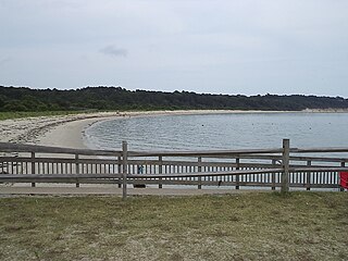
Kiptopeke State Park is a state park located in the southern end of the Eastern Shore of Virginia and the Delmarva Peninsula in Northampton County, near Cape Charles. From 1949, the site was owned by the Virginia Ferry Corporation and used through 1964 as the northern terminus for the Little Creek-Cape Charles Ferry service which crossed the lower Chesapeake Bay from the Eastern Shore / Delmarva to Norfolk and Hampton Roads harbor on the Western Shore. In 1964, the ferry service was replaced by the Chesapeake Bay Bridge-Tunnel which opened up giving automobile traffic convenient access to the park, the Cape, Delmarva and "The Shore" to the urban centers to the west in North Carolina, Virginia, Maryland and the District of Columbia.

Historically, the harbor was the key to the Hampton Roads area's growth, both on land and in water-related activities and events. Ironically, the harbor and its tributary waterways were both important transportation conduits and obstacles to other land-based commerce and travel. For hundreds of years, state and community leaders have worked to develop solutions to accommodate both.