Long Island Sound is a marine sound and tidal estuary of the Atlantic Ocean. It lies predominantly between the U.S. state of Connecticut to the north and Long Island in New York to the south. From west to east, the sound stretches 110 mi (180 km) from the East River and the Throgs Neck Bridge in New York City, along the North Shore of Long Island, to Block Island Sound. A mix of freshwater from tributaries, and saltwater from the Atlantic Ocean, Long Island Sound is 21 mi (34 km) at its widest point and varies in depth from 65 to 230 feet.
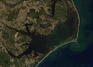
Pamlico Sound is a large estuarine lagoon in North Carolina. The largest lagoon along the North American East Coast, it extends 80 mi (130 km) long and 15 to 20 miles wide. It is part of a large, interconnected network of similar lagoons that includes Albemarle Sound, Currituck Sound, Croatan Sound, Roanoke Sound, Pamlico Sound, Bogue Sound, Back Sound, and Core Sound known collectively as the Albemarle-Pamlico sound system. With over 3,000 sq. mi. (7,800 km2) of open water the combined estuary is second only in size to 4,479 sq mi (11,600 km2) Chesapeake Bay in the United States.

Hammocks Beach State Park is a North Carolina state park in Onslow County, North Carolina in the United States. Located near Swansboro, along the Southern Outer Banks, or Crystal Coast, the state park covers 1,611 acres (6.52 km2) and consists mainly of Bear Island. The park also owns three smaller islands, Dudley, Huggins and Jones, located in the nearby mouth of the White Oak River. After a recently completed deal, 319 acres (1.29 km2) acres on the mainland were added to the park.

Hunting Island is a 5,000-acre (20 km2) secluded semitropical barrier island located 15 miles (24 km) east of Beaufort, South Carolina, United States in between Harbor Island and Fripp Island. Since 1935, it has been classified as a state park. It is the most-visited state park facility in South Carolina and is a part of the ACE Basin estuarine reserve area. Known for its natural environment, the island remains one of the few remaining undeveloped Sea Islands in the Lowcountry. The park is known for its 19th century lighthouse which bears its name. The park's beach has been featured in several travel publications and was listed in 2013 as a Top 25 beach in the United States by TripAdvisor.

Assateague Island is a 37-mile (60 km) long barrier island located off the eastern coast of the Delmarva Peninsula facing the Atlantic Ocean. The northern two-thirds of the island are in Maryland, and the southern third is in Virginia.

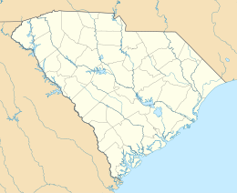
Fripp Island is a 6.546 sq mi (16.954 km2) barrier island and census-designated place (CDP) located along the Atlantic coast of the lowcountry part of South Carolina. It was first listed as a CDP in the 2020 census with a population of 963.
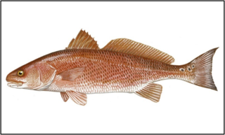
The red drum, also known as redfish, channel bass, puppy drum, spottail bass, or simply red, is a game fish found in the Atlantic Ocean from Massachusetts to Florida and in the Gulf of Mexico from Florida to northern Mexico. It is the only species in the genus Sciaenops.
Assateague Island National Seashore is a unit of the National Park Service system of the U.S. Department of the Interior. Located on the East Coast along the Atlantic Ocean in Maryland and Virginia, Assateague Island is the largest natural barrier island ecosystem in the Middle Atlantic states region that remains predominantly unaffected by human development. Located within a three-hour drive to the east and south of Richmond, Washington, Baltimore, Wilmington, Philadelphia major metropolitan areas plus north of the several clustered smaller cities around Hampton Roads harbor of Virginia with Newport News, Hampton, Norfolk, Portsmouth, Chesapeake and Virginia Beach. The National Seashore offers a setting in which to experience a dynamic barrier island and to pursue a multitude of recreational opportunities. The stated mission of the park is to preserve and protect “unique coastal resources and the natural ecosystem conditions and processes upon which they depend, provide high-quality resource-based recreational opportunities compatible with resource protection and educate the public as to the values and significance of the area”.

The South Carolina Aquarium, located in Charleston, South Carolina, opened on May 19, 2000, on the historic Charleston Harbor. It is home to more than five thousand animals including North American river otters, alligators, great blue herons, owls, loggerhead sea turtles, lined seahorses, jellyfish, pufferfish, green moray eels, horseshoe crabs, sea stars, and sharks. The largest exhibit at the aquarium is the Great Ocean Tank, which extends from the first to the third floor of the Aquarium and is the deepest tank in North America ; it holds more than 385,000 US gallons (1,460,000 L) of water and contains more than 500 animals. The Aquarium also features a Touch Tank, where patrons may touch horseshoe crabs, Atlantic stingrays, and other marine animals.
Island Beach State Park is a New Jersey state park located just south of Seaside Park on the Barnegat Peninsula in Berkeley Township, Ocean County, New Jersey, United States. The park is operated and maintained by the New Jersey Division of Parks and Forestry. Most of the park encompasses the former borough of Island Beach.
Virtually untouched for centuries, Little St. Simons Island is a barrier island located on the coast of the US state of Georgia, and is one of the least developed of Georgia's Golden Isles. The island covers an area of 10,000 acres (40 km2) and boasts 7 miles (11 km) of beaches. Little St. Simons Island is located slightly east and north of St. Simons Island and Sea Island. It is separated from these islands by the Hampton River and from the marshes of the mainland by Buttermilk Sound. The mouth of the Altamaha River opens directly north of the island. The island's continuous growth can be attributed to sediment deposited by the undammed Altamaha.

Bogue Banks form a 21-mile (34 km) barrier island off the mainland of North Carolina in Carteret County. The island, separated from the mainland by Bogue Sound, runs east to west, with the ocean beaches facing due south. Bogue Banks is the only island on the Carteret County shore that has been developed with housing: numerous communities are located on the island and can be accessed by one of two bridges across Bogue Sound, either from Morehead City to Atlantic Beach, which is the more heavily traveled bridge, or from Cape Carteret to Emerald Isle. The communities of Bogue Banks are the most prominent of the Crystal Coast. NC 58 traverses a majority of the island's length. There are several hotels that dot the island, but most of the land contains private houses, some of which are rented out during the summer, or maritime forest. Stores and other commercial properties are limited to the five main communities.
Ludlam Island is a barrier island in southern New Jersey, on which Sea Isle City and Strathmere, a part of Upper Township, are located.

The Atlantic Plain is one of eight distinct physiographic divisions of the contiguous United States. Using the USGS physiographic classification system, the Atlantic Plain division comprises two provinces and six sections. The Coastal Plain province is differentiated from the Continental Shelf province simply based on the portion of the land mass above and below sea level.

The Virginia Aquarium & Marine Science Center, formerly known as the Virginia Marine Science Museum, is an aquarium and marine science museum located in Virginia Beach, Virginia, just south of Rudee Inlet. The exhibits at the museum are contained in over 800,000 US gallons (3,028,000 L) of fresh and saltwater displays.

The Cape Romain National Wildlife Refuge is a 66,287 acre (267 km²) National Wildlife Refuge in southeastern South Carolina near Awendaw, South Carolina. The refuge lands and waters encompass water impoundments, creeks and bays, emergent salt marsh and barrier islands. 29,000 acres (120 km2) are designated as Class I Wilderness. Most of the refuge is only accessible by boat. The Intracoastal Waterway passes the Refuge. Mainland facilities include the refuge's headquarters and visitor center which are located on U.S. Highway 17 about 30 minutes by car from Charleston, South Carolina.

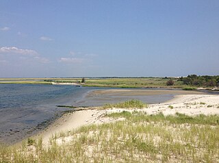
Masonboro Island is a barrier island in New Hanover County, North Carolina, United States. The island, which is undeveloped and accessible only by boat, is a component of the North Carolina National Estuarine Research Reserve and a North Carolina State Natural Area. It lies south of Wrightsville Beach, separated by Masonboro Inlet, and north of Carolina Beach, separated by Carolina Beach Inlet. The island is a destination for boating, surfing, and camping.

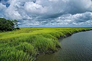
The North Inlet-Winyah Bay National Estuarine Research Reserve, in the U.S. State of South Carolina, features the salt marshes and ocean dominated tidal creeks of the North Inlet Estuary plus the brackish waters and marshes of the adjacent Winyah Bay Estuary. North Inlet is a relatively pristine system in which water and habitat quality are much higher than those in Winyah Bay. As the estuary with the third largest watershed on the east coast, Winyah Bay has been greatly influenced by agriculture, industry and other human activities. More than 90 percent of North Inlet's watershed is in its natural forested state

The Core Banks are barrier islands in North Carolina, part of the Outer Banks and Cape Lookout National Seashore. Named after the Coree tribe, they extend from Ocracoke Inlet to Cape Lookout, and consist of two low-relief narrow islands, North Core Banks and South Core Banks, and, since September 2011, two smaller islands. New Drum Inlet, Old Drum Inlet and Ophelia Inlet now separate the islands. The Core Banks are now uninhabited. However, Portsmouth, at the north end of the North Core Banks, was once a substantial port, and Cape Lookout Village, about one and half miles south of the Cape Lookout Lighthouse, contains the historic Lookout Life-Saving Station, a U.S. Coast Guard Station, and several island homes.
The Bald Head Island Conservancy (BHIC) is a non-profit organization founded November 7, 1983. BHIC's mission is barrier island conservation, preservation and education. It is located in the Smith Island Complex in Brunswick County, North Carolina, which includes Bald Head Island, Middle and Bluff Islands, all of which are bounded by the Cape Fear River and the Atlantic Ocean. BHIC sponsors and facilitates scientific research that benefits coastal communities and provides numerous recreational and educational activities for students, educators, visitors, and residents. In coordination with various organizations, partnerships and collaborations, the Conservancy has led the nation in conservation and research efforts and is uniquely poised to become a leader in Barrier Island Conservation world-wide.