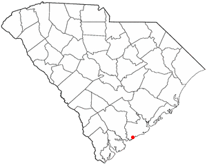
Charleston is the most populous city in the U.S. state of South Carolina, the county seat of Charleston County, and the principal city in the Charleston metropolitan area. The city lies just south of the geographical midpoint of South Carolina's coastline on Charleston Harbor, an inlet of the Atlantic Ocean formed by the confluence of the Ashley, Cooper, and Wando rivers. Charleston had a population of 150,227 at the 2020 census. The population of the Charleston metropolitan area, comprising Berkeley, Charleston, and Dorchester counties, was estimated to be 849,417 in 2023. It ranks as the third-most populous metropolitan statistical area in the state, and the 71st-most populous in the United States.

Isle of Palms is a city in Charleston County, South Carolina, United States. At the 2010 census, the population was 4,133. Isle of Palms is a barrier island on the South Carolina coast. The city is included within the Charleston-North Charleston-Summerville metropolitan area and the Charleston-North Charleston Urbanized Area. The town lies along a narrow strip of land, hugging the beach, separated from the mainland by the Intracoastal Waterway. It is a community of both vacation home owners and year-round residents, with large beachfront homes, resorts, and local restaurants. Beach volleyball is popular in the summer, and the "Windjammer" club hosts several tournaments throughout the year.

Kiawah is a sea island, or barrier island, on the Atlantic coast of the United States. Located 25 miles (40 km) southwest of Charleston in Charleston County, South Carolina, it is primarily a private beach and golf resort. It is home to the Kiawah Island Golf Resort, with spacious villas, beaches, large and acclaimed golf courses, and other attractions. As of the 2010 census, Kiawah Island's population was 1,626, up from 1,163 at the 2000 census. The island is part of the Charleston-North Charleston-Summerville metropolitan area. Alternative spellings and variants of the name itself include "Kiawa", "Kittiwar", and "Kittiwah". Census Tract 21.04, located on the island, has a per capita income of $168,369, the highest in South Carolina.

Mount Pleasant is a large suburban town in Charleston County, South Carolina, United States. In the Lowcountry, it is the fourth-most populous municipality in South Carolina, and for several years was one of the state's fastest-growing areas, doubling in population between 1990 and 2000. The population was 90,801 at the 2020 census. It is part of the Charleston metropolitan area.

Seabrook Island, formerly known as Simmons Island, is a barrier island in Charleston County, South Carolina, United States. The population was 1,714 at the 2010 census, up from 1,250 in 2000.

Sullivan's Island, historically known as O'Sullivan's Island, is a town and island in Charleston County, South Carolina, United States, at the entrance to Charleston Harbor, with a population of 1,791 at the 2010 census, and 1,891 people in 2020. The town is part of the Charleston metropolitan area, and is considered a very affluent suburb of Charleston.

The First Battle of Fort Wagner was fought on July 10 and 11, 1863, on Morris Island in Charleston harbor during the American Civil War. An attempt by the Union Army to capture Fort Wagner was repulsed. The more famous Second Battle of Fort Wagner, which involved an assault by the 54th Massachusetts, would be fought on July 18.

Figure Eight Island is a barrier island in the U.S. state of North Carolina, just north of Wrightsville Beach, widely known as an affluent summer colony and vacation destination. The island is part of the Wilmington Metropolitan Area, and lies between the Intracoastal Waterway and the Atlantic Ocean. As a private island, Figure Eight can only be reached by boat or via a guarded causeway swing bridge—the only private bridge over the Intracoastal Waterway in the American Southeast.

South Carolina was the first state to secede from the Union in December 1860, and was one of the founding member states of the Confederacy in February 1861. The bombardment of the beleaguered U.S. garrison at Fort Sumter in Charleston Harbor on April 12, 1861, is generally recognized as the first military engagement of the war. The retaking of Charleston in February 1865, and raising the flag again at Fort Sumter, was used for the Union symbol of victory.

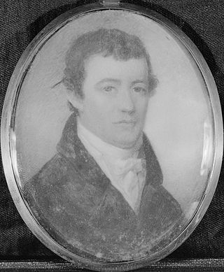
Arnoldus Vanderhorst was an American military officer and planter. He was a general of the South Carolina militia during the American Revolutionary War and served as the governor of South Carolina from 1794 to 1796.

The Charleston Harbor is an inlet of the Atlantic Ocean at Charleston, South Carolina. The inlet is formed by the junction of Ashley and Cooper rivers at 32°49′7.10″N79°55′40.41″W. Morris and Sullivan's Islands shelter the entrance. Charleston Harbor forms part of the Intracoastal Waterway.

McLeod Plantation is a former slave plantation located on James Island, South Carolina, near the intersection of Folly and Maybank roads at Wappoo Creek, which flows into the Ashley River. The plantation is considered an important Gullah heritage site, preserved in recognition of its cultural and historical significance to African-American and European-American cultures.

Pleasure Island is a coastal barrier island in Southeastern North Carolina, United States, just south of the City of Wilmington. Pleasure Island is located within Federal Point Township, in New Hanover County. The coastal resort towns of Carolina Beach and Kure Beach, as well as the annexed communities of Wilmington Beach and Hanby Beach are located on the island. The southern end of Pleasure Island was separated from Bald Head Island by Corncake Inlet until the inlet was shoaled and closed in 1998 by Hurricane Bonnie; thus Pleasure Island and Bald Head Island are no longer separate islands.

The Robert Barnwell Rhett House is a historic house at 6 Thomas Street in Charleston, South Carolina. A National Historic Landmark, it is significant as the home of Robert Barnwell Rhett, a leading secessionist politician. He opposed John C. Calhoun to lead the Bluffton Movement for separate state action on the Tariff of 1842. Rhett was one of the leading fire-eaters at the Nashville Convention of 1850, which failed to endorse his aim of secession.
The Arnoldus Vander Horst House is a plantation house on Kiawah Island, South Carolina. It is named for Arnoldus Vanderhorst, who was a governor of South Carolina.

Elias Horry was a lawyer, politician, businessman and plantation owner who twice served in the South Carolina General Assembly as well as the intendant (mayor) of Charleston, South Carolina, serving two terms from 1815 to 1817 and 1820 to 1821.

The Elias Vanderhorst House at 28 Chapel Street, Charleston, South Carolina, is a four-story mansion house which was built around 1835 as a home for members of the prominent Vanderhorst family of plantation owners.

Capers Island is a state-owned barrier island on the Atlantic Ocean in Charleston County, South Carolina about 15 miles north of the city of Charleston. It is separated from the mainland by salt marshes and the Intracoastal Waterway. To the southwest it is separated from the barrier island Dewees Island by Capers Inlet. To the northwest, it is separated from the barrier island Bulls Island by Price Inlet.

The Daniel Elliott Huger House was the last home of a Royal governor in South Carolina.

Peter Fayssoux Stevens was an American soldier, educator and clergyman. He was an officer in the Confederate States Army and a bishop in the Reformed Episcopal Church who also served as 4th superintendent of the South Carolina Military Academy.


