
Dorchester County is a county located in the U.S. state of South Carolina. As of the 2020 census, the population was 161,540. Its county seat is St. George.
Summerville is a town in the U.S. state of South Carolina situated mostly in Dorchester County, with small portions in Berkeley and Charleston counties. It is part of the Charleston-North Charleston-Summerville Metropolitan Statistical Area. Summerville's population at the 2020 census was 50,915.

South Carolina Highway 61 (SC 61) is a 67-mile-long (108 km) state highway in the U.S. state of South Carolina. The highway is designated on a north–south direction, but physically travels in an east–west direction, from SC 30 in Charleston to U.S. Route 78 (US 78) near Branchville. The portion of SC 61 from Church Creek Bridge and 10 miles (16 km) north is designated a National Scenic Byway.

Ashley River Historic District is a historic district located west of the Ashley in the South Carolina Lowcountry near Charleston, South Carolina, United States. The Historic District includes land from five municipalities, almost equally split between Charleston and Dorchester counties. The district includes dry land, swamps, and marshes of the Rantowles Creek and Stono Swamp watershed.

The Codman Square District is a historic district in the Dorchester neighborhood of Boston, Massachusetts. It consists of four of the most prominent properties facing the main Codman Square intersection, where Talbot Avenue and Washington Street cross. The area has a long history as a major civic center in Dorchester, and is now one of the large neighborhood's major commercial hubs. The properties in the district include the 1806 Congregational Church, the 1904 Codman Square branch of the Boston Public Library, the former Girls Latin Academy building, and the Lithgow Building, a commercial brick structure at the southeast corner of the junction that was built in 1899.

Abbeville Historic District is a historic district in Abbeville, South Carolina. It includes several properties listed separately in the National Register of Historic Places, including the Abbeville County Courthouse and the Abbeville Opera House. The district was listed in National Register on September 14, 1972.
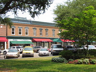
Summerville Historic District may refer to:

Indian Field Methodist Campground is a camp meeting site for the Methodist Church in Dorchester County, South Carolina. It is on SC Route S-18-73, off US Route 15, about 5 mi (8 km) north of Saint George. Indian Field was built in 1848 and has been a site for religious gatherings for over 160 years. It is associated with the Indian Field United Methodist Church located on U.S. Highway 15 about 2 miles (3 km) north of the campground and just south of U.S. Highway 178. It was named a historic district of the National Register of Historic Places on March 30, 1973.

Laurens Historic District is a national historic district located at Laurens, Laurens County, South Carolina. It encompasses 77 contributing buildings and 1 contributing structure in Laurens. The district includes residential, commercial, religious, and governmental buildings built between 1880 and 1940. Notable buildings include the Laurens County Courthouse, Old Methodist Church, St. Paul First Baptist Church, Public Square commercial buildings, Rosenblum's and Maxwell Bros. and Kinard Store, Provident Finance Co. and Parker Furniture, McDonald House, Augustus Huff House, Gov. William Dunlap Simpson House, and Hudgens-Harney House.

This is a list of the National Register of Historic Places listings in Dorchester County, South Carolina.

Appleby's Methodist Church is a historic Methodist church located near St. George, Dorchester County, South Carolina. It was probably built about 1840–1850, and is a one-story, wooden meeting house in the Greek Revival style. The building is clapboard and the medium gable roof is covered with asphalt shingles. Also on the property is a contributing late 19th-century cemetery.

Old White Meeting House Ruins and Cemetery is a historic site near Summerville, Dorchester County, South Carolina. The meeting house was built about 1700, burned during the American Revolution in 1781, rebuilt in 1794, then reduced to ruins by the Charleston earthquake of 1886. The extant ruins include portions of each corner – the largest approximately 9’ high – and significant remnants of the foundation of walls. Also on the property is a contributing cemetery.

Mount Carmel A.M.E. Zion Church & Campground is a historic African Methodist Episcopal Zion camp meeting grounds in Heath Springs, South Carolina, Lancaster County, South Carolina. It was established in 1866 and consists of a complex of approximately 55 small "cabins" or "tents" and the brick church of Mt. Carmel A.M.E. Zion Church is located in the general form of a rectangle. Mount Carmel A.M.E Zion Church Campmeeting starts every year on the first Wednesday in September, and last for 4–5 days. An "arbor," or open-air structure, is located in the center of the complex, where music, gospel singing, praise and worship, preaching and teachings are held. People come to worship, fellowship, network, and eat food from as far as New York City, NY to Orlando, FL. There is also a section on the grounds for vendors. The majority of the cabins are small frame, some are two story cabins for larger families made from concrete block and wooden structures. Also on the property is the church cemetery.

Colonial Dorchester State Historic Site sits along the Ashley River, near the town of Summerville in Dorchester County, South Carolina. In 1969, the site was donated to the South Carolina State Park Service and was added to the National Register of Historic Places on December 2, 1969. Currently the site of a 325-acre park, Old Dorchester State Park offers visitors a glimpse into South Carolina's Colonial past. The park boasts one of the most well-preserved oyster-shell tabby forts in the country, St. George's Bell Tower, log shipping wharves, burial sites and cemeteries, as well as on-going archaeological digs that are still unearthing the settlement's history.

The Dorchester Common Historic District encompasses three public buildings that front the public common in the village of Dorchester, New Hampshire. The oldest of the three buildings is the schoolhouse, which dates to 1808 and is now a local museum. The Dorchester Community Church was built in 1828, and the town hall in 1844, on the site of the town's first (1828) town hall. The district was listed on the National Register of Historic Places in 1985; the church was also separately listed in 1980.

St. Paul Camp Ground, also known as St. Paul A.M.E. Camp Ground, is a historic African Methodist Episcopal camp meeting and national historic district located near Harleyville, Dorchester County, South Carolina. The district encompasses 43 contributing buildings. It was established about 1880, and the buildings and grounds are used for one week each year. The tabernacle is a one-story building clad in rough-sawn weatherboard. Also on the property are 54 tents, two stores, and a storage house.

Johnston Historic District is a national historic district in Johnston, Edgefield County, South Carolina. The district encompasses 127 contributing buildings, 16 contributing sites, 1 contributing structure, and 1 contributing object in the village of Johnston. The district includes commercial and residential properties from approximately 1880 to 1920. They are in a variety of popular architectural styles such as Italianate, Second Empire, Victorian, Queen Anne, and Neo-Classical. The district also includes three churches and the town's cemetery. The railroad, which passes through Johnston, was the primary cause for the creation of the town and continues to be a reminder of the town's early transportation history. Notable buildings include the Johnston Depot, Western Carolina Bank, H. W. Crouch Building, Bank of Johnston, Crouch-Halford House, and Johnston First Baptist Church.

Camp Welfare is a historic African-American religious campground located near Monticello, Fairfield County, South Carolina. It was founded after the American Civil War by the African Methodist Episcopal Zion Church. It is a collection of approximately 100 one-story, frame, weatherboarded cabins called tents arranged in a double "U"-shape. The focal point of the camp is the arbor; a rough, gable roofed wooden shelter with wooden benches. Also located at the camp is Zion Church; a frame building with a gable roof surmounted by a belfry built about 1930.
Cattle Creek Campground, also known as Cattle Creek United Methodist Church and Campground, is a historic camp meeting ground that is now a national historic district located near Rowesville, Orangeburg County, South Carolina. The district encompasses 37 contributing buildings and 1 contributing site. It was founded in 1786, although this date has been challenged. The campground burned in 1898 and was rebuilt. Another fire in 2017 destroyed 15 "tents," which were again rebuilt. It includes 36 cabins, called “tents,” arranged in a wide semi-circle. They are located around an open, 56 feet by 81 feet, pavilion structure known as the “stand” or “tabernacle.” Also located on the property is a cemetery. It is one of three remaining Methodist campgrounds in South Carolina.


