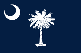
South Carolina is a state in the coastal Southeastern region of the United States. It is bordered to the north by North Carolina, to the southeast by the Atlantic Ocean, and to the southwest by Georgia across the Savannah River. South Carolina is the 40th most extensive and 23rd most populous U.S. state with a recorded population of 5,124,712 according to the 2020 census. In 2019, its GDP was $213.45 billion. South Carolina is composed of 46 counties. The capital is Columbia with a population of 137,300 in 2020; while its largest city is Charleston with a 2020 population of 150,277. The Greenville–Spartanburg-Anderson metropolitan area is the most populous in the state, with a 2020 population estimate of 1,455,892.

The Cherokee are one of the indigenous peoples of the Southeastern Woodlands of the United States. Prior to the 18th century, they were concentrated in their homelands, in towns along river valleys of what is now southwestern North Carolina, southeastern Tennessee, southwestern Virginia, edges of western South Carolina, northern Georgia and northeastern Alabama.

York County is a county on the north central border in the U.S. state of South Carolina. As of the 2020 census, the population was 282,090, making it the seventh most populous county in the state. Its county seat is the city of York, and its largest city is Rock Hill. The county is served by one interstate highway, Interstate 77.

Lancaster County is a county located in the U.S. state of South Carolina. As of the 2020 census, its population was 96,016, Its county seat is Lancaster, which has an urban population of 23,979. The county was created in 1785.

Yadkin County is located in the U.S. state of North Carolina. As of the 2020 census, the population was 37,214. Its county seat is Yadkinville. Yadkin County is included in the Winston-Salem, NC Metropolitan Statistical Area, which is also included in the Greensboro–Winston-Salem–High Point, NC Combined Statistical Area.

McDowell County is a county located in the U.S. state of North Carolina. As of the 2020 census, the population was 44,578. Its county seat is Marion.

Gaston County is a county in the U.S. state of North Carolina. As of the 2020 census, the population was 227,943. The county seat is Gastonia. Dallas served as the original county seat from 1846 until 1911.

Catawba County is a county in the U.S. state of North Carolina. As of the 2020 census, the population was 160,610. Its county seat is Newton, and its largest city is Hickory.

Caldwell County is a county in the U.S. state of North Carolina. It is located in the foothills of the Blue Ridge Mountains. As of the 2020 census, the population was 80,652. Its county seat is Lenoir. Caldwell County is part of the Hickory-Lenoir-Morganton, NC Metropolitan Statistical Area.

Burke County is a county located in the U.S. state of North Carolina. As of the 2020 census, its population was 87,570. Its county seat is Morganton.

Belmont is a small suburban city in Gaston County, North Carolina, United States, located about 13 miles (21 km) west of uptown Charlotte and 9 miles (14 km) east of Gastonia. The population was 10,076 at the 2010 census. Once known as Garibaldi Station, it was named for the New York banker August Belmont. Belmont is home to Belmont Abbey College.

Mount Gilead, sometimes abbreviated as Mt. Gilead, is a town in Montgomery County, in the Piedmont region of North Carolina, United States. The population was 1,181 at the 2010 census.

Waxhaw is a town in Union County, North Carolina, United States. The population was 20,534 according to the 2020 Census. The population grew 108.28% from 2010. The name is derived from the indigenous people who lived in the area, who were known as the Waxhaw people.

Hickory is a city in North Carolina primarily located in Catawba County. It is the 24th most populous city in North Carolina, with its formal boundaries extending into Burke and Caldwell counties. It is located approximately 60 miles (97 km) northwest of Charlotte. Hickory's population in the 2020 census was 43,490. Hickory is the main city of the Hickory–Lenoir–Morganton Metropolitan Statistical Area, which had a population of 365,276 in the 2020 census.

The Pine Ridge Indian Reservation, also called Pine Ridge Agency, is an Oglala Lakota Indian reservation located almost entirely within the U.S. state of South Dakota, with a small portion in Nebraska. Originally included within the territory of the Great Sioux Reservation, Pine Ridge was created by the Act of March 2, 1889, 25 Stat. 888. in the southwest corner of South Dakota on the Nebraska border. Today it consists of 3,468.85 sq mi (8,984 km2) of land area and is one of the largest reservations in the United States.

The Catawba, also known as Issa, Essa or Iswä but most commonly Iswa, are a federally recognized tribe of Native Americans, known as the Catawba Indian Nation. Their current lands are in South Carolina, on the Catawba River, near the city of Rock Hill. Their territory once extended into North Carolina, as well, and they still have legal claim to some parcels of land in that state. They were once considered one of the most powerful Southeastern tribes in the Carolina Piedmont, as well as one of the most powerful tribes in the South as a whole, with other, smaller tribes merging into the Catawba as their post-contact numbers dwindled due to the effects of colonization on the region.

Lake Norman is the largest man-made body of fresh water in North Carolina. It was created between 1959 and 1964 as part of the construction of the Cowans Ford Dam by Duke Energy. Located in Iredell County 40 miles north of Charlotte, Lake Norman State Park boasts the region's popular mountain biking trail system.

Western North Carolina is the region of North Carolina which includes the Appalachian Mountains; it is often known geographically as the state's Mountain Region. It contains the highest mountains in the Eastern United States, with 125 peaks rising to over 5,000 feet in elevation. Mount Mitchell at 6,684 feet, is the highest peak of the Appalachian Mountains and mainland eastern North America. The population of the region, as measured by the 2010 U.S. Census, is 1,473,241, which is approximately 15% of North Carolina's total population.
Cherryville Township is a township in northwestern Gaston County, North Carolina, United States. As of the 2010 census it had a population of 16,500. It includes the incorporated city of Cherryville, the inactive incorporated town of Dellview, the unincorporated community of Tryon, and a portion of the town of High Shoals. It is represented on the Gaston County Board of Commissioners by Allen Fraley of Cherryville.

The Charlotte metropolitan area, sometimes referred to as Metrolina, is a metropolitan area of the U.S. states of North and South Carolina, containing the city of Charlotte. The metropolitan area also includes the cities of Gastonia, Concord, Huntersville, and Rock Hill as well as the large suburban area in the counties surrounding Mecklenburg County, which is at the center of the metro area. Located in the Piedmont, it is the largest metropolitan area in the Carolinas, and the fourth largest in the Southeastern United States. The Charlotte metropolitan area is one of the fastest growing metropolitan areas in the United States.


