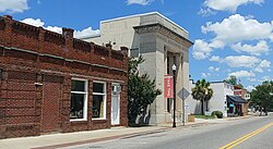
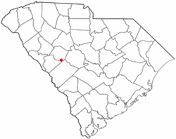
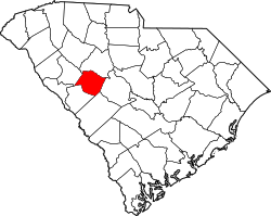
Ridge Spring, South Carolina

Last updated
Ridge Spring, South Carolina
RidgeSpringSC.jpg
Downtown Ridge Spring
SCMap-doton-RidgeSpring.PNG
Location of Ridge Spring, South Carolina
Coordinates: 33°50′45″N81°39′39″W / 33.84583°N 81.66083°W / 33.84583; -81.66083 Coordinates: 33°50′45″N81°39′39″W / 33.84583°N 81.66083°W / 33.84583; -81.66083
Country United States
State South Carolina
County Saluda
Area
[1]
  Total1.85 sq mi (4.79 km2)
  Land1.82 sq mi (4.72 km2)
  Water0.03 sq mi (0.07 km2)
Elevation
633 ft (193 m)
Population
 (2020) [2]
  Total579
  Density317.78/sq mi (122.72/km2)
Time zone UTC-5 (Eastern (EST))
  Summer (DST) UTC-4 (EDT)
ZIP code
29129
Area code(s) 803, 839
FIPS code 45-60325 [3]
GNIS feature ID1250381 [4]
Website www.ridgespringsc.com

Ridge Spring is a town in Saluda County, South Carolina, United States. The population was 737 at the 2010 census. It is part of the Columbia, SC Metropolitan Statistical Area. The Mayor-Elect is Ms. Qwendolyn Etheredge.

Contents

History

Ridge Hill High School was added to the National Register of Historic Places in 2010. [5]

Geography

Ridge Spring is located at 33°50′45″N81°39′39″W / 33.84583°N 81.66083°W / 33.84583; -81.66083 (33.845942, -81.660845). [6]

According to the United States Census Bureau, the town has a total area of 1.9 square miles (4.9 km2), of which 1.8 square miles (4.7 km2) are land and 0.04 square miles (0.10 km2) (1.08%) is covered by water.

Demographics

Historical population
CensusPop.Note
1880 328
1890 39018.9%
1900 4115.4%
1910 50522.9%
1920 59718.2%
1930 6285.2%
1940 6615.3%
1950 598−9.5%
1960 6498.5%
1970 644−0.8%
1980 96950.5%
1990 861−11.1%
2000 823−4.4%
2010 737−10.4%
2020 579−21.4%
U.S. Decennial Census [7] [2]

As of the census [3] of 2000, 823 people, 321 households, and 217 families resided in the town. The population density was 449.3 people per square mile (173.5 people/km2). The 368 housing units averaged 200.9 per square mile (77.6/km2). The racial makeup of the town was 33.90% White, 63.91% Black, 0.12% Native American, 0.61% from other races, and 1.46% from two or more races. Hispanics or Latinos of any race were 2.55% of the population.

Of the 321 households, 26.2% had children under the age of 18 living with them, 40.5% were married couples living together, 22.4% had a female householder with no husband present, and 32.1% were not families. About 28.0% of all households were made up of individuals, and 15.9% had someone living alone who was 65 years of age or older. The average household size was 2.56 and the average family size was 3.18.

In the town, the population was distributed as 24.4% under the age of 18, 9.7% from 18 to 24, 23.5% from 25 to 44, 23.7% from 45 to 64, and 18.7% who were 65 years of age or older. The median age was 40 years. For every 100 females, there were 81.3 males. For every 100 females age 18 and over, there were 80.3 males.

The median income for a household in the town was $25,982, and for a family was $28,984. Males had a median income of $30,476 versus $20,208 for females. The per capita income for the town was $12,083. About 23.4% of families and 26.6% of the population were below the poverty line, including 39.2% of those under age 18 and 16.0% of those age 65 or over.

Education

Ridge Spring has a public library, a branch of the Saluda County Library. [8]

Related Research Articles

<span class="mw-page-title-main">Saluda County, South Carolina</span> County in South Carolina, United States

Saluda County is a county in the U.S. state of South Carolina. As of the 2020 census, the population was 18,862. Its county seat is Saluda. The county was formed from northern and eastern portions of Edgefield County.

Wesley is a town in Washington County, Maine, United States. The town was named after John Wesley, founder of the English Methodist movement. The population was 122 at the 2020 census.

<span class="mw-page-title-main">Haworth, Oklahoma</span> Town in Oklahoma, United States

Haworth is a town in McCurtain County, Oklahoma, United States. The population was 297 at the 2010 census.

<span class="mw-page-title-main">Rayburn Township, Armstrong County, Pennsylvania</span> Township in Pennsylvania, United States

Rayburn Township is a township in Armstrong County, Pennsylvania, United States. The population was 1,766 at the 2020 census, a decrease from the figure of 1,907 tabulated in 2010.

<span class="mw-page-title-main">Klingerstown, Pennsylvania</span> CDP in Pennsylvania, United States

Klingerstown is a census-designated place (CDP) in Upper Mahantongo Township, Schuylkill County, Pennsylvania, United States. As of the 2000 census, the CDP population was 102.

<span class="mw-page-title-main">Perry, South Carolina</span> Town in South Carolina, United States of America

Perry is a town in Aiken County, South Carolina, United States. The population was 233 at the 2010 census. It is part of the Augusta, Georgia metropolitan area.

<span class="mw-page-title-main">Johnston, South Carolina</span> Town in South Carolina, United States

Johnston is a town in Edgefield County, South Carolina, United States. The population was 2,362 at the 2010 census. It is part of the Augusta, Georgia, metropolitan area. The town's official welcome sign states that it is "Peach Capital of the World".

<span class="mw-page-title-main">Joanna, South Carolina</span> Census-designated place in South Carolina, United States

Joanna is an unincorporated community and census-designated place (CDP) in Laurens County, South Carolina, United States. The population was 1,539 at the 2010 census, down from 1,609 at the 2000 census. It is part of the Greenville–Mauldin–Easley Metropolitan Statistical Area.

<span class="mw-page-title-main">Watts Mills, South Carolina</span> Census-designated place in South Carolina, United States

Wattsville is an unincorporated community in Laurens County, South Carolina, United States. The town name is derived from Watts Mill, a textile mill in the center of town. The area is listed as the Wattsville census-designated place (CDP) for statistical purposes. The population of the CDP was 1,635 at the 2010 census. It is part of the Greenville–Mauldin–Easley Metropolitan Statistical Area.

Pine Ridge is a town in Lexington County, South Carolina, United States. The population was 2,064 at the 2010 census. It is part of the Columbia, South Carolina Metropolitan Statistical Area.

Seven Oaks is a census-designated place (CDP) in Lexington County, South Carolina, United States, 8 miles (13 km) northwest of downtown Columbia, the state capital. The population of the CDP was 15,144 at the 2010 census. It is part of the Columbia Metropolitan Statistical Area.

<span class="mw-page-title-main">South Congaree, South Carolina</span> Town in South Carolina, United States

South Congaree is a town in Lexington County, South Carolina, United States. The population was 2,306 at the 2010 census. It is part of the Columbia, South Carolina Metropolitan Statistical Area.

<span class="mw-page-title-main">Clarks Hill, South Carolina</span> CDP in South Carolina, United States

Clarks Hill is a census-designated place (CDP) in McCormick County, South Carolina, United States. The population was 376 at the 2000 census.

<span class="mw-page-title-main">Silverstreet, South Carolina</span> Town in South Carolina, United States

Silverstreet is a town in Newberry County, South Carolina, United States. The population was 162 at the 2010 census. Arguably its biggest tourist attraction is its Thunderbolt siren, tested once a week for three minutes, and the last of its kind in Newberry County.

<span class="mw-page-title-main">Saluda, South Carolina</span> Town in South Carolina, United States

Saluda is a town in Saluda County, South Carolina, United States, along the Little Saluda River. The population was 3,565 at the 2010 census. It is the county seat of Saluda County.

<span class="mw-page-title-main">Ward, South Carolina</span> Town in South Carolina, United States

Ward is a town in Saluda County, South Carolina, United States. The population was 91 at the 2010 census.

<span class="mw-page-title-main">Middletown Springs, Vermont</span> Town in Vermont, United States

Middletown Springs is a town in Rutland County, Vermont, United States. The population was 794 at the 2020 census.

<span class="mw-page-title-main">Virgilina, Virginia</span> Town in Virginia, United States

Virgilina is a town in Halifax County, Virginia, United States. The population was 154 at the 2010 census. Virgilina was once a copper mining town. It was a stop on the Atlantic and Danville Railway as recently as the 1950s. It is named "Virgilina" because it is located on the Virginia and North Carolina border.

<span class="mw-page-title-main">Monetta, South Carolina</span> Town in South Carolina, United States of America

Monetta is a town in Aiken and Saluda counties, South Carolina, United States. The population was 236 at the 2010 census.

<span class="mw-page-title-main">Walton (town), New York</span> Town in New York, United States

Walton is a town in Delaware County, New York, United States. The population was 5,576 at the 2010 census. The town is in the west-central part of the county and contains the village of Walton. The town claims to be the "Scarecrow Capital of the World."

References

  1. "ArcGIS REST Services Directory". United States Census Bureau. Retrieved October 15, 2022.
  2. 1 2 "Census Population API". United States Census Bureau. Retrieved Oct 15, 2022.
  3. 1 2 "U.S. Census website". United States Census Bureau . Retrieved 2008-01-31.
  4. "US Board on Geographic Names". United States Geological Survey. 2007-10-25. Retrieved 2008-01-31.
  5. "National Register Information System". National Register of Historic Places . National Park Service. July 9, 2010.
  6. "US Gazetteer files: 2010, 2000, and 1990". United States Census Bureau. 2011-02-12. Retrieved 2011-04-23.
  7. "Census of Population and Housing". Census.gov. Retrieved June 4, 2015.
  8. "Locations & Hours". Greenville County Library System. Retrieved 13 June 2019.