Ward, South Carolina

Last updated

Ward, South Carolina
WardSouthCarolina.jpg
SCMap-doton-Ward.PNG
Coordinates: 33°51′28″N81°43′56″W / 33.85778°N 81.73222°W / 33.85778; -81.73222
Country United States
State South Carolina
County Saluda
Area
[1]
  Total0.78 sq mi (2.01 km2)
  Land0.78 sq mi (2.01 km2)
  Water0.00 sq mi (0.00 km2)
Elevation
666 ft (203 m)
Population
 (2020) [2]
  Total119
  Density153.35/sq mi (59.23/km2)
Time zone UTC-5 (EST)
  Summer (DST) UTC-4 (EDT)
ZIP code
29166
Area code(s) 803, 839
FIPS code 45-74590 [3]
GNIS feature ID1251321 [4]

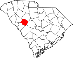
Ward is a town in Saluda County, South Carolina, United States. The population was 91 at the 2010 census.

Contents

History

Spann Methodist Church and Cemetery was added to the National Register of Historic Places in 2003. [5]

Geography

Ward is located at 33°51′28″N81°43′56″W / 33.85778°N 81.73222°W / 33.85778; -81.73222 (33.857891, -81.732286). [6]

According to the United States Census Bureau, the town has a total area of 0.8 square miles (2.1 km2), all land.

Ward is on County Road 23, west of U.S. Route 1, and is just north of the Edgefield County line.

Demographics

Historical population
CensusPop.Note
1890 161
1900 135−16.1%
1910 18335.6%
1920 23427.9%
1930 233−0.4%
1940 204−12.4%
1950 122−40.2%
1960 16232.8%
1970 150−7.4%
1980 98−34.7%
1990 13234.7%
2000 110−16.7%
2010 91−17.3%
2020 11930.8%
U.S. Decennial Census [7] [2]

As of the census [3] of 2000, there were 110 people, 51 households, and 27 families residing in the town. The population density was 141.3 inhabitants per square mile (54.6/km2). There were 62 housing units at an average density of 79.7 per square mile (30.8/km2). The racial makeup of the town was 68.18% White and 31.82% Black.

There were 51 households, out of which 27.5% had children under the age of 18 living in them, 39.2% were married couples living together, 11.8% had a female householder with no husband present, and 45.1% were non-families. 45.1% of all households were made up of individuals, and 33.3% had someone living alone who was 65 years of age or older. The average household size was 2.16 and the average family size was 3.07.

In the town, the population was spread out, with 21.8% under the age of 18, 6.4% from 18 to 24, 28.2% from 25 to 44, 21.8% from 45 to 64, and 21.8% who were 65 years of age or older. The median age was 40 years. For every 100 females, there were 77.4 males. For every 100 females age 18 and over, there were 75.5 males.

The median income for a household in the town was $21,000, and the median income for a family was $41,250. Males had a median income of $31,667 versus $23,594 for females. The per capita income for the town was $13,026. There were 23.1% of families and 15.3% of the population living below the poverty line, including 15.8% of under eighteens and 21.1% of those over 64.

Related Research Articles

<span class="mw-page-title-main">Stockton, Iowa</span> City in Iowa, United States

Stockton is a city in Muscatine County, Iowa, United States. The population was 176 at the time of the 2020 census. It is part of the Muscatine Micropolitan Statistical Area.

<span class="mw-page-title-main">Mapleton, Maine</span> Town in the state of Maine, United States

Mapleton is a town in Aroostook County, Maine, United States. The population was 1,886 at the 2020 census.

<span class="mw-page-title-main">Wallagrass, Maine</span> Town in the state of Maine, United States

Wallagrass is a town in Aroostook County, Maine, United States. The population was 519 at the 2020 census.

<span class="mw-page-title-main">Manchester, Maine</span> Town in Maine, United States

Manchester is a town in Kennebec County, Maine, United States, located at 44.33°N 69.87°W. The population was 2,456 at the 2020 census. The southern part of the town bordering Cobbosseecontee Lake is a popular recreation spot in central Maine, and part of the Winthrop Lakes Region. Manchester is included in the Augusta, Maine micropolitan New England City and Town Area.

Lakeville is a town in Penobscot County, Maine, United States. The population was 104 at the 2020 census.

<span class="mw-page-title-main">Whalan, Minnesota</span> City in Minnesota, United States

Whalan is a city in Fillmore County, Minnesota, United States. The population was 63 at the 2010 census.

<span class="mw-page-title-main">Rocky Point, Montana</span> Census-designated place in Montana, United States

Rocky Point is a census-designated place (CDP) in Lake County, Montana, United States. The population was 97 at the 2010 census.

<span class="mw-page-title-main">Killbuck, Ohio</span> Village in Ohio, United States

Killbuck is a village in Holmes County, Ohio, United States, along Killbuck Creek. The population was 810 at the 2020 census.

<span class="mw-page-title-main">Richland Township, Cambria County, Pennsylvania</span> Township in Pennsylvania, United States

Richland Township is a township in Cambria County, Pennsylvania, United States. The population was 12,814 at the 2010 census. It is part of the Johnstown, Pennsylvania Metropolitan Statistical Area.

Pine Ridge is a town in Lexington County, South Carolina, United States. The population was 2,064 at the 2010 census. It is part of the Columbia, South Carolina Metropolitan Statistical Area.

<span class="mw-page-title-main">Roaring Springs, Texas</span> Town in Texas, United States

Roaring Springs is a town in Motley County, Texas, United States. The population was 265 at the 2000 census.

<span class="mw-page-title-main">Gary City, Texas</span> Town in Texas, United States

Gary City is a town in Panola County, Texas, United States. The population was 336 as of the 2020 census.

<span class="mw-page-title-main">Gauley Bridge, West Virginia</span> Town in West Virginia, United States

Gauley Bridge is a town in Fayette County, West Virginia, United States. The population was 614 at the 2010 census. The Kanawha River is formed at Gauley Bridge by the confluence of the New and Gauley Rivers. Two miles to the southeast of Gauley Bridge, in Glen Ferris, is Kanawha Falls, a popular stopping point on Midland Trail Scenic Highway.

<span class="mw-page-title-main">Leon, West Virginia</span> Town in West Virginia, United States

Leon is a town in Mason County, West Virginia, United States, situated along the Kanawha River. The population was 137 at the 2020 census. It is part of the Point Pleasant, WV–OH Micropolitan Statistical Area.

<span class="mw-page-title-main">Bramwell, West Virginia</span> Town in West Virginia, United States

Bramwell is a town in Mercer County, West Virginia, United States, along the Bluestone River. The population was 277 at the 2020 census. It is part of the Bluefield, WV-VA micropolitan area which has a population of 107,578.

<span class="mw-page-title-main">Bancroft, West Virginia</span> Town in West Virginia, United States

Bancroft is a town in Putnam County, West Virginia, United States, along the Kanawha River. The population was 389 at the 2020 census. It is part of the Huntington–Ashland metropolitan area.

<span class="mw-page-title-main">Lester, West Virginia</span> Town in West Virginia, United States

Lester is a town in Raleigh County, West Virginia, United States. The population was 337 at the 2020 census. The community was named after Champ Lester, a local pioneer.

<span class="mw-page-title-main">Reedy, West Virginia</span> Town in West Virginia, United States

Reedy is a town in Roane County, West Virginia, United States. The population was 152 at the 2020 census.

<span class="mw-page-title-main">Richland, Richland County, Wisconsin</span> Town in Wisconsin, United States

Richland is a town in Richland County, Wisconsin, United States. The population was 1,364 at the 2000 census.

Whitewater is a town in Walworth County, Wisconsin, United States. The population was 1,433 at the 2020 census.

References

  1. "ArcGIS REST Services Directory". United States Census Bureau. Retrieved October 15, 2022.
  2. 1 2 "Census Population API". United States Census Bureau. Retrieved October 15, 2022.
  3. 1 2 "U.S. Census website". United States Census Bureau . Retrieved January 31, 2008.
  4. "US Board on Geographic Names". United States Geological Survey. October 25, 2007. Retrieved January 31, 2008.
  5. "National Register Information System". National Register of Historic Places . National Park Service. July 9, 2010.
  6. "US Gazetteer files: 2010, 2000, and 1990". United States Census Bureau. February 12, 2011. Retrieved April 23, 2011.
  7. "Census of Population and Housing". Census.gov. Retrieved June 4, 2015.