Sharon, Georgia

Last updated

Sharon, Georgia
Taliaferro County Georgia Incorporated and Unincorporated areas Sharon Highlighted.svg
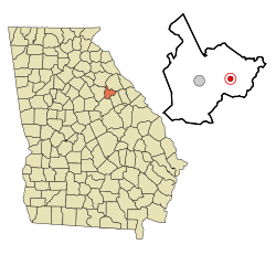
Location in Taliaferro County and the state of Georgia
Coordinates: 33°33′31″N82°47′38″W / 33.55861°N 82.79389°W / 33.55861; -82.79389
Country United States
State Georgia
County Taliaferro
Incorporated (city)1884
Area
[1]
  Total0.78 sq mi (2.03 km2)
  Land0.78 sq mi (2.02 km2)
  Water0.00 sq mi (0.01 km2)
Elevation
600 ft (183 m)
Population
 (2020)
  Total104
  Density133.33/sq mi (51.46/km2)
Time zone UTC-5 (Eastern (EST))
  Summer (DST) UTC-4 (EDT)
ZIP code
30664
Area code 706
FIPS code 13-69896 [2]
GNIS feature ID0322779 [3]

Sharon is a city in Taliaferro County, Georgia, United States. The population was 104 in 2020.

Contents

History

The community of Sharon is visible on maps as early as 1865. [4] The Georgia General Assembly incorporated Sharon as a town in 1884. [5] The community is named after the Plain of Sharon, a place mentioned in the Hebrew Bible. [6]

Into the 1890s, Sharon was bustling with thousands of travelers who came there for the reputed healing powers of the nearby Electric Health Resort, where it was said that exposure to bedrock in a subterranean chamber provided electrical healing powers. The resort, which included a hotel, lake, and post office, eventually burned down. [7]

Geography

Sharon is located at 33°33′31″N82°47′38″W / 33.55861°N 82.79389°W / 33.55861; -82.79389 (33.558724, -82.793784). [8] According to the United States Census Bureau, the city has a total area of 0.8 square miles (2.1 km2), all land.

Demographics

Historical population
CensusPop.Note
1890 172
1900 31985.5%
1910 293−8.2%
1920 282−3.8%
1930 253−10.3%
1940 28211.5%
1950 224−20.6%
1960 26417.9%
1970 160−39.4%
1980 140−12.5%
1990 94−32.9%
2000 10511.7%
2010 14033.3%
2020 104−25.7%
U.S. Decennial Census [9]
1850-1870 [10] 1870-1880 [11]
1890-1910 [12] 1920-1930 [13]
1940 [14] 1950 [15] 1960 [16]
1970 [17] 1980 [18] 1990 [19]
2000 [20] 2010 [21] 2020 [22]
Sharon, Georgia – Racial and ethnic composition
Note: the US Census treats Hispanic/Latino as an ethnic category. This table excludes Latinos from the racial categories and assigns them to a separate category. Hispanics/Latinos may be of any race.
Race / Ethnicity (NH = Non-Hispanic)Pop 2000 [23] Pop 2010 [21] Pop 2020 [22] % 2000% 20102020
White alone (NH)29544727.62%38.57%45.19%
Black or African American alone (NH)75755271.43%53.57%50.00%
Native American or Alaska Native alone (NH)0020.00%0.00%1.92%
Asian alone (NH)1000.95%0.00%0.00%
Pacific Islander alone (NH)0000.00%0.00%0.00%
Some Other Race alone (NH)0000.00%0.00%0.00%
Mixed Race or Multi-Racial (NH)0520.00%3.57%1.92%
Hispanic or Latino (any race)0610.00%4.29%0.96%
Total105140104100.00%100.00%100.00%

As of the census [2] of 2000, there were 105 people, 46 households, and 28 families residing in the city. By 2020, its population was 104.

Notable person

Lloyd D. Brown, United States Army Major General who commanded 28th Infantry Division in World War II [24]

See also

Related Research Articles

<span class="mw-page-title-main">Taliaferro County, Georgia</span> County in Georgia, United States

Taliaferro County is a county located in East central Piedmont region of the U.S. state of Georgia. As of the 2020 census, the population was 1,559, down from the 2010 census when the population was 1,717, making it the least populous county in Georgia and the second least populous county east of the Mississippi River. The county seat is Crawfordville.

<span class="mw-page-title-main">Richmond County, Georgia</span> Consolidated city-county in Georgia, United States

Richmond County is located in the state of Georgia in the U.S. As of the 2020 census, the population was 206,607. It is one of the original counties of Georgia, created on February 5, 1777. Following an election in 1995, Augusta consolidated governments with Richmond County. The consolidated entity is known as Augusta-Richmond County, or simply Augusta. Exempt are the cities of Hephzibah and Blythe, in southern Richmond County, which voted to remain separate. Richmond County is included in the Augusta-Richmond County, GA-SC metropolitan statistical area.

<span class="mw-page-title-main">Monroe County, Georgia</span> County in Georgia, United States

Monroe County is a county located in the central portion of the U.S. state of Georgia. As of the 2020 census, the population was 27,957. The county seat is Forsyth. The county was created on May 15, 1821. The county was named for James Monroe. Monroe County is included in the Macon, GA metropolitan statistical area.

<span class="mw-page-title-main">Lamar County, Georgia</span> County in Georgia, United States

Lamar County is a county located in the west central portion of the U.S. state of Georgia. As of the 2020 census, the population was 18,500. The county seat is Barnesville.

<span class="mw-page-title-main">Jefferson County, Georgia</span> County in Georgia, United States

Jefferson County is a county located in the U.S. state of Georgia. As of the 2020 census, the population was 15,709. The county seat and largest city is Louisville. The county was created on February 20, 1796, and named for Thomas Jefferson, the main author of the Declaration of Independence who became the third president of the United States.

<span class="mw-page-title-main">Clinch County, Georgia</span> County in Georgia, United States

Clinch County is a county located in the southeastern part of the U.S. state of Georgia. As of the 2020 census, the population was 6,749. The county seat is Homerville. The county was created on February 14, 1850, named in honor of Duncan Lamont Clinch.

<span class="mw-page-title-main">Keysville, Georgia</span> Town in Georgia, United States

Keysville is a town in Burke and Jefferson counties in the U.S. state of Georgia. As of the 2020 census, the city's population was 300.

<span class="mw-page-title-main">Midville, Georgia</span> City in Georgia, United States

Midville is a city in Burke County, Georgia, United States. The population was 269 at the 2010 census, and 385 in 2020. It is part of the Augusta, Georgia metropolitan area.

<span class="mw-page-title-main">Martinez, Georgia</span> Place in Georgia, United States

Martinez is an unincorporated community and census-designated place (CDP) in Columbia County, Georgia, United States. It is a northwestern suburb of Augusta and is part of the Augusta, Georgia metropolitan area. The population was 34,535 at the 2020 census.

<span class="mw-page-title-main">White Plains, Georgia</span> City in Georgia, United States

White Plains is a city in Greene County, Georgia, United States. The population was 284 at the 2010 census.

<span class="mw-page-title-main">Oglethorpe, Georgia</span> City in Georgia, United States

Oglethorpe is a city in Macon County, Georgia, United States. The population was 995 at the 2020 census, down from 1,328 in 2010. The city is the county seat of Macon County. It was named for Georgia's founder, James Oglethorpe.

<span class="mw-page-title-main">Hiltonia, Georgia</span> City in Georgia, United States

Hiltonia is a city in Screven County, Georgia, United States. The population was 310 in 2020.

<span class="mw-page-title-main">Oliver, Georgia</span> City in Georgia, United States

Oliver is a city in Screven County, Georgia, United States. The population was 210 as of 2020.

<span class="mw-page-title-main">Junction City, Georgia</span> Town in Georgia, United States

Junction City is a town in Talbot County, Georgia, United States. The population was 138 at the 2020 census.

<span class="mw-page-title-main">Crawfordville, Georgia</span> City in Georgia, United States

Crawfordville is a city in Taliaferro County, Georgia, United States. The population was 479 in 2020. The city is the county seat of Taliaferro County.

<span class="mw-page-title-main">Deenwood, Georgia</span> Place in Georgia, United States

Deenwood is an unincorporated community and census-designated place (CDP) in Ware County, Georgia, United States. The population was 2,207 at the 2020 census. It is part of the Waycross micropolitan statistical area. Deenwood Baptist Church is named after this geographical area.

<span class="mw-page-title-main">Sunnyside, Georgia</span> Place in Georgia, United States

Sunnyside is an unincorporated community and census-designated place (CDP) in Ware County, Georgia, United States. The population was 1,472 in 2020. It is part of the Waycross micropolitan statistical area.

<span class="mw-page-title-main">Camak, Georgia</span> Town in Georgia, United States

Camak is a town in Warren County, Georgia, United States. The town is located just off Interstate 20 between Atlanta and Augusta. The population was 141 in 2020.

<span class="mw-page-title-main">Norwood, Georgia</span> City in Georgia, United States

Norwood is a city in Warren County, Georgia, United States. The population was 202 in 2020.

<span class="mw-page-title-main">Alamo, Georgia</span> Town in Georgia, United States

Alamo is a town in Wheeler County, Georgia, United States. As of the 2020 census, the town had a population of 771. The town is the county seat of Wheeler County.

References

  1. "2020 U.S. Gazetteer Files". United States Census Bureau. Retrieved December 18, 2021.
  2. 1 2 "U.S. Census website". United States Census Bureau . Retrieved January 31, 2008.
  3. "US Board on Geographic Names". United States Geological Survey. October 25, 2007. Retrieved January 31, 2008.
  4. "Taliaferro County - 1865". georgiainfo.galileo.usg.edu. Archived from the original on July 16, 2011.
  5. Acts and Resolutions of the General Assembly of the State of Georgia. Clark & Hines, State Printers. 1885. p. 329.
  6. Krakow, Kenneth K. (1975). Georgia Place-Names: Their History and Origins (PDF). Macon, GA: Winship Press. p. 204. ISBN   0-915430-00-2.
  7. "Taliaferro County".
  8. "US Gazetteer files: 2010, 2000, and 1990". United States Census Bureau. February 12, 2011. Retrieved April 23, 2011.
  9. "Decennial Census of Population and Housing by Decade". US Census Bureau.
  10. "1870 Census of Population - Georgia - Population of Civil Divisions less than Counties" (PDF). US Census Bureau . 1870.
  11. "1880 Census of Population - Georgia - Population of Civil Divisions less than Counties" (PDF). US Census Bureau . 1880.
  12. "1910 Census of Population - Georgia" (PDF). US Census Bureau . 1930.
  13. "1930 Census of Population - Georgia" (PDF). US Census Bureau . 1930. p. 251-256.
  14. "1940 Census of Population - Georgia" (PDF). US Census Bureau . 1940.
  15. "1950 Census of Population - Georgia" (PDF). US Census Bureau . 1980.
  16. "1960 Census of Population - Population of County Subdivisions - Georgia" (PDF). US Census Bureau . 1960.
  17. "1970 Census of Population - Population of County Subdivisions - Georgia" (PDF). US Census Bureau . 1970.
  18. "1980 Census of Population - Number of Inhabitants - Georgia" (PDF). US Census Bureau . 1980.
  19. "1990 Census of Population - Summary Social, Economic, and Housing Characteristics - Georgia" (PDF). US Census Bureau . 1990.
  20. "2000 Census of Population - General Population Characteristics - Georgia" (PDF). US Census Bureau . 2000.
  21. 1 2 "P2 Hispanic or Latino, and Not Hispanic or Latino by Race – 2010: DEC Redistricting Data (PL 94-171) – Sharon city, Georgia". United States Census Bureau .
  22. 1 2 "P2 Hispanic or Latino, and Not Hispanic or Latino by Race – 2020: DEC Redistricting Data (PL 94-171) – Sharon city, Georgia". United States Census Bureau .
  23. "P004 Hispanic or Latino, and Not Hispanic or Latino by Race – 2000: DEC Summary File 1 – Sharon city, Georgia". United States Census Bureau .
  24. Sarah Cantey Whitaker Allen, Our Children's Ancestry, 1935, page 437