Pearson, Georgia

Last updated

Pearson, Georgia
Pearson City Hall Police Department Front.jpg
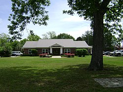
Pearson City Hall and Police Department
Motto(s): 
Visit for a day, or stay for a lifetime
Atkinson County Georgia Incorporated and Unincorporated areas Pearson Highlighted.svg
Location in Atkinson County and the state of Georgia
Coordinates: 31°17′54″N82°51′10″W / 31.29833°N 82.85278°W / 31.29833; -82.85278
Country United States
State Georgia
County Atkinson
Incorporated (city)Dec. 27, 1890
Area
[1]
  Total3.36 sq mi (8.71 km2)
  Land3.35 sq mi (8.68 km2)
  Water0.01 sq mi (0.02 km2)
Elevation
203 ft (62 m)
Population
 (2020)
  Total1,821
  Estimate 
(2022)
1,799
  Density543.26/sq mi (209.73/km2)
Time zone UTC-5 (Eastern (EST))
  Summer (DST) UTC-4 (EDT)
ZIP code
31642
Area code 912
FIPS code 13-59808 [2]
GNIS feature ID0332626 [3]
Website www.pearson-ga.com

Pearson is a city in Atkinson County, Georgia, United States. The population was 1,821 in 2020. [2] The city is the county seat of Atkinson County. [4]

Contents

History

Pearson was founded in 1875 as a depot on the Brunswick and Western Railroad. It was incorporated as a town in 1890 and in 1916 as a city. [5] The community was named after Benajah Pearson, a veteran of the Second Seminole War. [6] [7]

Geography

Pearson is located at 31°17′54″N82°51′10″W / 31.29833°N 82.85278°W / 31.29833; -82.85278 (31.298368, -82.852827), within Southeast Georgia. [8] According to the United States Census Bureau, the city has a total area of 3.4 square miles (8.7 km2), of which 0.0077 square miles (0.02 km2), or 0.28%, is water. [9]

Demographics

Historical population
CensusPop.Note
1900 336
1910 55866.1%
1920 79241.9%
1930 712−10.1%
1940 1,05748.5%
1950 1,40232.6%
1960 1,61515.2%
1970 1,7005.3%
1980 1,8277.5%
1990 1,714−6.2%
2000 1,8055.3%
2010 2,11717.3%
2020 1,821−14.0%
U.S. Decennial Census [10]
Pearson racial composition as of 2020 [11]
RaceNum.Perc.
White (non-Hispanic)53329.27%
Black or African American (non-Hispanic)55330.37%
Native American 40.22%
Asian 80.44%
Pacific Islander 20.11%
Other/Mixed 402.2%
Hispanic or Latino 68137.4%

As of the 2020 United States census, there were 1,821 people, 674 households, and 426 families residing in the city.

Education

Atkinson County students in K-12 grades are in the Atkinson County School District, which consists of two elementary schools (each includes a pre-school program) and a high school. [12] The district has 102 full-time teachers and over 1,648 students as of 2010. [13]

Media

Notable people

Related Research Articles

<span class="mw-page-title-main">Atkinson County, Georgia</span> County in Georgia, United States

Atkinson County is a county located in the southeastern region of the U.S. state of Georgia. As of the 2020 census, the county's population was 8,286. The county seat is Pearson. The county was formed in 1917 from parts of Coffee and Clinch counties. It is named for William Yates Atkinson, Democratic governor of Georgia from 1894 to 1898. In 2003, it had the highest illiteracy rate of any U.S. county at 36%.

<span class="mw-page-title-main">Alma, Georgia</span> City in Georgia, United States

Alma is a city in Bacon County, Georgia, United States, and the county seat. As of the 2020 census, the city had a population of 3,433.

<span class="mw-page-title-main">Winder, Georgia</span> City in Georgia, United States

Winder is a city and the county seat of Barrow County, Georgia, United States. It is located east of Atlanta and is part of the Atlanta metropolitan area. The population was 18,338 at the 2020 census.

<span class="mw-page-title-main">Nahunta, Georgia</span> City in Georgia, United States

Nahunta is a city and the county seat in Brantley County, Georgia, United States. It is part of the Brunswick, Georgia metropolitan statistical area. The population was 1,013 at the 2020 census. The city is an important crossroad which is intersected by U.S. Route 82 and U.S. Route 301 in its downtown area.

<span class="mw-page-title-main">Blythe, Georgia</span> City in the United States

Blythe is a city in Richmond County in the U.S. state of Georgia. As of the 2020 census, the city had a population of 744. It is part of the Augusta, Georgia metropolitan area.

<span class="mw-page-title-main">Metter, Georgia</span> City in Georgia, United States

Metter is a city and the county seat of Candler County, Georgia, United States. The population was 4,130 at the 2010 census. In 2020, its population was 4,004.

<span class="mw-page-title-main">Douglas, Georgia</span> City in Georgia, United States

Douglas is a city in Coffee County, Georgia, United States. As of the 2020 census, the city had a population of 11,722. Douglas is the county seat of Coffee County and the core city of the Douglas micropolitan statistical area, which had a population of 50,731 as of the 2010 census.

<span class="mw-page-title-main">Swainsboro, Georgia</span> City in Georgia, United States

Swainsboro is a city in Emanuel County, Georgia, United States. As of the 2020 census, the city had a population of 7,425. The city is the county seat of Emanuel County.

<span class="mw-page-title-main">Sparta, Georgia</span> City in Georgia, United States

Sparta is a city in and the county seat of Hancock County, Georgia, United States. It is part of the Milledgeville micropolitan statistical area. The city's population was 1,400 at the 2010 census.

<span class="mw-page-title-main">Hartwell, Georgia</span> City in Georgia, United States

Hartwell is a city in Hart County, Georgia, United States. The population was 4,469 at the 2010 census. The city is the county seat of Hart County.

<span class="mw-page-title-main">Wrightsville, Georgia</span> City in Georgia, United States

Wrightsville is a city in and the county seat of Johnson County, Georgia, United States. The population was 2,195 at the 2010 census, down from 2,223 at the 2000 census. By 2020, its population grew to 3,449. The city limits include Johnson State Prison on the northeast side of town. Wrightsville is part of the Dublin Micropolitan Statistical Area.

<span class="mw-page-title-main">Gray, Georgia</span> City in Georgia, United States

Gray is a city in Jones County, Georgia, United States. The population was 3,276 at the 2010 census, up from 1,811 at the 2000 census. In 2020, its population was 3,436. The city is the county seat of Jones County. It is part of the Macon metropolitan area.

<span class="mw-page-title-main">East Dublin, Georgia</span> City in Georgia, United States

East Dublin is a city in Laurens County, Georgia, United States. The population was 2,492 in 2020.

<span class="mw-page-title-main">Lincolnton, Georgia</span> City in Georgia, United States

Lincolnton is a city and the county seat of Lincoln County, Georgia, United States. The population was 1,480 at the 2020 census. It contains numerous houses and historic districts listed on the National Register of Historic Places. Both the city and the county were named for General Benjamin Lincoln, who served in the Continental Army during the American Revolution.

<span class="mw-page-title-main">Mount Vernon, Georgia</span> City in Georgia, United States

Mount Vernon is a city in, and the county seat of, Montgomery County, Georgia, United States. The population was 1,900 at the 2020 census, down from 2,451 in 2010. It is home to Brewton–Parker College.

<span class="mw-page-title-main">Blackshear, Georgia</span> City in Georgia, United States

The city of Blackshear is the county seat of Pierce County, Georgia, United States. As of the 2020 census, the city had a population of 3,506.

<span class="mw-page-title-main">Reidsville, Georgia</span> City in Georgia, United States

Reidsville is a city in, and county seat of, Tattnall County, Georgia. The population was 2,515 in 2020. The Georgia State Prison is near Reidsville.

<span class="mw-page-title-main">Lyons, Georgia</span> City in Georgia, United States

Lyons is a city in Toombs County, Georgia, United States. The population was 4,239 in 2020. The city is the county seat of Toombs County.

<span class="mw-page-title-main">Warrenton, Georgia</span> City in Georgia, United States

Warrenton is a city in Warren County, Georgia, United States. The population was 1,744 in 2020. The city is the county seat of Warren County.

<span class="mw-page-title-main">Alamo, Georgia</span> Town in Georgia, United States

Alamo is a town in Wheeler County, Georgia, United States. As of the 2020 census, the town had a population of 771. The town is the county seat of Wheeler County.

References

  1. "2020 U.S. Gazetteer Files". United States Census Bureau. Retrieved December 18, 2021.
  2. 1 2 "U.S. Census website". United States Census Bureau . Retrieved January 31, 2008.
  3. "US Board on Geographic Names". United States Geological Survey. October 25, 2007. Retrieved January 31, 2008.
  4. "Find a County". National Association of Counties. Archived from the original on May 31, 2011. Retrieved June 7, 2011.
  5. Hellmann, Paul T. (May 13, 2013). Historical Gazetteer of the United States. Routledge. p. 242. ISBN   978-1135948597 . Retrieved November 30, 2013.
  6. "Counties".
  7. "Atkinson County, Georgia". Our Georgia History. Retrieved December 6, 2013.
  8. "US Gazetteer files: 2010, 2000, and 1990". United States Census Bureau. February 12, 2011. Retrieved April 23, 2011.
  9. "Geographic Identifiers: 2010 Demographic Profile Data (G001): Pearson city, Georgia". U.S. Census Bureau, American Factfinder. Archived from the original on February 12, 2020. Retrieved May 6, 2013.
  10. "Census of Population and Housing". Census.gov. Retrieved June 4, 2015.
  11. "Explore Census Data". data.census.gov. Retrieved December 14, 2021.
  12. "Schools in Atkinson County". Georgia Board of Education. Retrieved October 9, 2010.[ permanent dead link ]
  13. Free District Report, Retrieved May 29, 2010.