Fort Valley, Georgia

Last updated

Fort Valley, Georgia
City Hall in Fort Valley, GA, US.jpg
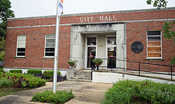
Fort Valley City Hall
Flag of Fort Valley, Georgia.png
Seal of Fort Valley, Georgia.png
Nickname: 
"Peach Capital of Georgia" [1]
Motto: 
"Where Caring Is A Way Of Life" [2]
Peach County Georgia Incorporated and Unincorporated areas Fort Valley Highlighted.svg
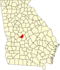
Location in Peach County and the state of Georgia
Coordinates: 32°33′N83°53′W / 32.550°N 83.883°W / 32.550; -83.883
Country United States
State Georgia
County Peach
Area
[3]
  Total7.55 sq mi (19.56 km2)
  Land7.54 sq mi (19.52 km2)
  Water0.01 sq mi (0.04 km2)
Elevation
518 ft (158 m)
Population
 (2020)
  Total8,780
  Density1,164.77/sq mi (449.73/km2)
Time zone UTC-5 (Eastern (EST))
  Summer (DST) UTC-4 (EDT)
ZIP code
31030
Area code 478
FIPS code 13-31096 [4]
GNIS feature ID0355881 [5]
Website Fort Valley website

Fort Valley is a city in and the county seat of Peach County, Georgia, United States. [6] As of the 2020 census, the city had a population of 8,780.

Contents

The city is in the Warner Robins metropolitan area and the Macon–Warner Robins combined statistical area.

History

The town's name is a mystery, as it has never had a fort. Historians believe that the name was mistakenly changed in a transcription error when the post office was named; the area was originally thought to have been called Fox Valley. [1]

Founded in 1836, Fort Valley was incorporated as a town in 1854 and as a city in 1907. In 1924 it was the designated seat of the newly formed Peach County. [7]

Fort Valley was the backdrop for a Life feature story in the March 22, 1943 edition. The World War II-era story focused on the town's sponsoring of the "Ham and Egg Show," a contest held by African-American farmers to highlight ham and poultry production in Peach County, Georgia. [8]

Geography

Police department Police Dept in Fort Valley, GA, US.jpg
Police department

The city is located in the central part of the state along U.S. Route 341, which is the main route through the city. Via U.S. 341, Roberta is 15 mi (24 km) northwest, and Perry is 12 mi (19 km) southeast. Georgia State Routes 49, 96, and 540 (Fall Line Freeway) also run through the city. GA-49 leads northeast 11 mi (18 km) to Byron and southwest 8 mi (13 km) to Marshallville. GA-96 leads east 16 mi (26 km) to Warner Robins and west 13 mi (21 km) to Reynolds. The Fall Line Freeway runs north of the city as a four-lane divided highway, leading northeast to Byron with GA-49 and west to Reynolds with GA-96.

According to the United States Census Bureau, the city has a total area of 5.3 square miles (14 km2), all land.

Demographics

Historical population
CensusPop.Note
1870 1,333
1880 1,277−4.2%
1890 1,75237.2%
1900 2,02215.4%
1910 2,69733.4%
1920 3,22319.5%
1930 4,56041.5%
1940 4,9538.6%
1950 6,82037.7%
1960 8,31021.8%
1970 9,25111.3%
1980 9,000−2.7%
1990 8,198−8.9%
2000 8,005−2.4%
2010 9,81522.6%
2020 8,780−10.5%
U.S. Decennial Census [9]

2020 census

Fort Valley racial composition [10]
RaceNum.Perc.
White (non-Hispanic)99211.3%
Black or African American (non-Hispanic)6,82577.73%
Native American 140.16%
Asian 230.26%
Pacific Islander 10.01%
Other/Mixed 2132.43%
Hispanic or Latino 7128.11%

As of the 2020 United States census, there were 8,780 people, 3,040 households, and 1,685 families residing in the city.

2000 census

As of the census [4] of 2000, there were 8,005 people, 3,050 households, and 1,878 families residing in the city. The population density was 1,519.5 inhabitants per square mile (586.7/km2). There were 3,303 housing units at an average density of 627.0 per square mile (242.1/km2). The racial makeup of the city was 22.10% White, 74.65% African American, 0.37% Native American, 0.25% Asian, 0.05% Pacific Islander, 1.85% from other races, and 0.72% from two or more races. Hispanic or Latino people of any race were 4.37% of the population.

There were 3,050 households, out of which 30.6% had children under the age of 18 living with them, 25.9% were married couples living together, 30.9% had a female householder with no husband present, and 38.4% were non-families. 29.1% of all households were made up of individuals, and 10.4% had someone living alone who was 65 years of age or older. The average household size was 2.57 and the average family size was 3.20.

In the city, the population was spread out, with 27.3% under the age of 18, 16.9% from 18 to 24, 26.0% from 25 to 44, 18.3% from 45 to 64, and 11.4% who were 65 years of age or older. The median age was 28 years. For every 100 females, there were 86.1 males. For every 100 females age 18 and over, there were 81.8 males.

The median income for a household in the city was $19,646, and the median income for a family was $24,206. Males had a median income of $27,016 versus $20,110 for females. The per capita income for the city was $10,815. About 31.8% of families and 37.7% of the population were below the poverty line, including 44.3% of those under the age of 18 and 17.3% of those 65 and older.

Economy

Fort Valley is the corporate headquarters of the Blue Bird Corporation, a large manufacturer of activity buses and school buses, which opened its first Fort Valley facility in 1935.

Athletics

Football

Despite being a city of less than 10,000 people, Fort Valley boasts one of the best football teams in the state. The Peach County High Trojans have played in eight state title games since 1990, and have made the playoffs every year since.

Track and field

Arts and culture

Points of interest

Education

Public schools

The Peach County School District holds grades pre-school to grade twelve, and consists of three elementary schools, two middle schools, and a high school. [11] The district has 270 full-time teachers and over 3,927 students. [12]

Colleges and universities

The city is home to Fort Valley State University, a historically black college. [13]

Infrastructure

A water tower in Fort Valley WaterTowerFortValleyGA.jpg
A water tower in Fort Valley

Transportation

Highways

U.S. Route:

State Routes:

Health care

Notable people

Related Research Articles

<span class="mw-page-title-main">Peach County, Georgia</span> County in Georgia, United States

Peach County is a county located in the central portion of the U.S. state of Georgia. As of the 2020 census, the population was 27,981. Its county seat is Fort Valley. Founded in 1924, it is the state's newest county, taken from Houston and Macon counties on July 18 of that year. Its namesake is the peach on account of it being located in a peach-growing district.

<span class="mw-page-title-main">Franklin County, Georgia</span> County in Georgia, United States

Franklin County is a county located in the northeastern part of the U.S. state of Georgia. As of the 2020 census, the population was 23,424. The county seat is Carnesville. On February 25, 1784, Franklin and Washington became Georgia's eighth and ninth counties, with Franklin named in honor of patriot Benjamin Franklin.

<span class="mw-page-title-main">Valley, Alabama</span> City in Alabama, United States

Valley is a city in Chambers County, Alabama, United States. Valley was incorporated in 1980 combining the four textile mill villages of Fairfax, Langdale, River View, and Shawmut. As of the 2010 census it had a population of 9,524. The city lies on the western bank of the Chattahoochee River, the state border between Alabama and Georgia. Valley is a pilot city for the Alabama Communities of Excellence program, a non-profit that partners with governments, businesses, and universities to prepare participating communities for a more vibrant future. It is included in the LaGrange, Georgia Micropolitan Statistical Area, which is included in the Greater Atlanta Combined Statistical Area.

<span class="mw-page-title-main">Fort Gaines, Georgia</span> City in Georgia, United States

Fort Gaines is a city in and the county seat of Clay County, Georgia, United States. It has a population of 1,107 as of the 2010 census.

<span class="mw-page-title-main">Forest Park, Georgia</span> City in Georgia, United States

Forest Park is a city in Clayton County, Georgia, United States. It is located approximately nine miles (14 km) south of Atlanta and is part of the Atlanta–Sandy Springs–Marietta Metropolitan Statistical Area. As of the 2020 census, the city had a population of 19,932.

<span class="mw-page-title-main">Riverdale, Georgia</span> City in Georgia, United States

Riverdale is a city in Clayton County, Georgia, United States. The population was 15,134 at the 2010 census, up from 12,478 in 2000. Riverdale is a suburb just south of Hartsfield–Jackson Atlanta International Airport and is part of the Atlanta metropolitan area.

<span class="mw-page-title-main">Powder Springs, Georgia</span> City in Georgia, United States

Powder Springs is a city in Cobb County, Georgia, United States. The population was 13,940 at the 2010 census, with an estimated population for 2019 of 15,758. The 12,000-capacity Walter H. Cantrell Stadium is located in Powder Springs. It is used mostly for football and soccer matches.

<span class="mw-page-title-main">Trenton, Georgia</span> City in Georgia, United States

Trenton is a city and the only incorporated municipality in Dade County, Georgia, United States—and as such, it serves as the county seat. The population was 2,195 at the 2020 census. Trenton is part of the Chattanooga, Tennessee–GA Metropolitan Statistical Area.

<span class="mw-page-title-main">Norcross, Georgia</span> City in Georgia, United States

Norcross is a city located in Gwinnett County, Georgia, United States. According to the 2010 census, the population was 9,116, while in 2020, the population increased to 17,209. Norcross is part of the Atlanta-Sandy Springs-Marietta metropolitan statistical area.

<span class="mw-page-title-main">McDonough, Georgia</span> City in Georgia, United States

McDonough is a city in Henry County, Georgia, United States. It is part of the Atlanta metropolitan area. Its population was 22,084 at the 2010 census, up from 8,493 in 2000. The city is the county seat of Henry County. The unincorporated communities of Blacksville, Flippen, Kelleytown, and Ola are located near McDonough, and addresses in those communities have McDonough ZIP Codes.

<span class="mw-page-title-main">Perry, Georgia</span> City in Georgia, United States

Perry is a city in Houston and Peach counties in the U.S. state of Georgia. It is the county seat of Houston County. The population was 13,839 at the 2010 census, up from 9,602 at the 2000 census. As of 2019 the estimated population was 17,894. It is part of the Warner Robins, Georgia metropolitan statistical area, within the Macon–Bibb County–Warner Robins combined statistical area.

<span class="mw-page-title-main">Warner Robins, Georgia</span> City in Georgia, United States

Warner Robins is a city in Houston and Peach counties in the U.S. state of Georgia. It is currently the state's eleventh-largest incorporated city, with a population of 80,308 in the 2020 census.

<span class="mw-page-title-main">Lexington, Georgia</span> City in Georgia, United States

The city of Lexington is the county seat of Oglethorpe County, Georgia, United States. The population was 239 at the 2000 census.

<span class="mw-page-title-main">Byron, Georgia</span> City in Georgia, United States

Byron is a city located primarily in Peach County, Georgia, United States. A small portion of the city also extends into parts of Houston and Crawford counties. The population was estimated to be 5,149 in 2019 by the Census Bureau, an increasing of 14.1% from 4,512 at the 2010 census. The city is in the Warner Robins metropolitan statistical area.

<span class="mw-page-title-main">Cedartown, Georgia</span> City in Georgia, United States

Cedartown is a city and the county seat of Polk County, Georgia, United States. As of the 2020 census, the city had a population of 10,190. Cedartown is the principal city of the Cedartown micropolitan area, which is included in the Atlanta–Athens-Clarke–Sandy Springs combined statistical area.

<span class="mw-page-title-main">Young Harris, Georgia</span> City in Georgia, United States

Young Harris is a city in Towns County, Georgia, United States. The population was 899 at the 2010 census. Young Harris is home to Young Harris College, after which it was named.

D'Tanyian Jacquez "Quezi" Green is an American former professional football player who was a wide receiver and punt returner in the National Football League (NFL) for five seasons during the 1990s and early 2000s. Green played college football for the Florida Gators, earning consensus All-American honors in 1997. He was a second-round pick in the 1998 NFL Draft, and played professionally for the Tampa Bay Buccaneers, the Washington Redskins and the Detroit Lions of the NFL.

<span class="mw-page-title-main">Central Georgia</span> Area containing the metropolitan region surrounding the city of Macon

Central Georgia, or Middle Georgia and the Heart of Georgia, is an eleven-county region in the U.S. state of Georgia. It abuts the Atlanta metropolitan area, just to the north, and is anchored by both the Macon and Warner Robins metropolitan areas.

Peach County High School is a public high school located in Fort Valley, Georgia, United States. The school is part of the Peach County School District, which serves Peach County.

The Warner Robins metropolitan area is a metropolitan statistical area located in Central Georgia. The Warner Robins MSA is a component of the larger Macon-Warner Robins-Fort Valley combined statistical area. As of 2020, its population was 191,614.

References

  1. 1 2 "Profile for Fort Valley, Georgia, GA". ePodunk. Retrieved September 2, 2012.
  2. "Fort Valley, Georgia". Fort Valley, Georgia. Retrieved September 2, 2012.
  3. "2020 U.S. Gazetteer Files". United States Census Bureau. Retrieved December 18, 2021.
  4. 1 2 "U.S. Census website". United States Census Bureau . Retrieved January 31, 2008.
  5. "US Board on Geographic Names". United States Geological Survey. October 25, 2007. Retrieved January 31, 2008.
  6. "Find a County". National Association of Counties. Archived from the original on May 31, 2011. Retrieved June 7, 2011.
  7. Hellmann, Paul T. (May 13, 2013). Historical Gazetteer of the United States. Routledge. p. 230. ISBN   978-1135948597 . Retrieved November 30, 2013.
  8. LIFE Magazine (March 22, 1943). Ham and Egg Show: Negro farmers vie for prizes, learn how to produce more food.
  9. "Census of Population and Housing". Census.gov. Retrieved June 4, 2015.
  10. "Explore Census Data". data.census.gov. Retrieved December 18, 2021.
  11. Georgia Board of Education [ permanent dead link ], Retrieved June 25, 2010.
  12. School Stats, Retrieved June 25, 2010.
  13. Fort Valley State University, Retrieved June 25, 2010.
  14. Didinger, Ray (April 23, 1991). "Blocking Out Negatives Once Unmotivated, Davis Now Serious Student And Prospect". Philadelphia Daily News. Retrieved September 30, 2011.
  15. "Jacquez Green". Pro-Football-Reference.Com. Retrieved September 2, 2012.
  16. "RADM Harold A. Houser '16: Governor of American Samoa". MMI Foundation. September 2010. Retrieved September 2, 2012.
  17. "Little Giants". Time Inc. Retrieved September 2, 2012.
  18. "Marcus Robinson". Pro-Football-Reference.Com. Retrieved September 2, 2012.
  19. "Tim Watson". NFL Enterprises LLC. Retrieved September 2, 2012.