Roberta, Georgia

Last updated

Roberta, Georgia
Roberta City Hall.JPG
Roberta City Hall
Motto: 
A small town with a big heart
Crawford County Georgia Incorporated and Unincorporated areas Roberta Highlighted.svg
Location in Crawford County and the state of Georgia
Coordinates: 32°43′17″N84°0′45″W / 32.72139°N 84.01250°W / 32.72139; -84.01250
Country United States
State Georgia
County Crawford
Area
[1]
  Total1.51 sq mi (3.90 km2)
  Land1.49 sq mi (3.86 km2)
  Water0.02 sq mi (0.04 km2)
Elevation
505 ft (154 m)
Population
 (2020)
  Total813
  Density546.00/sq mi (210.80/km2)
Time zone UTC-5 (Eastern (EST))
  Summer (DST) UTC-4 (EDT)
ZIP code
31078
Area code 478
FIPS code 13-65856 [2]
GNIS feature ID0321670 [3]
Website cityofroberta.com

Roberta is a city in Crawford County, Georgia, United States. The population was 1,007 at the 2010 census. [4] It is part of the Macon metropolitan statistical area.

Contents

History

Creek Agency

In the early nineteenth century, Indian agent Benjamin Hawkins built his plantation on the Flint River near Roberta. This was also a trading post and the Creek Agency.

New Knoxville

Originally in Crawford County, Knoxville was the only stop in the county, until the A&F Railroad bypassed it by about a mile to the southwest when it was built in 1888. A train station was built, and a new town sprang up. People migrated towards this new town, called "New Knoxville."

Hiram David McCrary allowed the railroad to use part of his land, and was given naming rights to the town, which he named "Roberta" for his 7-year-old daughter. [5] McCrary later became the owner of the first general store in Roberta, was its first elected mayor, co-owned its first motel, and served as tax collector and a railroad station agent.

In 1910, Roberta was incorporated as a city and was expanded in every direction by 1200 yards.

In 1949, the original train depot burned. It was replaced about a year later by a smaller concrete block building. A replica of the original depot was built in 2003 and currently houses the Chamber of Commerce Welcome Center.

Rise and demise

With the construction of the A&F Railroad and U.S. Highway 341, Roberta became a rapidly growing tourist town, with restaurants and hotels springing up. However, in the 1940s, passenger rail service ended in Roberta, ending one of the two main traffic flows. A decade later, Interstate 75 bypassed Roberta to the east, diverting much traffic. After these events, Roberta relaxed into a more small-town setting. [6]

Geography

Downtown Roberta DowntownRoberaGeorgia.jpg
Downtown Roberta

Roberta is located near the center of Crawford County at 32°43′17″N84°0′45″W / 32.72139°N 84.01250°W / 32.72139; -84.01250 (32.721283, -84.012512). [7] U.S. Route 80 passes through the city, leading east 26 miles (42 km) to Macon and west 69 miles (111 km) to Columbus. U.S. Route 341 crosses US 80 in the city center, leading north 27 miles (43 km) to Barnesville and southeast 27 miles (43 km) to Perry.

The city is located roughly on the fall line of the eastern U.S., meaning that it is located between the hillier Piedmont region to the north and the flatter Atlantic coastal plain to the south.

According to the United States Census Bureau, Roberta has a total area of 1.5 square miles (3.9 km2), of which 0.02 square miles (0.04 km2), or 1.11%, is water. [4]

Demographics

Historical population
CensusPop.Note
1900 252
1910 227−9.9%
1920 40478.0%
1930 44911.1%
1940 53519.2%
1950 67325.8%
1960 7146.1%
1970 7464.5%
1980 85915.1%
1990 9399.3%
2000 808−14.0%
2010 1,00724.6%
2020 813−19.3%
U.S. Decennial Census [8]
1850-1870 [9] 1870-1880 [10]
1890-1910 [11] 1920-1930 [12]
1940 [13] 1950 [14] 1960 [15]
1970 [16] 1980 [17] 1990 [18]
2000 [19]
Roberta racial composition as of 2020 [20]
RaceNum.Perc.
White (non-Hispanic)47558.43%
Black or African American (non-Hispanic)30137.02%
Asian 50.62%
Pacific Islander 10.12%
Other/Mixed 212.58%
Hispanic or Latino 101.23%

As of the 2020 United States census, there were 813 people, 354 households, and 206 families residing in the city.

Education

Crawford County School District

The Crawford County School District holds grades pre-school to grade twelve, and consists of one elementary school, a middle school, and a high school. [21] The district has 127 full-time teachers and over 2,090 students. [22]

Tourism

The Benjamin Hawkins Monument. Benjamin Hawkins Monument.jpg
The Benjamin Hawkins Monument.

The city has a restored 1962 Seaboard Coastline caboose next to the railroad depot in the downtown area. The caboose holds a small history of Roberta's railroad heritage and a memorial to employees of Southern Railroad. Also in the downtown block is the Benjamin Hawkins Monument, constructed in 1931. [6]

Related Research Articles

<span class="mw-page-title-main">Macon County, Georgia</span> County in Georgia, United States

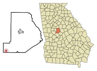
Macon County is a county located in the west central portion of the U.S. state of Georgia. As of the 2020 census, the population was 12,082. The county seat is Oglethorpe.

<span class="mw-page-title-main">Crawford County, Georgia</span> County in Georgia, United States

Crawford County is a county located in the central portion of the U.S. state of Georgia. As of the 2020 census, the population was 12,130. The county seat is Knoxville.

<span class="mw-page-title-main">Alma, Georgia</span> City in Georgia, United States

Alma is a city in Bacon County, Georgia, United States, and the county seat. As of the 2020 census, the city had a population of 3,433.

<span class="mw-page-title-main">Adairsville, Georgia</span> City in Georgia, United States

Adairsville is a city in Bartow County, Georgia, United States. As of the 2020 census, the city had a population of 4,878. Adairsville is approximately halfway between Atlanta and Chattanooga on Interstate 75. It is 12 miles (19 km) south of Calhoun, 18 miles (29 km) northeast of Rome and 61 miles (98 km) north of Atlanta.

<span class="mw-page-title-main">Allentown, Georgia</span> City in Georgia, United States

Allentown is a city in Bleckley, Laurens, Twiggs, and Wilkinson counties in the U.S. state of Georgia, primarily in Wilkinson County. As of the 2010 census, the city had a population of 169, down from 287 at the 2000 census. In 2020, its population was 195. The Twiggs County portion is part of the Macon metropolitan statistical area, while the Laurens County portion is part of the Dublin micropolitan statistical area. The remaining Wilkinson and Bleckley County portions are not part of any metropolitan or micropolitan area.

<span class="mw-page-title-main">Warner Robins, Georgia</span> City in Georgia, United States

Warner Robins is a city in Houston and Peach counties in the U.S. state of Georgia. It is currently the state's eleventh-largest incorporated city, with a population of 80,308 in the 2020 census.

<span class="mw-page-title-main">Ideal, Georgia</span> City in Georgia, United States

Ideal is a city in Macon County, Georgia, United States. The population was 407 at the 2020 census, down from 499 in 2010.

<span class="mw-page-title-main">Montezuma, Georgia</span> City in Georgia, United States

Montezuma is a city in Macon County, Georgia. The population was 3,047 at the 2020 census, down from 3,460 in 2010. It is home to the armory of Bravo Company, 648th Engineers of the Georgia Army National Guard.

<span class="mw-page-title-main">Oglethorpe, Georgia</span> City in Georgia, United States

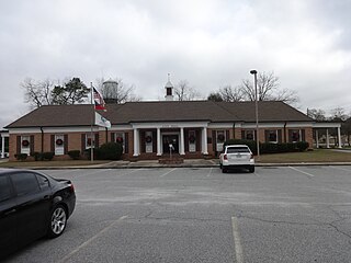
Oglethorpe is a city in Macon County, Georgia, United States. The population was 995 at the 2020 census, down from 1,328 in 2010. The city is the county seat of Macon County. It was named for Georgia's founder, James Oglethorpe.

<span class="mw-page-title-main">Culloden, Georgia</span> City in Georgia, United States

Culloden is a city in Monroe County, Georgia, United States. The population was 200 in the 2020 census. It is part of the Macon metropolitan statistical area.

<span class="mw-page-title-main">Chatsworth, Georgia</span> City in Georgia, United States

Chatsworth is a city in and the county seat of Murray County, Georgia, United States. It is part of the Dalton, Georgia, Metropolitan Statistical Area. Its population was 4,874 at the 2020 census, up from 4,299 in 2010. The city is the site of the coldest recorded temperature in Georgia, −17 °F (−27 °C) on January 27, 1940.

<span class="mw-page-title-main">Crawford, Georgia</span> City in Georgia, United States

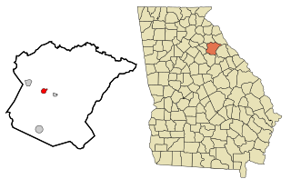
Crawford is a city in Oglethorpe County, Georgia, United States. The population was 832 at the 2010 census.

<span class="mw-page-title-main">Coleman, Georgia</span> Place in Georgia, United States

Coleman is a former incorporated city in Randolph County, Georgia, United States. It is listed as a census-designated place (CDP). The population was 149 at the 2000 census. The city was abolished by House Bill 1102 effective January 1, 2007, and no longer exists as a municipality.

<span class="mw-page-title-main">Talbotton, Georgia</span> City in Georgia, United States

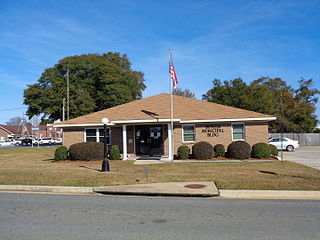
Talbotton is a city in Talbot County, Georgia, United States. The population was 970 at the 2010 census. The city is the county seat of Talbot County.

<span class="mw-page-title-main">Butler, Georgia</span> City in Georgia, United States

Butler is the county seat of Taylor County, Georgia, United States. Its population was 1,972 at the 2010 census, and 1,881 in 2020.

<span class="mw-page-title-main">Reynolds, Georgia</span> Town in Georgia, United States

Reynolds is a town in Taylor County, Georgia, United States. The population was 926 in 2020.

<span class="mw-page-title-main">Bronwood, Georgia</span> Town in Georgia, United States

Bronwood is a town in Terrell County, Georgia, United States. As of the 2020 census, the city had a population of 334. It is part of the Albany, Georgia metropolitan statistical area.

<span class="mw-page-title-main">Knoxville, Georgia</span> Place in Georgia, United States

Knoxville is an unincorporated community and census-designated place in Crawford County, Georgia, United States. It is the county seat of Crawford County. The community is part of the Macon Metropolitan Statistical Area. As of the 2020 census, Knoxville had a population of 65.

<span class="mw-page-title-main">Statenville, Georgia</span> Place in Georgia, United States

Statenville is an unincorporated community and the county seat of Echols County, Georgia, United States. It was formerly a census-designated place (CDP) with a population of 1,040 at the 2010 census. The ZIP code is 31648, and the area code 229.

<span class="mw-page-title-main">Macon metropolitan area, Georgia</span> Metropolitan statistical area in Georgia, United States

The Macon metropolitan area is a metropolitan statistical area consisting of five counties in Central Georgia, anchored by the principal city of Macon. At the 2010 U.S. census, the five-county area had a population of 232,293. A July 2017 estimate placed the population at 228,914. In 2022, its estimated population was 235,805.

References

  1. "2020 U.S. Gazetteer Files". United States Census Bureau. Retrieved December 18, 2021.
  2. "U.S. Census website". United States Census Bureau . Retrieved January 31, 2008.
  3. "US Board on Geographic Names". United States Geological Survey. October 25, 2007. Retrieved January 31, 2008.
  4. 1 2 "Geographic Identifiers: 2010 Demographic Profile Data (G001): Roberta city, Georgia". U.S. Census Bureau, American Factfinder. Archived from the original on February 12, 2020. Retrieved July 31, 2014.
  5. Krakow, Kenneth K. (1975). Georgia Place-Names: Their History and Origins (PDF). Macon, GA: Winship Press. p. 190. ISBN   0-915430-00-2.
  6. 1 2 Powell, Billy. "History of Crawford County: Knoxville, and Roberta". TheGagenWeb. Retrieved November 18, 2014.
  7. "US Gazetteer files: 2010, 2000, and 1990". United States Census Bureau. February 12, 2011. Retrieved April 23, 2011.
  8. "Decennial Census of Population and Housing by Decade". United States Census Bureau.
  9. "1870 Census of Population - Georgia - Population of Civil Divisions less than Counties" (PDF). United States Census Bureau . 1870.
  10. "1880 Census of Population - Georgia - Population of Civil Divisions less than Counties" (PDF). United States Census Bureau . 1880.
  11. "1910 Census of Population - Georgia" (PDF). United States Census Bureau . 1930.
  12. "1930 Census of Population - Georgia" (PDF). United States Census Bureau . 1930. pp. 251–256.
  13. "1940 Census of Population - Georgia" (PDF). United States Census Bureau . 1940.
  14. "1950 Census of Population - Georgia" (PDF). United States Census Bureau . 1980.
  15. "1960 Census of Population - Population of County Subdivisions - Georgia" (PDF). United States Census Bureau . 1960.
  16. "1970 Census of Population - Population of County Subdivisions - Georgia" (PDF). United States Census Bureau . 1970.
  17. "1980 Census of Population - Number of Inhabitants - Georgia" (PDF). United States Census Bureau . 1980.
  18. "1990 Census of Population - Summary Social, Economic, and Housing Characteristics - Georgia" (PDF). United States Census Bureau . 1990.
  19. "2000 Census of Population - General Population Characteristics - Georgia" (PDF). United States Census Bureau . 2000.
  20. "Explore Census Data". data.census.gov. Retrieved December 19, 2021.
  21. Georgia Board of Education [ permanent dead link ], Retrieved June 6, 2010.
  22. School Stats, Retrieved June 6, 2010.