Musella | |
|---|---|
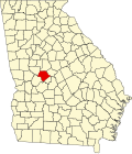
 Musella Location within the state of Georgia  Musella Musella (the United States) | |
| Coordinates: 32°47′52″N84°01′56″W / 32.79778°N 84.03222°W | |
| Country | United States |
| State | Georgia |
| County | Crawford |
| Elevation | 591 ft (180 m) |
| Population (2020) | |
• Total | 104 |
| Time zone | UTC-5 (Eastern (EST)) |
| • Summer (DST) | UTC-4 (EDT) |
| ZIP code | 31066 [1] |
| Area code | 478 |
| GNIS ID | 319174 [2] |
Musella is an unincorporated community and census-designated place (CDP) in Crawford County, Georgia, United States. [2]
Contents
The 2020 U.S. census listed a population of 104. [3]