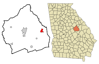
Culloden, Georgia

Last updated

Culloden, Georgia
Monroe County Georgia Incorporated and Unincorporated areas Culloden Highlighted.svg
Location in Monroe County and the state of Georgia
Coordinates: 32°51′47″N84°5′37″W / 32.86306°N 84.09361°W / 32.86306; -84.09361
Country United States
State Georgia
County Monroe
Area
[1]
  Total0.79 sq mi (2.06 km2)
  Land0.78 sq mi (2.01 km2)
  Water0.02 sq mi (0.04 km2)
Elevation
725 ft (221 m)
Population
 (2020) [2]
  Total200
  Density257.40/sq mi (99.36/km2)
Time zone UTC-5 (Eastern (EST))
  Summer (DST) UTC-4 (EDT)
ZIP code
31016
Area code 478
FIPS code 13-20848 [3]
GNIS feature ID0355402 [4]

Culloden is a city in Monroe County, Georgia, United States. The population was 200 in the 2020 census. [2] It is part of the Macon Metropolitan Statistical Area.

Contents

History

The first settlement at Culloden was made ca. 1739. [5] The community was named after William Culloden, a local merchant. [5] A post office called Culloden has been in operation since 1825. [6] The Georgia General Assembly incorporated the place in 1887 as the "City of Culloden", with municipal corporate limits extending in a one-mile radius from the central town well. [7]

Geography

Culloden is located in the southwestern part of Monroe County at 32°51′47″N84°5′37″W / 32.86306°N 84.09361°W / 32.86306; -84.09361 (32.863155, -84.093621). [8]

The city is located along U.S. Route 341 and Georgia State Route 74. U.S. 341 runs from north to south just east of the city, leading north 15 miles (24 km) to Barnesville and south 12 miles (19 km) to Roberta. GA-74 runs from west to east to the north of the city, leading east 32 miles (51 km) to Macon and west 17 miles (27 km) to Thomaston.

According to the United States Census Bureau, Culloden has a total area of 0.8 square miles (2.1 km2), of which 0.02 square miles (0.05 km2), or 2.14%, are water. [1] The city sits on the Eastern Continental Divide, separating waters that flow southwest to the Gulf of Mexico from those that flow southeast to the Atlantic Ocean. Water on the west side of the city flows into tributaries of Auchumpkee Creek, which leads southwest to the Flint River, part of the Apalachicola River watershed, while water to the east flows to tributaries of Echeconnee Creek, which runs southeast to the Ocmulgee River, part of the Altamaha River watershed.

Demographics

Historical population
CensusPop.Note
1880 381
1900 334
1910 3659.3%
1920 361−1.1%
1930 337−6.6%
1940 251−25.5%
1950 2614.0%
1960 260−0.4%
1970 2724.6%
1980 2813.3%
1990 242−13.9%
2000 223−7.9%
2010 175−21.5%
2020 20014.3%
U.S. Decennial Census [9]

2020 census

Culloden city, Georgia – Racial and Ethnic Composition
(NH = Non-Hispanic)
Note: the US Census treats Hispanic/Latino as an ethnic category. This table excludes Latinos from the racial categories and assigns them to a separate category. Hispanics/Latinos may be of any race.
Race / EthnicityPop 2010 [10] Pop 2020 [11] % 2010% 2020
White alone (NH)739741.71%48.50%
Black or African American alone (NH)1019157.71%45.50%
Native American or Alaska Native alone (NH)000.00%0.00%
Asian alone (NH)000.00%0.00%
Pacific Islander alone (NH)000.00%0.00%
Some Other Race alone (NH)000.00%0.00%
Mixed Race/Multi-Racial (NH)0100.00%5.00%
Hispanic or Latino (any race)120.57%1.00%
Total175200100.00%100.00%

2000 census

As of the census [3] of 2000, there were 223 people, 86 households, and 60 families residing in the city. The population density was 288.2 inhabitants per square mile (111.3/km2). There were 95 housing units at an average density of 122.8 per square mile (47.4/km2). The racial makeup of the city was 29.15% White and 70.85% African American. Hispanic or Latino of any race were 0.45% of the population.

There were 86 households, out of which 22.1% had children under the age of 18 living with them, 44.2% were married couples living together, 18.6% had a female householder with no husband present, and 30.2% were non-families. 27.9% of all households were made up of individuals, and 8.1% had someone living alone who was 65 years of age or older. The average household size was 2.59 and the average family size was 3.22.

In the city, the population was spread out, with 20.6% under the age of 18, 4.9% from 18 to 24, 31.8% from 25 to 44, 27.8% from 45 to 64, and 14.8% who were 65 years of age or older. The median age was 41 years. For every 100 females, there were 93.9 males. For every 100 females age 18 and over, there were 96.7 males.

The median income for a household in the city was $28,393, and the median income for a family was $48,125. Males had a median income of $28,542 versus $20,469 for females. The per capita income for the city was $22,442. About 12.7% of families and 15.6% of the population were below the poverty line, including 21.6% of those under the age of eighteen and 20.7% of those 65 or over.

Notable person

Related Research Articles

<span class="mw-page-title-main">Arlington, Georgia</span> City in Georgia, United States

Arlington is a city in Calhoun and Early counties, Georgia, United States. Per the 2020 census, the population was 1,209.

<span class="mw-page-title-main">Edison, Georgia</span> City in Georgia, United States

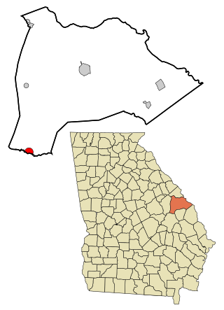
Edison is a city in Calhoun County, Georgia, United States. Per the 2020 census, the population was 1,230. The Edison Commercial Historic District is listed on the National Register of Historic Places.

<span class="mw-page-title-main">Morgan, Georgia</span> City in Georgia, United States

Morgan is a city in Calhoun County, Georgia, United States. The population was 1,741 at the 2020 census. The city is the county seat of Calhoun County.

<span class="mw-page-title-main">Broxton, Georgia</span> City in Georgia, United States

Broxton is a city in Coffee County, Georgia, United States. Per the 2020 census, the population was 1,060. It is known for its unique sandstone formation called Broxton Rocks along Rocky Creek 10 miles (16 km) north of town.

<span class="mw-page-title-main">Dooling, Georgia</span> Town in Georgia, United States

Dooling is a town in Dooly County, Georgia, United States. The population was 68 at the 2020 census.

<span class="mw-page-title-main">Union Point, Georgia</span> City in Georgia, United States

Union Point is a city in Greene County, Georgia, United States. As of the 2020 census, the city population was 1,597.

<span class="mw-page-title-main">Bartow, Georgia</span> Town in Georgia, United States

Bartow is a town in Jefferson County, Georgia, United States. As of the 2020 census, the city had a population of 186. Initially the town was known as "Spier's Turnout", but was changed to honor the first Confederate officer to die in battle, Colonel Francis S. Bartow of Savannah, Georgia, who was killed at the Battle of Manassas, Virginia on July 21, 1861.

<span class="mw-page-title-main">Wrightsville, Georgia</span> City in Georgia, United States

Wrightsville is a city in Johnson County, Georgia, United States. The population was 2,195 at the 2010 census, down from 2,223 at the 2000 census. The city limits include Johnson State Prison on the northeast side of town. The city is the county seat of Johnson County. Wrightsville is part of the Dublin Micropolitan Statistical Area.

<span class="mw-page-title-main">Oglethorpe, Georgia</span> City in Georgia, United States

Oglethorpe is a city in Macon County, Georgia, United States. The population was 995 at the 2020 census, down from 1,328 in 2010. The city is the county seat of Macon County. It was named for Georgia's founder, James Oglethorpe.

<span class="mw-page-title-main">Coleman, Georgia</span> Census-designated place in Georgia, United States

Coleman is a census-designated place and former incorporated city in Randolph County, Georgia, United States. The population was 149 at the 2000 census. The city was abolished by House Bill 1102 effective January 1, 2007, and no longer exists as a municipality.

<span class="mw-page-title-main">Geneva, Georgia</span> Town in Georgia, United States

Geneva is a town in Talbot County, Georgia, United States. The population was 114 at the 2000 census.

<span class="mw-page-title-main">Manassas, Georgia</span> City in Georgia, United States

Manassas is a city in Tattnall County, Georgia, United States. Per the 2020 census, the population was 59.

<span class="mw-page-title-main">Bronwood, Georgia</span> Town in Georgia, United States

Bronwood is a town in Terrell County, Georgia, United States. As of the 2020 census, the city had a population of 334.

<span class="mw-page-title-main">Boston, Georgia</span> City in Georgia, United States

Boston is a city in Thomas County, Georgia, United States. As of the 2020 census, the city had a population of 1,207.

<span class="mw-page-title-main">Danville, Georgia</span> Town in Georgia, United States

Danville is a town in Twiggs and Wilkinson counties in the U.S. state of Georgia. The population was 238 at the 2010 census, down from 373 in 2000.

<span class="mw-page-title-main">Camak, Georgia</span> Town in Georgia, United States

Camak is a town in Warren County, Georgia, United States. The town is located just off Interstate 20 between Atlanta and Augusta. The population was 165 at the 2000 census.

<span class="mw-page-title-main">Davisboro, Georgia</span> City in Georgia, United States

Davisboro is a city in Washington County, Georgia, United States. Per the 2020 census, the population was 1,832.

<span class="mw-page-title-main">Tennille, Georgia</span> City in Georgia, United States

Tennille is a city in Washington County, Georgia, United States. The population was 1,539 at the 2010 census.

<span class="mw-page-title-main">Alamo, Georgia</span> City in Georgia, United States

Alamo is a city in Wheeler County, Georgia, United States. As of the 2020 census, the city had a population of 771. The city is the county seat of Wheeler County.

<span class="mw-page-title-main">Varnell, Georgia</span> City in Georgia, United States

Varnell is a city in Whitfield County, Georgia, United States. It is part of the Dalton, Georgia Metropolitan Statistical Area. The population was 2,179 at the 2020 census.

References

  1. 1 2 "2022 U.S. Gazetteer Files: Georgia". United States Census Bureau. Retrieved January 27, 2023.
  2. 1 2 "P1. Race – Culloden city, Georgia: 2020 DEC Redistricting Data (PL 94-171)". U.S. Census Bureau. Retrieved January 27, 2023.
  3. 1 2 "U.S. Census website". United States Census Bureau . Retrieved January 31, 2008.
  4. "US Board on Geographic Names". United States Geological Survey. October 25, 2007. Retrieved January 31, 2008.
  5. 1 2 Krakow, Kenneth K. (1975). Georgia Place-Names: Their History and Origins (PDF). Macon, GA: Winship Press. p. 55. ISBN   0-915430-00-2.
  6. "Post Offices". Jim Forte Postal History. Retrieved April 15, 2018.
  7. Acts Passed by the General Assembly of Georgia. J. Johnston. 1887. pp.  655–656.
  8. "US Gazetteer files: 2010, 2000, and 1990". United States Census Bureau. February 12, 2011. Retrieved April 23, 2011.
  9. "Census of Population and Housing". Census.gov. Retrieved June 4, 2015.
  10. "P2 HISPANIC OR LATINO, AND NOT HISPANIC OR LATINO BY RACE – 2010: DEC Redistricting Data (PL 94-171) – Culloden city, Georgia". United States Census Bureau .
  11. "P2 HISPANIC OR LATINO, AND NOT HISPANIC OR LATINO BY RACE - 2020: DEC Redistricting Data (PL 94-171) – Culloden city, Georgia". United States Census Bureau .