Swainsboro, Georgia

Last updated

Swainsboro, Georgia
US Courthouse, Swainsboro, GA, US.jpg
United States Courthouse in Swainsboro
Flag of Swainsboro, Georgia.png
Seal of Swainsboro, Georgia.png
Logo of Swainsboro, Georgia.svg
Nickname: 
"Crossroads of the Great South"
Emanuel County Georgia Incorporated and Unincorporated areas Swainsboro Highlighted.svg
Location in Emanuel County and the state of Georgia
Coordinates: 32°35′37″N82°19′56″W / 32.59361°N 82.33222°W / 32.59361; -82.33222
Country United States
State Georgia
County Emanuel
Government
  MayorGreg Bennett
Area
[1]
  Total12.94 sq mi (33.52 km2)
  Land12.58 sq mi (32.58 km2)
  Water0.36 sq mi (0.94 km2)
Elevation
325 ft (99 m)
Population
 (2020)
  Total7,425
  Density590.27/sq mi (227.91/km2)
Time zone UTC-5 (Eastern (EST))
  Summer (DST) UTC-4 (EDT)
ZIP code
30401
Area code 478
FIPS code 13-74964 [2]
GNIS feature ID0356574 [3]
Website cityofswainsboro.org

Swainsboro is a city in Emanuel County, Georgia, United States. As of the 2020 census, the city had a population of 7,425. The city is the county seat of Emanuel County. [4]

Contents

History

In 1822, the Georgia state legislature established "Swainsborough" as the seat of Emanuel County. The town was named in recognition of Stephen Swain, the state senator who introduced the bill for the county's creation in 1812. The town's name was changed to "Paris" at its incorporation on February 18, 1854, but three years later reverted to its current name, Swainsboro. [5]

Transportation

Early in its corporate life, much like other rural Georgia towns, Swainsboro depended on railroads for transportation. However, in the 1930s, many of the town's streets and sidewalks were paved, and Swainsboro found itself at the intersection of two major national highways, U.S. 1 and U.S. 80, thus earning its city motto: "Crossroads of the Great South". U.S. 1 was the principal highway from Maine to Key West, and U.S. 80, at that time, ran from Tybee Island, Georgia, to San Diego. [6]

Geography

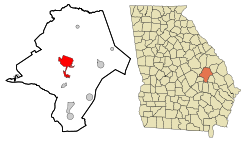
Swainsboro is located near the center of Emanuel County at 32°35'37" North, 82°19'56" West (32.593743, -82.332146). [7] U.S. Route 80 passes through the center of the city, and U.S. Route 1 bypasses it to the west. US 80 leads east 36 miles (58 km) to Statesboro and west 36 miles (58 km) to Dublin, while US 1 leads north 62 miles (100 km) to Augusta and south 106 miles (171 km) to Waycross. Interstate 16 is 14 miles (23 km) south of Swainsboro via US 1.

According to the United States Census Bureau, the city has a total area of 12.9 square miles (33.5 km2), of which 12.6 square miles (32.6 km2) is land and 0.35 square miles (0.9 km2), or 2.81%, is water. [8]

Demographics

Historical population
CensusPop.Note
1870 108
1880 18672.2%
1890 395112.4%
1900 895126.6%
1910 1,31346.7%
1920 1,57820.2%
1930 2,44254.8%
1940 3,57546.4%
1950 4,30020.3%
1960 5,94338.2%
1970 7,32523.3%
1980 7,6023.8%
1990 7,361−3.2%
2000 6,943−5.7%
2010 7,2774.8%
2020 7,4262.0%
U.S. Decennial Census [9]
Swainsboro racial composition as of 2020 [10]
RaceNum.Perc.
White (non-Hispanic)2,68436.15%
Black or African American (non-Hispanic)4,18056.3%
Native American 80.11%
Asian 911.23%
Pacific Islander 10.01%
Other/Mixed 1832.46%
Hispanic or Latino 2783.74%

As of the 2020 United States census, there were 7,425 people, 2,697 households, and 1,783 families residing in the city.

Education

Emanuel County School District

The Emanuel County School District, run by the Emanuel County Board of Education, holds pre-school to grade twelve, and consists of three elementary schools, a middle school, a high school, and two academies. [11] The district has 293 full-time teachers and over 4,664 students. [12]

Higher education

Notable people

Related Research Articles

<span class="mw-page-title-main">Emanuel County, Georgia</span> County in Georgia, United States

Emanuel County is a county located in the U.S. state of Georgia. As of the 2020 census, the population was 22,768. The county seat is Swainsboro.

<span class="mw-page-title-main">Alma, Georgia</span> City in Georgia, United States

Alma is a city in Bacon County, Georgia, United States, and the county seat. As of the 2020 census, the city had a population of 3,433.

<span class="mw-page-title-main">Winder, Georgia</span> City in Georgia, United States

Winder is a city and the county seat of Barrow County, Georgia, United States. It is located east of Atlanta and is part of the Atlanta metropolitan area. The population was 18,338 at the 2020 census.

<span class="mw-page-title-main">Statesboro, Georgia</span> City in Georgia, United States

Statesboro is the largest city and county seat of Bulloch County, Georgia, United States. Located in the southeastern part of the state, its population was 33,438 at the 2020 census. It is the principal city of the Statesboro micropolitan area, which had 81,099 residents, and is part of the Savannah–Hinesville–Statesboro combined statistical area.

<span class="mw-page-title-main">Evans, Georgia</span> Place in Georgia, United States

Evans is an unincorporated community and census-designated place (CDP) in Columbia County, Georgia, United States. It is a suburb of Augusta and is part of the Augusta metropolitan area. The population was 29,011 at the 2010 census, up from 17,727 at the 2000 census.

<span class="mw-page-title-main">Adrian, Georgia</span> City in Georgia, United States

Adrian is a city in Emanuel and Johnson County, Georgia, United States. As of the 2020 census, the city had a population of 552.

<span class="mw-page-title-main">Garfield, Georgia</span> City in Georgia, United States

Garfield is a city in Emanuel County, Georgia, United States. The population was 257 in 2020.

<span class="mw-page-title-main">Nunez, Georgia</span> City in Georgia, United States

Nunez is a city in Emanuel County, Georgia, United States. The population was 134 in 2020.

<span class="mw-page-title-main">Oak Park, Georgia</span> City in Georgia, United States

Oak Park is a city in Emanuel County, Georgia, United States. The population was 484 at the 2010 census, up from 366 in 2000. By 2020, its population was 512.

<span class="mw-page-title-main">Stillmore, Georgia</span> City in Georgia, United States

Stillmore is a city in Emanuel County, Georgia, United States. The population was 439 in 2020.

<span class="mw-page-title-main">Summertown, Georgia</span> City in Georgia, United States

Summertown is a city in Emanuel County, Georgia, United States. The population was 121 in 2020.

<span class="mw-page-title-main">Twin City, Georgia</span> City in Georgia, United States

Twin City is a city in Emanuel County, Georgia, United States. As of the 2020 census, the city had a population of 1,642.

<span class="mw-page-title-main">Greensboro, Georgia</span> City in Georgia, United States

Greensboro is a city in and the county seat of Greene County, Georgia, United States. Its population was 3,648 as of the 2020 census. The city is located approximately halfway between Atlanta and Augusta on Interstate 20.

<span class="mw-page-title-main">Louisville, Georgia</span> City in Georgia, United States

Louisville is a city in and the county seat of Jefferson County, Georgia, United States, and also a former state capital of Georgia. It is located southwest of Augusta on the Ogeechee River, and its population was 2,493 at the 2010 census, down from 2,712 at the 2000 census. By 2020, its population was 2,381. Its name is pronounced "Lewis-ville", though it and the differently pronounced city in Kentucky were both named for Louis XVI.

<span class="mw-page-title-main">Wrightsville, Georgia</span> City in Georgia, United States

Wrightsville is a city in and the county seat of Johnson County, Georgia, United States. The population was 2,195 at the 2010 census, down from 2,223 at the 2000 census. By 2020, its population grew to 3,449. The city limits include Johnson State Prison on the northeast side of town. Wrightsville is part of the Dublin Micropolitan Statistical Area.

<span class="mw-page-title-main">East Dublin, Georgia</span> City in Georgia, United States

East Dublin is a city in Laurens County, Georgia, United States. The population was 2,492 in 2020.

<span class="mw-page-title-main">Lincolnton, Georgia</span> City in Georgia, United States

Lincolnton is a city and the county seat of Lincoln County, Georgia, United States. The population was 1,480 at the 2020 census. It contains numerous houses and historic districts listed on the National Register of Historic Places. Both the city and the county were named for General Benjamin Lincoln, who served in the Continental Army during the American Revolution.

<span class="mw-page-title-main">Forsyth, Georgia</span> City in Georgia, United States

Forsyth is a city in and the county seat of Monroe County, Georgia, United States. The population was 4,384 at the 2020 census, up from 3,788 in 2010. Forsyth is part of the Macon metropolitan statistical area.

<span class="mw-page-title-main">North Augusta, South Carolina</span> City in South Carolina, United States

North Augusta is a city in Aiken and Edgefield counties in the U.S. state of South Carolina, on the north bank of the Savannah River. It lies directly across the river, and state border, from Augusta, Georgia. The population was 24,379 at the 2020 census, making it the 21st most populous city in South Carolina. The city is included in the Central Savannah River Area (CSRA) and is part of the Augusta, Georgia, metropolitan area.

<span class="mw-page-title-main">Waynesboro, Georgia</span> City in Georgia, United States

Waynesboro is a city and the county seat of Burke County, Georgia, United States. The population was 5,766 at the 2010 census. It is part of the Augusta, Georgia metropolitan area.

References

  1. "2020 U.S. Gazetteer Files". United States Census Bureau. Retrieved December 18, 2021.
  2. "U.S. Census website". United States Census Bureau . Retrieved January 31, 2008.
  3. "US Board on Geographic Names". United States Geological Survey. October 25, 2007. Retrieved January 31, 2008.
  4. "Find a County". National Association of Counties. Retrieved June 7, 2011.
  5. New Georgia Encyclopedia: Emanuel County
  6. History of Swainsboro
  7. "US Gazetteer files: 2010, 2000, and 1990". United States Census Bureau. February 12, 2011. Retrieved April 23, 2011.
  8. "Geographic Identifiers: 2010 Demographic Profile Data (G001): Swainsboro city, Georgia". American Factfinder. U.S. Census Bureau. Archived from the original on February 13, 2020. Retrieved January 27, 2016.
  9. "Census of Population and Housing". Census.gov. Retrieved June 4, 2015.
  10. "Explore Census Data". data.census.gov. Retrieved December 18, 2021.
  11. Georgia Board of Education [ permanent dead link ], Retrieved June 8, 2010.
  12. School Stats, Retrieved June 8, 2010.
  13. East Georgia College, Retrieved June 8, 2010.
  14. Southeastern Technical College, Retrieved June 8, 2010.