Jonesboro, Georgia

Last updated

Jonesboro, Georgia
Jonesboro Buildings.JPG
Buildings in the Jonesboro Historic District
Flag of Jonesboro, Georgia.png
Seal of Jonesboro, Georgia.png
Logo of Jonesboro, Georgia.svg
Clayton County Georgia Incorporated and Unincorporated areas Jonesboro Highlighted.svg
Location in Clayton County and the state of Georgia
Metro atlanta.jpg
Red pog.svg
Jonesboro
Location of Jonesboro in Metro Atlanta
Coordinates: 33°31′28″N84°21′15″W / 33.52444°N 84.35417°W / 33.52444; -84.35417
Country United States
State Georgia
County Clayton
Government
   Mayor Donya Sartor
Area
[1]
  Total3.00 sq mi (7.76 km2)
  Land2.98 sq mi (7.71 km2)
  Water0.02 sq mi (0.05 km2)
Elevation
919 ft (280 m)
Population
 (2020)
  Total4,235
  Density1,422.10/sq mi (549.16/km2)
Time zone UTC-5 (Eastern (EST))
  Summer (DST) UTC-4 (EDT)
ZIP codes
30236-30238
Area code(s) 770/678/470
FIPS code 13-42604 [2]
GNIS feature ID0332118 [3]
Website jonesboroga.com

Jonesboro is a city in and the county seat of Clayton County, Georgia, United States. [4] The population was 4,724 as of the 2010 census.

Contents

The city's name was originally spelled Jonesborough.[ citation needed ] During the Civil War, the final skirmish in the Atlanta Campaign was fought here south of Atlanta, cutting off the city and forcing the mayor of Atlanta to surrender at Marietta in early September 1864. The final fall of Atlanta in the Battle of Jonesborough ended up being a decisive point in the nation's history, propelling Abraham Lincoln to re-election two months later, and continuing the war until the Confederacy finally surrendered the following year.

Geography

Jonesboro is located at 33°31′28″N84°21′15″W / 33.52444°N 84.35417°W / 33.52444; -84.35417 (33.524512, -84.354290). [5]

According to the United States Census Bureau, the city has a total area of 2.6 square miles (6.7 km2), of which 2.6 square miles (6.7 km2) is land and 0.1 square miles (0.26 km2) (1.89%) is water.

The railroad through Jonesboro is built on the Eastern Continental Divide and there are no bridges for the tracks for many miles in either direction.

Climate

Climate data for Jonesboro, Georgia, 1991–2020 normals, extremes 1994present
MonthJanFebMarAprMayJunJulAugSepOctNovDecYear
Record high °F (°C)77
(25)
81
(27)
89
(32)
92
(33)
95
(35)
103
(39)
104
(40)
104
(40)
99
(37)
98
(37)
86
(30)
78
(26)
104
(40)
Mean maximum °F (°C)69.7
(20.9)
73.6
(23.1)
80.7
(27.1)
85.3
(29.6)
90.4
(32.4)
95.9
(35.5)
96.1
(35.6)
95.9
(35.5)
92.5
(33.6)
82.8
(28.2)
76.8
(24.9)
72.6
(22.6)
97.7
(36.5)
Mean daily maximum °F (°C)52.7
(11.5)
56.5
(13.6)
64.7
(18.2)
73.0
(22.8)
80.5
(26.9)
86.7
(30.4)
89.6
(32.0)
88.6
(31.4)
83.2
(28.4)
73.4
(23.0)
62.4
(16.9)
54.7
(12.6)
72.2
(22.3)
Daily mean °F (°C)42.5
(5.8)
45.9
(7.7)
53.3
(11.8)
61.0
(16.1)
69.7
(20.9)
76.6
(24.8)
79.8
(26.6)
78.8
(26.0)
73.3
(22.9)
62.5
(16.9)
51.7
(10.9)
45.1
(7.3)
61.7
(16.5)
Mean daily minimum °F (°C)32.3
(0.2)
35.3
(1.8)
41.8
(5.4)
49.1
(9.5)
58.8
(14.9)
66.5
(19.2)
70.0
(21.1)
69.0
(20.6)
63.3
(17.4)
51.6
(10.9)
40.9
(4.9)
35.4
(1.9)
51.2
(10.7)
Mean minimum °F (°C)17.1
(−8.3)
22.3
(−5.4)
28.6
(−1.9)
36.3
(2.4)
45.9
(7.7)
58.2
(14.6)
63.4
(17.4)
63.5
(17.5)
53.1
(11.7)
37.1
(2.8)
27.7
(−2.4)
24.0
(−4.4)
15.9
(−8.9)
Record low °F (°C)5
(−15)
6
(−14)
14
(−10)
29
(−2)
37
(3)
50
(10)
52
(11)
57
(14)
42
(6)
29
(−2)
19
(−7)
7
(−14)
5
(−15)
Average precipitation inches (mm)5.02
(128)
4.86
(123)
4.95
(126)
4.19
(106)
3.47
(88)
4.59
(117)
5.09
(129)
4.42
(112)
3.56
(90)
3.62
(92)
4.19
(106)
4.96
(126)
52.92
(1,343)
Average snowfall inches (cm)0.5
(1.3)
0.0
(0.0)
0.1
(0.25)
0.0
(0.0)
0.0
(0.0)
0.0
(0.0)
0.0
(0.0)
0.0
(0.0)
0.0
(0.0)
0.0
(0.0)
0.0
(0.0)
0.2
(0.51)
0.8
(2.06)
Average precipitation days (≥ 0.01 in)10.510.69.78.58.310.811.210.27.96.88.210.4113.1
Average snowy days (≥ 0.1 in)0.30.00.00.00.00.00.00.00.00.00.00.10.4
Source 1: NOAA [6]
Source 2: National Weather Service (mean maxima/minima 20062020) [7]

Infrastructure

Transit systems

MARTA and Xpress GA/Georgia RTA buses serve the city.

Demographics

Historical population
CensusPop.Note
1870 531
1880 1,04897.4%
1890 803−23.4%
1900 8779.2%
1910 97010.6%
1920 1,0609.3%
1930 1,0650.5%
1940 1,20413.1%
1950 1,74144.6%
1960 3,01473.1%
1970 4,10536.2%
1980 4,1320.7%
1990 3,635−12.0%
2000 3,8295.3%
2010 4,72423.4%
2020 4,235−10.4%
U.S. Decennial Census [8]

2020 census

Jonesboro racial composition [9]
RaceNum.Perc.
White (non-Hispanic)1,12626.59%
Black or African American (non-Hispanic)2,24753.06%
Native American 60.24%
Asian 1242.93%
Pacific Islander 30.07%
Other/Mixed 1463.45%
Hispanic or Latino 58313.77%

As of the 2020 United States census, there were 4,235 people, 1,195 households, and 771 families residing in the city.

2000 census

As of the census [2] of 2000, there were 3,829 people, 1,466 households, and 1,023 families residing in the city. The population density was 1,477.4 inhabitants per square mile (570.4/km2). There were 1,561 housing units at an average density of 602.3 per square mile (232.5/km2). The racial composition of the city was 72.79% African American, 20.63% White, 0.21% Native American, 0.73% Asian, 0.31% Pacific Islander, 3.45% from other races, and 1.88% from two or more races. Hispanic or Latino of any race were 7.55% of the population. In the past 2 years that population has doubled to about 15.86%.

There were 1,466 households, out of which 34.1% had children under the age of 18 living with them, 38.6% were married couples living together, 25.6% had a female householder with no husband present, and 30.2% were non-families. 25.5% of all households were made up of individuals, and 11.5% had someone living alone who was 65 years of age or older. The average household size was 2.60 and the average family size was 3.09.

In the city, the population was spread out, with 29.2% under the age of 18, 9.6% from 18 to 24, 29.6% from 25 to 44, 19.2% from 45 to 64, and 12.4% who were 65 years of age or older. The median age was 32 years. For every 100 females, there were 84.1 males. For every 100 females age 18 and over, there were 78.1 males.

The median income for a household in the city was $31,951, and the median income for a family was $39,143. Males had a median income of $29,236 versus $25,797 for females. The per capita income for the city was $16,178. About 19.2% of families and 20.2% of the population were below the poverty line, including 33.9% of those under age 18 and 19.7% of those age 65 or over.

History

Jonesboro was inhabited by settlers as early as 1821, as a result of the Treaty of Indian Springs, [10] and it was founded as Leaksville in 1823. [11] In 1825, the Flint River Baptist Church was erected on a hill in Leaksville. After the Macon and Western Railroad arrived into the area in 1846, the town was renamed to Jonesboro, in order to honor railroad official Samuel G. Jones who was also honored by its citizens. [10] Jonesboro was incorporated over three decades later, in 1859. [12]

Jonesboro hosted the beach volleyball at the 1996 Summer Olympics with the artificial beach created at Clayton County International Park. [13] Jonesboro elected their first Black Mayor, Dr. Sonya Sartor, in March 2023. [14]

Notable people

Movies and literature

Many of the scenes from the 1977 film Smokey and the Bandit were filmed in Jonesboro. Another 1977 movie, the obscure 'In Hot Pursuit (aka The Polk County Pot Plane), was filmed in and around Jonesboro.

Tara, the fictional plantation in Margaret Mitchell's novel Gone with the Wind was supposed to be located approximately five miles outside of Jonesboro, the closest town.

"We Are Marshall" was briefly filmed at Tara Stadium in Jonesboro. The stadium was changed from green to light blue and light yellow for the scene.

Lynyrd Skynyrd's (pronounced 'lĕh-'nérd 'skin-'nérd) album cover was photographed near the corner of Mill and Main streets.

Landmarks

Education

Clayton County Public Schools operates public schools.

Related Research Articles

<span class="mw-page-title-main">Henry County, Georgia</span> County in Georgia, United States

Henry County is located in the north central portion of the U.S. state of Georgia. According to the 2020 census, the population of Henry County was 240,712, up from 203,922 in 2010. The seat of government is McDonough. The county was named for Patrick Henry.

<span class="mw-page-title-main">Clayton County, Georgia</span> County in Georgia, United States

Clayton County is located in the north central portion of the U.S. state of Georgia. As of 2021, the population was estimated to be 297,100 by the Census Bureau. The county seat is Jonesboro.

<span class="mw-page-title-main">Holly Springs, Georgia</span> City in Georgia, United States

Holly Springs is a city in Cherokee County, Georgia, United States. The population was 9,189 as of the 2010 census, up from 3,195 in 2000.

<span class="mw-page-title-main">Nelson, Georgia</span> City in Georgia, United States

Nelson is a city in Pickens and Cherokee Counties, Georgia, United States. At the 2020 census, the population was 1,145. It is part of the Atlanta metropolitan area.

<span class="mw-page-title-main">Bonanza, Georgia</span> Place in Georgia, United States

Bonanza is an unincorporated community and census-designated place (CDP) in Clayton County, Georgia, United States. The population was 3,135 at the 2010 census.

<span class="mw-page-title-main">Conley, Georgia</span> Place in Georgia, United States

Conley is an unincorporated community and census-designated place (CDP) in Clayton County, Georgia, United States. It is at Atlanta’s southeast corner, 7.98 miles from downtown. The population was 6,680 at the 2020 census. It is part of the Atlanta Metropolitan Area.

<span class="mw-page-title-main">Forest Park, Georgia</span> City in Georgia, United States

Forest Park is a city in Clayton County, Georgia, United States. It is located approximately nine miles (14 km) south of Atlanta and is part of the Atlanta–Sandy Springs–Marietta Metropolitan Statistical Area. As of the 2020 census, the city had a population of 19,932.

<span class="mw-page-title-main">Irondale, Georgia</span> Place in Georgia, United States

Irondale is an unincorporated community and census-designated place (CDP) in Clayton County, Georgia, United States. The population was 8,740 at the 2020 census.

<span class="mw-page-title-main">Lake City, Georgia</span> City in Georgia, United States

Lake City is a city in Clayton County, Georgia, United States. The population was 2,612 at the 2010 census.

<span class="mw-page-title-main">Lovejoy, Georgia</span> City in Georgia, United States

Lovejoy is a city in Clayton County, Georgia, United States. As of the 2010 census, the city had a population of 6,422, up from 2,495 in 2000. During the American Civil War, it was the site of the Battle of Lovejoy's Station during the Atlanta Campaign of 1864. Lovejoy was incorporated as a town on September 16, 1861.

<span class="mw-page-title-main">Morrow, Georgia</span> City in Georgia, United States

Morrow is a city in Clayton County, Georgia, United States. It is part of the Atlanta metropolitan area. Its population was 6,445 at the 2010 census, up from 4,882 in 2000. It is the home of Clayton State University and the Georgia Archives.

<span class="mw-page-title-main">Riverdale, Georgia</span> City in Georgia, United States

Riverdale is a city in Clayton County, Georgia, United States. The population was 15,134 at the 2010 census, up from 12,478 in 2000. Riverdale is a suburb just south of Hartsfield–Jackson Atlanta International Airport and is part of the Atlanta metropolitan area.

<span class="mw-page-title-main">Belvedere Park, Georgia</span> Place in Georgia, United States

Belvedere Park is an unincorporated community and census-designated place (CDP) in DeKalb County, Georgia, United States. The population was 15,113 at the 2020 census.

<span class="mw-page-title-main">Blue Ridge, Georgia</span> City in Georgia, United States

Blue Ridge is a city in Fannin County, Georgia, United States. As of the 2020 census, the city had a population of 1,253. The city is the county seat of Fannin County and the largest city in the county as well.

<span class="mw-page-title-main">Fairburn, Georgia</span> City in Georgia, United States

Fairburn is a city in Fulton County, Georgia, United States, with a population of 12,950, according to the 2010 census. Though it has a rich history of its own, the city is now a closely linked suburb of Atlanta, which lies just 17 miles to the north.

<span class="mw-page-title-main">Lilburn, Georgia</span> City in Georgia, United States

Lilburn is a city in Gwinnett County, Georgia, United States. The population was 14,502 at the 2020 census. The estimated population was 12,810 in 2019. It is a part of the Atlanta metropolitan area.

<span class="mw-page-title-main">Hampton, Georgia</span> City in Georgia, United States

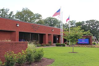
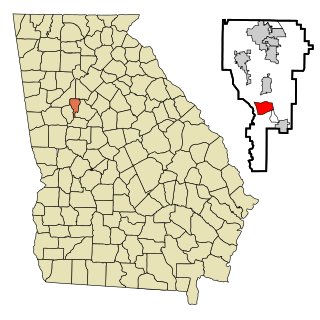
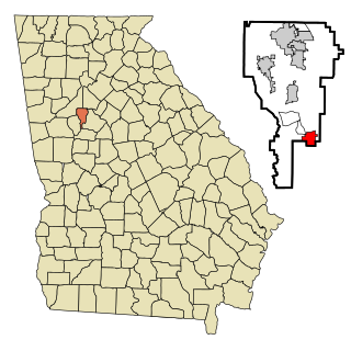
Hampton is a city in southwestern Henry County, Georgia, United States. The 2020 census was 8,368. As of the 2010 census, the city had a population of 6,987, up from 3,857 at the 2000 census. By 2018 the estimated population was 7,922. "Hampton" mailing addresses outside the city limits reach into rural parts of eastern Clayton County and northern Spalding County. It is a southeastern suburb in the Atlanta metropolitan area.

<span class="mw-page-title-main">Williamson, Georgia</span> City in Georgia, United States

Williamson is a city in Pike County, Georgia, United States. The population was 352 at the 2010 census.

<span class="mw-page-title-main">Clayton, Iowa</span> City in Iowa, United States

Clayton is a city in Clayton County, Iowa, United States. The population was 45 at the 2020 census, down from 55 in 2000. Clayton is located directly on the Mississippi River and is only accessible via a very steep road.

Jonesboro is a town in Washington County, Maine, United States. The town was named for John Coffin Jones, a landholder. The population was 587 at the 2020 census.

References

  1. "2020 U.S. Gazetteer Files". United States Census Bureau. Retrieved December 18, 2021.
  2. 1 2 "U.S. Census website". United States Census Bureau . Retrieved January 31, 2008.
  3. "US Board on Geographic Names". United States Geological Survey. October 25, 2007. Retrieved January 31, 2008.
  4. "Find a County". National Association of Counties. Archived from the original on May 31, 2011. Retrieved June 7, 2011.
  5. "US Gazetteer files: 2010, 2000, and 1990". United States Census Bureau. February 12, 2011. Retrieved April 23, 2011.
  6. "U.S. Climate Normals Quick Access – Station: Jonesboro, GA". National Oceanic and Atmospheric Administration. Retrieved February 27, 2023.
  7. "NOAA Online Weather Data – NWS Atlanta". National Weather Service. Retrieved February 27, 2023.
  8. "Census of Population and Housing". Census.gov. Retrieved June 4, 2015.
  9. "Explore Census Data". data.census.gov. Retrieved December 13, 2021.
  10. 1 2 "Jonesboro, GA - City History". www.jonesboroga.com. Retrieved November 8, 2023.
  11. Hellmann, Paul T. (May 13, 2013). Historical Gazetteer of the United States. Routledge. p. 234. ISBN   978-1135948597 . Retrieved November 30, 2013.
  12. "City History." (Archive) City of Jonesboro. Retrieved on September 21, 2012.
  13. Georgia Department of Economic Development. "Clayton County International Park". Explore Georgia.
  14. "Jonesboro voters elect Dr. Donya Sartor as their first-ever Black mayor". March 24, 2023.