Ponce de Leon Court Historic District

Last updated

Ponce de Leon Court Historic District
PonceCourtHisDistDecaturGA.JPG
Ponce de Leon Court Historic District
Atlanta Central.png
Red pog.svg
USA Georgia location map.svg
Red pog.svg
Usa edcp location map.svg
Red pog.svg
NRHP reference No. 11000774
Added to NRHPNovember 2, 2011

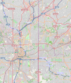
The Ponce de Leon Court Historic District [1] consists of a single cul-de-sac located immediately east of downtown Decatur, Georgia. The street is accessed off of East Ponce de Leon Avenue, a historic road that runs east from Atlanta, Georgia through Decatur. Historic Decatur Cemetery is located to the north, and affluent Glynnwood Estates, developed in 1927, and Glenwood school border Ponce de Leon Court on the east.

Contents

Ponce de Leon Court is a local historic district in the city of Decatur, and was listed in the Georgia Register of Historic Places in June 2010. It was listed in the National Register of Historic Places on November 2, 2011. The single-street district includes approximately 26 parcels, and was based on a subdivision plat developed by John L. Womack in the 1920s. Womack reportedly wanted homes on this street to remind him of the tropics, so he planted both palm trees and banana trees. The palm trees flourished, but the banana trees died. [2] In the twenty-first century, residents successfully reintroduced banana trees on the north end of the street thanks to a change in the microclimate. The Womack family still owned property on the court when it was designated a historic district.

The closely spaced homes on the narrow street are within walking distance of downtown Decatur, and were constructed in an era when developments did not plan adequately for the automobile. The sense of scale and detail created a strong sense of community, and resulted in this street being recognized as a unique asset in Decatur. Ponce de Leon Court primarily includes 1920s-era American Craftsman bungalows, but also has a few historic multi-family homes. Both the single and multi-family structures, as well as historic palm trees, have remained largely intact from the era when they were built.

The street consists entirely of homes. There are no churches, businesses, or apartment blocks.

Notes

Related Research Articles

<span class="mw-page-title-main">Decatur, Georgia</span> City in Georgia, United States

Decatur is a city and the county seat of DeKalb County, Georgia, United States, part of the Atlanta metropolitan area. With a population of 24,928 in the 2020 census, the municipality is sometimes assumed to be larger since multiple ZIP Codes in unincorporated DeKalb County bear Decatur as the address.

<span class="mw-page-title-main">Druid Hills, Georgia</span> Neighborhood of Atlanta, Georgia, United States

Druid Hills is a community which includes both a census-designated place (CDP) in unincorporated DeKalb County, Georgia, United States, as well as a neighborhood of the city of Atlanta. The CDP's population was 14,568 at the 2010 census. The CDP formerly contained the main campus of Emory University and the Centers for Disease Control and Prevention (CDC); however, they were annexed by Atlanta in 2018. The Atlanta-city section of Druid Hills is one of Atlanta's most affluent neighborhoods with a mean household income in excess of $238,500.

<span class="mw-page-title-main">North Decatur, Georgia</span> Place in Georgia, United States

North Decatur is an unincorporated community and census-designated place (CDP) in DeKalb County, Georgia, United States. The population was 18,511 in 2020.

<span class="mw-page-title-main">Scottdale, Georgia</span> Place in Georgia, United States

Scottdale is an unincorporated community and census-designated place (CDP) in DeKalb County, Georgia, United States. The population was 10,698 in 2020.

Kirkwood is a national historic designated neighborhood on the east side of Atlanta, Georgia, United States. It is a historic streetcar suburb situated entirely in DeKalb County, bordered by the neighborhoods of Lake Claire, East Lake, Edgewood, and Oakhurst. Kirkwood is bound on the north by DeKalb Avenue, on the south by Memorial Drive and Interstate 20, on the west by Montgomery Street, and on the east by 1st Ave. A large part of the neighborhood is listed on the National Register of Historic Places as Kirkwood Historic District.

<span class="mw-page-title-main">Atlanta City Hall</span> United States historic place

Atlanta City Hall is the headquarters of the City of Atlanta government. It was constructed in 1930, and is located in Downtown Atlanta. It is a high-rise office tower very similar to dozens of other city halls built in the United States during the same time period. Located in South Downtown, it is near other governmental structures, such as the Georgia State Capitol and the Fulton County Courthouse. The Neo-Gothic structure features many architectural details that have helped to make the building a historical landmark. It is Atlanta’s fourth city hall.

<span class="mw-page-title-main">Oakhurst, Decatur, Georgia</span>

Oakhurst is a historic neighborhood in the southwest corner of Decatur, Georgia, a suburb of Atlanta, Georgia. It is located south of downtown Decatur and approximately six miles east of downtown Atlanta. Oakhurst primarily consists of residences built in the early 20th century and neighborhood businesses. It is roughly bounded by the City of Atlanta's Kirkwood neighborhood on the west ; the Atlanta city limits on the south; West College Ave. on the north; and South McDonough St. on the east. There is also a neighborhood near the College Heights Early Learning Center referred to as "College Heights", but it is part of Historic Oakhurst.

<span class="mw-page-title-main">Old Fourth Ward</span> Neighborhoods of Atlanta in Fulton County, Georgia, United States

The Old Fourth Ward, often abbreviated O4W, is an intown neighborhood on the eastside of Atlanta, Georgia, United States. The neighborhood is best known as the location of the Martin Luther King Jr. historic site.

<span class="mw-page-title-main">Ponce de Leon Avenue</span> Road in Georgia, USA

Ponce de Leon Avenue, often simply called Ponce, provides a link between Atlanta, Decatur, Clarkston, and Stone Mountain, Georgia. It was named for Ponce de Leon Springs, in turn from explorer Juan Ponce de León, but is not pronounced as in Spanish. Several grand and historic buildings are located on the avenue.

<span class="mw-page-title-main">Clairemont – Great Lakes (Decatur)</span>

Clairemont - Great Lakes is a historic neighborhood in the north central section of the Atlanta, Georgia suburb of Decatur. It primarily consists of residences and churches. However, there are businesses on West Ponce de Leon Avenue, in the southernmost section of the neighborhood. Its rough boundaries are Coventry Road, Ponce de Leon Avenue and Commerce Drive on the south; Church Street on the east; Scott Boulevard on the north; and Willow on the northeast. The section of Superior Avenue north of Scott Boulevard is also considered part of this neighborhood. Ridgeland Park, located northeast of the Clairemont - Great Lakes neighborhood, is not presently considered part of the neighborhood. It was developed later (1946–1950), in unincorporated DeKalb County. However, in 2008 the city of Decatur began evaluating annexation of this neighborhood, which is contiguous to the rest of the development.

<span class="mw-page-title-main">Glennwood Estates (Decatur)</span>

Glennwood Estates is a historic neighborhood located in the northeast section of Decatur, Georgia. It is a residential neighborhood chiefly of single-family homes including a nature preserve and an adjoining park. At least a third of the homes were built in the 1920s and were relatively large for the time. Glenn Creek and the South Fork of Peachtree Creek Tributary run through the neighborhood.

<span class="mw-page-title-main">Decatur Heights</span>

Decatur Heights is a historic community located in the northeast corner of the Atlanta, Georgia suburb of Decatur. It includes residences, churches and a nature preserve. During much of the 20th Century, this community primarily consisted modest homes. However, in the 1990s it became a neighborhood where “tear downs” were increasingly common. This has resulted in the demolition of the modest cottages the community was historically known for.

<span class="mw-page-title-main">Adair Park (Decatur)</span>

Adair Park is a historic and contemporary community in the west section of the Atlanta, Georgia suburb of Decatur. It is one of Decatur’s most diverse communities in terms of building types, and includes several individual neighborhoods. Adair Park has single family residences, townhomes, cluster homes, institutional buildings and commercial buildings – built from the early 1900s to 2008. Its rough boundaries are: downtown Decatur to the east; Ponce de Leon Avenue to the north; Howard Avenue and the railroad tracks to the south; and the Parkwood neighborhood to the west. There is also an Adair Park in southwest Atlanta, but it is not part of the Decatur community.

<span class="mw-page-title-main">Ponce de Leon Heights (Decatur)</span>

Ponce de Leon Heights is a historic neighborhood in the west section Decatur, a suburb of the Atlanta, Georgia, USA. It includes single family residences and a church, primarily built in the early 1900s. The neighborhood is located between Scott Blvd. to the northwest, Ponce de Leon Avenue to the south and Coventry Road to the east. Although the neighborhood partially fronts on Ponce de Leon Avenue, there are no commercial businesses.

Chelsea Heights and Westchester Hills are adjacent neighborhoods, separated by a municipal park, in the northwest corner of the Atlanta, Georgia suburb of Decatur. Chelsea Heights straddles the east and west sides of the CSX railroad tracks, falling within the City of Decatur and the unincorporated DeKalb County, respectively. The latter part, though located east of what historically was Druid Hills, is part of the Druid Hills CDP and participates in the Druid Hills Civic Association: see Chelsea Heights.

Parkwood is a neighborhood on the western side of Decatur, Georgia, a suburb of Atlanta. Although a small portion of the neighborhood was always within the city limits of Decatur, the remainder of the Parkwood neighborhood was voluntarily annexed into the City of Decatur effective July 1, 2014. The neighborhood is bounded by Ponce de Leon Avenue to the north; East Lake Road to the south; the CSX railroad tracks to the west; and Melrose Avenue and the Adair Park community to the east.

<span class="mw-page-title-main">Sycamore Street (Decatur)</span> Atlanta, Georgia

Sycamore Street is both a street and a historic neighborhood located in the Atlanta, Georgia suburb of Decatur. The street is known for its homes, which are some of the largest historic homes in Decatur. It is also "book-ended” by MARTA stations, and the MARTA track runs underneath the western end of Sycamore Street. The neighborhood includes historic homes, historic churches, townhouses and adaptive reuse condominiums.

<span class="mw-page-title-main">Streetcars in Atlanta</span> Aspect of the history of Atlanta, Georgia, USA

Streetcars originally operated in Atlanta downtown and into the surrounding areas from 1871 until the final line's closure in 1949.

<span class="mw-page-title-main">Ponce de Leon Springs (Atlanta)</span> Former mineral springs in Atlanta, Georgia

Ponce de Leon Springs was a mineral spring in Atlanta, Georgia, in the United States. The spring was a popular tourist destination from the mid-1800s through the early 1900s. Around the turn of the century, the land surrounding the spring was developed into an amusement park. By the 1920s, the amusement park was demolished, and the area was developed for industrial and, later, commercial properties.

<span class="mw-page-title-main">Washington–Rawson</span>

Washington–Rawson was a neighborhood of Atlanta, Georgia. It included what is now Center Parc Stadium and the large parking lot to its north, until 1997 the site of Atlanta–Fulton County Stadium, as well as the I-20-Downtown Connector interchange. Washington and Rawson streets intersected where the interchange is today. To the northwest was Downtown Atlanta, to the west Mechanicsville, to the east Summerhill, and to the south Washington Heights, now called Peoplestown.

References

  1. " "Archived copy". Archived from the original on March 9, 2012. Retrieved March 9, 2013.{{cite web}}: CS1 maint: archived copy as title (link)" City of Decatur Website: Historic Districts" Retrieved: 18 August 2008.
  2. " Archived 2005-07-21 at the Wayback Machine " Atlanta Journal Constitution, 23 FEB 1995" Retrieved: 18 August 2008.

33°46′35″N84°17′27″W / 33.7764°N 84.2908°W / 33.7764; -84.2908