Nashville, Georgia

Last updated

Nashville, Georgia
NashvilleCityHall.jpg
Nashville City Hall
Berrien County Georgia Incorporated and Unincorporated areas Nashville Highlighted.svg
Location in Berrien County and the state of Georgia
Coordinates: 31°12′25″N83°14′48″W / 31.20694°N 83.24667°W / 31.20694; -83.24667
Country United States
State Georgia
County Berrien
Area
[1]
  Total4.91 sq mi (12.72 km2)
  Land4.86 sq mi (12.58 km2)
  Water0.05 sq mi (0.14 km2)
Elevation
240 ft (73 m)
Population
 (2023)
  Total7,371
  Density1,018.74/sq mi (393.30/km2)
Time zone UTC-5 (Eastern (EST))
  Summer (DST) UTC-4 (EDT)
ZIP code
31639,31620
Area code(s) 229,912
FIPS code 13-54264 [2]
GNIS feature ID0332466 [3]
Website www.cityofnashvillega.net

Nashville is a city in and the county seat of Berrien County, Georgia, United States. [4] The population was 7,029 at the 2022 census estimates. [5] It is called the "City of Dogwoods", as the tree grows in large numbers around the area.[ citation needed ]

Contents

History

Nashville Square, circa 1905 Nashville, Georgia (circa 1905).jpg
Nashville Square, circa 1905

Nashville was founded about 1840. In 1856, Nashville was designated seat of the newly formed Berrien County. It was incorporated as a town in 1892 and as a city in 1900. [6] While some say the city is named after Francis Nash (1742–1777), an officer in the American Revolutionary War, many historical articles in the local newspaper claim otherwise. [7] The Berrien Press published an article in its November 22, 2006 edition under the title of Will the Naming of Nashville Controversy Ever Be Truly Settled? [8] The 2006 article pointed to The Griffin Papers, written in the 1930s, and several articles from The Nashville Herald - December 24, 1909, October 14, 1910, January 19, 1933, June 13, 1935, June 29, 1944, October 12, 1950, November 27, 1952, and March 5, 1953. Every one of these articles, and the 1956 Berrien County Centennial plates all lay claim to Nashville being named after Simon W. Nash, a local citizen of the 1850s and 1860s.

Geography

According to the United States Census Bureau, the city has a total area of 4.7 square miles (12.2 km2), of which 4.6 square miles (12.0 km2) is land and 0.039 square miles (0.1 km2), or 1.13%, is water. [9]

Climate

The climate in this area is characterized by relatively high temperatures and evenly distributed precipitation throughout the year. According to the Köppen Climate Classification system, Nashville has a humid subtropical climate, abbreviated "Cfa" on climate maps. [10]

Climate data for Nashville, Georgia
MonthJanFebMarAprMayJunJulAugSepOctNovDecYear
Average high °C (°F)17
(62)
19
(66)
22
(72)
27
(80)
30
(86)
33
(91)
33
(92)
33
(92)
31
(88)
27
(81)
23
(73)
18
(65)
26
(79)
Average low °C (°F)3
(37)
4
(40)
8
(46)
12
(53)
16
(60)
19
(66)
20
(68)
20
(68)
18
(65)
12
(54)
7
(45)
4
(39)
12
(53)
Average precipitation mm (inches)110
(4.5)
120
(4.8)
120
(4.7)
110
(4.2)
110
(4.4)
120
(4.9)
140
(5.6)
150
(6.1)
86
(3.4)
53
(2.1)
64
(2.5)
110
(4.2)
1,300
(51.2)
Source: Weatherbase [11]

Demographics

Historical population
CensusPop.Note
1870 95
1890 426
1900 293−31.2%
1910 990237.9%
1920 2,025104.5%
1930 1,672−17.4%
1940 2,44946.5%
1950 3,41439.4%
1960 4,07019.2%
1970 4,3236.2%
1980 4,83111.8%
1990 4,782−1.0%
2000 4,697−1.8%
2010 4,9395.2%
2020 4,9470.2%
U.S. Decennial Census [12]
Nashville racial composition as of 2020 [13]
RaceNum.Perc.
White (non-Hispanic)3,47070.14%
Black or African American (non-Hispanic)1,04721.16%
Native American 110.22%
Asian 220.44%
Other/Mixed 2014.06%
Hispanic or Latino 1963.96%

As of the 2020 United States census, there were 4,947 people, 2,032 households, and 1,217 families residing in the city.

Education

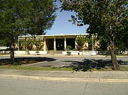
Berrien County students in kindergarten to grade twelve are in the Berrien County School District, which consists of two elementary schools, a middle school, a high school, and a charter school. [14] The district has 172 full-time teachers and over 3,037 students. [15]

The city of Nashville is served by a public library, the Carrie Dorsey Perry Memorial Library, a part of the Coastal Plain Regional Library System network. [16]

Related Research Articles

<span class="mw-page-title-main">Berrien County, Georgia</span> County in Georgia, United States

Berrien County is a county located in the south central portion of the U.S. state of Georgia. As of the 2020 census, the population was 18,160. The county seat is Nashville. The county was created February 25, 1856 out of portions of Coffee, Irwin and Lowndes counties by an act of the Georgia General Assembly. It is named after Georgia senator John M. Berrien.

<span class="mw-page-title-main">Brantley, Alabama</span> Town in Alabama, United States

Brantley is a city in Crenshaw County, Alabama, United States. At the 2020 census, the population was 825. Brantley was incorporated in 1891 as a city.

<span class="mw-page-title-main">Silt, Colorado</span> Town in Colorado, United States

Silt is a statutory town in Garfield County, Colorado, United States. The population was 3,536 at the 2020 census, up from 2,930 at the 2010 census.

<span class="mw-page-title-main">Enigma, Georgia</span> Town in Georgia, United States

Enigma is a town in Berrien County, Georgia, United States. The population was 1,278 at the 2010 census, and 1,058 in 2020. The origin of the name "Enigma" is obscure; the name is itself an enigma. Enigma has frequently been noted on lists of unusual place names.

<span class="mw-page-title-main">Nahunta, Georgia</span> City in Georgia, United States

Nahunta is a city and the county seat in Brantley County, Georgia, United States. It is part of the Brunswick, Georgia Metropolitan Statistical Area. The population was 1,013 at the 2020 census. The city is an important crossroad which is intersected by U.S. Route 82 and U.S. Route 301 in its downtown area.

<span class="mw-page-title-main">Quitman, Georgia</span> City in Georgia, United States

Quitman is a city in and the county seat of Brooks County, Georgia, United States. The population was 4,064 in 2020. The Quitman Historic District is listed on the National Register of Historic Places.

<span class="mw-page-title-main">Kingsland, Georgia</span> City in Georgia, United States

Kingsland is a city in Camden County, Georgia, United States. The population was 18,337 at the 2020 census.

<span class="mw-page-title-main">Moultrie, Georgia</span> City in Georgia, United States

Moultrie is the county seat and largest city of Colquitt County, Georgia, United States. It is the third largest city in Southwest Georgia, behind Thomasville and Albany. As of the 2020 census, Moultrie's population was 14,638. It was originally known as Ochlockoney until it was incorporated by the Georgia General Assembly in 1859. Moultrie is an agricultural community set in the Southern Rivers part of Georgia.

<span class="mw-page-title-main">Adel, Georgia</span> City in Georgia, United States

Adel is a city in and the county seat of Cook County, Georgia, United States, located fifty-two miles (84 km) southeast of Albany. As of the 2020 census, the city had a population of 5,571.

<span class="mw-page-title-main">Vienna, Georgia</span> City in Georgia, United States

The city of Vienna is the county seat of Dooly County, Georgia, United States. The population was 4,011 at the 2010 census, up from 2,973 in 2000. Vienna is situated on the Flint River. It was established as Berrien in 1826. In 1833, its name was changed to Drayton. In 1841, it was renamed Vienna. Vienna was disincorporated at the time they changed the city's name to Vienna. The present name is after Vienna, in Austria.

<span class="mw-page-title-main">Calhoun, Georgia</span> City in Georgia, United States

Calhoun is a city in Gordon County, Georgia, United States. As of the 2020 census, the city had a population of 16,949. Calhoun is the county seat of Gordon County.

<span class="mw-page-title-main">Cairo, Georgia</span> City in Georgia, United States

Cairo is a city in Grady County, Georgia, United States. As of the 2020 census, the city had a population of 10,179. The city is the county seat of Grady County.

<span class="mw-page-title-main">Hartwell, Georgia</span> City in Georgia, United States

Hartwell is a city in Hart County, Georgia, United States. The population was 4,469 at the 2010 census. The city is the county seat of Hart County.

<span class="mw-page-title-main">Bamberg, South Carolina</span> City in South Carolina, United States

Bamberg is a city in and the county seat of Bamberg County, South Carolina, United States. The population was 3,607 at the 2010 census.

<span class="mw-page-title-main">Barnwell, South Carolina</span> City in South Carolina, United States

Barnwell is a city in and county seat of Barnwell County, South Carolina, United States, located along U.S. Route 278. The population was 4,750 at the 2010 census.

<span class="mw-page-title-main">Italy, Texas</span> Town in Texas, United States

Italy is a town in Ellis County, Texas, United States. Its population was 1,926 in 2020. The community was named after Italy by a settler who had visited the European country.

<span class="mw-page-title-main">Blythewood, South Carolina</span> Town in South Carolina, United States

Blythewood is a town in Richland and Fairfield counties, South Carolina, United States. It is a suburb of Columbia, South Carolina. The 2020 United States census puts the population at 4,772. It is part of the Columbia, South Carolina, Metropolitan Statistical Area. It is located around 15 miles from downtown Columbia.

<span class="mw-page-title-main">Hamlin, Texas</span> City in Texas, United States

Hamlin is a city in Jones and Fisher Counties in the U.S. state of Texas. The population was 2,124 at the 2010 census, and in 2018, the estimated population was 1,997. The Jones County portion of Hamlin is part of the Abilene, Texas metropolitan area.

<span class="mw-page-title-main">Brilliant, Ohio</span> Census-designated place in Ohio, United States

Brilliant is an unincorporated community and census-designated place (CDP) in eastern Jefferson County, Ohio, United States, along the Ohio River. It was named after the Brilliant Glass factory that once was located in the town. The population was 1,317 as of the 2020 census. It is part of the Weirton–Steubenville metropolitan area.

<span class="mw-page-title-main">Palmyra, Virginia</span> Census-designated place in Virginia, United States

Palmyra is a census-designated place (CDP) in and the county seat of Fluvanna County, Virginia, United States. The population as of the 2010 census was 104. Palmyra lies on the eastern bank of the Rivanna River along U.S. Route 15. The ZIP code for Palmyra and surrounding rural land is 22963.

References

  1. "2020 U.S. Gazetteer Files". United States Census Bureau. Retrieved December 18, 2021.
  2. "U.S. Census website". United States Census Bureau . Retrieved January 31, 2008.
  3. "US Board on Geographic Names". United States Geological Survey. October 25, 2007. Retrieved January 31, 2008.
  4. "Find a County". National Association of Counties. Retrieved June 7, 2011.
  5. "Geographic Identifiers: 2022 Demographic Profile Data (G001): Nashville city, Georgia". U.S. Census Bureau, American Factfinder. Retrieved November 4, 2013.
  6. Hellmann, Paul T. (May 13, 2013). Historical Gazetteer of the United States. Routledge. p. 241. ISBN   978-1135948597 . Retrieved November 30, 2013.
  7. Krakow, Kenneth K. (1975). Georgia Place-Names: Their History and Origins (PDF). Macon, GA: Winship Press. p. 156. ISBN   0-915430-00-2.
  8. The Berrien Press, page 2, November 22, 2006
  9. "Geographic Identifiers: 2010 Demographic Profile Data (G001): Nashville city, Georgia". U.S. Census Bureau, American Factfinder. Archived from the original on February 12, 2020. Retrieved November 4, 2013.
  10. Climate Summary for Nashville, Georgia
  11. "Weatherbase.com". Weatherbase. 2013. Retrieved on September 28, 2013.
  12. "Census of Population and Housing". Census.gov. Retrieved June 4, 2015.
  13. "Explore Census Data". data.census.gov. Retrieved December 18, 2021.
  14. Georgia Board of Education [ permanent dead link ], Retrieved May 30, 2010.
  15. School Stats, Retrieved May 30, 2010.
  16. "Carrie Dorsey Perry Memorial Library". Coastal Plain Regional Library. Archived from the original on October 30, 2015. Retrieved May 10, 2017.