Jesup, Georgia

Last updated

Jesup, Georgia
Jesup City Hall.jpg
City Hall photo
Wayne County Georgia Incorporated and Unincorporated areas Jesup Highlighted.svg
Location in Wayne County and the state of Georgia
Coordinates: 31°36′7″N81°53′6″W / 31.60194°N 81.88500°W / 31.60194; -81.88500
Country United States
State Georgia
County Wayne
Government
   Mayor Ralph Hickox
   City Manager Rose Marcus
Area
[1]
  Total16.76 sq mi (43.41 km2)
  Land16.55 sq mi (42.85 km2)
  Water0.21 sq mi (0.56 km2)
Elevation
95 ft (29 m)
Population
 (2020)
  Total9,809
  Density592.83/sq mi (228.90/km2)
Time zone UTC-5 (Eastern (EST))
  Summer (DST) UTC-4 (EDT)
ZIP codes
31545-31546, 31599
Area code 912
FIPS code 13-42268 [2]
GNIS feature ID0316104 [3]
Website http://www.jesupga.gov/

Jesup is a city in Wayne County, Georgia, United States. The population was 9,809 at the 2020 census. The city is the county seat of Wayne County. [4]

Contents

History

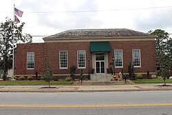
By February 1869, Willis Clary had begun building a two-story hotel near the junction of Macon and Brunswick Railroad and the Atlantic and Gulf Railroad and four stores had sprung up in the area. [5] Clary became a driving force for the establishment of what would become Jesup and was its first mayor.

By September 1869, the town included five stores, a sawmill, and a railroad eating house in addition to Clary's hotel. [6] By December 1869 the community had become known as Jesup.

Jesup was named for Thomas Jesup, a general during the Second Seminole War. [7]

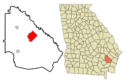
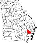
The area was then part of Appling County, Georgia. On August 27, 1872, eastern sections of Appling land districts 3 and 4 were added to Wayne County. [8] In 1873, the seat of Wayne County was transferred to Jesup from Waynesville. [9]

In 2021, Rose Marcus made history by becoming the first African American City Manager and first African American female City Manager for the City of Jesup in Jesup, GA.

Geography

Jesup is located at 31°36′7″N81°53′6″W / 31.60194°N 81.88500°W / 31.60194; -81.88500 (31.601866, -81.885070). [10]

According to the United States Census Bureau, the city has a total area of 16.6 square miles (43 km2), of which, 16.5 square miles (43 km2) of it is land and 0.1 square miles (0.26 km2) of it (0.30%) is water. It is 35 miles west of Hinesville and 12 miles southwest of Ludowici, Georgia.

Demographics

Historical population
CensusPop.Note
1880 562
1890 90761.4%
1900 805−11.2%
1910 1,41575.8%
1920 1,94137.2%
1930 2,30318.7%
1940 2,90326.1%
1950 4,60558.6%
1960 7,30458.6%
1970 9,09124.5%
1980 9,4183.6%
1990 8,958−4.9%
2000 9,2793.6%
2010 10,21410.1%
2020 9,809−4.0%
U.S. Decennial Census [11]
Jesup racial composition as of 2020 [12]
RaceNum.Perc.
White (non-Hispanic)4,69247.83%
Black or African American (non-Hispanic)3,95440.31%
Native American 270.28%
Asian 920.94%
Other/Mixed 3363.43%
Hispanic or Latino 7087.22%

As of the 2020 United States census, there were 9,809 people, 3,754 households, and 2,365 families residing in the city.

Government and infrastructure

The Federal Bureau of Prisons operates the Federal Correctional Institution in Jesup. [13] The United States Postal Service operates the Jesup Post Office. [14]

Education

Wayne County High School Wayne County High School.jpg
Wayne County High School
Wayne County Library Wayne County library.jpg
Wayne County Library

The Wayne County School District holds pre-school to grade twelve, and consists of a pre-K center, five elementary schools, two middle schools, a high school, and an academy school. [15] The district has 320 full-time teachers and over 5,256 students. [16]

Jesup is home to Coastal Pines Technical College as well as one high school, Wayne County High School, which is located within the city limits. This complex replaced the original Wayne County High School on Orange Street, and was completed in 2002. In 2014, the county school system took bids for asbestos removal and the demolition of buildings belonging to the old high school. [17] Until its demolition, the original facility was still providing usefulness, housing the Jesup Police, the Boys and Girls Club of Wayne County, and the Three Rivers Regional Library System's Regional Office. The Jesup Police Department is now located in the facilities previously housing Jesup Elementary, at 642 E. Plum Street. All sporting events except basketball and tennis and track including football, baseball, soccer, and softball, are held at the original Wayne County High School complex.

The Wayne County Library borders the sports complex.

Transportation

Amtrak's Silver Meteor passenger train stops at the Jesup Amtrak Station.

United States highways that pass through Jesup are U.S. Highway 25, U.S. Highway 84, U.S. Highway 301, and U.S. Highway 341.

Jesup-Wayne County Airport, also known as William A. Zorn Airport (FAA location identifier: JES), is located south of town.

Notable people

Related Research Articles

<span class="mw-page-title-main">Wayne County, Georgia</span> County in Georgia, United States

Wayne County is a county located in the southeastern part of the U.S. state of Georgia. As of the 2020 census, the population was 30,144. The county seat is Jesup.

<span class="mw-page-title-main">Lanier County, Georgia</span> County in Georgia, United States

Lanier County is a county in the south central portion of the U.S. state of Georgia. As of the 2020 census, the population was 9,877. The county seat and only incorporated municipality is Lakeland. The county is named after the Georgia poet Sidney Lanier.

<span class="mw-page-title-main">Appling County, Georgia</span> County in Georgia, United States

Appling County is a county located in the southeastern part of the U.S. state of Georgia. As of the 2020 census, the population was 18,444. The county seat is Baxley.

<span class="mw-page-title-main">Baxley, Georgia</span> City in Georgia, United States

Baxley is a city in Appling County, Georgia, United States. As of the 2020 census, the city had a population of 4,942. The city is the county seat of Appling County.

<span class="mw-page-title-main">Cochran, Georgia</span> City in Georgia, United States

Cochran is a city in Bleckley County, Georgia, United States. As of the 2020 census, the city had a population of 5,026. The city is the county seat of Bleckley County.

<span class="mw-page-title-main">Pembroke, Georgia</span> City and County Seat in Georgia, United States

Pembroke is a city and county seat in Bryan County, Georgia, United States. As of the 2020 census, the population of the city was 2,513. It is located approximately 35 miles west of Savannah, Georgia, and approximately 20 miles south of Statesboro, Georgia. Pembroke is part of the Savannah metropolitan statistical area.

<span class="mw-page-title-main">Kingsland, Georgia</span> City in Georgia, United States

Kingsland is a city in Camden County, Georgia, United States. The population was 18,337 at the 2020 census.

<span class="mw-page-title-main">Roberta, Georgia</span> City in Georgia, United States

Roberta is a city in Crawford County, Georgia, United States. The population was 1,007 at the 2010 census. It is part of the Macon metropolitan statistical area.

<span class="mw-page-title-main">Eastman, Georgia</span> City in Georgia, United States

Eastman is a city in Dodge County, Georgia, United States. The population was 5,658 at the 2020 census, up from 4,962 at the 2010 census. The city was named after William Pitt Eastman, a native of Massachusetts who purchased a large tract of land along the Macon and Brunswick Railroad, and settled a city on the site.

<span class="mw-page-title-main">Country Club Estates, Georgia</span> Place in Georgia, United States

Country Club Estates is an unincorporated community and census-designated place (CDP) in Glynn County, Georgia, United States. It is part of the Brunswick metropolitan statistical area. The population was 8,373 at the 2020 census, down from 8,545 in 2010.

<span class="mw-page-title-main">Loganville, Georgia</span> City in Georgia, United States

Loganville is a city in Walton and Gwinnett counties, Georgia, United States. The population was 10,458 at the 2010 census. Loganville is located about 36 mi (58 km) east of Atlanta and is part of the Atlanta metropolitan area.

<span class="mw-page-title-main">Hazlehurst, Georgia</span> City in Georgia, United States

Hazlehurst is a city in and the county seat of Jeff Davis County, Georgia, United States. The population was 4,088 in 2020.

<span class="mw-page-title-main">Riceboro, Georgia</span> City in the United States

Riceboro is a city in Liberty County, Georgia, United States. The population was 809 at the 2010 census. It is a part of the Hinesville-Fort Stewart metropolitan statistical area.

<span class="mw-page-title-main">Montezuma, Georgia</span> City in Georgia, United States

Montezuma is a city in Macon County, Georgia. The population was 3,047 at the 2020 census, down from 3,460 in 2010. It is home to the armory of Bravo Company, 648th Engineers of the Georgia Army National Guard.

<span class="mw-page-title-main">Forsyth, Georgia</span> City in Georgia, United States

Forsyth is a city in and the county seat of Monroe County, Georgia, United States. The population was 4,384 at the 2020 census, up from 3,788 in 2010. Forsyth is part of the Macon metropolitan statistical area.

<span class="mw-page-title-main">Social Circle, Georgia</span> City in Georgia, United States

Social Circle is a city in southern Walton County, extending into Newton County, in the U.S. state of Georgia, 45 miles east of Atlanta.

<span class="mw-page-title-main">Hawkinsville, Georgia</span> City in Georgia, United States

Hawkinsville is a city in and the county seat of Pulaski County, Georgia, United States. The population was 3,980 in 2020.

<span class="mw-page-title-main">McRae, Georgia</span> City in Georgia, United States

McRae was a city in and the county seat of Telfair County, Georgia, United States. It was designated as the seat in 1871, after being established the previous year as a station on the Macon and Brunswick Railroad. Upon the city's merger with adjacent Helena in 2015, the new county seat is the combined city of McRae-Helena.

<span class="mw-page-title-main">Lyons, Georgia</span> City in Georgia, United States

Lyons is a city in Toombs County, Georgia, United States. The population was 4,239 in 2020. The city is the county seat of Toombs County.

<span class="mw-page-title-main">McRae–Helena, Georgia</span> City in Georgia, United States

McRae–Helena is a city in the U.S. state of Georgia, formed on January 1, 2015, by the merger of the two cities of McRae and Helena. McRae–Helena is the county seat of Telfair County.

References

  1. "2020 U.S. Gazetteer Files". United States Census Bureau. Retrieved December 18, 2021.
  2. "U.S. Census website". United States Census Bureau . Retrieved January 31, 2008.
  3. "US Board on Geographic Names". United States Geological Survey. October 25, 2007. Retrieved January 31, 2008.
  4. "Find a County". National Association of Counties. Archived from the original on May 9, 2015. Retrieved June 7, 2011.
  5. "A Visit to Macon and Brunswick Railroad". Macon Daily Telegraph. Macon, Georgia. February 28, 1869. Retrieved January 14, 2018.
  6. "From Brunswick". Macon Daily Telegraph. Macon, Georgia. September 23, 1869. Retrieved January 14, 2018.
  7. Krakow, Kenneth K. (1975). Georgia Place-Names: Their History and Origins (PDF). Macon, GA: Winship Press. p. 121. ISBN   0-915430-00-2.
  8. Acts and Resolutions of the General Assembly of the State of Georgia, Passed at its Session in July and August, 1872. Vol. 1. p. 387.
  9. Hellmann, Paul T. (May 13, 2013). Historical Gazetteer of the United States. Routledge. p. 234. ISBN   978-1135948597 . Retrieved November 30, 2013.
  10. "US Gazetteer files: 2010, 2000, and 1990". United States Census Bureau. February 12, 2011. Retrieved April 23, 2011.
  11. "Census of Population and Housing". Census.gov. Retrieved June 4, 2015.
  12. "Explore Census Data". data.census.gov. Retrieved December 14, 2021.
  13. "Contact." Federal Correctional Institution, Jesup. Retrieved on April 26, 2011. "FCI JESUP FEDERAL CORRECTIONAL INSTITUTION 2600 HIGHWAY 301 SOUTH JESUP, GA 31599"
  14. "Post Office™ Location - JESUP Archived 2012-08-30 at the Wayback Machine ." United States Postal Service. Retrieved on April 26, 2011. "405 E WALNUT ST JESUP, GA "
  15. Georgia Board of Education [ permanent dead link ], Retrieved June 30, 2010.
  16. School Stats, Retrieved June 30, 2010.
  17. [ dead link ]