McDonough, Georgia

Last updated

McDonough, Georgia
City
McDonough courthouse.jpg
Flag of McDonough, Georgia.png
Seal of McDonough, Georgia.png
Nickname: 
The Geranium City
Henry County Georgia Incorporated and Unincorporated areas McDonough Highlighted.svg
Location in Henry County and the state of Georgia
USA Georgia location map.svg
Red pog.svg
McDonough
Location of McDonough in Henry County
Usa edcp location map.svg
Red pog.svg
McDonough
McDonough (the United States)
North America laea location map.svg
Red pog.svg
McDonough
McDonough (North America)
Coordinates: 33°26′42″N84°8′57″W / 33.44500°N 84.14917°W / 33.44500; -84.14917
CountryFlag of the United States.svg United States
State Georgia
County Henry
Named for Thomas Macdonough
Area
[1]
  Total13.01 sq mi (33.71 km2)
  Land12.85 sq mi (33.29 km2)
  Water0.16 sq mi (0.42 km2)
Elevation
863 ft (263 m)
Population
 (2020)
  Total29,051
  Density2,260.43/sq mi (872.72/km2)
Time zone UTC-5 (Eastern (EST))
  Summer (DST) UTC-4 (EDT)
ZIP Codes
30252–30253
Area code(s) 770/678/470
FIPS code 13-48624 [2]
GNIS feature ID0317901 [3]
Website www.mcdonoughga.org

McDonough is a city in Henry County, Georgia, United States. It is part of the Atlanta metropolitan area. Its population was 22,084 at the 2010 census, [4] up from 8,493 in 2000. The city is the county seat of Henry County. [5] The unincorporated communities of Blacksville, Flippen, Kelleytown, and Ola are located near McDonough, and addresses in those communities have McDonough ZIP Codes.

Contents

History

The town was named for naval officer Commodore Thomas Macdonough [6] and founded in 1823 around a traditional town square design. The buildings surrounding the square are intact, although there are some vacancies. The county courthouse and historic jail building are on the north side near the Welcome Center in a historically maintained Standard Oil service station, built in 1920. The station also houses the Main Street Program Office.

One block east of the square, the town's original cotton warehouse has been replaced with the Henry County Judicial Center. In the same area the Henry County Courthouse Annex has an original oil on canvas "Cotton Gin" (4+12 by 11 feet) by artist Jean Charlot. He painted this oil in 1942 for the town post office. His works can be found all over the world in everything from children's books to large murals.

The town was a relay station on the New York City to New Orleans stagecoach line and was connected by other stage lines with Fayetteville and Decatur, and with Macon by way of Jackson. [7]

Geography

McDonough is in central Henry County, 28 miles (45 km) southeast of downtown Atlanta. U.S. Route 23 passes through the center of the city, leading northwest 9 miles (14 km) to Stockbridge and south 7 miles (11 km) to Locust Grove. Interstate 75 passes through the southwestern arm of the city, with access from Exits 216, 218, and 221. I-75 leads northwest to Atlanta and southeast 56 miles (90 km) to Macon.

According to the United States Census Bureau, the city has a total area of 12.9 square miles (33.4 km2), of which 12.7 square miles (32.9 km2) are land and 0.2 square miles (0.5 km2), or 1.50%, are water. [4]

Demographics

Historical population
CensusPop.Note
1870 320
1880 3200.0%
1890 51560.9%
1900 68332.6%
1910 88229.1%
1920 1,26343.2%
1930 1,068−15.4%
1940 1,23215.4%
1950 1,63532.7%
1960 2,22436.0%
1970 2,67520.3%
1980 2,7783.9%
1990 2,9295.4%
2000 8,493190.0%
2010 22,084160.0%
2020 29,05131.5%
U.S. Decennial Census [8]

2000 census

At the 2000 census, [2] there were 8,493 people, 3,069 households and 2,102 families living in the city. The population density was 1,093.8 inhabitants per square mile (422.3/km2). There were 3,234 housing units at an average density of 416.5/sq mi (160.8/km2). The racial makeup of the city was 61.4% white, 34.3% African American, 0.2% Native American, 1.4% Asian, 1.8% from other races, and 1% from two or more races. Hispanic or Latino residents of any race were 3.7% of the population.

There were 3,069 households, of which 35.7% had children under the age of 18 living with them, 45.2% were married couples living together, 18.8% had a female householder with no husband present, and 31.5% were non-families. 25.4% of all households were made up of individuals, and 8.0% had someone living alone who was 65 years of age or older. The average household size was 2.61 and the average family size was 3.14.

26.4% of the population were under the age of 18, 10.6% from 18 to 24, 34.1% from 25 to 44, 16.8% from 45 to 64, and 12.1% who were 65 years of age or older. The median age was 31 years. For every 100 females, there were 90.3 males. For every 100 females age 18 and over, there were 86.1 males.

The median household income was $40,482 and the median family income was $46,818. Males had a median income of $34,669 versus $28,318 for females. The per capita income for the city was $19,029. About 9.6% of families and 12.8% of the population were below the poverty line, including 13.3% of those under age 18 and 18.3% of those age 65 or over.

Although it is considered to be located in Stockbridge many of the Eagle's Landing Country Club's homes are within McDonough's 30253 zip code.

2010 census

As of the 2010 United States Census, there were 22,084 people, 8,053 households, and 5,404 families living in the city. [9] The population density was 1,737.4 inhabitants per square mile (670.8/km2). There were 9,063 housing units at an average density of 713.6 per square mile (275.5/km2). [10] The racial makeup of the city was 34.8% white, 58.2% black or African American, 1.8% Asian, 0.3% American Indian, 0.1% Pacific islander, 2.2% from other races, and 2.6% from two or more races. Those of Hispanic or Latino origin made up 6.1% of the population. [9]

Of the 8,053 households, 38.8% had children under the age of 18 living with them, 38.3% were married couples living together, 23.3% had a female householder with no husband present, 32.9% were non-families, and 28.1% of all households were made up of individuals. The average household size was 2.64 and the average family size was 3.25. The median age was 33.1 years. [9]

2020 census

McDonough racial composition [11]
RaceNum.Perc.
White (non-Hispanic)4,99817.2%
Black or African American (non-Hispanic)20,09269.16%
Native American 550.19%
Asian 6102.1%
Pacific Islander 300.1%
Other/Mixed 1,3064.5%
Hispanic or Latino 1,9606.75%

As of the 2020 United States census, there were 29,051 people, 8,543 households, and 5,778 families residing in the city.

Economy

Snapper Inc. manufacturing residential and professional lawn care and snow removal equipment, was based in McDonough.[ citation needed ] The company began in 1894 as Southern Saw Works, and claims to have invented the first self-propelled rotary lawn mower. [12] The company was sold to Briggs and Stratton, [12] which operated the plant until its closure in 2015.[ citation needed ]

Goya Foods has its Atlanta offices in an unincorporated area near McDonough. [13] [14]

Arts and culture

Several individual buildings and two historic districts in the city are listed on the National Register of Historic Places, including the downtown McDonough Historic District. [15]

Events

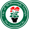
The city hosts a Geranium Festival each springtime on the third Saturday in May, celebrating the locally grown flowers and community. [16] The one-day festival serves as a showcase of local artistry and talent through the open-air craft markets and live musical performances. The festival is sponsored by the McDonough Lions Club, and held on the McDonough Square and surrounding areas. [16]

Sports

The city's semi-professional soccer team Georgia Revolution FC plays in the National Premier Soccer League at the Warhawk Stadium. [17]

WWE developmental territory Deep South Wrestling was based in McDonough.[ citation needed ]

Education

Henry County School District

The Henry County School District holds grades pre-school to grade twelve. The district has twenty eight elementary schools, nine middle schools, and ten high schools. [18] The district has 1,543 full-time teachers and over 40,000 students. [19]

Henry County Public Schools

Elementary schools

  • Cotton Indian Elementary School
  • Dutchtown Elementary School
  • East Lake Elementary School
  • Flippen Elementary School
  • Hickory Flat Elementary School
  • McDonough Elementary School
  • New Hope Elementary School
  • Oakland Elementary School
  • Ola Elementary School
  • Pleasant Grove Elementary School
  • Rock Spring Elementary School
  • Timber Ridge Elementary School
  • Tussahaw Elementary School
  • Unity Grove Elementary School
  • Walnut Creek Elementary School
  • Wesley Lakes Elementary School

Middle schools

  • Eagle's Landing Middle School
  • Henry County Middle School
  • Ola Middle School
  • Woodland Middle School
  • Union Grove Middle School

High schools

Private schools

Higher education

Media

WKKP is the local radio station, broadcasting on 100.9 FM and 1410 AM; it has a classic country format. [26]

The Henry Herald is the local county news print media. [27]

Film

Infrastructure

Transportation

Xpress GA provides local bus service.

McDonough is served by the following highways:

Until the mid-1960s the Southern Railway operated the Cincinnati to Miami Ponce de Leon, which made stops in McDonough. [31]

Notable people

"The McDonough Road" is mentioned by Rhett Butler in the 1939 film, Gone with the Wind .

Related Research Articles

<span class="mw-page-title-main">Whitfield County, Georgia</span> County in Georgia, United States

Whitfield County is a county located in the northwestern part of the U.S. state of Georgia. As of the 2020 census shows a population of 102,864. The county seat is Dalton. The county was created on December 30, 1851, and named after George Whitefield, Methodist evangelist. The "e" was omitted to reflect the pronunciation of his name.

<span class="mw-page-title-main">Paulding County, Georgia</span> County in Georgia, United States

Paulding County is a county located in the northwestern part of the U.S. state of Georgia. Part of the Atlanta metropolitan area, it had an estimated population of 168,661 in 2020. The county seat is Dallas.

<span class="mw-page-title-main">Lumpkin County, Georgia</span> County in Georgia, United States

Lumpkin County is a county located in the north central portion of the U.S. state of Georgia. As of the 2020 census, the population was 33,488. Its county seat is Dahlonega. Lumpkin County is included in the Atlanta-Sandy Springs-Roswell, Georgia Metropolitan Statistical Area.

<span class="mw-page-title-main">Henry County, Georgia</span> County in Georgia, United States

Henry County is located in the north central portion of the U.S. state of Georgia. According to the 2020 census, the population of Henry County was 240,712, up from 203,922 in 2010. The seat of government is McDonough. The county was named for Patrick Henry.

<span class="mw-page-title-main">Hall County, Georgia</span> County in Georgia, United States

Hall County is a county located in the northeast portion of the U.S. state of Georgia. As of the 2020 census, the population was 203,136, up from 179,684 at the 2010 census. The county seat is Gainesville. The entirety of Hall County comprises the Gainesville, Georgia, Metropolitan Statistical Area, which is also part of the Atlanta-Athens-Clarke County-Sandy Springs, Combined Statistical Area.

<span class="mw-page-title-main">Barrow County, Georgia</span> County in Georgia, United States

Barrow County is a county located in the north central portion of the U.S. state of Georgia. As of the 2020 census, the population was 83,505. The county seat is Winder. Barrow County is included in the Atlanta-Sandy Springs-Roswell metropolitan statistical area.

<span class="mw-page-title-main">Lula, Georgia</span> City in Georgia, United States

Lula is a city in Hall and Banks counties in the U.S. state of Georgia. Most of the city is in Hall County, with a small eastern portion of the city located in Banks County. The population was 2,822 at the 2020 census. The Hall County portion of Lula is part of the Gainesville, GA Metropolitan Statistical Area. Lula is the home of RailRoad Days, a yearly festival held usually every May. Lula is the railroad junction between the Atlanta northeast line and the Athens north line of Norfolk Southern Railway.

<span class="mw-page-title-main">Forest Park, Georgia</span> City in Georgia, United States

Forest Park is a city in Clayton County, Georgia, United States. It is located approximately nine miles (14 km) south of Atlanta and is part of the Atlanta–Sandy Springs–Marietta Metropolitan Statistical Area. As of the 2020 census, the city had a population of 19,932.

<span class="mw-page-title-main">Acworth, Georgia</span> City in Georgia, United States

Acworth is a city in Cobb County, Georgia, United States. It is part of the Atlanta metropolitan area. As of the 2020 census, this city had a population of 22,440, up from 20,425 in 2010. Acworth is located in the foothills of the North Georgia mountains along the southeastern banks of Lake Acworth and Lake Allatoona on the Etowah River. Unincorporated areas known as Acworth extend into Bartow, Cherokee and Paulding counties.

<span class="mw-page-title-main">Dawsonville, Georgia</span> City in Georgia, United States

Dawsonville is a city in and the county seat of Dawson County, Georgia, United States. The population was 2,536 at the 2010 census, up from 619 in 2000.

<span class="mw-page-title-main">Lilburn, Georgia</span> City in Georgia, United States

Lilburn is a city in Gwinnett County, Georgia, United States. The population was 14,502 at the 2020 census. The estimated population was 12,810 in 2019. It is a part of the Atlanta metropolitan area.

<span class="mw-page-title-main">Norcross, Georgia</span> City in Georgia, United States

Norcross is a city located in Gwinnett County, Georgia, United States. According to the 2010 census, the population was 9,116, while in 2020, the population increased to 17,209. Norcross is part of the Atlanta-Sandy Springs-Marietta metropolitan statistical area.

<span class="mw-page-title-main">Blacksville, Georgia</span> Unincorporated community in Georgia, United States

Blacksville is an unincorporated community in Henry County, Georgia, United States. At the 2000 census it was recorded as a census-designated place (CDP), with a population of four. It was no longer a CDP at the 2010 census.

<span class="mw-page-title-main">Hampton, Georgia</span> City in Georgia, United States

Hampton is a city in southwestern Henry County, Georgia, United States. The 2020 census was 8368. As of the 2010 census, the city had a population of 6,987, up from 3,857 at the 2000 census. By 2018 the estimated population was 7,922. "Hampton" mailing addresses outside the city limits reach into rural parts of eastern Clayton County and northern Spalding County. It is a southeastern suburb in the Atlanta metropolitan area.

<span class="mw-page-title-main">Stockbridge, Georgia</span> City in Georgia, United States

Stockbridge is a city in Henry County, Georgia, United States. As of the 2010 census, the population was 25,637, up from 9,853 in 2000.

<span class="mw-page-title-main">Lexington, Georgia</span> City in Georgia, United States

The city of Lexington is the county seat of Oglethorpe County, Georgia, United States. The population was 239 at the 2000 census.

<span class="mw-page-title-main">Conyers, Georgia</span> City in Georgia, United States

Conyers is an Atlanta suburb, the county seat of and only city in Rockdale County, Georgia, United States. The city is 24 miles (38.6 km) east of downtown Atlanta and is a part of the Atlanta Metropolitan Area. As of the 2010 census, the city population was 15,195. The formerly separate town of Milstead is now part of Conyers.

<span class="mw-page-title-main">Monroe, Georgia</span> City in Georgia, United States

Monroe is a city in Walton County, Georgia, United States, serving as the county seat. It is located both one hour east of Atlanta via US 78 and GA 138 to I-20 and east of Hartsfield–Jackson International Airport and is one of the exurban cities in the Atlanta metropolitan area. The population was 14,928 at the 2020 U.S. census.

<span class="mw-page-title-main">St. Albans, West Virginia</span> City in West Virginia, United States

St. Albans is a city in western Kanawha County, West Virginia, United States, at the confluence of the Kanawha and Coal rivers. The population was 10,861 at the 2020 census. It is part of the Charleston metropolitan area.

<span class="mw-page-title-main">Locust Grove, Georgia</span> City in Georgia, United States

Locust Grove is a city in Henry County, Georgia, United States. The population was 5,402 at the 2010 census, up from 2,322 in 2000. Some unincorporated communities such as Luella and many rural areas surround Locust Grove, and those communities have Locust Grove postal addresses.

References

  1. "2020 U.S. Gazetteer Files". United States Census Bureau. Retrieved December 18, 2021.
  2. 1 2 "U.S. Census website". United States Census Bureau . Retrieved January 31, 2008.
  3. "US Board on Geographic Names". United States Geological Survey. October 25, 2007. Retrieved January 31, 2008.
  4. 1 2 "Geographic Identifiers: 2010 Demographic Profile Data (G001): McDonough city, Georgia". American Factfinder. U.S. Census Bureau. Retrieved May 18, 2017.[ dead link ]
  5. "Find a County". National Association of Counties. Archived from the original on May 31, 2011. Retrieved June 7, 2011.
  6. Gannett, Henry (1905). The Origin of Certain Place Names in the United States. U.S. Government Printing Office. p.  193.
  7. "History of Henry County". www.rootsweb.ancestry.com. Retrieved April 24, 2009.[ title missing ]
  8. "Census of Population and Housing". Census.gov. Retrieved June 4, 2015.
  9. 1 2 3 "DP-1 Profile of General Population and Housing Characteristics: 2010 Demographic Profile Data". United States Census Bureau. Archived from the original on February 13, 2020. Retrieved November 28, 2016.
  10. "Population, Housing Units, Area, and Density: 2010 - County". United States Census Bureau. Archived from the original on February 13, 2020. Retrieved November 28, 2016.
  11. "Explore Census Data". data.census.gov. Retrieved December 13, 2021.
  12. 1 2 "About Snapper". Snapper. Retrieved December 27, 2023.
  13. "Contact Us." Goya Foods. Retrieved on March 26, 2016. "Goya Atlanta 4005 Haworth Parkway McDonough, GA 30253"
  14. Maps of McDonough." U.S. Census Bureau. Retrieved on April 19, 2016.
  15. "Georgia - Henry County". National Register of Historic Places. Retrieved December 27, 2023.
  16. 1 2 "ABOUT US". THE GERANIUM FESTIVAL. Retrieved December 27, 2023.
  17. "MCDONOUGH'S SOCCER CLUB". Georgia Revolution FC. Retrieved December 27, 2023.
  18. Georgia Board of Education [ permanent dead link ], Retrieved June 19, 2010.
  19. School Stats, Retrieved June 19, 2010.
  20. Eagle's Landing Christian Academy, Retrieved June 19, 2010.
  21. New Creation Center, Retrieved June 19, 2010.
  22. Creekside Christian Academy, Retrieved August 8, 2010.
  23. "Daycare in McDonough, Georgia - Sunbrook Academy at Luella".
  24. "Gordon State College at McDonough". www.gordonstate.edu. Retrieved May 1, 2020.
  25. "Mercer University". www.mercer.edu.
  26. "WJGA-FM, WKKP AM-FM". Georgia Association of Broadcasters. Retrieved December 25, 2023.
  27. "About The Henry herald. (McDonough, Henry County, Ga.) 1987-1998". Library of Congress. Retrieved December 25, 2023.
  28. "GET IN THE SPIRIT WITH THESE HOLIDAY MOVIES MADE IN GEORGIA". Explore Georgia. Retrieved December 25, 2023.
  29. "Glory". Movie-Locations.com. Retrieved December 25, 2023.
  30. "Smokey and the Bandit Filming Locations: A 40-Year Now and Then Look Back". Horsepower Memories. June 16, 2017. Retrieved December 25, 2023.
  31. Southern Railway timetable, May 1, 1965, Table 3
  32. Reinhard, Beth (May 20, 2011). "Home is Where the Votes Are". National Journal. Retrieved May 21, 2011.
  33. "John Lunsford's Biography". Vote Smart . Retrieved March 5, 2021.