Buchanan, Georgia

Last updated

Buchanan, Georgia
Haralson County Georgia Courthouse.jpg
Former Haralson County courthouse in Buchanan, now the Buchanan-Haralson Public Library
Haralson County Georgia Incorporated and Unincorporated areas Buchanan Highlighted.svg
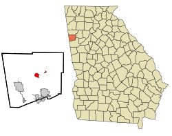
Location in Haralson County and the state of Georgia
Coordinates: 33°48′6″N85°11′1″W / 33.80167°N 85.18361°W / 33.80167; -85.18361
Country United States
State Georgia
County Haralson
Named for James Buchanan
Area
[1]
  Total1.70 sq mi (4.40 km2)
  Land1.49 sq mi (3.86 km2)
  Water0.21 sq mi (0.54 km2)
Elevation
1,243 ft (379 m)
Population
 (2020)
  Total938
  Density629.95/sq mi (243.15/km2)
Time zone UTC-5 (Eastern (EST))
  Summer (DST) UTC-4 (EDT)
ZIP code
30113
Area code 770
FIPS code 13-11616 [2]
GNIS feature ID0354892 [3]
Website buchananga.com

Buchanan is a city and the county seat of Haralson County, Georgia, United States. [4] The population was 1,104 at the 2010 census, [5] up from 941 at the 2000 census.

Contents

Locally, the city's name is pronounced Buck-HAN-uhn.

History

Buchanan was founded in 1856 as seat of the newly formed Haralson County. It was named for United States President James Buchanan. [6] Buchanan was incorporated as a town in 1857 and as a city in 1902. [7]

It is home of one of few one-room schoolhouses surviving in Georgia, the Little Creek One-room Schoolhouse. [8] The state had about 7,000 of them in 1900.

Geography

Buchanan is located just east of the center of Haralson County at 33°48′6″N85°11′1″W / 33.80167°N 85.18361°W / 33.80167; -85.18361 (33.801726, -85.183506). [9] U.S. Route 27 bypasses the city to the east, leading north 16 miles (26 km) to Cedartown and south 6 miles (10 km) to Bremen.

According to the United States Census Bureau, Buchanan has a total area of 1.7 square miles (4.4 km2), of which 1.5 square miles (3.8 km2) are land and 0.2 square miles (0.5 km2), or 12.42%, are water. [5]

Demographics

Historical population
CensusPop.Note
1880 158
1890 324105.1%
1900 35910.8%
1910 46228.7%
1920 4916.3%
1930 429−12.6%
1940 50417.5%
1950 65129.2%
1960 75315.7%
1970 8006.2%
1980 1,01927.4%
1990 1,009−1.0%
2000 941−6.7%
2010 1,10417.3%
2020 938−15.0%
U.S. Decennial Census [10]

2020 census

Buchanan racial composition [11]
RaceNum.Perc.
White (non-Hispanic)80285.5%
Black or African American (non-Hispanic)717.57%
Asian 20.21%
Other/Mixed 444.69%
Hispanic or Latino 192.03%

As of the 2020 United States census, there were 938 people, 436 households, and 274 families residing in the city.

2000 census

As of the census [2] of 2000, there were 941 people, 345 households, and 221 families residing in the city. The population density was 638.6 inhabitants per square mile (246.6/km2). There were 380 housing units at an average density of 257.9 per square mile (99.6/km2). The racial makeup of the city was 87.14% White, 11.37% African American, 0.11% Native American, 0.11% Asian, 0.11% from other races, and 1.17% from two or more races. Hispanic or Latino of any race were 0.53% of the population.

There were 345 households, out of which 27.0% had children under the age of 18 living with them, 46.1% were married couples living together, 14.8% had a female householder with no husband present, and 35.7% were non-families. 33.6% of all households were made up of individuals, and 17.7% had someone living alone who was 65 years of age or older. The average household size was 2.38 and the average family size was 3.02.

In the city, the population was spread out, with 22.8% under the age of 18, 8.0% from 18 to 24, 28.5% from 25 to 44, 21.5% from 45 to 64, and 19.2% who were 65 years of age or older. The median age was 38 years. For every 100 females, there were 96.9 males. For every 100 females age 18 and over, there were 86.2 males.

The median income for a household in the city was $23,269, and the median income for a family was $26,964. Males had a median income of $24,205 versus $16,458 for females. The per capita income for the city was $11,821. About 20.5% of families and 22.7% of the population were below the poverty line, including 23.4% of those under age 18 and 19.8% of those age 65 or over.

Education

Haralson County School District

The Haralson County School District holds pre-school to grade twelve, and consists of four elementary schools, a middle school, and a high school. [12] The district has 231 full-time teachers and over 3,766 students. [13]

Related Research Articles

<span class="mw-page-title-main">Cleburne County, Alabama</span> County in Alabama, United States

Cleburne County is a county located in the east central portion of the U.S. state of Alabama. As of the 2020 census, the population was 15,056. Its county seat is Heflin. Its name is in honor of Patrick R. Cleburne of Arkansas who rose to the rank of major general in the Confederate States Army. The eastern side of the county borders the state of Georgia.

<span class="mw-page-title-main">Pike County, Georgia</span> County in Georgia, United States

Pike County is a county located in the west central portion of the U.S. state of Georgia. As of the 2020 census, the population was 18,889. The county seat is Zebulon.

<span class="mw-page-title-main">Paulding County, Georgia</span> County in Georgia, United States

Paulding County is a county located in the northwestern part of the U.S. state of Georgia. Part of the Atlanta metropolitan area, it had an estimated population of 168,661 in 2020. The county seat is Dallas.

<span class="mw-page-title-main">Haralson County, Georgia</span> County in Georgia, United States

Haralson County is a county located in the northwestern part of the U.S. state of Georgia. As of the 2020 census, the population was 29,919, up from 28,780 2010. The county seat is Buchanan. The county was created on January 26, 1856, and was named for Hugh A. Haralson, a former Georgia congressman.

<span class="mw-page-title-main">Coweta County, Georgia</span> County in Georgia, United States

Coweta County is a county located in the west central portion of the U.S. state of Georgia. It is part of Metro Atlanta. As of the 2020 census, the population was 146,158. The county seat is Newnan.

<span class="mw-page-title-main">Carroll County, Georgia</span> County in Georgia, United States

Carroll County is a county located in the northwestern part of the State of Georgia. As of the 2020 census, its population was 119,148. Its county seat is the city of Carrollton. Carroll County is included in the Atlanta-Sandy Springs-Roswell, GA Metropolitan Statistical Area and is also adjacent to Alabama on its western border.

<span class="mw-page-title-main">Bremen, Georgia</span> City in Georgia, United States

Bremen is a city in Haralson and Carroll counties, Georgia, United States. As of the 2010 census, the city had a population of 6,227, up from 4,579 at the 2000 census. Most of the city is in Haralson County, with a small portion in Carroll County.

<span class="mw-page-title-main">Temple, Georgia</span> City in Georgia, United States

Temple is a city in Carroll and Haralson counties in the U.S. state of Georgia. The population was 4,228 at the 2010 census, up from 2,383 in 2000, a 77% increase.

<span class="mw-page-title-main">Haralson, Georgia</span> Town in Georgia, United States

Haralson is a town in Coweta and Meriwether counties in the U.S. state of Georgia. The population was 172 at the 2020 census. It is noted for being one of the filming locations for both The Walking Dead and Lawless.

<span class="mw-page-title-main">Gibson, Georgia</span> City in Georgia, United States

Gibson is a city in Glascock County, Georgia, United States. The population was 663 at the 2010 census. The city is the county seat of Glascock County and home to the Glascock County Courthouse, a National Register of Historic Places listed site.

<span class="mw-page-title-main">Tallapoosa, Georgia</span> City in Georgia, United States

Tallapoosa is a city in Haralson County, Georgia. The population was 3,170 at the 2010 census, up from 2,789 at the 2000 census.

<span class="mw-page-title-main">Waco, Georgia</span> City in Georgia, United States

Waco is a city in Haralson County, Georgia, United States, located near the Alabama state line. The population was 516 at the 2010 census, up from 469 at the 2000 census.

<span class="mw-page-title-main">Hampton, Georgia</span> City in Georgia, United States

Hampton is a city in southwestern Henry County, Georgia, United States. The 2020 census was 8368. As of the 2010 census, the city had a population of 6,987, up from 3,857 at the 2000 census. By 2018 the estimated population was 7,922. "Hampton" mailing addresses outside the city limits reach into rural parts of eastern Clayton County and northern Spalding County. It is a southeastern suburb in the Atlanta metropolitan area.

<span class="mw-page-title-main">Arcade, Georgia</span> City in Georgia, United States

Arcade is a city in Jackson County, Georgia, United States. As of the 2020 census it had a population of 1,884.

<span class="mw-page-title-main">Wrightsville, Georgia</span> City in Georgia, United States

Wrightsville is a city in Johnson County, Georgia, United States. The population was 2,195 at the 2010 census, down from 2,223 at the 2000 census. The city limits include Johnson State Prison on the northeast side of town. The city is the county seat of Johnson County. Wrightsville is part of the Dublin Micropolitan Statistical Area.

<span class="mw-page-title-main">Lincolnton, Georgia</span> City in Georgia, United States

The city of Lincolnton is the county seat of Lincoln County, Georgia, United States. The population was 1,480 at the 2020 census. It contains numerous houses and historic districts listed on the National Register of Historic Places. Both the city and the county were named for General Benjamin Lincoln, who served in the Continental Army during the American Revolution.

<span class="mw-page-title-main">Brainard, Nebraska</span> Village in Nebraska, United States

Brainard is a village in Butler County, Nebraska, United States. The population was 330 at the 2010 census.

<span class="mw-page-title-main">White Hall, West Virginia</span> Town in West Virginia, United States

White Hall is a town in Marion County, West Virginia, United States. The population was 706 at the 2020 census. Incorporated in 1989, White Hall is adjacent to the county seat, Fairmont, and is part of the Fairmont, West Virginia, Micropolitan Statistical Area. White Hall has many different stores and restaurants.

<span class="mw-page-title-main">Melvina, Wisconsin</span> Village in Wisconsin, United States

Melvina is a village in Monroe County, Wisconsin, United States. The population was 93 at the 2020 census.

<span class="mw-page-title-main">Jefferson Valley, New York</span> Census-designated place in New York, United States

Jefferson Valley-Yorktown, commonly known as Jefferson Valley, is a census-designated place (CDP) located in the town of Yorktown in Westchester County, New York, United States. The population was 14,142 at the 2010 census. It is a hot spot for local shoppers, due to its Jefferson Valley Mall.

References

  1. "2020 U.S. Gazetteer Files". United States Census Bureau. Retrieved December 18, 2021.
  2. 1 2 "U.S. Census website". United States Census Bureau . Retrieved January 31, 2008.
  3. "US Board on Geographic Names". United States Geological Survey. October 25, 2007. Retrieved January 31, 2008.
  4. "Find a County". National Association of Counties. Archived from the original on May 31, 2011. Retrieved June 7, 2011.
  5. 1 2 "Geographic Identifiers: 2010 Demographic Profile Data (G001): Buchanan city, Georgia". American Factfinder. U.S. Census Bureau. Retrieved May 17, 2017.[ dead link ]
  6. Krakow, Kenneth K. (1975). Georgia Place-Names: Their History and Origins (PDF). Macon, GA: Winship Press. p. 27. ISBN   0-915430-00-2.
  7. Hellmann, Paul T. (May 13, 2013). Historical Gazetteer of the United States. Routledge. p. 221. ISBN   978-1135948597 . Retrieved November 30, 2013.
  8. "Little Creek One-room Schoolhouse". Haralson County Historical Society.
  9. "US Gazetteer files: 2010, 2000, and 1990". United States Census Bureau. February 12, 2011. Retrieved April 23, 2011.
  10. "Census of Population and Housing". Census.gov. Retrieved June 4, 2015.
  11. "Explore Census Data". data.census.gov. Retrieved December 12, 2021.
  12. Georgia Board of Education [ permanent dead link ], Retrieved June 11, 2010.
  13. School Stats, Retrieved June 11, 2010.