Summerville, Georgia

Last updated

Summerville, Georgia
Summerville-City-Hall-ga.jpg
Summerville City Hall
Seal of Summerville, Georgia.png
Chattooga County Georgia Incorporated and Unincorporated areas Summerville Highlighted.svg
Location in Chattooga County and the state of Georgia
Coordinates: 34°28′47″N85°20′53″W / 34.47972°N 85.34806°W / 34.47972; -85.34806
Country United States
State Georgia
County Chattooga
Area
[1]
  Total
4.02 sq mi (10.40 km2)
  Land4.02 sq mi (10.40 km2)
  Water0 sq mi (0.00 km2)
Elevation
650 ft (198 m)
Population
 (2020)
  Total
4,435
  Density1,105.0/sq mi (426.64/km2)
Time zone UTC-5 (Eastern (EST))
  Summer (DST) UTC-4 (EDT)
ZIP code
30747
Area codes 706/762
FIPS code 13-74376 [2]
GNIS feature ID0333158 [3]
Website www.summervillega.org

Summerville is a city and the county seat of Chattooga County, Georgia, United States. [4] The population was 4,435 at the 2020 census.

Contents

History

Hollis and Hinton store on Commerce Street, circa 1911 Summerville, Georgia (circa 1911).jpg
Hollis and Hinton store on Commerce Street, circa 1911

Summerville was founded in 1838 as the seat of the newly formed Chattooga County. It was incorporated as a town in 1839 and as a city in 1909. [5] Summerville was named from the fact it was a popular summer resort. [6] The city thrived in the late 1880s with the construction of the Chattanooga, Rome and Columbus Railroad (later part of the Central of Georgia system). [7]

The Chattooga County Courthouse, listed on the National Register of Historic Places, was completed in 1909. [7] The Summerville Depot, completed by the Central of Georgia in 1918, is also listed on the National Register, and is home to several annual festivals. [8]

The Summerville Commercial Historic District was listed on the National Register of Historic Places in 2012. [9] It covers about eight city blocks centered around Commerce Street, Georgia Avenue, and Washington Avenue in Summerville.

Geography

According to the United States Census Bureau, the city has a total area of 4.0 square miles (10 km2), all of it land. The city lies along the Chattooga River at the western base of the Taylor Ridge. U.S. Route 27 connects Summerville with Chattanooga, Tennessee, to the north, and Rome to the southeast. Georgia State Route 114 connects the city with Lyerly to the south, and Georgia State Route 48 connects the city with Menlo near the Alabama state line to the west.

Climate

Climate data for Summerville, Georgia, 1991–2020 normals, extremes 2000present
MonthJanFebMarAprMayJunJulAugSepOctNovDecYear
Record high °F (°C)79
(26)
84
(29)
88
(31)
92
(33)
97
(36)
102
(39)
104
(40)
103
(39)
99
(37)
98
(37)
87
(31)
78
(26)
104
(40)
Mean maximum °F (°C)70.3
(21.3)
73.7
(23.2)
81.0
(27.2)
85.9
(29.9)
90.1
(32.3)
94.9
(34.9)
96.1
(35.6)
95.7
(35.4)
93.5
(34.2)
87.0
(30.6)
77.3
(25.2)
71.4
(21.9)
98.1
(36.7)
Mean daily maximum °F (°C)52.0
(11.1)
56.6
(13.7)
64.3
(17.9)
73.4
(23.0)
79.9
(26.6)
86.6
(30.3)
89.9
(32.2)
89.2
(31.8)
84.4
(29.1)
74.5
(23.6)
63.3
(17.4)
54.6
(12.6)
72.4
(22.4)
Daily mean °F (°C)40.5
(4.7)
44.0
(6.7)
50.8
(10.4)
59.0
(15.0)
67.3
(19.6)
75.0
(23.9)
78.5
(25.8)
77.6
(25.3)
71.7
(22.1)
60.6
(15.9)
49.4
(9.7)
43.4
(6.3)
59.8
(15.5)
Mean daily minimum °F (°C)29.0
(−1.7)
31.4
(−0.3)
37.2
(2.9)
44.5
(6.9)
54.6
(12.6)
63.3
(17.4)
67.1
(19.5)
66.0
(18.9)
59.0
(15.0)
46.6
(8.1)
35.5
(1.9)
32.2
(0.1)
47.2
(8.4)
Mean minimum °F (°C)11.9
(−11.2)
17.3
(−8.2)
22.1
(−5.5)
30.3
(−0.9)
39.2
(4.0)
53.7
(12.1)
57.5
(14.2)
57.1
(13.9)
45.9
(7.7)
30.2
(−1.0)
21.1
(−6.1)
18.4
(−7.6)
10.5
(−11.9)
Record low °F (°C)3
(−16)
8
(−13)
17
(−8)
24
(−4)
34
(1)
48
(9)
50
(10)
50
(10)
39
(4)
24
(−4)
12
(−11)
8
(−13)
3
(−16)
Average precipitation inches (mm)5.01
(127)
5.37
(136)
6.14
(156)
4.95
(126)
4.37
(111)
4.93
(125)
4.29
(109)
4.32
(110)
4.24
(108)
3.75
(95)
4.64
(118)
6.32
(161)
58.33
(1,482)
Average snowfall inches (cm)0.1
(0.25)
0.1
(0.25)
0.0
(0.0)
0.0
(0.0)
0.0
(0.0)
0.0
(0.0)
0.0
(0.0)
0.0
(0.0)
0.0
(0.0)
0.0
(0.0)
0.0
(0.0)
0.1
(0.25)
0.3
(0.75)
Average precipitation days (≥ 0.01 in)9.59.39.57.98.89.99.28.86.16.57.59.4102.4
Average snowy days (≥ 0.1 in)0.10.10.00.00.00.00.00.00.00.00.00.10.3
Source 1: NOAA [10]
Source 2: National Weather Service (mean maxima/minima 20062020) [11]

Demographics

Historical population
CensusPop.Note
1850 248
1860 35041.1%
1870 281−19.7%
1880 34021.0%
1890 56064.7%
1900 486−13.2%
1910 65735.2%
1920 1,00352.7%
1930 933−7.0%
1940 1,35845.6%
1950 3,973192.6%
1960 4,70618.4%
1970 5,0437.2%
1980 4,878−3.3%
1990 5,0253.0%
2000 4,556−9.3%
2010 4,534−0.5%
2020 4,435−2.2%
U.S. Decennial Census [12]

2020 census

Summerville racial composition [13]
RaceNum.Perc.
White (non-Hispanic)3,06069.0%
Black or African American (non-Hispanic)95821.6%
Native American 60.14%
Asian 50.11%
Other/Mixed 2706.09%
Hispanic or Latino 1363.07%

As of the 2020 United States census, there were 4,435 people, 1,769 households, and 997 families residing in the city.

2000 census

As of the census [2] of 2000, there were 4,556 people, 1,823 households, and 1,141 families residing in the city. The population density was 1,144.3 inhabitants per square mile (441.8/km2). There were 2,092 housing units at an average density of 525.4 per square mile (202.9/km2). The racial makeup of the city was 72.06% White, 25.31% African American, 0.07% Native American, 0.15% Asian, 0.90% from other races, and 1.51% from two or more races. Hispanic or Latino of any race were 1.58% of the population.
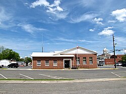
Summerville Depot Summerville-Depot-ga.jpg
Summerville Depot

There were 1,823 households, out of which 28.7% had children under the age of 18 living with them, 39.8% were married couples living together, 17.8% had a female householder with no husband present, and 37.4% were non-families. 33.0% of all households were made up of individuals, and 16.4% had someone living alone who was 65 years of age or older. The average household size was 2.39 and the average family size was 3.04.

In the city, the population was spread out, with 24.3% under the age of 18, 9.0% from 18 to 24, 26.5% from 25 to 44, 21.7% from 45 to 64, and 18.5% who were 65 years of age or older. The median age was 38 years. For every 100 females, there were 84.7 males. For every 100 females age 18 and over, there were 78.8 males.

The median income for a household in the city was $24,911, and the median income for a family was $35,579. Males had a median income of $26,707 versus $20,222 for females. The per capita income for the city was $15,090. About 18.1% of families and 20.7% of the population were below the poverty line, including 28.5% of those under age 18 and 20.3% of those age 65 or over.

Education

Public education in Summerville is administered by the Chattooga County School District. The district operates three elementary schools, one middle school, and one high school. [14] The district has 184 full-time teachers and over 2,834 students. [15]

World Friendship Flag Project Inc.

The World Friendship Flag Project Inc. is a nonprofit organization based in Summerville that focuses on childhood hunger and community engagement in Summerville through CARE and the Paradise Garden Foundation. [16] [17]

World Friendship Flag Project Inc.
Formation1995
FounderJohn Charles Turner
TypeChildhood hunger nonprofit
Headquarters214 W 1st Ave, Summerville, GA 30747
OriginsRotary Interact Club
Website www.worldfriendshipflag.com

History and influence on Summerville

The organization's founder, John Charles Turner, is a retired teacher who taught art at Chattooga High School. He was the advisor of the school's Rotary Interact Club where the World Friendship Flag was created. The flag was designed by Howard Finster, an artist who also resided in Summerville. [18] [19]

The flag was shown at the 1996 Atlanta Olympics. Brody Malone, a gymnast from Summerville, competed in the 2020 Tokyo Olympics and was given a signed World Friendship Flag. [20]

In 2021, Summerville began the annual Friendship Festival, which occurs in Dowdy Park on the last Saturday in July. Preceding the event is Friendship Week, a week-long event with activities intended to promote community engagement. [21] [22] Summerville has branded itself as the "friendship capital of the world." [23] [24]

In 2023, a pocket park known as the World Friendship Pocket Park was completed in Summerville. The park was funded by a "Buy a Brick" fundraiser which allowed people to purchase engraved bricks to be displayed in the park. [25] In the center of the park is the "Solid Rock of World Friendship," a commemorative rock for the World Friendship Flag Project. [26]

Notable people

See also

References

  1. "2020 U.S. Gazetteer Files". United States Census Bureau. Retrieved December 18, 2021.
  2. 1 2 "U.S. Census website". United States Census Bureau . Retrieved January 31, 2008.
  3. "US Board on Geographic Names". United States Geological Survey. October 25, 2007. Retrieved January 31, 2008.
  4. "Find a County". National Association of Counties. Retrieved June 7, 2011.
  5. Hellmann, Paul T. (May 13, 2013). Historical Gazetteer of the United States. Routledge. p. 248. ISBN   978-1135948597 . Retrieved November 30, 2013.
  6. "Summerville". Calhoun Times. September 1, 2004. p. 37. Retrieved April 24, 2015.
  7. 1 2 Elizabeth Cooksey, "Chattooga County," New Georgia Encyclopedia, 2005.
  8. Kenneth Thomas, Jr., National Register of Historic Places Inventory Form for Summerville Depot, December 1991.
  9. "Summerville Commercial Historic District Listed in the National Register of Historic Places". July 6, 2012.
  10. "U.S. Climate Normals Quick Access – Station: Summerville, GA". National Oceanic and Atmospheric Administration. Retrieved May 11, 2023.
  11. "NOAA Online Weather Data – NWS Atlanta". National Weather Service. Retrieved May 11, 2023.
  12. "Census of Population and Housing". Census.gov. Retrieved June 4, 2016.
  13. "Explore Census Data". data.census.gov. Retrieved December 17, 2021.
  14. Georgia Board of Education [ permanent dead link ], Retrieved June 3, 2010.
  15. School Stats, Retrieved June 3, 2010.
  16. "End World Hunger, Howard Finster | Summerville, GA". www.worldfriendshipflag.com. Retrieved October 27, 2025.
  17. Maze, Brent (July 15, 2024). "Retired teacher shares friendship flag with Selma". The Selma Times‑Journal. Retrieved October 28, 2025.
  18. Roberts, Buddy (February 9, 1995). "Best Quest Aims To Go Global". The Summerville News. pp. 1-B. Retrieved October 28, 2025.
  19. "World Friendship Flag In Selma, Alabama Last Week". AM 1180 Radio. Retrieved October 28, 2025.
  20. Staley, Dave (August 6, 2021). "Friendship Flag And Summerville - Stronger Than Ever". WDEF. Retrieved October 27, 2025.
  21. "Summerville Kicks Off Friendship Week, Culminates In Multicultural Festival This Saturday". AM 1180 Radio. Retrieved October 27, 2025.
  22. "Friendship Festival Today In Summerville". AM 1180 Radio. Retrieved October 28, 2025.
  23. "Visit Us". Chattoogachamber. Retrieved October 27, 2025.
  24. Street, From Summerville Main (July 2, 2021). "Summerville to host Friendship Festival July 31". Northwest Georgia News. Retrieved October 27, 2025.
  25. AllOnGeorgia (June 6, 2022). "World Friendship Pocket Park Project Offers Residents The Opportunity To Purchase Engraved Bricks To Adorn The Park". AllOnGeorgia. Retrieved October 27, 2025.
  26. "World Friendship Pocket Park Project". AM 1180 Radio. Retrieved October 27, 2025.