Cloudland, Georgia

Last updated

Cloudland
The Lookout Restaurant, Cloudland GA Nov 2020.jpg
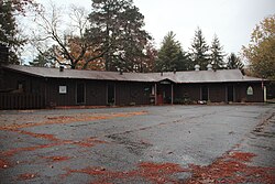
The Lookout Restaurant in Cloudland
USA Georgia location map.svg
Red pog.svg
Cloudland
Location in Georgia
Usa edcp location map.svg
Red pog.svg
Cloudland
Location in the United States
Coordinates: 34°30′57″N85°29′40″W / 34.51583°N 85.49444°W / 34.51583; -85.49444
CountryUnited States
State Georgia
County Chattooga

Cloudland is an unincorporated community in western Chattooga County in the U.S. state of Georgia. [1] It is located at an elevation of 1,498 feet atop Lookout Mountain, [2] a broad ridge that occupies northwestern Georgia and northeastern Alabama. Camp Juliette Low, named for founder Juliette Gordon Low, is located just northeast of town.

Contents

History

Cloudland had its start in the late 19th century as a summer resort. [3] The community was named after businessman A.C. Cloud. [4] A post office was in operation at Cloudland from 1916 until 1981. [5] [4]

See also

Flag of Georgia (U.S. state).svg  Georgia (U.S. state)portal

Related Research Articles

<span class="mw-page-title-main">Chattooga County, Georgia</span> County in Georgia, United States

Chattooga County is a county located in the northwestern part of the U.S. state of Georgia. As of the 2020 census, the population was 24,965. The county seat is Summerville. The county was created on December 28, 1838.

<span class="mw-page-title-main">Menlo, Georgia</span> City in Georgia, United States

Menlo is a small city in Chattooga County, Georgia, United States. The population was 474 at the 2010 census.

<span class="mw-page-title-main">Chattooga River</span> River in the Southeastern USA

The Chattooga River is the main tributary of the Tugaloo River.

The Chattooga River runs 64.4 miles (103.6 km) through northwest Georgia and northeast Alabama in the United States. The river begins in walker County, Georgia and flows southwest into Weiss Lake on the Coosa River in Alabama. This river is one of two rivers named Chattooga in the state of Georgia. The other, more famous Chattooga River forms part of the boundary between Georgia and South Carolina, and was the wild river featured in the book and movie Deliverance. The name Chattooga is likely from the Cherokee word gatsugi, which means "I have crossed".

<span class="mw-page-title-main">Georgia State Route 48</span> State highway in Georgia, United States

State Route 48 (SR 48) is a 12.6-mile-long (20.3 km) east–west state highway located entirely in Chattooga County in the northwestern part of the U.S. state of Georgia. The highway connects the Alabama state line with Summerville, via Cloudland and Menlo.

<span class="mw-page-title-main">Trion, Georgia</span> Town in Georgia, United States

Trion is a town in Chattooga County, Georgia, United States. The population was 1,960 at the 2020 census, down from 1,827 at the 2010 census. Trion is the second-largest incorporated community in Chattooga County, which has a population of approximately 26,000. Trion is known as the denim capital of the world because of the Mount Vernon manufacturing plant, which employs about 4,000 people.

<span class="mw-page-title-main">Georgia State Route 157</span> State highway in Georgia, United States

State Route 157 (SR 157) is a 39.1-mile-long (62.9 km) state highway that travels south-to-north through portions of Chattooga, Walker, and Dade counties in the northwestern part of the U.S. state of Georgia.

Berryton is an unincorporated community in Chattooga County, in the U.S. state of Georgia.

Chattoogaville is an unincorporated community in Chattooga County, in the U.S. state of Georgia. The community lies about 12 miles (19 km) south of the county seat at Summerville.

Chelsea is an unincorporated community in Chattooga County, in the U.S. state of Georgia.

Farmersville is an unincorporated community in Chattooga County, in the U.S. state of Georgia.

Gore is an unincorporated community in Chattooga County, in the U.S. state of Georgia.

Holland is an unincorporated community in Chattooga County, in the U.S. state of Georgia.

Pennville is an unincorporated community in Chattooga County, in the U.S. state of Georgia.

Shackelton is a ghost town in Chattooga County, in the U.S. state of Georgia.

Silver Hill is an unincorporated community in Chattooga County, in the U.S. state of Georgia.

Armuchee is an unincorporated community in both Floyd County and Chattooga County, Georgia, United States. The community is located along U.S. Route 27, 9 miles (14 km) north of Rome.

Alpine is an unincorporated community in Chattooga County, in the U.S. state of Georgia. The community is located on the northwest side of the Broomtown Valley in northwest Georgia, southeast of Menlo. It is on Georgia Route 337 north of Alpine Creek.

Beatum is an unincorporated community in Chattooga County, in the U.S. state of Georgia.

References

  1. U.S. Geological Survey Geographic Names Information System: Cloudland, Georgia
  2. U.S. Geological Survey. Dougherty Gap 7.5-minute topographic map, 2014. Acme Mapper
  3. "Cloudland". Calhoun Times. September 1, 2004. p. 36. Retrieved April 24, 2015.
  4. 1 2 Krakow, Kenneth K. (1975). Georgia Place-Names: Their History and Origins (PDF). Macon, GA: Winship Press. p. 46. ISBN   0-915430-00-2.
  5. "Chattooga County". Jim Forte Postal History. Archived from the original on February 5, 2016. Retrieved April 25, 2015.

Commons-logo.svg Media related to Cloudland, Georgia at Wikimedia Commons