
Walker County is a county located in the northwestern part of the U.S. state of Georgia. As of the 2010 census, the population was 68,756. The county seat is LaFayette. The county was created on December 18, 1833, from land formerly belonging to the Cherokee Indian Nation.

Chattooga County is a county located in the northwestern part of the U.S. state of Georgia. As of the 2010 census, the population was 26,015. According to the World Population Review, as of 2021, it is estimated at 24,803. The county seat is Summerville. The county was created on December 28, 1838.

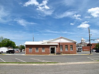
Lyerly is a town in Chattooga County, Georgia, United States. As of the 2020 census, the town had a population of 454.

Menlo is a small city in Chattooga County, Georgia, United States. The population was 474 at the 2010 census.
Summerville is a city and the county seat of Chattooga County, Georgia, United States. The population was 4,534 at the 2010 census.

LaFayette is a city in, and the county seat of, Walker County, Georgia, United States. As of the 2000 census, the city population was 6,702, which rose to 7,121 in 2010. It was founded as Chattooga.

The Chattooga River is the main tributary of the Tugaloo River.

The Chattahoochee–Oconee National Forest in northern Georgia comprises two United States National Forests, the Oconee National Forest in eastern Georgia and the Chattahoochee National Forest located in the North Georgia Mountains. The Chattahoochee National Forest is composed of an eastern and western forest. The western forest contains Johns Mountain, Little Sand Mountain, and Taylor Ridge (Georgia). The combined total area of the Chattahoochee–Oconee National Forest is 866,468 acres (3,506 km2), of which the Chattahoochee National Forest comprises 750,145 acres (3,036 km2) and the Oconee National Forest comprises 116,232 acres (470 km2). The county with the largest portion of the eastern forest is Rabun County, Georgia, which has 148,684 acres (601.7 km2) within its boundaries.
The Chattooga River runs 64.4 miles (103.6 km) through northwest Georgia and northeast Alabama in the United States. The river begins in Chattooga County, Georgia and flows into Weiss Lake on the Coosa River in Alabama. This river is one of two rivers named Chattooga in the state of Georgia. The other Chattooga River forms part of the boundary between Georgia and South Carolina.

Trion is a town in Chattooga County, Georgia, United States. The population was 1,827 as of the 2010 census, down from 1,993 at the 2000 census. Trion is the second-largest incorporated community in Chattooga County, which has a population of approximately 26,000. Trion is known as the denim capital of the world because of the Mount Vernon manufacturing plant, which employs about 4,000 people.

Cloudland is an unincorporated community in western Chattooga County in the U.S. state of Georgia. It is located at an elevation of 1,498 feet atop Lookout Mountain, a broad ridge that occupies northwestern Georgia and northeastern Alabama. The Girl Scouts' Camp Juliette Low, named for founder Juliette Gordon Low, is located just northeast of town.
Berryton is an unincorporated community in Chattooga County, in the U.S. state of Georgia.
Chattoogaville is an unincorporated community in Chattooga County, in the U.S. state of Georgia. The community lies about 12 miles (19 km) south of the county seat at Summerville.
Chelsea is an unincorporated community in Chattooga County, in the U.S. state of Georgia.
Farmersville is an unincorporated community in Chattooga County, in the U.S. state of Georgia.
Gore is an unincorporated community in Chattooga County, in the U.S. state of Georgia.

Subligna is an unincorporated community in Chattooga County, Georgia, United States.
Holland is an unincorporated community in Chattooga County, in the U.S. state of Georgia.
Pennville is an unincorporated community in Chattooga County, in the U.S. state of Georgia.
Silver Hill is an unincorporated community in Chattooga County, in the U.S. state of Georgia.


