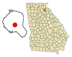
Homer, Georgia | |
---|---|
Coordinates: 34°20′08″N83°29′55″W / 34.33556°N 83.49861°W | |
Country | United States |
State | Georgia |
County | Banks |
Area | |
• Total | 9.84 sq mi (25.48 km2) |
• Land | 9.80 sq mi (25.39 km2) |
• Water | 0.04 sq mi (0.10 km2) |
Elevation | 837 ft (255 m) |
Population (2020) | |
• Total | 1,264 |
• Density | 128.95/sq mi (49.79/km2) |
Time zone | UTC-5 (Eastern (EST)) |
• Summer (DST) | UTC-4 (EDT) |
ZIP code | 30547 |
Area code | 706 |
FIPS code | 13-39720 [3] |
GNIS feature ID | 2405857 [2] |
Website | https://townofhomerga.com/ |
Homer is a town in Banks County, Georgia, United States. The population was 1,141 at the 2010 census. [4] The town is the county seat of Banks County. [5]
The community was named after Homer Jackson, a pioneer citizen. [6] Homer was founded in 1858 as seat for the newly established Banks County. [7] Homer was incorporated as a town in 1859, and its first courthouse was built in 1863.
According to the United States Census Bureau, the town has a total area of 9.7 square miles (25.0 km2), of which 9.6 square miles (24.9 km2) is land and 0.04 square miles (0.1 km2), or 0.38%, is water. [4]
Census | Pop. | Note | %± |
---|---|---|---|
1870 | 120 | — | |
1880 | 140 | 16.7% | |
1900 | 221 | — | |
1910 | 228 | 3.2% | |
1920 | 291 | 27.6% | |
1930 | 248 | −14.8% | |
1940 | 283 | 14.1% | |
1950 | 340 | 20.1% | |
1960 | 612 | 80.0% | |
1970 | 365 | −40.4% | |
1980 | 734 | 101.1% | |
1990 | 742 | 1.1% | |
2000 | 950 | 28.0% | |
2010 | 1,141 | 20.1% | |
2020 | 1,264 | 10.8% | |
2023 (est.) | 1,647 | [8] | 30.3% |
U.S. Decennial Census [9] |
As of the census [3] of 2000, there were 950 people, 366 households, and 249 families residing in the town. The population density was 99.1 inhabitants per square mile (38.3/km2). There were 406 housing units at an average density of 42.4 per square mile (16.4/km2). The racial makeup of the town was 84.32% White, 11.79% African American, 1.16% Native American, 0.84% Asian, 1.16% from other races, and 0.74% from two or more races. Hispanic or Latino people of any race were 2.00% of the population.
There were 366 households, out of which 36.3% had children under the age of 18 living with them, 54.4% were married couples living together, 10.4% had a female householder with no husband present, and 31.7% were non-families. 26.2% of all households were made up of individuals, and 12.6% had someone living alone who was 65 years of age or older. The average household size was 2.60 and the average family size was 3.16.
In the town, the population was spread out, with 28.1% under the age of 18, 10.5% from 18 to 24, 29.1% from 25 to 44, 20.5% from 45 to 64, and 11.8% who were 65 years of age or older. The median age was 33 years. For every 100 females, there were 95.5 males. For every 100 females age 18 and over, there were 95.1 males.
The median income for a household in the town was $35,500, and the median income for a family was $41,667. Males had a median income of $30,147 versus $23,438 for females. The per capita income for the town was $17,353. About 8.9% of families and 13.3% of the population were below the poverty line, including 14.3% of those under age 18 and 21.1% of those age 65 or over.
Homer is among the earliest to hold the world record for an Easter egg hunt - 80,000 eggs, listed in the 1985 Guinness Book of World Records. The event in the small town of 1,100 people is an Easter Sunday tradition that has lasted 47 years. The egg hunt each year draws about 5,000 egg hunters, children and adults. Even though it no longer holds the record, Homer has long touted its annual hunt as the world's largest.
Banks County students in kindergarten to grade twelve are in the Banks County School District, which consists of two elementary schools, a middle school and a high school. [10] The district has 150 full-time teachers and over 2,428 students. [11]
Colfax County is a county in the U.S. state of New Mexico. As of the 2020 census, the population was 12,387. Its county seat is Raton. It is south from the Colorado state line. This county was named for Schuyler Colfax (1823–1885), seventeenth Vice President of the United States under U.S. President Ulysses S. Grant.
Banks County is a county located in the northeastern part of the U.S. state of Georgia. As of the 2020 census, the population was 18,035, down from 18,395 in 2010. The county seat is Homer. The Old Banks County Courthouse is located in Homer and listed on the National Register of Historic Places. A new county courthouse was constructed adjacent to the old one in 1983.
Andalusia is a city in and the county seat of Covington County, Alabama, United States. At the 2020 census, the population was 8,805.
Hamilton is a city in and the county seat of Marion County, Alabama, United States. It incorporated in 1896 and since 1980 has been the county's largest city, surpassing Winfield. It was previously the largest town in 1910. At the 2020 census, the population was 7,042.
Danville is a city in Yell County, Arkansas, United States. The population was 2,409 at the 2010 census. Along with Dardanelle, it is one of two county seats for Yell County.
Lula is a city in Hall and Banks counties in the U.S. state of Georgia. Most of the city is in Hall County, with a small eastern portion of the city located in Banks County. The population was 2,822 at the 2020 census. The Hall County portion of Lula is part of the Gainesville, GA Metropolitan Statistical Area. Lula is the home of RailRoad Days, a yearly festival held usually every May. Lula is the railroad junction between the Atlanta northeast line and the Athens north line of Norfolk Southern Railway.
Summerville is a city and the county seat of Chattooga County, Georgia, United States. The population was 4,534 at the 2010 census.
Lyndon is a village in Whiteside County, Illinois, United States. The population was 648 at the 2010 census, up from 566 in 2000.
Huntsville is a city in Randolph County, Missouri, United States. The population was 1,376 at the 2020 census. It is the county seat of Randolph County.
Sparta is a town in Alleghany County, North Carolina, United States. As of the 2020 census, the population of the town was 1,834. It is the county seat of Alleghany County.
McConnelsville is a village in and the county seat of Morgan County, Ohio, United States, on the east bank of the Muskingum River. Located 21 miles (34 km) southeast of Zanesville and 26 miles (42 km) northwest of Marietta, the population was 1,667 at the 2020 census.
Mifflintown is a borough in and the county seat of Juniata County, Pennsylvania, United States. The population was 842 at the 2020 census.
Paducah is a town in Cottle County, Texas, United States. The population was 1,186 at the 2010 census, down from 1,498 in 2000. It is the county seat of Cottle County. It is just south of the Texas Panhandle and east of the Llano Estacado.
Madison is a town in Madison County, Virginia, United States. The population was 205 at the 2020 census. It is the county seat of Madison County.
Eastville is a town in Northampton County, Virginia, United States. The population was 300 at the 2020 census. It is the county seat of Northampton County. The Northampton County Courthouse Historic District is part of the Eastville Historic District at the county seat.
Hunts Point is a town in the Eastside, a region of King County, Washington, United States, and part of the Seattle metropolitan area. The town is on a small peninsula surrounded by Lake Washington, and is near the suburbs of Medina, Clyde Hill, Yarrow Point, and Kirkland, as well as the city of Bellevue. As of the 2020 census, the town had a total population of 457.
Madison is a city and former coal town in Boone County, West Virginia, United States. The population was 2,911 at the 2020 census. It is the county seat of Boone County.
Glenville is a town in and the county seat of Gilmer County, West Virginia, United States, along the Little Kanawha River. The population was 1,128 at the 2020 census. It is the home of Glenville State University.
Harrisville is a town and the county seat of Ritchie County, West Virginia, United States. Harrisville is located at the junction of State Routes 31 and 16, five miles south of U.S. 50. Within the community are an elementary school, the county board of education, many businesses, three banks, a library, offices of the Ritchie Gazette and The Pennsboro News, a municipal park, and North Bend Golf Course. North Bend Lake and North Bend State Park are located just outside town limits. Municipal elections are held every two years.
Balsam Lake is a village in, and the county seat of Polk County, Wisconsin, United States. The population was 1,009 at the 2010 census. The village is located within the Town of Balsam Lake.