Heron Bay, Georgia | |
|---|---|
| Coordinates: 33°20′21″N84°11′32″W / 33.33917°N 84.19222°W | |
| Country | United States |
| State | Georgia |
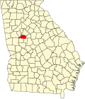
| Counties | Henry, Spalding |
| Area | |
• Total | 4.89 sq mi (12.68 km2) |
| • Land | 4.51 sq mi (11.68 km2) |
| • Water | 0.38 sq mi (0.99 km2) |
| Elevation | 781 ft (238 m) |
| Population (2020) | |
• Total | 4,679 |
| • Density | 1,037.24/sq mi (400.48/km2) |
| Time zone | UTC-5 (Eastern (EST)) |
| • Summer (DST) | UTC-4 (EDT) |
| Area code(s) | 770/678/470 |
| GNIS feature ID | 2583405 [2] |
Heron Bay is an unincorporated community and census-designated place (CDP) in Henry and Spalding counties in the U.S. state of Georgia. Its population was 4,679 as of the 2020 census.
| Census | Pop. | Note | %± |
|---|---|---|---|
| 2010 | 3,384 | — | |
| 2020 | 4,679 | 38.3% | |
| U.S. Decennial Census [3] 1850-1870 [4] 1870-1880 [5] 1890-1910 [6] 1920-1930 [7] 1940 [8] 1950 [9] 1960 [10] 1970 [11] 1980 [12] 1990 [13] 2000 [14] 2010 [15] 2020 [16] | |||
Heron Bay was first listed as a census designated place in the 2010 U.S. census. [15]
| Race / Ethnicity (NH = Non-Hispanic) | Pop 2010 [17] | Pop 2020 [16] | % 2010 | % 2020 |
|---|---|---|---|---|
| White alone (NH) | 1,355 | 1,069 | 40.04% | 22.85% |
| Black or African American alone (NH) | 1,618 | 2,989 | 47.81% | 63.88% |
| Native American or Alaska Native alone (NH) | 5 | 7 | 0.15% | 0.15% |
| Asian alone (NH) | 89 | 105 | 2.63% | 2.24% |
| Pacific Islander alone (NH) | 5 | 3 | 0.15% | 0.06% |
| Some Other Race alone (NH) | 1 | 22 | 0.03% | 0.47% |
| Mixed Race or Multi-Racial (NH) | 76 | 139 | 2.25% | 2.97% |
| Hispanic or Latino (any race) | 235 | 345 | 6.94% | 7.37% |
| Total | 3,384 | 4,679 | 100.00% | 100.00% |
As of the 2020 United States census, there were 4,679 people, 1,046 households, and 976 families residing in the CDP.