East Griffin, Georgia | |
---|---|
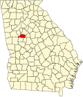
![]() Location in Spalding County and the state of Georgia | |
Coordinates: 33°14′21″N84°14′2″W / 33.23917°N 84.23389°W | |
Country | United States |
State | Georgia |
County | Spalding |
Area | |
• Total | 1.45 sq mi (3.76 km2) |
• Land | 1.43 sq mi (3.70 km2) |
• Water | 0.02 sq mi (0.06 km2) |
Elevation | 873 ft (266 m) |
Population (2020) | |
• Total | 1,561 |
• Density | 1,092.37/sq mi (421.78/km2) |
Time zone | UTC-5 (Eastern (EST)) |
• Summer (DST) | UTC-4 (EDT) |
FIPS code | 13-25440 [2] |
GNIS feature ID | 0331620 [3] |
East Griffin is an unincorporated community and census-designated place (CDP) in Spalding County, Georgia, United States. The population was 1,561 in 2020.
East Griffin is located at 33°14′21″N84°14′2″W / 33.23917°N 84.23389°W (33.239156, -84.233786). [4]
According to the United States Census Bureau, the CDP has a total area of 1.6 square miles (4.1 km2), of which 1.5 square miles (3.9 km2) is land and 0.64% is water.
Census | Pop. | Note | %± |
---|---|---|---|
1950 | 1,539 | — | |
1960 | 1,715 | 11.4% | |
1970 | 1,479 | −13.8% | |
1980 | 1,570 | 6.2% | |
1990 | 1,569 | −0.1% | |
2000 | 1,635 | 4.2% | |
2010 | 1,451 | −11.3% | |
2020 | 1,561 | 7.6% | |
U.S. Decennial Census [5] 1850-1870 [6] 1870-1880 [7] 1890-1910 [8] 1920-1930 [9] 1940 [10] 1950 [11] 1960 [12] 1970 [13] 1980 [14] 1990 [15] 2000 [16] 2010 [17] 2020 [18] |
Race / Ethnicity (NH = Non-Hispanic) | Pop 2000 [19] | Pop 2010 [17] | Pop 2020 [18] | % 2000 | % 2010 | % 2020 |
---|---|---|---|---|---|---|
White alone (NH) | 1,362 | 967 | 959 | 83.30% | 66.64% | 61.43% |
Black or African American alone (NH) | 194 | 392 | 408 | 11.87% | 27.02% | 26.14% |
Native American or Alaska Native alone (NH) | 6 | 1 | 5 | 0.37% | 0.07% | 0.32% |
Asian alone (NH) | 7 | 0 | 3 | 0.43% | 0.00% | 0.19% |
Pacific Islander alone (NH) | 0 | 0 | 0 | 0.00% | 0.00% | 0.00% |
Some Other Race alone (NH) | 1 | 1 | 5 | 0.06% | 0.07% | 0.32% |
Mixed Race or Multi-Racial (NH) | 23 | 31 | 68 | 1.41% | 2.14% | 4.36% |
Hispanic or Latino (any race) | 42 | 59 | 113 | 2.57% | 4.07% | 7.24% |
Total | 1,635 | 1,451 | 1,561 | 100.00% | 100.00% | 100.00% |
East Griffin first appeared as an unincorporated place in the 1950 U.S. census and was designated a census designated place in the 1980 U.S. census. [11] [14] [13]
Montgomery is an unincorporated community and census-designated place (CDP) in Chatham County, Georgia, United States. The population was 4,443 at the 2020 United States census, down slightly from 4,523 in 2010. It is a suburb of Savannah and is part of the Savannah metropolitan area.
Bonanza is an unincorporated community and census-designated place (CDP) in Clayton County, Georgia, United States. The population was 3,135 at the 2010 census, and 4,406 in 2020.
Conley is an unincorporated community and census-designated place (CDP) in Clayton County, Georgia, United States. It is at Atlanta's southeast corner, 7.98 miles from downtown. The population was 6,680 at the 2020 census. It is part of the Atlanta metropolitan area.
Irondale is an unincorporated community and census-designated place (CDP) in Clayton County, Georgia, United States. The population was 8,740 at the 2020 census.
Fair Oaks is an unincorporated community and census-designated place (CDP) in Cobb County, Georgia, United States. The population was 9,028 at the 2020 census.
Vinings is an unincorporated community and census-designated place (CDP) in Cobb County, Georgia, United States that runs along the Chattahoochee River bank across from Buckhead. As of the 2020 census, the CDP had a total population of 12,581. Located next to the affluent Paces section of Buckhead in northwest Atlanta, Vinings is known for its historic sites, shopping districts, proximity to local freeways and The Battery, and nearby nature areas. The United States Postal Service assigns "Atlanta" to the ZIP Code (30339) that includes Vinings.
East Newnan is an unincorporated community and census-designated place (CDP) in Coweta County, Georgia, United States. The population was 1,022 in 2020.
Belvedere Park is an unincorporated community and census-designated place (CDP) in DeKalb County, Georgia, United States. The population was 15,113 at the 2020 census.
Candler-McAfee is an unincorporated community and census-designated place (CDP) in DeKalb County, Georgia, United States. It is located east of Atlanta approximately 10 miles (16 km) east of Downtown Atlanta and to the south of Decatur, Georgia The population was 22,468 in 2020.
Gresham Park is an unincorporated community and census-designated place (CDP) in DeKalb County, Georgia, United States. The population was 7,700 at the 2020 census.
North Decatur is an unincorporated community and census-designated place (CDP) in DeKalb County, Georgia, United States. The population was 18,511 in 2020.
Redan is an unincorporated community and census-designated place (CDP) in DeKalb County, Georgia, United States. As of the 2020 census, the CDP had a total population of 31,749. It is a predominantly African American community in eastern DeKalb County, and is a suburb of Atlanta.
Mountain Park is an unincorporated community and census-designated place (CDP) in Gwinnett County, Georgia, United States. The population was 11,554 at the 2010 census. The older name for the area is Trickum, which is reflected in Five Forks-Trickum Road which bisects the community. The older community was centered on Five Forks and Rockbridge Roads.
Hilltop is an unincorporated community and census-designated place (CDP) in Pike County, Georgia, United States. The population was 245 in 2020.
Coleman is a former incorporated city in Randolph County, Georgia, United States. It is listed as a census-designated place (CDP). The population was 149 at the 2000 census. The city was abolished by House Bill 1102 effective January 1, 2007, and no longer exists as a municipality.
Lakeview Estates, also known as Sunrise Lakes by local residents, is an unincorporated community and census-designated place (CDP) in Rockdale County, Georgia, United States. The population was 2,660 in 2020.
Experiment is an unincorporated community and census-designated place (CDP) in Spalding County, Georgia, United States. The population was 3,328 in 2020.
Hannahs Mill is an unincorporated community and census-designated place (CDP) in Upson County, Georgia, United States. The population was 3,267 at the 2000 census.
Lincoln Park is an unincorporated community and census-designated place (CDP) in Upson County, Georgia, United States. The population was 1,122 at the 2000 census.
Deenwood is an unincorporated community and census-designated place (CDP) in Ware County, Georgia, United States. The population was 2,207 at the 2020 census. It is part of the Waycross micropolitan statistical area. Deenwood Baptist Church is named after this geographical area.