Orchard Hill, Georgia

Last updated
Orchard Hill, Georgia
Orchard Hill City Hall.JPG
Orchard Hill City Hall, December 2013
Spalding County Georgia Incorporated and Unincorporated areas Orchard Hill Highlighted.svg
Location in Spalding County and the state of Georgia
Coordinates: 33°11′13″N84°12′41″W / 33.18694°N 84.21139°W / 33.18694; -84.21139 Coordinates: 33°11′13″N84°12′41″W / 33.18694°N 84.21139°W / 33.18694; -84.21139
Country United States
State Georgia
County Spalding
Area
[1]
  Total0.36 sq mi (0.93 km2)
  Land0.35 sq mi (0.92 km2)
  Water0.00 sq mi (0.01 km2)
Elevation
860 ft (262 m)
Population
 (2020)
  Total219
  Density616.90/sq mi (237.87/km2)
Time zone UTC-5 (Eastern (EST))
  Summer (DST) UTC-4 (EDT)
ZIP code
30266
Area code 770
FIPS code 13-58296 [2]
GNIS feature ID0320094 [3]

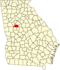
Orchard Hill is a town in Spalding County, Georgia, United States. The population was 230 at the 2000 census.

Contents

History

Orchard Hill was named for the setting of the original town site. [4] The Georgia General Assembly incorporated Orchard Hill as a town in 1912. [5]

Geography

Orchard Hill is located at 33°11′13″N84°12′41″W / 33.18694°N 84.21139°W / 33.18694; -84.21139 (33.186853, -84.211379). [6]

According to the United States Census Bureau, the town has a total area of 0.4 square miles (1.0 km2), all land.

Demographics

Historical population
CensusPop.
1980 162
1990 23947.5%
2000 230−3.8%
2010 209−9.1%
2020 2194.8%
U.S. Decennial Census [7]

As of the census [2] of 2000, there were 230 people, 89 households, and 70 families residing in the town. The population density was 646.9 inhabitants per square mile (249.8/km2). There were 94 housing units at an average density of 264.4 per square mile (102.1/km2). The racial makeup of the town was 96.52% White, 1.30% African American, 2.17% from other races. Hispanic or Latino of any race were 2.17% of the population.

There were 89 households, out of which 37.1% had children under the age of 18 living with them, 59.6% were married couples living together, 14.6% had a female householder with no husband present, and 21.3% were non-families. 16.9% of all households were made up of individuals, and 4.5% had someone living alone who was 65 years of age or older. The average household size was 2.58 and the average family size was 2.91.

In the town, the population was spread out, with 25.7% under the age of 18, 14.8% from 18 to 24, 24.3% from 25 to 44, 28.7% from 45 to 64, and 6.5% who were 65 years of age or older. The median age was 33 years. For every 100 females, there were 84.0 males. For every 100 females age 18 and over, there were 83.9 males.

The median income for a household in the town was $31,429, and the median income for a family was $37,500. Males had a median income of $30,481 versus $17,500 for females. The per capita income for the town was $14,215. About 7.1% of families and 9.0% of the population were below the poverty line, including none of those under the age of eighteen and 21.4% of those 65 or over.

See also

Related Research Articles

<span class="mw-page-title-main">Spalding County, Georgia</span> County in Georgia, United States

Spalding County is a county located in the west central portion of the U.S. state of Georgia. As of the 2020 census, the population was 67,306. The county seat is Griffin. The county was created December 20, 1851 and named for former United States representative and senator Thomas Spalding.

<span class="mw-page-title-main">Lamar County, Georgia</span> County in Georgia, United States

Lamar County is a county located in the west central portion of the U.S. state of Georgia. As of the 2010 census, the population was 18,317. The county seat is Barnesville.

<span class="mw-page-title-main">Girard, Georgia</span> Town in Georgia, United States

Girard is a town in Burke County, Georgia, United States. The population was 156 at the 2010 census. It is part of the Augusta, Georgia metropolitan area.

<span class="mw-page-title-main">Jenkinsburg, Georgia</span> City in Georgia, United States

Jenkinsburg is a city in Butts County, Georgia, United States. The population was 370 at the 2010 census.

<span class="mw-page-title-main">Moreland, Georgia</span> Town in Georgia, United States

Moreland is a town in Coweta County, Georgia, United States. As of the 2020 census, the town population was 382.

<span class="mw-page-title-main">Turin, Georgia</span> Town in Georgia, United States

Turin is a town in Coweta County, Georgia, United States. The population was 274 at the 2010 census. It is part of the Atlanta metropolitan area.

<span class="mw-page-title-main">Woolsey, Georgia</span> Town in Georgia, United States

Woolsey is a town in Fayette County, Georgia, United States. The population was 158 at the 2010 census.

<span class="mw-page-title-main">Union City, Georgia</span> City in Georgia, United States

Union City is a city in Fulton County, Georgia, United States. The population was 19,456 at the 2010 census.

<span class="mw-page-title-main">Ranger, Georgia</span> Town in Georgia, United States

Ranger is a town in Gordon County, Georgia, United States. The population was 131 at the 2010 census, up from 85 in 2000.

<span class="mw-page-title-main">Mountain Park, Gwinnett County, Georgia</span> CDP in Georgia, United States

Mountain Park is an unincorporated, census-designated place in Gwinnett County, Georgia, United States. The population was 11,554 at the 2010 census. The older name for the area is Trickum, which is reflected in Five Forks-Trickum Road which bisects the community. The older community was centered on Five Forks and Rockbridge Roads.

<span class="mw-page-title-main">Gay, Georgia</span> Town in Georgia, United States

Gay is a town in Meriwether County, Georgia, United States. The population was 110 at the 2020 census.

<span class="mw-page-title-main">Lone Oak, Georgia</span> Town in Georgia, United States

Lone Oak is a town in Meriwether County, Georgia, United States. The population was 104 at the 2000 census.

<span class="mw-page-title-main">Luthersville, Georgia</span> City in Georgia, United States

Luthersville is a city in Meriwether County, Georgia, United States. The population was 874 at the 2010 census.

<span class="mw-page-title-main">Concord, Georgia</span> Town in Georgia, United States

Concord is a town in Pike County, Georgia, United States. The population was 375 at the 2010 census.

<span class="mw-page-title-main">Bronwood, Georgia</span> Town in Georgia, United States

Bronwood is a town in Terrell County, Georgia, United States. As of the 2020 census, the city had a population of 334.

<span class="mw-page-title-main">Camak, Georgia</span> Town in Georgia, United States

Camak is a town in Warren County, Georgia, United States. The town is located just off Interstate 20 between Atlanta and Augusta. The population was 165 at the 2000 census.

<span class="mw-page-title-main">Laurel, Indiana</span> Town in Indiana, United States

Laurel is a town in Laurel Township, Franklin County, Indiana, United States. The population was 512 at the 2010 census.

<span class="mw-page-title-main">Parkway Village, Kentucky</span> City in Kentucky, United States

Parkway Village is a home rule-class city in Jefferson County, Kentucky, United States, and a part of the Louisville Metro government. It was developed in the 1920s and incorporated in 1941. The population was 650 at the 2010 census.

<span class="mw-page-title-main">Longville, Minnesota</span> City in Minnesota, United States

Longvillepronunciation  is a city in Cass County, Minnesota, United States. The population was 156 at the 2010 census. The city was named after its founder, Jim Long. It is roughly four hours north of the Twin Cities. It is part of the Brainerd Micropolitan Statistical Area. Minnesota State Highway 84 serves as a main route in the community, and Minnesota State Highway 200 is nearby. Longville is home to Longville Municipal Airport.

<span class="mw-page-title-main">Neville, Ohio</span> Village in Ohio, United States

Neville is a village in Clermont County, Ohio, United States, along the Ohio River. The population was 100 at the 2010 census.

References

  1. "2020 U.S. Gazetteer Files". United States Census Bureau. Retrieved December 18, 2021.
  2. 1 2 "U.S. Census website". United States Census Bureau . Retrieved 2008-01-31.
  3. "US Board on Geographic Names". United States Geological Survey. 2007-10-25. Retrieved 2008-01-31.
  4. Krakow, Kenneth K. (1975). Georgia Place-Names: Their History and Origins (PDF). Macon, GA: Winship Press. p. 167. ISBN   0-915430-00-2.
  5. Acts and Resolutions of the General Assembly of the State of Georgia. State printer. 1912. p. 1190.
  6. "US Gazetteer files: 2010, 2000, and 1990". United States Census Bureau. 2011-02-12. Retrieved 2011-04-23.
  7. "Census of Population and Housing". Census.gov. Retrieved June 4, 2015.

Commons-logo.svg Media related to Orchard Hill, Georgia at Wikimedia Commons