Lovejoy, Georgia | |
---|---|
Motto(s): A great place to grow and prosper | |
Coordinates: 33°26′39″N84°18′54″W / 33.44417°N 84.31500°W | |
Country | United States |
State | Georgia |
County | Clayton |
Area | |
• Total | 2.94 sq mi (7.61 km2) |
• Land | 2.91 sq mi (7.54 km2) |
• Water | 0.03 sq mi (0.07 km2) |
Elevation | 951 ft (290 m) |
Population (2020) | |
• Total | 10,122 |
• Density | 3,477.16/sq mi (1,342.38/km2) |
Time zone | UTC-5 (Eastern (EST)) |
• Summer (DST) | UTC-4 (EDT) |
ZIP code | 30250 |
Area code | 770 |
FIPS code | 13-47616 [2] |
GNIS feature ID | 0317440 [3] |
Website | www |
Lovejoy is a city in Clayton County, Georgia, United States. As of the 2010 census, the city had a population of 6,422, [4] up from 2,495 in 2000. During the American Civil War, it was the site of the Battle of Lovejoy's Station during the Atlanta Campaign of 1864. Lovejoy was incorporated as a town on September 16, 1861. [5]
Lovejoy is proposed by the Georgia Department of Transportation and MARTA to be the endpoint of metro Atlanta's first commuter rail line.
Around 1850, the location just north of Fosterville, GA, was positioned along the new railway from Atlanta to Macon. The trainstop there was named for a prosperous local planter, James Lankford Lovejoy. On early maps, the location is called "Lovejoys." [6] It became known as Lovejoy's Station by 1864, where it was the setting of a civil war battle during Sherman's campaign through Georgia. James Lovejoy left the region and died in Clinch County, Georgia in 1877.
The Georgia General Assembly incorporated Lovejoy as a town in 1891. [7]
Lovejoy was also the site of a cotton gin until 1932. [8]
In 1979, Betty Talmadge, former first-lady of Georgia, purchased the remnants of the Hollywood set "Tara," the fictional plantation featured in Gone With the Wind, and brought them to Lovejoy. [9] The main road through Lovejoy today is named "Tara Blvd." The remnants of Tara are available to be toured at the Lovejoy Plantation through www.savingtara.com.
Lovejoy is located in southern Clayton County at 33°26′39″N84°18′54″W / 33.44417°N 84.31500°W (33.444164, -84.315105). [10] It is bordered by Henry County to the south and the unincorporated community of Bonanza to the north. U.S. Routes 19 and 41 pass through the western part of Lovejoy, leading north 24 miles (39 km) to downtown Atlanta and south 14 miles (23 km) to Griffin.
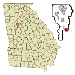
According to the United States Census Bureau, the city has a total area of 2.6 square miles (6.8 km2), of which 0.02 square miles (0.06 km2), or 0.91%, is water. [4]
Census | Pop. | Note | %± |
---|---|---|---|
1910 | 198 | — | |
1920 | 221 | 11.6% | |
1930 | 178 | −19.5% | |
1980 | 205 | — | |
1990 | 754 | 267.8% | |
2000 | 2,495 | 230.9% | |
2010 | 6,422 | 157.4% | |
2020 | 10,122 | 57.6% | |
2023 (est.) | 12,080 | [11] | 19.3% |
U.S. Decennial Census [12] |
Race | Num. | Perc. |
---|---|---|
White (non-Hispanic) | 932 | 9.21% |
Black or African American (non-Hispanic) | 7,709 | 76.16% |
Native American | 21 | 0.21% |
Asian | 105 | 1.04% |
Pacific Islander | 5 | 0.05% |
Other/Mixed | 334 | 3.3% |
Hispanic or Latino | 1,016 | 10.04% |
As of the 2020 United States census, there were 10,122 people, 1,756 households, and 1,272 families residing in the city.
As of the census [2] of 2000, there were 2,495 people, 491 households, and 369 families residing in the city. The population density was 1,064.3 inhabitants per square mile (410.9/km2). There were 596 housing units at an average density of 254.2 per square mile (98.1/km2). The racial makeup of the city was 64.09% White, 33.51% African American, 0.36% Native American, 0.60% Asian, 0.12% Pacific Islander, 0.60% from other races, and 0.72% from two or more races. Hispanic or Latino of any race were 2.44% of the population.
There were 491 households, out of which 41.5% had children under the age of 18 living with them, 50.7% were married couples living together, 19.1% had a female householder with no husband present, and 24.8% were non-families. 18.9% of all households were made up of individuals, and 3.9% had someone living alone who was 65 years of age or older. The average household size was 2.66 and the average family size was 2.99.
In the city, the population was spread out, with 17.2% under the age of 18, 19.2% from 18 to 24, 45.0% from 25 to 44, 14.9% from 45 to 64, and 3.7% who were 65 years of age or older. The median age was 30 years. For every 100 females, there were 265.3 males. For every 100 females age 18 and over, there were 314.9 males.
The median income for a household in the city was $40,139, and the median income for a family was $40,268. Males had a median income of $21,964 versus $23,229 for females. The per capita income for the city was $14,642. About 6.1% of families and 11.8% of the population were below the poverty line, including 13.8% of those under age 18 and 2.8% of those age 65 or over.
Clayton County Public Schools operates public schools. The schools in this area are: Lovejoy Middle School and Lovejoy High School.
In 1989, professional wrestler Jody Hamilton opened a school and training facility in Lovejoy. It was later moved to Atlanta and operated as the WCW Power Plant until 2001. [14]
MARTA serves the city. A planned commuter rail service is expected to terminate in the city.
Clayton County is located in the north central portion of the U.S. state of Georgia. As of 2021, the population was estimated to be 297,100 by the Census Bureau. The county seat is Jonesboro.
Nelson is a city in Pickens and Cherokee Counties, Georgia, United States. At the 2020 census, the population was 1,145. It is part of the Atlanta metropolitan area.
Bonanza is an unincorporated community and census-designated place (CDP) in Clayton County, Georgia, United States. The population was 3,135 at the 2010 census.
Conley is an unincorporated community and census-designated place (CDP) in Clayton County, Georgia, United States. It is at Atlanta's southeast corner, 7.98 miles from downtown. The population was 6,680 at the 2020 census. It is part of the Atlanta Metropolitan Area.
Forest Park is a city in Clayton County, Georgia, United States. It is located approximately nine miles (14 km) south of Atlanta and is part of the Atlanta–Sandy Springs–Marietta Metropolitan Statistical Area. As of the 2020 census, the city had a population of 19,932.
Irondale is an unincorporated community and census-designated place (CDP) in Clayton County, Georgia, United States. The population was 8,740 at the 2020 census.
Jonesboro is a city in and the county seat of Clayton County, Georgia, United States. The population was 4,724 as of the 2010 census.
Lake City is a city in Clayton County, Georgia, United States. The population was 2,612 at the 2010 census.
Morrow is a city in Clayton County, Georgia, United States. It is part of the Atlanta metropolitan area. Its population was 6,445 at the 2010 census, up from 4,882 in 2000. It is the home of Clayton State University and the Georgia Archives.
Vinings is an unincorporated community and census-designated place (CDP) in Cobb County, Georgia, United States that runs along the Chattahoochee River bank across from Buckhead. As of the 2020 census, the CDP had a total population of 12,581. Located next to the affluent Paces section of Buckhead in northwest Atlanta, Vinings is known for its historic sites, shopping districts, proximity to local freeways and The Battery, and nearby nature areas. The United States Postal Service assigns "Atlanta" to the ZIP Code (30339) that includes Vinings.
Belvedere Park is an unincorporated community and census-designated place (CDP) in DeKalb County, Georgia, United States. The population was 15,113 at the 2020 census.
Clarkston is a city in DeKalb County, Georgia, United States. The population was 14,756 as of the 2020 census, up from 7,554 in 2010.
Gresham Park is an unincorporated community and census-designated place (CDP) in DeKalb County, Georgia, United States. The population was 7,700 at the 2020 census.
Tyrone is a town in Fayette County, Georgia, United States. The population was 6,879 at the 2010 census, up from 3,916 in 2000. The estimated population in 2018 was 7,388. It is a part of the Atlanta metropolitan area.
Lilburn is a city in Gwinnett County, Georgia, United States. The population was 14,502 at the 2020 census. The estimated population was 12,810 in 2019. It is a part of the Atlanta metropolitan area.
Hampton is a city in southwestern Henry County, Georgia, United States. The 2020 census was 8,368. As of the 2010 census, the city had a population of 6,987, up from 3,857 at the 2000 census. By 2018 the estimated population was 7,922. "Hampton" mailing addresses outside the city limits reach into rural parts of eastern Clayton County and northern Spalding County. It is a southeastern suburb in the Atlanta metropolitan area.
Milner is a city in Lamar County, Georgia, United States. The population was 610 at the 2010 census, up from 522 at the 2000 census. Milner is part of Metro Atlanta.
Hiram is a city in Paulding County, Georgia, United States. As of the 2020 census, the population is 4,929.
Experiment is an unincorporated community and census-designated place (CDP) in Spalding County, Georgia, United States. The population was 3,233 at the 2000 census.
Clayton is a city in Clayton County, Iowa, United States. The population was 45 at the 2020 census, down from 55 in 2000. Clayton is located directly on the Mississippi River and is only accessible via a very steep road.