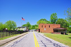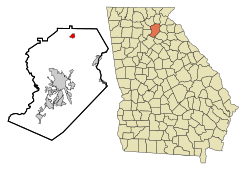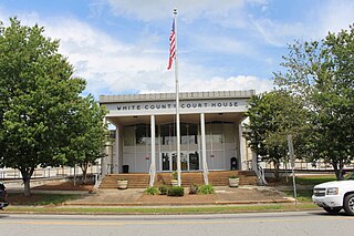
White County is a county located in the northeastern part of the U.S. state of Georgia. As of the 2020 census, the population was 28,003. The county seat is Cleveland. The county was created on December 22, 1857, formerly a part of Habersham County and most likely was named for Newton County Representative David T. White, who helped a Habersham representative successfully attain passage of an act creating the new county.

Towns County is a county located in the northeastern part of the U.S. state of Georgia. As of the 2020 census, the population was 12,493. Its county seat is Hiawassee. The county was created on March 6, 1856, and named for lawyer, legislator, and politician George W. Towns.

Hall County is a county located in the northeast portion of the U.S. state of Georgia. As of the 2020 census, the population was 203,136, up from 179,684 at the 2010 census. The county seat is Gainesville. The entirety of Hall County comprises the Gainesville, Georgia, Metropolitan Statistical Area, which is also part of the Atlanta-Athens-Clarke County-Sandy Springs, Combined Statistical Area.

Lula is a city in Hall and Banks counties in the U.S. state of Georgia. Most of the city is in Hall County, with a small eastern portion of the city located in Banks County. The population was 2,822 at the 2020 census. The Hall County portion of Lula is part of the Gainesville, GA Metropolitan Statistical Area. Lula is the home of RailRoad Days, a yearly festival held usually every May. Lula is the railroad junction between the Atlanta northeast line and the Athens north line of Norfolk Southern Railway.

Turin is a town in Coweta County, Georgia, United States. The population was 274 at the 2010 census. It is part of the Atlanta metropolitan area.

Rest Haven is a town primarily in northern Gwinnett and partly in southern Hall counties in the U.S. state of Georgia. As of the 2010 census, it had a total population of 62.

Oakwood is a city in Hall County, Georgia, United States. It is part of the Gainesville, Georgia Metropolitan Statistical Area. The population was 4,822 at the 2020 census, up from 3,970 in 2010. Oakwood is home to the University of North Georgia Gainesville Campus and Wayne Farms.

Bowersville is a town in Hart County, Georgia, United States. As of the 2020 census, the town had a population of 444.

Hampton is a city in southwestern Henry County, Georgia, United States. The 2020 census was 8,368. As of the 2010 census, the city had a population of 6,987, up from 3,857 at the 2000 census. By 2018 the estimated population was 7,922. "Hampton" mailing addresses outside the city limits reach into rural parts of eastern Clayton County and northern Spalding County. It is a southeastern suburb in the Atlanta metropolitan area.

Pendergrass is a city in Jackson County, Georgia, United States. The population was 1692 at the time of the 2020 census.

Talmo is a town in Jackson County, Georgia, United States. The population was 257 at the 2020 census.

Gainesville is a city in Ozark County, Missouri, United States. The population was 745 at the 2020 census. It is the county seat of Ozark County.

Silver Springs is a village in Wyoming County, New York, United States. The population was 782 at the 2010 census.

Batavia is a village in and the county seat of Clermont County, Ohio, United States. The population was 1,972 at the 2020 census. It is part of the Cincinnati metropolitan area.
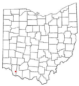
Bethel is a village in Tate Township, Clermont County, Ohio, United States. The population was 2,620 at the 2020 census. Bethel was founded in 1798 by Obed Denham as Denham Town, in what was then the Northwest Territory. Bethel is the home of the first movie theater in Ohio which was founded in 1908 by Aaron Little.

Felicity is a village in Franklin Township, Clermont County, Ohio, United States. The population was 651 at the [[2020 United States Census|2020 census.

Mulberry is a census-designated place (CDP) in Miami Township, Clermont County, Ohio, United States. The population was 3,459 at the 2020 census.

Summerside is a census-designated place (CDP) in Union Township, Clermont County, Ohio, United States. Its population was 4,941 as of the 2020 census.
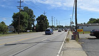
Withamsville is a census-designated place (CDP) in Pierce and Union townships of Clermont County, Ohio, United States. The population was 7,357 at the 2020 census.
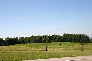
Gainesville is an incorporated town in Wyoming County, New York. The population was 2,333 at the 2000 census. The town is named after General Edmund P. Gaines.
