
Spartanburg County is a county located on the northwestern border of the U.S. state of South Carolina. As of the 2020 census, the population was 327,997, making it the fifth-most populous county in South Carolina. Its county seat is Spartanburg.

Porterdale is a town in Newton County, Georgia, the United States. The population was 1,429 at the 2010 census.

Volga is a city in Clayton County, Iowa, United States. The population was 203 at the time of the 2020 census, down from 247 in 2000.

Brownville is a town in Piscataquis County, Maine, United States. The population was 1,139 at the 2020 census. The town includes the villages of Brownville, Knight's Landing and Brownville Junction, near which passes the 100-Mile Wilderness of the Appalachian Trail.
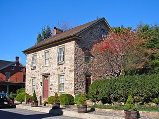
Landisburg is a borough in Perry County, Pennsylvania, United States. The population was 220 at the 2010 census. It is part of the Harrisburg–Carlisle Metropolitan Statistical Area.

Central Pacolet is a town in Spartanburg County, South Carolina, United States, along the Pacolet River. The population was 216 at the 2010 census.
Pacolet is a town in Spartanburg County, South Carolina, United States. The population was 2,235 at the 2010 census.
CFAX is a news/talk radio station in Victoria, British Columbia, Canada. It was independently run until September 30, 2004, when it was taken over by Canadian media company CHUM Limited. Its sister station is CHBE-FM, which began broadcasting in 2000. It is now owned by Bell Media through its Bell Media Radio division.
The Pacolet River is a tributary of the Broad River, about 50 miles (80 km) long, in northwestern South Carolina in the United States. One of its principal headwaters tributaries also drains a small portion of western North Carolina. Via the Broad and Congaree rivers, it is part of the watershed of the Santee River, which flows to the Atlantic Ocean. The stream's name has also been spelled historically as "Pacolate River".
Bughtlin is a suburb of Edinburgh, the capital of Scotland. It is east of the A902.
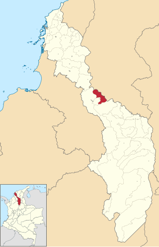
Talaigua Nuevo is a town and municipality located in the Bolívar Department, northern Colombia.
White Sulphur Springs is a hamlet in Liberty, Sullivan County, New York, United States. It is a rural area, and at one point it was surrounded by small dairy farms and had a cheese factory within its bounds.
Underwood is a village in the Municipality of Kincardine, Bruce County, Ontario, Canada, located just south of North Bruce on Highway 21.

Lockwood, Greene & Company was an American engineering firm. It was active under various names from 1871 to 2017.
Earle Sumner Draper (1893–1994) was an American town planner and a landscape designer, who is famous for having coined the term "urban sprawl".

Pacolet Mill Office, also known as Pacolet Municipal Building and Town Hall, is a historic office building located at Pacolet, Spartanburg County, South Carolina. It built in 1908 by the Pacolet Manufacturing Company. It is a one-story, brick building with full-height basement level. It has a low-pitched hip roof with flared eaves and decorative exposed rafter tails. The roof is clad with clay Spanish tile. The site features a curving cast stone or concrete pergola added some time between 1920 and 1927. In 2004, the building became the town hall for the Town of Pacolet.

Chicopee is a former mill village located approximately four miles south of downtown Gainesville, and is in Hall County, Georgia, United States.
Pitchin is an unincorporated community in Clark County, in the U.S. state of Ohio.
Swords is an unincorporated community in Morgan County, in the U.S. state of Georgia.
Parmerton is a ghost town in Parmer County, Texas, United States. It was originally known as Parmer Switch when the Pecos Valley and Northern Texas Railway built a line through the area in 1898 and it was named for Martin Parmer. The town was composed of 200 acres of land formerly owned by the XIT Ranch and had been used for wheat farming. A one-story courthouse was built at the midway point between Bovina and Friona and a post office was established in September 1907, shortly after Parmerton was voted Parmer County seat. After significant political intrigue, a second election was held in December 1907, after which Parmerton was stripped of its status in favor of Farwell. The post office closed in 1908 and Parmerton went into decline; today, nothing remains except for an historical marker and a railroad switch.

