Montezuma, Georgia

Last updated

Montezuma, Georgia
Montezuma City Hall.JPG
Montezuma City Hall in Montezuma
Motto(s): 
"Great future, rich past"
Macon County Georgia Incorporated and Unincorporated areas Montezuma Highlighted.svg
Location in Macon County and the state of Georgia
Coordinates: 32°18′10″N84°1′38″W / 32.30278°N 84.02722°W / 32.30278; -84.02722
Country United States
State Georgia
County Macon
Area
[1]
  Total4.63 sq mi (12.00 km2)
  Land4.57 sq mi (11.82 km2)
  Water0.07 sq mi (0.18 km2)
Elevation
364 ft (111 m)
Population
 (2020) [2]
  Total3,047
  Density667.47/sq mi (257.73/km2)
Time zone UTC-5 (Eastern (EST))
  Summer (DST) UTC-4 (EDT)
ZIP code
31063
Area code 478
FIPS code 13-52304 [3]
GNIS feature ID0332410 [4]
Website www.montezuma-ga.org

Montezuma is a city in Macon County, Georgia (ZIP code 31063). The population was 3,047 at the 2020 census, [2] down from 3,460 in 2010. It is home to the armory of Bravo Company, 648th Engineers of the Georgia Army National Guard.

Contents

History

Montezuma had its start in 1851, when the railroad was extended to that point. [5] The city was named after the famous Aztec leader by soldiers returning from the Mexican American War and was incorporated in 1854. [6]

Montezuma is home to a thriving Mennonite community, founded when 10 to 15 Mennonite families moved from Virginia in the 1950s. [7]

Geography

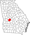
Montezuma is in south-central Macon County, on the east side of the Flint River. It is bordered to the west across the river by Oglethorpe, the Macon county seat. Several state highways converge in Montezuma. State Route 26 (Walnut Street) passes through the south side of the city, leading east 35 miles (56 km) to Hawkinsville and west past Oglethorpe 18 miles (29 km) to Ellaville. State Route 90 passes through the center of Montezuma, leading southeast 21 miles (34 km) to Vienna and northwest 20 miles (32 km) to Rupert. State Route 49 also passes through the city center, leading northeast 13 miles (21 km) to Marshallville and southwest 11 miles (18 km) to Andersonville.

According to the United States Census Bureau, the city has a total area of 4.6 square miles (12 km2), of which 0.07 square miles (0.18 km2), or 1.49%, are water. [1]

Demographics

Historical population
CensusPop.Note
1880 440
1890 70660.5%
1900 90327.9%
1910 1,63080.5%
1920 1,82712.1%
1930 2,28425.0%
1940 2,3462.7%
1950 2,92124.5%
1960 3,74428.2%
1970 4,12510.2%
1980 4,83017.1%
1990 4,506−6.7%
2000 3,999−11.3%
2010 3,460−13.5%
2020 3,047−11.9%
U.S. Decennial Census [8]
1850-1870 [9] 1880 [10]
1890-1910 [11] 1920-1930 [12]
1930-1940 [13] 1940-1950 [14]
1960-1980 [15] 1990 [16]
Montezuma racial composition as of 2020 [17]
RaceNum.Perc.
White (non-Hispanic)60919.99%
Black or African American (non-Hispanic)2,17571.38%
Native American 20.07%
Asian 912.99%
Pacific Islander 20.07%
Other/Mixed 461.51%
Hispanic or Latino 1224.0%

As of the 2020 United States census, there were 3,047 people, 1,276 households, and 898 families residing in the city.

Education

Education is provided by the Macon County School District. Macon County Middle School, and Macon County High School, are both located in Montezuma. [18] [19]

Notable people

Related Research Articles

<span class="mw-page-title-main">Putnam County, Georgia</span> County in Georgia, United States

Putnam County is a county located in the central portion of the U.S. state of Georgia. As of the 2020 census, the population was 22,047. The county seat is Eatonton.

<span class="mw-page-title-main">Wayne County, Georgia</span> County in Georgia, United States

Wayne County is a county located in the southeastern part of the U.S. state of Georgia. As of the 2020 census, the population was 30,144. The county seat is Jesup.

<span class="mw-page-title-main">Taliaferro County, Georgia</span> County in Georgia, United States

Taliaferro County is a county located in the U.S. state of Georgia. As of the 2020 census, the population was 1,559, down from the 2010 census when the population was 1,717, making it the least populous county in Georgia and the second-least populous county east of the Mississippi River. The county seat is Crawfordville.

<span class="mw-page-title-main">Macon County, Georgia</span> County in Georgia, United States

Macon County is a county located in the west central portion of the U.S. state of Georgia. As of the 2020 census, the population was 12,082. The county seat is Oglethorpe.

<span class="mw-page-title-main">Bibb County, Georgia</span> County in Georgia, United States

Bibb County is located in the U.S. state of Georgia. As of the 2020 census, its population was 157,346. Bibb County is geographically located in the Central Georgia region, and is the largest county in the Macon metropolitan area.

<span class="mw-page-title-main">Alma, Georgia</span> City in Georgia, United States

Alma is a city in Bacon County, Georgia, United States, and the county seat. As of the 2020 census, the city had a population of 3,433.

<span class="mw-page-title-main">Allentown, Georgia</span> City in Georgia, United States

Allentown is a city in Bleckley, Laurens, Twiggs, and Wilkinson counties in the U.S. state of Georgia, primarily in Wilkinson County. As of the 2010 census, the city had a population of 169, down from 287 at the 2000 census. In 2020, its population was 195. The Twiggs County portion is part of the Macon metropolitan statistical area, while the Laurens County portion is part of the Dublin micropolitan statistical area. The remaining Wilkinson and Bleckley County portions are not part of any metropolitan or micropolitan area.

<span class="mw-page-title-main">Fort Oglethorpe, Georgia</span> City in Georgia, United States

Fort Oglethorpe is a city predominantly in Catoosa County with some portions in Walker County in the U.S. state of Georgia. As of the 2020 census, the city had a population of 10,423. It is part of the Chattanooga, TN–GA Metropolitan Statistical Area. It is home to Lakeview – Fort Oglethorpe High School.

<span class="mw-page-title-main">Trenton, Georgia</span> City in Georgia, United States

Trenton is a city and the only incorporated municipality in Dade County, Georgia, United States—and as such, it serves as the county seat. The population was 2,195 at the 2020 census. Trenton is part of the Chattanooga, Tennessee–GA Metropolitan Statistical Area.

<span class="mw-page-title-main">Dooling, Georgia</span> Town in Georgia, United States

Dooling is a town in Dooly County, Georgia, United States. The population was 68 at the 2020 census.

<span class="mw-page-title-main">Lilly, Georgia</span> City in Georgia, United States

Lilly is a city in Dooly County, Georgia, United States. The population was 129 in 2020.

<span class="mw-page-title-main">Gray, Georgia</span> City in Georgia, United States

Gray is a city in Jones County, Georgia, United States. The population was 3,276 at the 2010 census, up from 1,811 at the 2000 census. In 2020, its population was 3,436. The city is the county seat of Jones County. It is part of the Macon metropolitan area.

<span class="mw-page-title-main">Barnesville, Georgia</span> City in Georgia, United States

Barnesville is a city in Lamar County, Georgia, United States. As of the 2010 census, the city had a population of 6,755, up from 5,972 at the 2000 census. The city is the county seat of Lamar County and is part of the Atlanta metropolitan area.

<span class="mw-page-title-main">Ideal, Georgia</span> City in Georgia, United States

Ideal is a city in Macon County, Georgia, United States. The population was 407 at the 2020 census, down from 499 in 2010.

<span class="mw-page-title-main">Marshallville, Georgia</span> City in Georgia, United States

Marshallville is a city in Macon County, Georgia, United States. The population was 1,048 at the 2020 census, down from 1,448 in 2010.

<span class="mw-page-title-main">Oglethorpe, Georgia</span> City in Georgia, United States

Oglethorpe is a city in Macon County, Georgia, United States. The population was 995 at the 2020 census, down from 1,328 in 2010. The city is the county seat of Macon County. It was named for Georgia's founder, James Oglethorpe.

<span class="mw-page-title-main">Buena Vista, Georgia</span> City in Georgia, United States

Buena Vista is a city in Marion County, Georgia, United States. It is part of the Columbus, Georgia-Alabama metropolitan statistical area. The population was 1,585 at the 2020 census, down from 2,173 in 2010. Formerly known as "Pea Ridge", the city changed its name to Buena Vista in honor of Zachary Taylor's victory in the Mexican–American War. The city is the county seat of Marion County. It is the birthplace of baseball legend Josh Gibson and Medal of Honor recipient Luther H. Story.

<span class="mw-page-title-main">Lexington, Georgia</span> City in Georgia, United States

The city of Lexington is the county seat of Oglethorpe County, Georgia, United States. The population was 239 at the 2000 census.

<span class="mw-page-title-main">Rossville, Georgia</span> City in Georgia, United States

Rossville is a city in Walker County, Georgia, United States. The population was 3,980 at the 2020 census. It is part of the Chattanooga, TN–GA Metropolitan Statistical Area.

<span class="mw-page-title-main">Waynesboro, Georgia</span> City in Georgia, United States

Waynesboro is a city and the county seat of Burke County, Georgia, United States. The population was 5,766 at the 2010 census. It is part of the Augusta, Georgia metropolitan area.

References

  1. 1 2 "2022 U.S. Gazetteer Files: Georgia". United States Census Bureau. Retrieved January 19, 2023.
  2. 1 2 "P1. Race – Montezuma city, Georgia: 2020 DEC Redistricting Data (PL 94-171)". U.S. Census Bureau. Retrieved January 19, 2023.
  3. "U.S. Census website". United States Census Bureau . Retrieved January 31, 2008.
  4. "US Board on Geographic Names". United States Geological Survey. October 25, 2007. Retrieved January 31, 2008.
  5. Krakow, Kenneth K. (1975). Georgia Place-Names: Their History and Origins (PDF). Macon, GA: Winship Press. p. 150. ISBN   0-915430-00-2.
  6. Acts Passed by the General Assembly of Georgia. J. Johnston. 1854. p. 232.
  7. Watson, Stephanie; Lisa Wojna (2008). Weird, Wacky, and Wild Georgia Trivia. Blue Bike Books. p. 59. ISBN   978-1-897278-44-4.
  8. "Decennial Census of Population and Housing by Decades". US Census Bureau.
  9. "1870 Census of Population - Georgia" (PDF). US Census Bureau . 1870.
  10. "1880 Census of Population - Georgia" (PDF). US Census Bureau . 1880.
  11. "1910 Census of Population - Georgia" (PDF). US Census Bureau . 1930.
  12. "1930 Census of Population - Georgia" (PDF). US Census Bureau . 1930. p. 253.
  13. "1940 Census of Population - Georgia" (PDF). US Census Bureau . 1940.
  14. "1950 Census of Population - Georgia" (PDF). US Census Bureau . 1980.
  15. "1980 Census of Population - Number of Inhabitants - Georgia" (PDF). US Census Bureau . 1980.
  16. "1990 Census of Population - General Population Characteristics - Georgia" (PDF). US Census Bureau . 1990.
  17. "Explore Census Data". data.census.gov. Retrieved December 18, 2021.
  18. "Macon County Middle School". Macon County School District. Retrieved April 20, 2021.
  19. "Macon County High School". Macon County School District. Retrieved April 20, 2021.
  20. "Negro Leagues Baseball eMuseum: Personal Profiles: James Colzie". www.nlbemuseum.com. Retrieved August 20, 2020.