Fair Oaks, Georgia

Last updated

Fair Oaks, Georgia
Fair Oaks United Methodist Church, Cobb County, GA April 2017.jpg
Fair Oaks United Methodist Church
Cobb County Georgia Incorporated and Unincorporated areas Fair Oaks Highlighted.svg
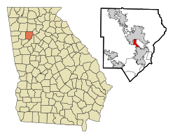
Location in Cobb County and the state of Georgia
Coordinates: 33°55′11″N84°32′40″W / 33.91972°N 84.54444°W / 33.91972; -84.54444
Country United States
State Georgia
County Cobb
Area
[1]
  Total1.96 sq mi (5.09 km2)
  Land1.96 sq mi (5.08 km2)
  Water0.00 sq mi (0.00 km2)
Elevation
1,102 ft (336 m)
Population
 (2020)
  Total9,028
  Density4,600/sq mi (1,800/km2)
Time zone UTC-5 (Eastern (EST))
  Summer (DST) UTC-4 (EDT)
Area code(s) 770/678/470
FIPS code 13-28520 [2]
GNIS feature ID0331684 [3]

Fair Oaks is an unincorporated community and census-designated place (CDP) in Cobb County, Georgia, United States. The population was 9,028 at the 2020 census.

Contents

Fair Oaks lies just outside the city limits of Smyrna and Marietta, and the area uses "Smyrna" or "Marietta" for its mailing addresses. Except for actual residents of Fair Oaks, very few locals even know it exists as a separately-counted area. The name is also rarely used by local businesses, even in the immediate area.

The area was named for its many mature native oak trees. This, however, is threatened by nearby Dobbins Air Reserve Base and new Federal Aviation Administration regulations regarding flight paths for takeoff and landing. In 2005, the lower house of the Georgia General Assembly passed a resolution in support of the community, which was built in the early 20th century, well before the military base.

Geography

Fair Oaks is located at 33°55′11″N84°32′40″W / 33.91972°N 84.54444°W / 33.91972; -84.54444 (33.919802, -84.544507). [4]

According to the United States Census Bureau, the CDP has a total area of 2.0 square miles (5.2 km2), of which 0.51% is water.

Demographics

Historical population
CensusPop.Note
1950 3,181
1960 7,543137.1%
1980 8,486
1990 6,996−17.6%
2000 8,44320.7%
2010 8,225−2.6%
2020 9,0289.8%
U.S. Decennial Census [5]
1850-1870 [6] 1870-1880 [7]
1890-1910 [8] 1920-1930 [9]
1940 [10] 1950 [11] 1960 [12]
1970 [13] 1980 [14] 1990 [15]
2000 [16] 2010 [17] 2020 [18]

Fair Oaks was listed as an unincorporated place in the 1950 U.S. Census [11] and in the 1960 U.S. Census. [11] It was no longer listed in the 1970 U.S. Census. [13] It was designated a census designated place in the 1980 U.S. Census. [14]

2020

Fair Oaks CDP, Georgia – Racial and Ethnic Composition
(NH = Non-Hispanic)
Note: the US Census treats Hispanic/Latino as an ethnic category. This table excludes Latinos from the racial categories and assigns them to a separate category. Hispanics/Latinos may be of any race.
Race / EthnicityPop 2000 [19] Pop 2010 [17] Pop 2020 [18] % 2000% 2010% 2020
White alone (NH)3,1631,9541,46337.46%23.76%16.21%
Black or African American alone (NH)1,9801,7362,12123.45%21.11%23.49%
Native American or Alaska Native alone (NH)1919220.23%0.23%0.24%
Asian alone (NH)7148610.84%0.58%0.68%
Pacific Islander alone (NH)1000.01%0.00%0.00%
Some Other Race alone (NH)720710.08%0.24%0.79%
Mixed Race/Multi-Racial (NH)1171152201.39%1.40%2.44%
Hispanic or Latino (any race)3,0854,3335,07036.54%52.68%56.16%
Total8,4438,2259,028100.00%100.00%100.00%

2000

As of the census [2] of 2000, there were 8,443 people, 2,952 households, and 1,791 families residing in the CDP. The population density was 4,325.4 inhabitants per square mile (1,670.0/km2). There were 3,136 housing units at an average density of 1,606.6 per square mile (620.3/km2). The racial makeup of the CDP was 50.76% White, 23.83% African American, 0.72% Native American, 0.98% Asian, 0.01% Pacific Islander, 20.43% from other races, and 3.26% from two or more races. Hispanic or Latino of any race were 36.54% of the population.

There were 2,952 households, out of which 33.7% had children under the age of 18 living with them, 35.7% were married couples living together, 15.8% had a female householder with no husband present, and 39.3% were non-families. 28.4% of all households were made up of individuals, and 6.5% had someone living alone who was 65 years of age or older. The average household size was 2.80 and the average family size was 3.32.

In the CDP, the population was spread out, with 25.7% under the age of 18, 15.6% from 18 to 24, 37.6% from 25 to 44, 14.6% from 45 to 64, and 6.5% who were 65 years of age or older. The median age was 28 years. For every 100 females, there were 123.6 males. For every 100 females age 18 and over, there were 128.5 males.

The median income for a household in the CDP was $31,766, and the median income for a family was $34,491. Males had a median income of $22,401 versus $21,491 for females. The per capita income for the CDP was $13,245. About 11.9% of families and 15.0% of the population were below the poverty line, including 11.1% of those under age 18 and 15.7% of those age 65 or over.

Related Research Articles

<span class="mw-page-title-main">Rock Creek, Alabama</span> CDP in Alabama, United States

Rock Creek is a census-designated place in Jefferson County, Alabama, United States. Its location is northwest of Hueytown. At the 2020 census, the population was 1,471. This area was damaged by an F5 tornado on April 8, 1998. An EF2 tornado struck northwest from here on January 23, 2012.

<span class="mw-page-title-main">Bonanza, Georgia</span> Place in Georgia, United States

Bonanza is an unincorporated community and census-designated place (CDP) in Clayton County, Georgia, United States. The population was 3,135 at the 2010 census.

<span class="mw-page-title-main">Conley, Georgia</span> Place in Georgia, United States

Conley is an unincorporated community and census-designated place (CDP) in Clayton County, Georgia, United States. It is at Atlanta’s southeast corner, 7.98 miles from downtown. The population was 6,680 at the 2020 census. It is part of the Atlanta Metropolitan Area.

<span class="mw-page-title-main">Irondale, Georgia</span> Place in Georgia, United States

Irondale is an unincorporated community and census-designated place (CDP) in Clayton County, Georgia, United States. The population was 8,740 at the 2020 census.

<span class="mw-page-title-main">Vinings, Georgia</span> Place in Georgia, United States

Vinings is an unincorporated community and census-designated place (CDP) in Cobb County, Georgia, United States that runs along the Chattahoochee River bank across from Buckhead. As of the 2020 census, the CDP had a total population of 12,581. Located next to the affluent Paces section of Buckhead in northwest Atlanta, Vinings is known for its historic sites, shopping districts, proximity to local freeways and The Battery, and nearby nature areas. The United States Postal Service assigns "Atlanta" to the ZIP Code (30339) that includes Vinings.

<span class="mw-page-title-main">East Newnan, Georgia</span> Place in Georgia, United States

East Newnan is an unincorporated community and census-designated place (CDP) in Coweta County, Georgia, United States. The population was 1,321 at the 2010 census.

<span class="mw-page-title-main">Belvedere Park, Georgia</span> Place in Georgia, United States

Belvedere Park is an unincorporated community and census-designated place (CDP) in DeKalb County, Georgia, United States. The population was 15,113 at the 2020 census.

<span class="mw-page-title-main">Candler-McAfee, Georgia</span> Place in Georgia, United States

Candler-McAfee is an unincorporated community and census-designated place (CDP) in DeKalb County, Georgia, United States. It is located east of Atlanta approximately 10 miles (16 km) east of Downtown Atlanta and to the south of Decatur, Georgia The population was 23,025 at the 2010 census.

<span class="mw-page-title-main">Gresham Park, Georgia</span> Place in Georgia, United States

Gresham Park is an unincorporated community and census-designated place (CDP) in DeKalb County, Georgia, United States. The population was 7,700 at the 2020 census.

<span class="mw-page-title-main">North Decatur, Georgia</span> Place in Georgia, United States

North Decatur is an unincorporated community and census-designated place (CDP) in DeKalb County, Georgia, United States. The population was 16,698 at the 2010 census.

<span class="mw-page-title-main">Panthersville, Georgia</span> Place in Georgia, United States

Panthersville is an unincorporated community and census-designated place (CDP) in DeKalb County, Georgia, United States. The population was 9,749 at the 2010 census.

<span class="mw-page-title-main">Redan, Georgia</span> Place in Georgia, United States

Redan is an unincorporated community and census-designated place (CDP) in DeKalb County, Georgia, United States. As of the 2020 census, the CDP had a total population of 31,749. It is a predominantly African American community in eastern DeKalb County, and is a suburb of Atlanta.

<span class="mw-page-title-main">Scottdale, Georgia</span> Place in Georgia, United States

Scottdale is an unincorporated community and census-designated place (CDP) in DeKalb County, Georgia, United States. The population was 10,631 at the 2010 census.

<span class="mw-page-title-main">Lindale, Georgia</span> Place in Georgia, United States

Lindale is an unincorporated community and census-designated place (CDP) in Floyd County, Georgia, United States. It is part of the Rome, Georgia Metropolitan Statistical Area. The population was 4,191 at the 2010 census.

<span class="mw-page-title-main">Hilltop, Georgia</span> Place in Georgia, United States

Hilltop is an unincorporated community and census-designated place (CDP) in Pike County, Georgia, United States. The population was 401 at the 2000 census.

<span class="mw-page-title-main">Lakeview Estates, Georgia</span> Place in Georgia, United States

Lakeview Estates, also known as Sunrise Lakes by local residents, is an unincorporated community and census-designated place (CDP) in Rockdale County, Georgia, United States. The population was 2,637 at the 2000 census.

<span class="mw-page-title-main">East Griffin, Georgia</span> Place in Georgia, United States

East Griffin is an unincorporated community and census-designated place (CDP) in Spalding County, Georgia, United States. The population was 1,635 at the 2000 census.

<span class="mw-page-title-main">Experiment, Georgia</span> Place in Georgia, United States

Experiment is an unincorporated community and census-designated place (CDP) in Spalding County, Georgia, United States. The population was 3,233 at the 2000 census.

<span class="mw-page-title-main">Waihee-Waiehu, Hawaii</span> Census-designated place in Hawaii, United States

Waihee-Waiehu is a census-designated place (CDP) in Maui County, Hawaii, United States. The population was 9,234 at the 2020 census.

Fair Haven is a census-designated place (CDP) in the town of Fair Haven, Vermont in Rutland County, Vermont, United States. The population was 2,269 at the 2010 census.

References

  1. "2020 U.S. Gazetteer Files". United States Census Bureau. Retrieved December 18, 2021.
  2. 1 2 "U.S. Census website". United States Census Bureau . Retrieved January 31, 2008.
  3. "US Board on Geographic Names". United States Geological Survey. October 25, 2007. Retrieved January 31, 2008.
  4. "US Gazetteer files: 2010, 2000, and 1990". United States Census Bureau. February 12, 2011. Retrieved April 23, 2011.
  5. "Decennial Census of Population and Housing by Decade". US Census Bureau.
  6. "1870 Census of Population - Georgia - Population of Civil Divisions less than Counties" (PDF). US Census Bureau . 1870.
  7. "1880 Census of Population - Georgia - Population of Civil Divisions less than Counties" (PDF). US Census Bureau . 1880.
  8. "1910 Census of Population - Georgia" (PDF). US Census Bureau . 1930.
  9. "1930 Census of Population - Georgia" (PDF). US Census Bureau . 1930. pp. 251–256.
  10. "1940 Census of Population - Georgia" (PDF). US Census Bureau . 1940.
  11. 1 2 3 "1950 Census of Population - Georgia" (PDF). US Census Bureau . 1980.
  12. "1960 Census of Population - Population of County Subdivisions - Georgia" (PDF). US Census Bureau . 1960.
  13. 1 2 "1970 Census of Population - Population of County Subdivisions - Georgia" (PDF). US Census Bureau . 1970.
  14. 1 2 "1980 Census of Population - Number of Inhabitants - Georgia" (PDF). US Census Bureau . 1980.
  15. "1990 Census of Population - Summary Social, Economic, and Housing Characteristics - Georgia" (PDF). US Census Bureau . 1990.
  16. "2000 Census of Population - General Population Characteristics - Georgia" (PDF). US Census Bureau . 2000.
  17. 1 2 "P2 HISPANIC OR LATINO, AND NOT HISPANIC OR LATINO BY RACE - 2010: DEC Redistricting Data (PL 94-171) - Fair Oaks CDP, Georgia". United States Census Bureau .
  18. 1 2 "P2 HISPANIC OR LATINO, AND NOT HISPANIC OR LATINO BY RACE - 2020: DEC Redistricting Data (PL 94-171) - Fair Oaks CDP, Georgia". United States Census Bureau .
  19. "P004 HISPANIC OR LATINO, AND NOT HISPANIC OR LATINO BY RACE – 2000: DEC Summary File 1 – Fair Oaks CDP, Georgia". United States Census Bureau .