Stone Mountain Freeway is a freeway in the north-central part of the U.S. state of Georgia. It connects Interstate 285 (I-285) east of Atlanta, with the suburbs of Stone Mountain and Snellville before transitioning into an arterial road that continues to Athens. The freeway is signed as U.S. Route 78 (US 78) for its entire length, with the western half signed as State Route 410 (SR 410), and the eastern half also being signed as SR 10. It begins at the US 29/US 78 split northeast of Decatur, and continues east through eastern DeKalb and southern Gwinnett counties.

The Georgia Department of Transportation (GDOT) is the organization in charge of developing and maintaining all state and federal roadways in the U.S. state of Georgia. In addition to highways, the department also has a limited role in developing public transportation and general aviation programs. GDOT is headquartered in downtown Atlanta and is part of the executive branch of state government.

U.S. Route 411 (US 411) is an alternate parallel-highway associated with US 11. US 411 extends for about 309.7 miles (498.4 km) from US 78 in Leeds, Alabama, to US 25W/US 70 in Newport, Tennessee. US 411 travels through northeastern Alabama, northwestern Georgia, and southeastern Tennessee. It is signed north-south, as with most highways that have odd numbers, but the route runs primarily in a northeast-southwest direction, and covers a more east-west mileage than it does north-south. Notable towns and cities along its route include Gadsden, Alabama; Rome, Georgia; Cartersville, Georgia; Maryville, Tennessee; Sevierville, Tennessee, and Newport, Tennessee.

Beacon Hill is a neighbourhood located in Beacon Hill-Cyrville Ward in the east end of Ottawa, Ontario, Canada. Beacon Hill was a part of the City of Gloucester until it was amalgamated with the new city of Ottawa in 2001.

State Route 13 (SR 13) is a 49.5-mile-long (79.7 km) state highway in the north-central part of the U.S. state of Georgia, that travels through portions of Fulton, DeKalb, Gwinnett, and Hall counties.
Bradfordville is an unincorporated community in northern Leon County, Florida, United States. It is 8 miles (13 km) north of Tallahassee and south of the Florida/Georgia state line by 8 miles (13 km) at the intersection of US 319 and County Road 0342. Its elevation is 223 feet.

Macedonia is an unincorporated community along Georgia Highway 20 in eastern Cherokee County, Georgia, United States approximately six miles east of the county seat, Canton. The center of Macedonia is approximately 45 miles north of Atlanta via I-75 / I-575 or 35 miles via Georgia 400. Straight-line distance indicates mileage of 31 miles from the center of downtown Atlanta.

King's Highway 93, commonly referred to as Highway 93, is a provincially maintained highway in the Canadian province of Ontario. Located entirely within Simcoe County, the highway extends 23.9 kilometres (14.9 mi) from an interchange with Highway 400 in Springwater, just south of the community of Hillsdale, to an intersection with Highway 12 at the town limits of Midland. The route follows the historic Penetanguishene Road, an early colonization road which served to connect Lake Simcoe with Georgian Bay, thus providing an overland route from Lake Huron to Lake Ontario via Yonge Street.
Center Hill is a neighborhood located in northwest Atlanta, Georgia with a population of 4,741. Center Hill is located between Donald L. Hollowell Highway, Hamilton E. Holmes Drive, and Simpson Road. Center Hill is a neighborhood in Atlanta, Georgia. Many retirees live in Center Hill and residents tend to be liberal.

State Route 53 (SR 53) is a 172.146-mile-long (277.042 km) west-to-east state highway located in the northern part of the U.S. state of Georgia. The highway travels from the Alabama state line west of Cave Spring northeast, then east, then southeast to US 129 Bus./US 441 Bus./SR 15/SR 24 Bus. in Watkinsville.
Vinegar Hill is an unincorporated community in Markham, Ontario, Canada bounded by Highway 7 to the north, Highway 407 to the south, and streets just west and east of Main Street South, bordered by the Rouge River. The name of the community is believed to be linked to a cider mill on the east side of the river valley or barrel makers that filled them with vinegar to test their straightness when rolling down Markham Road.
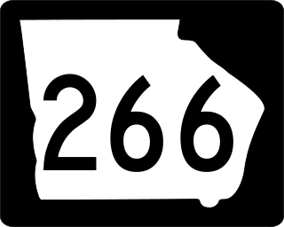
State Route 266 (SR 266) is a 18.2-mile-long (29.3 km) east–west state highway located in the southwestern part of the U.S. state of Georgia. Its path is within Clay and Randolph counties.

U.S. Route 278 (US 278) in the U.S. state of Georgia is an east–west United States Highway traversing the north-central portion of the state. The highway travels from the Alabama state line near Esom Hill to the South Carolina state line where it crosses the Savannah River in the Augusta metropolitan area.

U.S. Route 23 (US 23) in the U.S. state of Georgia, is a north–south United States highway that travels from the St. Marys River south-southeast of Folkston to the North Carolina state line, in the northern part of Dillard. At nearly 392 miles (631 km) in length, it is the longest U.S. Highway in Georgia.

U.S. Route 441 (US 441) in the U.S. state of Georgia is a 354.2-mile-long (570.0 km) north–south United States Highway. It travels from the Florida state line near the Fargo city area to the North Carolina state line, in the northern part of Dillard. It is a spur route of US 41, although it has no intersections with its "parent" route within the state. It does have an intersection with another spur route of US 41 however, specifically US 341 in McRae–Helena.

State Route 201 (SR 201) is a 20.9-mile-long (33.6 km) state highway in the northwestern part of the U.S. state of Georgia. It travels from Villanow, in Walker County northeast to Varnell, in Whitfield County.
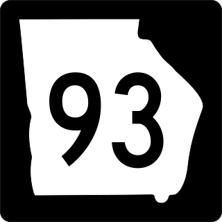
State Route 93 (SR 93) is a state highway in southwest part of the U.S. state of Georgia. The highway runs 60.9 miles (98.0 km) from Moncrief north to Pelham, northeast to Hinsonton, north to Lester, and west to Baconton.
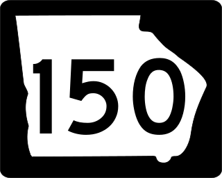
State Route 150 (SR 150) is a 25.3-mile-long (40.7 km) state highway that travels southwest–to–northeast through portions of McDuffie and Columbia counties in the east-central part of the U.S. state of Georgia. It travels from Thomson northeast to the South Carolina state line, southwest of Clarks Hill, South Carolina.
Roxana is an unincorporated community in Paulding County, Georgia, United States, located on Dallas Acworth Highway near Gracepointe Church and Somerset Drive extending to the Seven Hills Community in Dallas Georgia past Seven Hills Blvd and Harmony Grove Road. The Crossroads Community begins where Dallas Acworth Highway and Cedarcrest road intersect and includes the northeastern part of Dallas Georgia and parts of Acworth Georgia. This area includes zip codes 30132 and 30101. The Crossroads Library is located at 909 Harmony Grove Church Rd, Acworth, GA 30101, part of Paulding County.


