
Interstate 16 (I-16), also known as Jim Gillis Historic Savannah Parkway, is an east–west Interstate Highway located entirely within the US state of Georgia. It carries the hidden designation of State Route 404 (SR 404) for its entire length. I-16 travels from downtown Macon, at an interchange with I-75 and SR 540 to downtown Savannah at Montgomery Street (exit 167B). It also passes through or near the communities of Dublin, Metter, and Pooler. I-16's unsigned designation of SR 404 has a spur that is signed in Savannah.

The city of Douglasville is the county seat of Douglas County, Georgia, United States. As of the 2020 census, the city had a population of 34,650, up from 30,961 in 2010 and 20,065 in 2000.

Sandy Springs is a city in northern Fulton County, Georgia, United States, and an inner ring suburb of Atlanta. The city's population was 108,080 at the 2020 census, making it Georgia's seventh-largest city. It is the site of several corporate headquarters, including UPS, Newell Brands, Inspire Brands, Focus Brands, Cox Enterprises, and Mercedes-Benz USA's corporate offices.
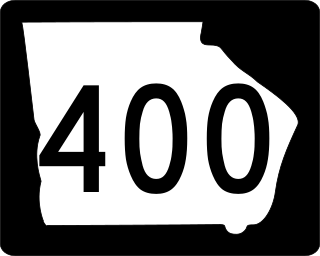
Georgia State Route 400 is a freeway and state highway in the U.S. state of Georgia serving parts of Metro Atlanta. It is concurrent with U.S. Route 19 (US 19) from exit 4 (Interstate 285) until its northern terminus south-southeast of Dahlonega, linking the city of Atlanta to its north-central suburbs and exurbs. SR 400 travels from the Lindbergh neighborhood in the Buckhead district of Atlanta, at Interstate 85 (I-85), to just south-southeast of Dahlonega. Like the Interstate highways, it is a limited-access road, but unlike the interstates, the exit numbers are not mileage-based, they are sequential. Once SR 400 passes exit 17 (SR 306), it changes from a limited-access freeway into an at-grade divided highway with traffic lights, but still with a high speed limit of 65 miles per hour (105 km/h), and ends at the J.B. Jones Intersection at SR 60/SR 115 in Lumpkin County.

Interstate 520 (I-520) is a 23.34-mile (37.56 km) auxiliary Interstate Highway that encircles most of Augusta, Georgia, and North Augusta, South Carolina, as a three-quarter beltway around the western, southern, and eastern parts of the main part of the Augusta metropolitan area. It begins at I-20 and State Route 232 (SR 232) in the northern part of Augusta, Georgia, and ends at I-20 in the northern part of North Augusta, South Carolina. I-520 is also known as Bobby Jones Expressway and the Deputy James D. Paugh Memorial Highway in Georgia and Palmetto Parkway in South Carolina. On the Georgia side, the road also carries the internal designation State Route 415 (SR 415).

State Route 316 (SR 316), also known as University Parkway, or Georgia 316, is a 38.9-mile-long (62.6 km) state highway that exists in the northern part of the U.S. state of Georgia. It links the Atlanta metropolitan area with Athens, home of the University of Georgia.

Interstate 75 (I-75) in the US state of Georgia travels north–south along the U.S. Route 41 (US 41) corridor in the central part of the state, traveling through the cities of Valdosta, Macon, and Atlanta. It is also designated—but not signed—as State Route 401 (SR 401).

The Outer Perimeter is a freeway originally planned to encircle Atlanta, in the U.S. state of Georgia about 20 to 25 miles outside of Interstate 285, which is colloquially referred to as the Perimeter and is a point of reference for local travel outside Atlanta's city core.
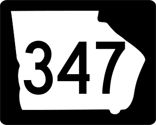
State Route 347 (SR 347) is a west-to-east state highway in the northeastern part of the U.S. state of Georgia. It travels from the Lake Lanier Islands north of Buford to a point on the northern edge of Braselton. Its routing is entirely within Hall County. The highway connects the Lake Lanier Islands with Buford and Braselton.

State Route 53 (SR 53) is a 172.146-mile-long (277.042 km) west-to-east state highway located in the northern part of the U.S. state of Georgia. The highway travels from the Alabama state line west of Cave Spring northeast, then east, then southeast to US 129 Bus./US 441 Bus./SR 15/SR 24 Bus. in Watkinsville.

Georgia State Route 246 (SR 246) and North Carolina Highway 106 (NC 106) are actually a pair of highway designations that run concurrently on a single road that runs from Dillard, Georgia to Highlands, North Carolina. The route is unique for its five state crossings between Georgia and North Carolina along the southern slopes of Kinley Mountain.

U.S. Route 80 (US 80) is a 296-mile-long (476 km) U.S. Highway in the U.S. state of Georgia. It travels west-to-east from the Alabama state line in Columbus across the central portion of the state through cities such as Macon, Dublin, Statesboro, and Savannah to connect to its eastern terminus at an intersection with Tybrisa Street and Inlet Avenue in Tybee Island, near the Atlantic Ocean. Here, the roadway continues as Butler Avenue. US-80 is the main east-west non-Interstate route through Georgia.

U.S. Route 29 (US 29) in the state of Georgia, is a north–south United States Numbered Highway that runs southwest to northeast from West Point at the Alabama state line to the South Carolina state line, near Lake Hartwell. From West Point to downtown Atlanta, the Georgia Department of Transportation (GDOT) has cosigned US 29 with State Route 14 (SR 14). North of downtown Atlanta, the route runs along SR 8 to Dacula and again from west of Statham to the South Carolina state line.
Winston is an unincorporated community, formerly incorporated as a city, in southwestern Douglas County, Georgia, United States.

Pretoria is an unincorporated community located in Dougherty County in the U.S. state of Georgia.
Greenwood is an unincorporated community located in Mitchell County, Georgia, United States.
Lester is an unincorporated community located in Mitchell County, Georgia, United States.
Akridge is an unincorporated community located in Mitchell County, Georgia, United States.

Georgia State Route 87 (SR 87) is a 107-mile-long (172 km) state highway that travels south-to-north through portions of Dodge, Bleckley, Twiggs, Bibb, Monroe, and Butts counties in the historic southern and central parts of the U.S. state of Georgia. The highway connects the Eastman area and the southwestern part of Dodge County with Flovilla, via Cochran and the Macon metropolitan area. The highway is largely, but not entirely, concurrent with U.S. Route 23 (US 23) and serves local traffic.
Roxana is an unincorporated community in Paulding County, Georgia, United States, located on Dallas Acworth Highway near Gracepointe Church and Somerset Drive extending to the Seven Hills Community in Dallas Georgia past Seven Hills Blvd and Harmony Grove Road. The Crossroads Community begins where Dallas Acworth Highway and Cedarcrest road intersect and includes the northeastern part of Dallas Georgia and parts of Acworth Georgia. This area includes zip codes 30132 and 30101. The Crossroads Library is located at 909 Harmony Grove Church Rd, Acworth, GA 30101, part of Paulding County.


