
Golders Green is an area in the London Borough of Barnet in England. A smaller suburban linear settlement, near a farm and public grazing area green of medieval origins, dates to the early 19th century. Its bulk forms a late 19th century and early 20th century suburb with a commercial crossroads. The rest is of later build. It is centred approximately 6 miles (9 km) north west of Charing Cross on the intersection of Golders Green Road and Finchley Road.
Loddon is a small town and civil parish in Norfolk, England, about 12 miles (19 km) south-east of Norwich. The town lies on the River Chet, a tributary of the River Yare within The Broads. The name "Loddon" is thought to mean muddy river in Celtic in reference to the Chet.

Newburgh is a town in Orange County, New York, United States. It forms part of the Poughkeepsie—Newburgh—Middletown metropolitan area, which is a part of the New York megacity, and is a suburban satellite of the urbanized city of Newburgh. The city of Newburgh was a part of the town prior to 1865. New York Stewart International Airport is partially located within the township, and much of the land into which it could have been expanded has been turned into Stewart State Forest.

Willenhall is a historic market town in the Metropolitan Borough of Walsall, in the West Midlands, England, with a population taken at the 2011 census of 28,480. It is situated between Wolverhampton and Walsall, historically in the county of Staffordshire. It lies upon the River Tame, and is part of the Black Country.
Ingleby Barwick is a town and civil parish in the Borough of Stockton-on-Tees, North Yorkshire, England. It is south of the River Tees and north-east of the River Leven.

State Route 10 is a primary state highway in the U.S. state of Virginia. The state highway runs 93.58 miles (150.60 km) from U.S. Route 360 in Richmond east to SR 337 in Suffolk. SR 10 is a major suburban highway through Chesterfield County between the Southside of Richmond and Hopewell. Between Hopewell and Smithfield, which is served by SR 10 Business, the state highway passes through rural Prince George, Surry, and Isle of Wight counties, following the route of an old stagecoach road through an area that features many of the preserved James River plantations. SR 10 runs concurrently with US 258 and SR 32 between Smithfield and Suffolk.
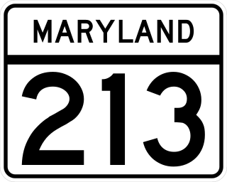
Maryland Route 213 (MD 213) is a 68.25-mile (109.84 km) state highway located on the Eastern Shore of Maryland in the United States. The route runs from MD 662 in Wye Mills, Queen Anne's County, north to the Pennsylvania border in Cecil County, where the road continues into that state as Pennsylvania Route 841 (PA 841). The route, which is a two-lane undivided highway most of its length, passes through mainly rural areas as well as the towns of Centreville, Chestertown, Galena, Cecilton, Chesapeake City, and Elkton. MD 213 intersects many routes including U.S. Route 50 (US 50) near Wye Mills, US 301 near Centreville, and US 40 in Elkton. It crosses over the Chesapeake & Delaware Canal in Chesapeake City on the Chesapeake City Bridge. MD 213 is designated by the state as the Chesapeake Country Scenic Byway between the southern terminus and Chesapeake City with the portion north of MD 18 in Centreville a National Scenic Byway. In addition, the route is also considered part of the Atlantic to Appalachians Scenic Byway between Chesapeake City and MD 273 in Fair Hill.

Virginia State Route 3 is a primary state highway in the U.S. state of Virginia that extends from the town of Culpeper south and eastwardly to Gloucester in Virginia's Middle Peninsula region. For many years, a portion was named "Historyland Highway".

U.S. Route 13 is a north–south U.S. highway established in 1926 that runs for 517 miles (832 km) from Interstate 95 just north of Fayetteville, North Carolina, to U.S. Route 1 in Morrisville, Pennsylvania, a northeastern suburb of Philadelphia. In the U.S. state of Virginia, US 13 runs north–south through the Hampton Roads and Eastern Shore regions of the state, using the Chesapeake Bay Bridge–Tunnel to get between the two. In the Hampton Roads area, it uses Military Highway to bypass the city centers. It is most usually a four-lane highway, sometimes up to freeway or expressway standards with controlled access.

Clyattville is an unincorporated community and census-designated place (CDP) in Lowndes County, Georgia, United States. It was established in the 1840s.

U.S. Route 221 (US 221) in the U.S. state of Georgia is a south–north U.S. Highway. It travels from the Florida border near the Quitman area to the South Carolina state line, north of Pollards Corner. The highway connects North Central Florida with Upstate South Carolina.
Redditch is a town and local government district in north-east Worcestershire, England. The town is divided into separate districts. All street-name signs in Redditch have the street name in white lettering on a blue background and the district name in black lettering on a white background at the bottom of the sign. In the New Town areas the roads are usually named in alphabetical order and house numbering in the cul-de-sac closes is consecutive, starting with number 1 as the first house on the left as you enter, and the highest house number will be on the opposite side of the road as you leave.

U.S. Route 301 (US 301) is a 170-mile-long (270 km) U.S. Highway in the U.S. state of Georgia. It travels south-to-north from the St. Marys River south-southeast of Folkston to the Savannah River north-northeast of Sylvania, via Jesup, Ludowici, Glennville, Claxton, Statesboro, and Sylvania.

U.S. Route 129 (US 129) is a 375-mile-long (604 km) U.S. Highway in the U.S. state of Georgia. It travels south-to-north from the Florida state line, south of Statenville, to the North Carolina state line, northwest of Blairsville.

U.S. Route 441 (US 441) in the U.S. state of Georgia is a 354.2-mile-long (570.0 km) north–south United States Highway. It travels from the Florida state line near the Fargo city area to the North Carolina state line, in the northern part of Dillard. It is a spur route of US 41, although it has no intersections with its "parent" route within the state. It does have an intersection with another spur route of US 41 however, specifically US 341 in McRae–Helena.

State Route 62 (SR 62) is a 62.1-mile-long (99.9 km) state highway in the southwestern part of the U.S. state of Georgia. It connects Columbia, Alabama with Albany.

Ensbury Park is a mainly residential suburb of Bournemouth, in Dorset, England. It includes the housing estate of Slades Farm and lies within the ward district of Northbourne and Redhill.
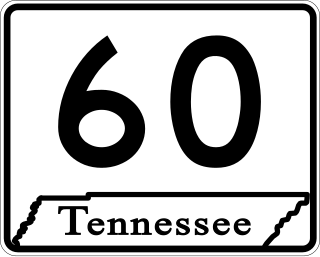
State Route 60 is a north-south major state route in Eastern Tennessee. It covers 54 miles (87 km) and runs from the Tennessee-Georgia state line in Bradley County to Dayton joining US 27.
Bethany is an unincorporated community in Baker County, Georgia, United States.

Georgia State Route 87 (SR 87) is a 107-mile-long (172 km) state highway that travels south-to-north through portions of Dodge, Bleckley, Twiggs, Bibb, Monroe, and Butts counties in the historic southern and central parts of the U.S. state of Georgia. The highway connects the Eastman area and the southwestern part of Dodge County with Flovilla, via Cochran and the Macon metropolitan area. The highway is largely, but not entirely, concurrent with U.S. Route 23 (US 23) and serves local traffic.


