
The Conasauga River is a river that runs through southeast Tennessee and northwest Georgia. The Conasauga River is 93 miles (150 km) long and drains into the Oostanaula River, a tributary of the Coosa River and part of the watershed of the Gulf of Mexico. The river is home to over 90 species of fish and 25 surviving species of freshwater mussels. The Conasauga River watershed encompasses over 500,000 acres (2,000 km2) in two states, multiple counties, and two ecologically different regions.

The Soque River and its watershed are located entirely within the county boundaries of Habersham County in northeast Georgia. The Soque is a tributary of the Chattahoochee River. Portions of the river run along State Route 197.
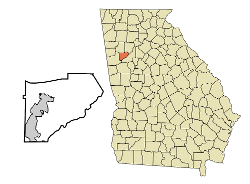
Juno is an unincorporated community in Dawson County, Georgia, United States. It lies along State Route 183 to the northwest of the city of Dawsonville, the county seat of Dawson County. Its elevation is 1,493 feet (455 m).
Hartford is an unincorporated community in Pulaski County, Georgia, United States. It lies a short distance east of the city of Hawkinsville, the county seat of Pulaski County. Hartford sits at the intersection of Alternate U.S. Route 129 with State Routes 26, 27, 230, 257, and U.S. Route 341. Its elevation is 256 feet (78 m).
Culverton is an unincorporated community in Hancock County, Georgia, United States. It lies along State Route 16 to the east of the city of Sparta, the county seat of Hancock County. Its elevation is 554 feet (169 m). The community is part of the Milledgeville Micropolitan Statistical Area.

Juniperjuu-nih-pər is an unincorporated community in Marion County, Georgia, United States. It lies along State Route 355 on the Talbot County line, to the north of the city of Buena Vista, the county seat of Marion County. Its elevation is 413 feet (126 m). It is part of the Columbus, Georgia Metropolitan Area.

Haddock is an unincorporated community in Jones County, Georgia, United States. It lies along State Route 22, to the east of the city of Gray, the county seat. Its elevation is 499 feet (152 m). It has a post office with the ZIP code 31033.
Townsend is an unincorporated community in McIntosh County, Georgia, United States. It lies along State Route 57 northwest of the city of Darien, the county seat. Its elevation is 20 feet (6 m). It has a post office with the ZIP code 31331.

Hopeulikit is an unincorporated community in Bulloch County, Georgia, United States.
Bold Springs is an unincorporated community in Walton County, Georgia, United States. It is located around Georgia State Route 81 and Bold Springs Road. Walton County Parks & Recreation operates the 3-acre (1.2 ha) Bold Springs Park in the community. A variant name is Bold Spring.
Winston is an unincorporated community, formerly incorporated as a city, in southwestern Douglas County, Georgia, United States.
Cotton is an unincorporated community located in Mitchell County, United States.
Flint is an unincorporated community located in Mitchell County, Georgia, United States.
Greenwood is an unincorporated community located in Mitchell County, Georgia, United States.
Laney is an unincorporated community located in Mitchell County, Georgia, United States.
Akridge is an unincorporated community located in Mitchell County, Georgia, United States.

Mineral Bluff is a census-designated place and unincorporated community located in Fannin County in the U.S. state of Georgia. Its population was 223 as of the 2020 census. The community is situated 6 miles (10 km) northeast of the city of Blue Ridge, the county seat, 80 miles (130 km) east of Chattanooga, Tennessee, and 100 miles (160 km) north of Atlanta.
Dry Branch is an unincorporated community located in Twiggs and Bibb counties, Georgia, United States. Its ZIP code is 31020. The area covered by the ZIP code has a population of 3,198 and contains 100.81 square miles of land and is 0.4% water.
Pine Mountain Valley is located in Harris County, Georgia, United States. Its ZIP code is 31823.
Roxana is an unincorporated community in Paulding County, Georgia, United States, located on Dallas Acworth Highway near Gracepointe Church and Somerset Drive extending to the Seven Hills Community in Dallas Georgia past Seven Hills Blvd and Harmony Grove Road. The Crossroads Community begins where Dallas Acworth Highway and Cedarcrest road intersect and includes the northeastern part of Dallas Georgia and parts of Acworth Georgia. This area includes zip codes 30132 and 30101. The Crossroads Library is located at 909 Harmony Grove Church Rd, Acworth, GA 30101, part of Paulding County.


