Cotton, Georgia | |
|---|---|
 Cotton  Cotton | |
| Coordinates: 31°09′42″N84°04′01″W / 31.1617°N 84.0669°W | |
| Country | United States |
| State | Georgia |
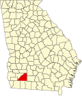
| County | Mitchell |
| Elevation | 325 ft (99 m) |
| Time zone | UTC-5 (Eastern (EST)) |
| • Summer (DST) | UTC-4 (EDT) |
| ZIP code | 31765 |
| Area code | 229 |
Cotton is an unincorporated community located in Mitchell County, United States. [1]